Island Park is a village located in the Town of Hempstead in Nassau County, New York, United States. The population was 4,655 at the 2010 census.
| Name: | Island Park village |
|---|---|
| LSAD Code: | 47 |
| LSAD Description: | village (suffix) |
| State: | New York |
| County: | Nassau County |
| Elevation: | 12 ft ft (0 m) |
| Total Area: | 0.45 sq mi (1.15 km²) |
| Land Area: | 0.45 sq mi (1.15 km²) |
| Water Area: | 0.00 sq mi (0.00 km²) |
| Total Population: | 4,928 |
| Population Density: | 11,074.16/sq mi (4,278.35/km²) |
| ZIP code: | 11558 |
| Area code: | 516 |
| FIPS code: | 3637847 |
| GNISfeature ID: | 0953828 |
| Website: | www.villageofislandpark.com |
Online Interactive Map
Click on ![]() to view map in "full screen" mode.
to view map in "full screen" mode.
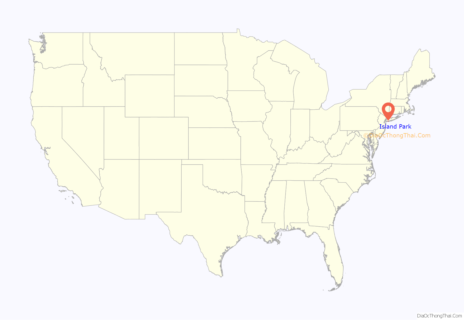
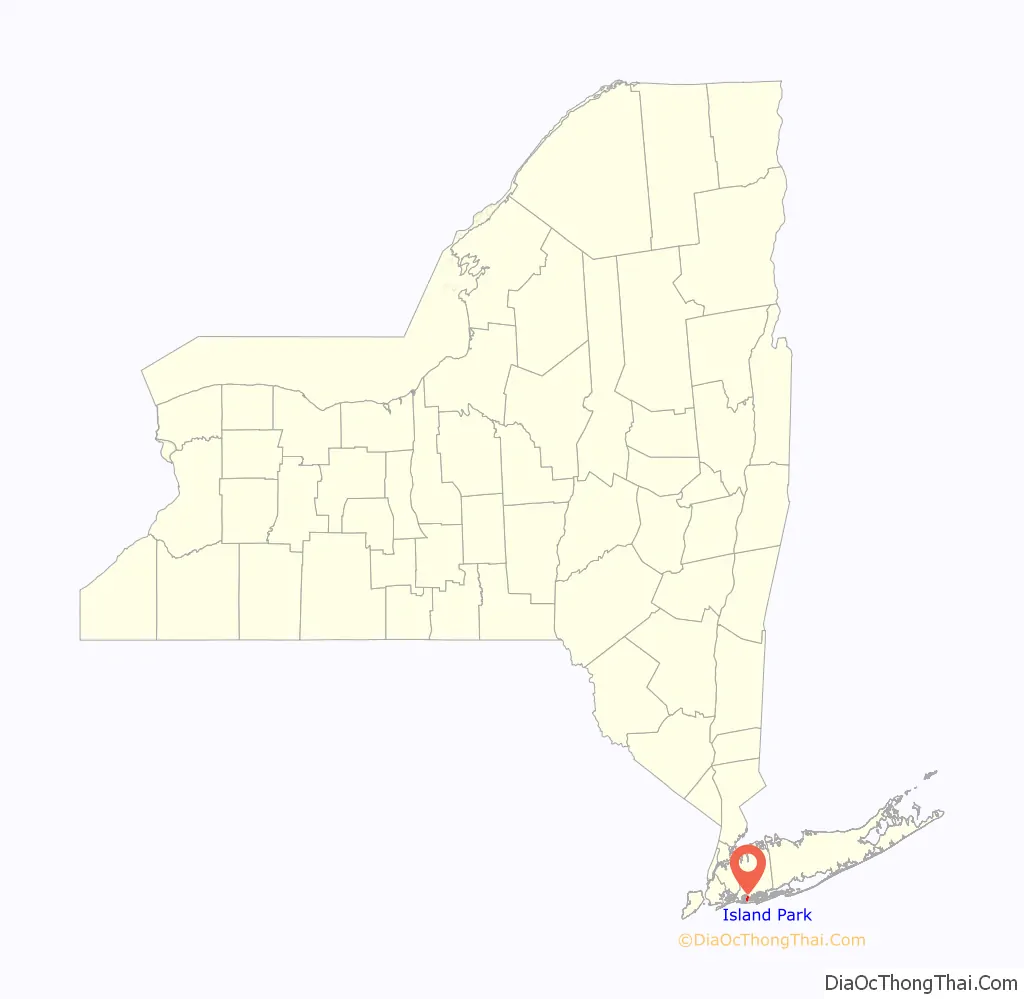
Island Park location map. Where is Island Park village?
History
Island Park was developed by the Island Park-Long Beach Company as a resort community in the 1920s, after previous development plans for the area were cancelled due to the outbreak of World War I and the subsequent wartime efforts.
Island Park incorporated itself as a village in 1926. Its first mayor was Charles N. Talbot, who served in that capacity for 12 years.
In the 1950s, there was a proposal in which Island Park would have annexed the adjacent hamlet of Harbor Isle. The proposal was ultimately was defeated, and to this day, Harbor Isle remains an unincorporated hamlet governed by the Town of Hempstead.
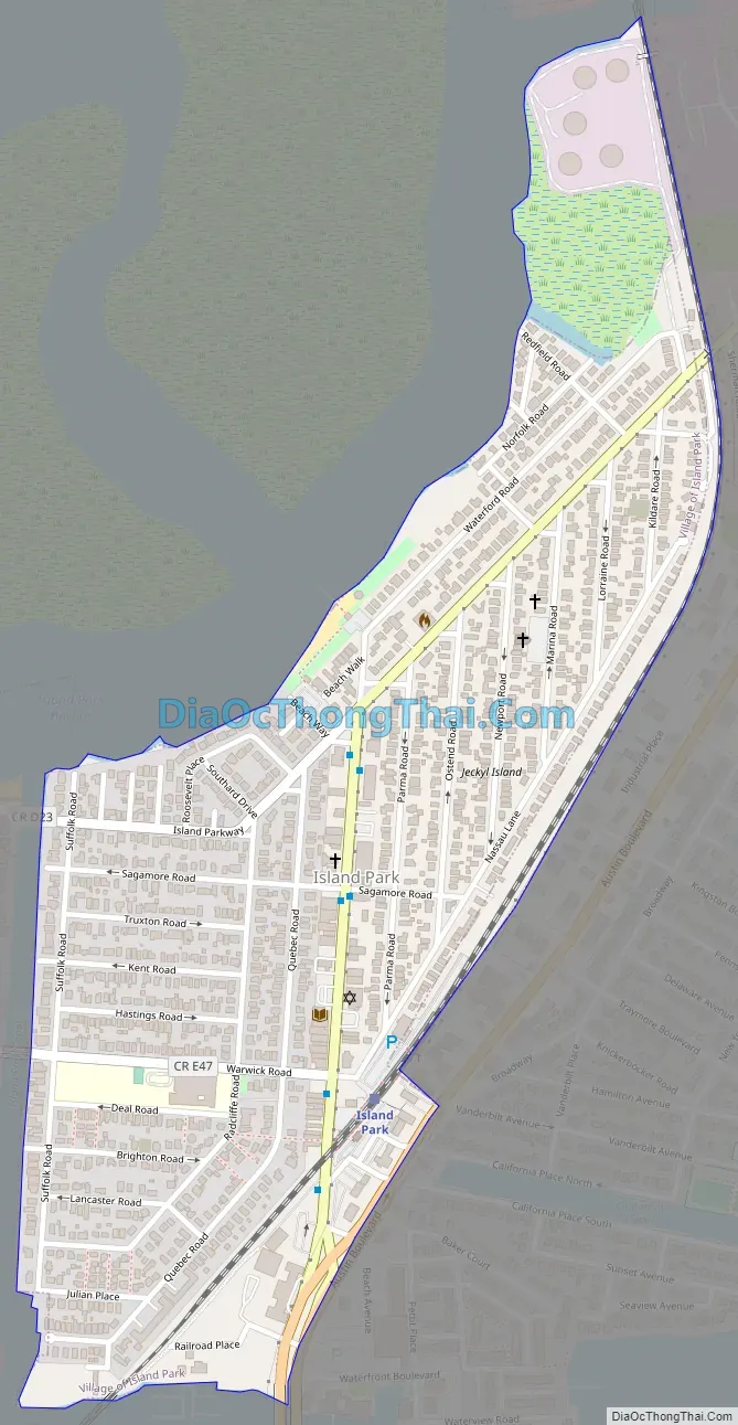
Island Park Road Map
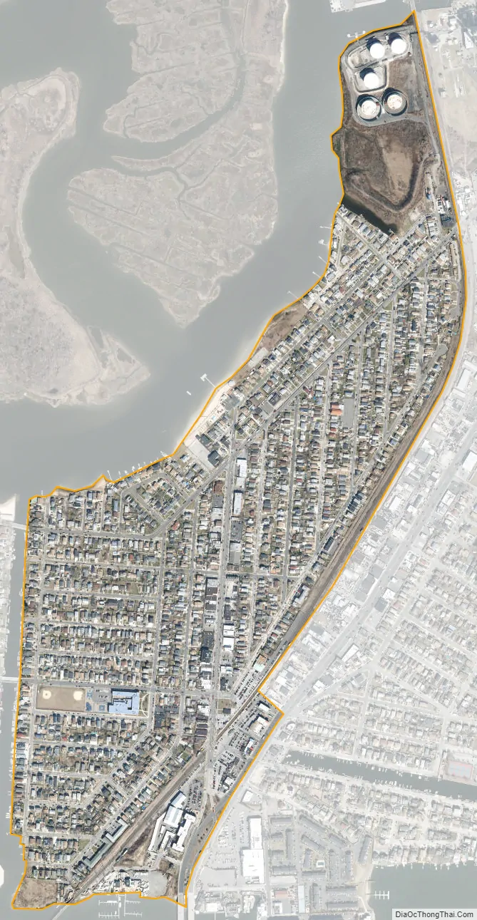
Island Park city Satellite Map
Geography
According to the United States Census Bureau, the village has a total area of 1.5 square miles (3.9 km), all land.
The Village of Island Park is part of the Outer Barrier of Long Island and is bordered on the west by a man-made canal running parallel to Suffolk Road. Its northern borders follow another channel, while its eastern and southern borders are delineated by the rails of the Long Beach Branch of the Long Island Rail Road.
See also
Map of New York State and its subdivision:- Albany
- Allegany
- Bronx
- Broome
- Cattaraugus
- Cayuga
- Chautauqua
- Chemung
- Chenango
- Clinton
- Columbia
- Cortland
- Delaware
- Dutchess
- Erie
- Essex
- Franklin
- Fulton
- Genesee
- Greene
- Hamilton
- Herkimer
- Jefferson
- Kings
- Lake Ontario
- Lewis
- Livingston
- Madison
- Monroe
- Montgomery
- Nassau
- New York
- Niagara
- Oneida
- Onondaga
- Ontario
- Orange
- Orleans
- Oswego
- Otsego
- Putnam
- Queens
- Rensselaer
- Richmond
- Rockland
- Saint Lawrence
- Saratoga
- Schenectady
- Schoharie
- Schuyler
- Seneca
- Steuben
- Suffolk
- Sullivan
- Tioga
- Tompkins
- Ulster
- Warren
- Washington
- Wayne
- Westchester
- Wyoming
- Yates
- Alabama
- Alaska
- Arizona
- Arkansas
- California
- Colorado
- Connecticut
- Delaware
- District of Columbia
- Florida
- Georgia
- Hawaii
- Idaho
- Illinois
- Indiana
- Iowa
- Kansas
- Kentucky
- Louisiana
- Maine
- Maryland
- Massachusetts
- Michigan
- Minnesota
- Mississippi
- Missouri
- Montana
- Nebraska
- Nevada
- New Hampshire
- New Jersey
- New Mexico
- New York
- North Carolina
- North Dakota
- Ohio
- Oklahoma
- Oregon
- Pennsylvania
- Rhode Island
- South Carolina
- South Dakota
- Tennessee
- Texas
- Utah
- Vermont
- Virginia
- Washington
- West Virginia
- Wisconsin
- Wyoming


