Islandia is a village in the northern part of the Town of Islip in Suffolk County, on Long Island, in New York, United States. The population was 3,335 at the 2010 census.
| Name: | Islandia village |
|---|---|
| LSAD Code: | 47 |
| LSAD Description: | village (suffix) |
| State: | New York |
| County: | Suffolk County |
| Incorporated: | April 1985 |
| Elevation: | 66 ft (20 m) |
| Total Area: | 2.21 sq mi (5.73 km²) |
| Land Area: | 2.21 sq mi (5.73 km²) |
| Water Area: | 0.00 sq mi (0.00 km²) |
| Total Population: | 3,567 |
| Population Density: | 1,611.11/sq mi (622.08/km²) |
| ZIP code: | 11749, 11760 |
| Area code: | 631, 934 |
| FIPS code: | 3637840 |
| GNISfeature ID: | 0979937 |
| Website: | www.newvillageofislandia.com |
Online Interactive Map
Click on ![]() to view map in "full screen" mode.
to view map in "full screen" mode.
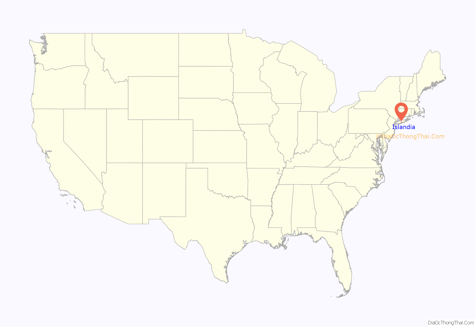
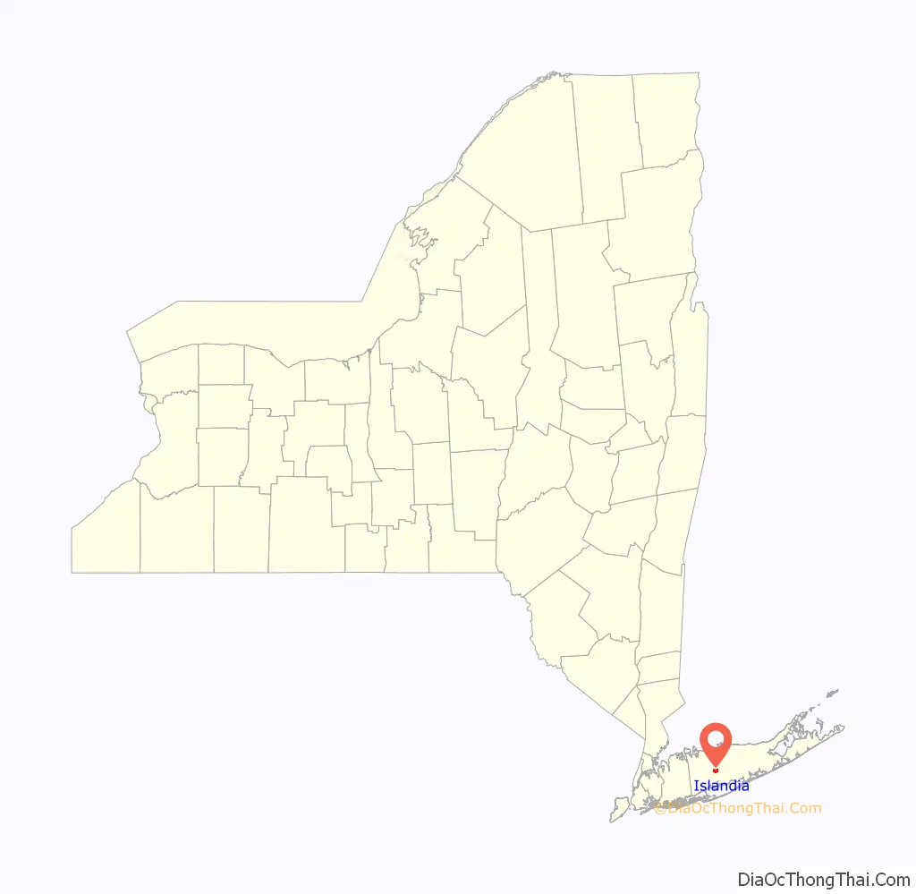
Islandia location map. Where is Islandia village?
History
Islandia incorporated itself as a village in April 1985 after CA Technologies established its world headquarters in Hauppauge and trying to capture the Hauppauge School District, in the area some people informally referred to as South Hauppauge. After more than three years of conducting local research, residents appeared in front of Islip’s officials to take the first steps in incorporating Islandia on September 16, 1980. At the meeting, locals presented the Town of Islip was a petition signed by 432 Islandia Residents, which was over the 180 minimum required, and also presented the $1,000 (1980 USD) filing fee required. Many officials in the Town of Islip, including Town Supervisor Michael LoGrande, were less than thrilled with the proposal, and Islip soon sued the organizers of the prospective village in an attempt to prevent Islandia’s incorporation. It wasn’t until December 1984 that the Town of Islip dropped their opposition and asked residents in return for at least 200 residents to sign a letter to promise that the community would not exclude minorities from living within its borders. An incorporation vote was soon held, during which residents ultimately voted in favor of incorporating, and in April 1985, Islandia officially became an incorporated village. Its founding father was Warren Raymond.
When it incorporated, Islandia became the first new village on Long Island to incorporate in over 15 years (the last village incorporated prior to Islandia was Lake Grove in 1968).
The core of Islandia is a 500-home housing development built by Levitt & Sons circa 1963, which offered seven different model homes to choose from. The original Levitt home buyers were informed during pre-construction sales that their children should attend the Hauppauge Union Free School District, but instead it became part of the Central Islip Union Free School District. The Levitt development was assigned the Central Islip ZIP code 11722 and was considered part of Central Islip until the incorporation of Islandia in 1985.
In August 2016, the village board approved plans for a new casino to be opened at the Marriott hotel. These plans attracted opposition from some members of the community citing possible crime and traffic problems, while others supported the first new casino to be opened in Suffolk County. Marriott International sold the property to Delaware North for $40.41 million because Marriott has a corporate policy against gambling. On February 27, 2017, Jake’s 58 casino opened with 250 video lottery terminals.
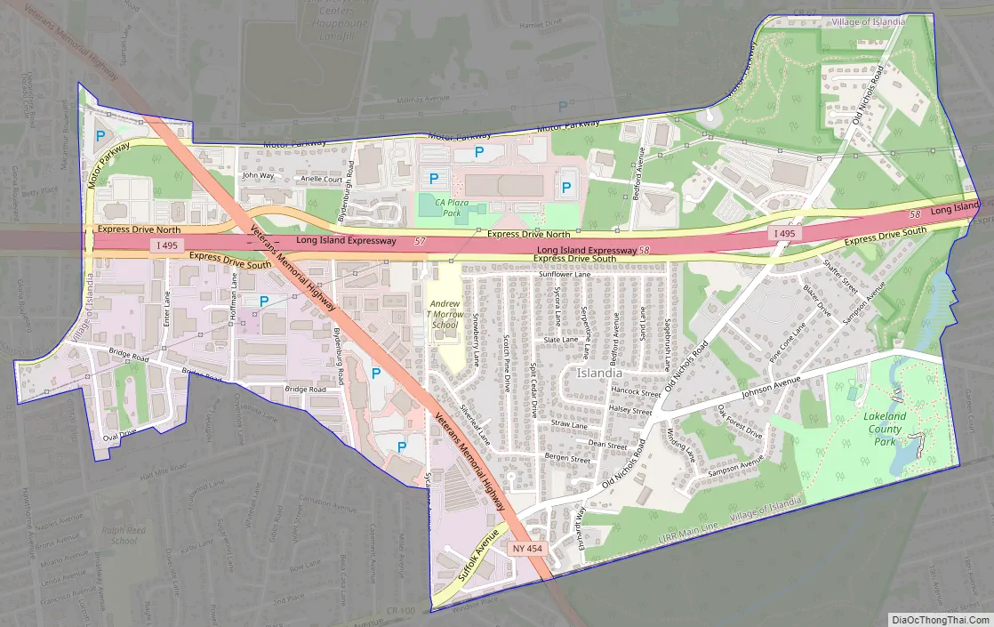
Islandia Road Map
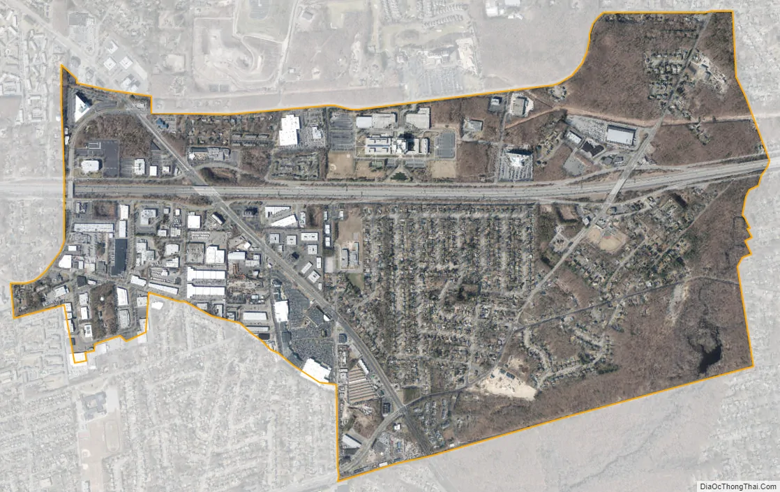
Islandia city Satellite Map
Geography
According to the United States Census Bureau, the village has a total area of 2.2 square miles (5.7 km), all land.
Honeysuckle Pond, in Suffolk County’s Lakeland Park, lies within the confines of the Village and should therefore be included in its geographic makeup. In the latter half of 2016 and the majority of 2017, the pond was virtually nonexistent, reduced to a muddy puddle devoid of wildlife.
Islandia straddles the Long Island Expressway and is near the geographic center of Long Island. It has no central business district, although it is home to the Islandia Center, which has a Walmart and Dave & Buster’s.
See also
Map of New York State and its subdivision:- Albany
- Allegany
- Bronx
- Broome
- Cattaraugus
- Cayuga
- Chautauqua
- Chemung
- Chenango
- Clinton
- Columbia
- Cortland
- Delaware
- Dutchess
- Erie
- Essex
- Franklin
- Fulton
- Genesee
- Greene
- Hamilton
- Herkimer
- Jefferson
- Kings
- Lake Ontario
- Lewis
- Livingston
- Madison
- Monroe
- Montgomery
- Nassau
- New York
- Niagara
- Oneida
- Onondaga
- Ontario
- Orange
- Orleans
- Oswego
- Otsego
- Putnam
- Queens
- Rensselaer
- Richmond
- Rockland
- Saint Lawrence
- Saratoga
- Schenectady
- Schoharie
- Schuyler
- Seneca
- Steuben
- Suffolk
- Sullivan
- Tioga
- Tompkins
- Ulster
- Warren
- Washington
- Wayne
- Westchester
- Wyoming
- Yates
- Alabama
- Alaska
- Arizona
- Arkansas
- California
- Colorado
- Connecticut
- Delaware
- District of Columbia
- Florida
- Georgia
- Hawaii
- Idaho
- Illinois
- Indiana
- Iowa
- Kansas
- Kentucky
- Louisiana
- Maine
- Maryland
- Massachusetts
- Michigan
- Minnesota
- Mississippi
- Missouri
- Montana
- Nebraska
- Nevada
- New Hampshire
- New Jersey
- New Mexico
- New York
- North Carolina
- North Dakota
- Ohio
- Oklahoma
- Oregon
- Pennsylvania
- Rhode Island
- South Carolina
- South Dakota
- Tennessee
- Texas
- Utah
- Vermont
- Virginia
- Washington
- West Virginia
- Wisconsin
- Wyoming


