Kensington is a village in Nassau County, on the North Shore of Long Island, in New York, United States. The population was 1,161 at the 2010 census.
The Incorporated Village of Kensington is in the Town of North Hempstead and is on the Great Neck Peninsula.
| Name: | Kensington village |
|---|---|
| LSAD Code: | 47 |
| LSAD Description: | village (suffix) |
| State: | New York |
| County: | Nassau County |
| Incorporated: | November 7, 1921 |
| Elevation: | 128 ft (39 m) |
| Total Area: | 0.25 sq mi (0.66 km²) |
| Land Area: | 0.25 sq mi (0.66 km²) |
| Water Area: | 0.00 sq mi (0.00 km²) |
| Total Population: | 1,226 |
| Population Density: | 4,826.77/sq mi (1,861.91/km²) |
| ZIP code: | 11021 |
| Area code: | 516 |
| FIPS code: | 3639309 |
| GNISfeature ID: | 0954527 |
| Website: | vok-ny.com |
Online Interactive Map
Click on ![]() to view map in "full screen" mode.
to view map in "full screen" mode.
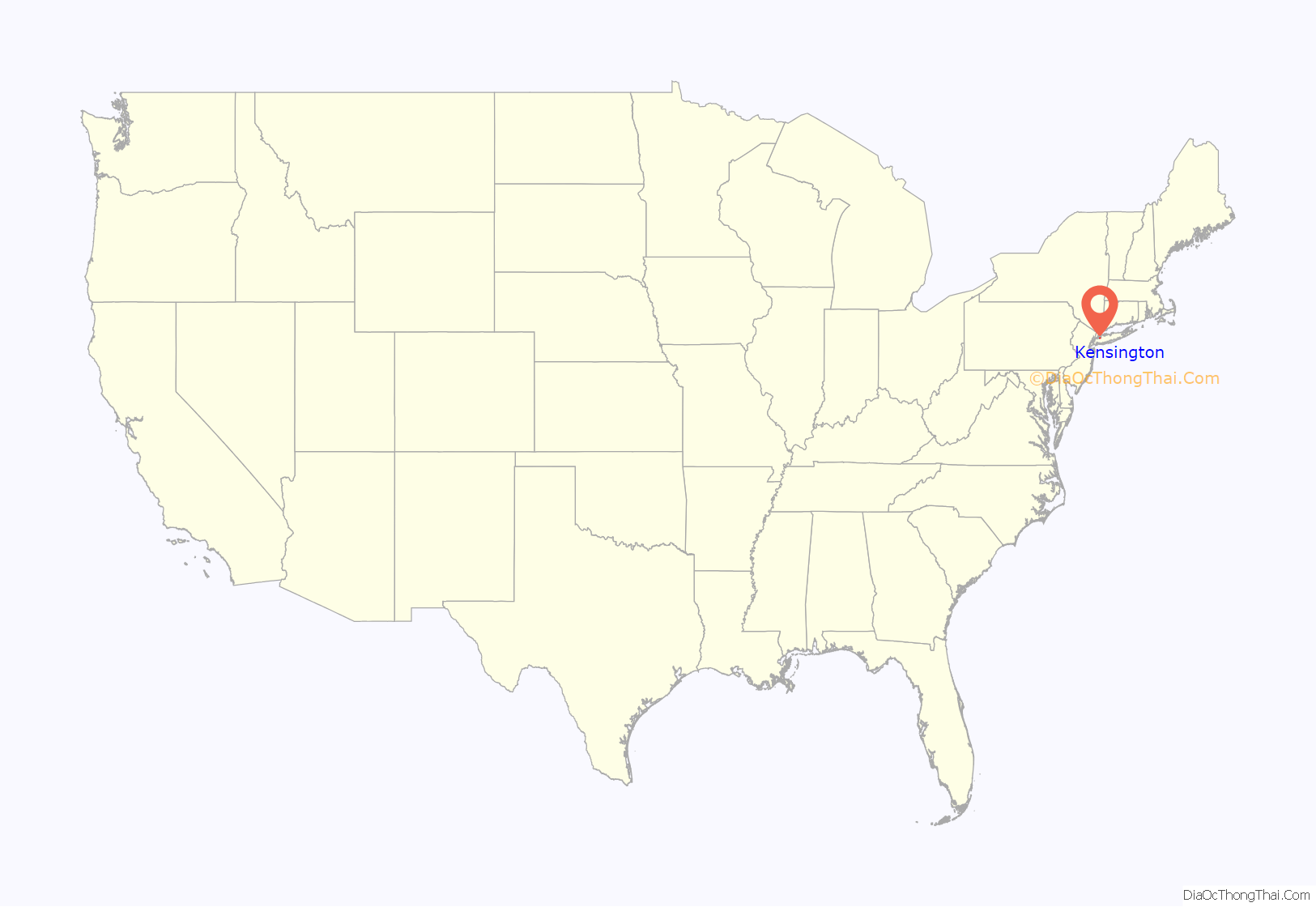
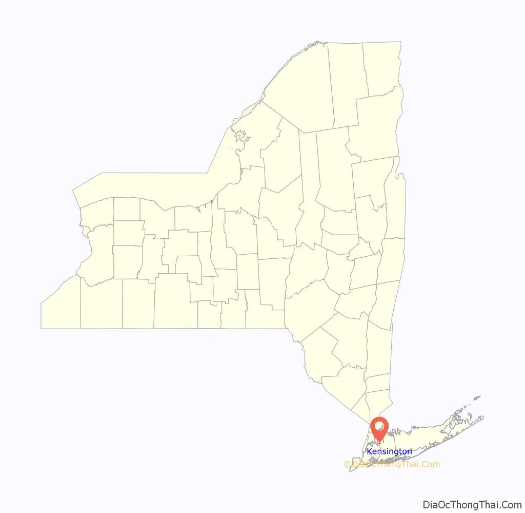
Kensington location map. Where is Kensington village?
History
On November 7, 1921, by a unanimous vote of the residents, Kensington incorporated as a village. The first village elections for officers and trustees were held on November 28, 1921, and Byron Eldred was elected unanimously as its first Mayor. The village was named after London’s Kensington Gardens, and the entrance gates at the main entrance to the village were based on Kensington Garden’s gates.
Many of Kensington’s mayors have served for substantially long terms. Notable are Mayor Seymour Cohen, Mayor Steven Randall and Mayor Bonnie Golub. The mayor also serves as Commissioner of Police. The Village of Kensington was initially established as an enclave of homes of famous celebrities.
The waterfront park was deeded to the Kensington Association in August 1915. This included a 500-foot sand beach on Manhasset Bay, miniature lakes, a boat dock, tennis courts, and one of the largest fresh water swimming pools in the United States.
In order to maintain the residential character of the community, a restrictive covenant was written to keep business and industry out. Furthermore, a membership corporation called the Kensington Association was initiated to take care of maintenance and police protection.
Kensington was recognized as one of the safest places to live in the U.S. and remains that way to this day.
In 2017, Niche.com ranked Kensington #1 in its lists of both the “Best Places to Live in New York” and the “Best Suburbs to Live in New York”.
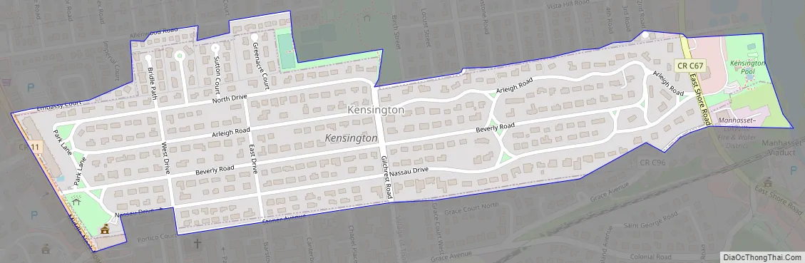
Kensington Road Map
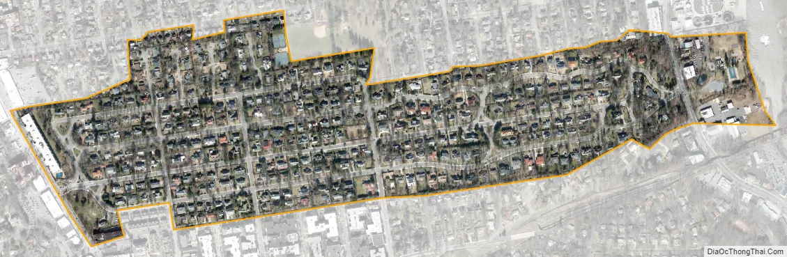
Kensington city Satellite Map
Geography
According to the United States Census Bureau, the village has a total area of 0.2 square mile (0.6 km), all land.
See also
Map of New York State and its subdivision:- Albany
- Allegany
- Bronx
- Broome
- Cattaraugus
- Cayuga
- Chautauqua
- Chemung
- Chenango
- Clinton
- Columbia
- Cortland
- Delaware
- Dutchess
- Erie
- Essex
- Franklin
- Fulton
- Genesee
- Greene
- Hamilton
- Herkimer
- Jefferson
- Kings
- Lake Ontario
- Lewis
- Livingston
- Madison
- Monroe
- Montgomery
- Nassau
- New York
- Niagara
- Oneida
- Onondaga
- Ontario
- Orange
- Orleans
- Oswego
- Otsego
- Putnam
- Queens
- Rensselaer
- Richmond
- Rockland
- Saint Lawrence
- Saratoga
- Schenectady
- Schoharie
- Schuyler
- Seneca
- Steuben
- Suffolk
- Sullivan
- Tioga
- Tompkins
- Ulster
- Warren
- Washington
- Wayne
- Westchester
- Wyoming
- Yates
- Alabama
- Alaska
- Arizona
- Arkansas
- California
- Colorado
- Connecticut
- Delaware
- District of Columbia
- Florida
- Georgia
- Hawaii
- Idaho
- Illinois
- Indiana
- Iowa
- Kansas
- Kentucky
- Louisiana
- Maine
- Maryland
- Massachusetts
- Michigan
- Minnesota
- Mississippi
- Missouri
- Montana
- Nebraska
- Nevada
- New Hampshire
- New Jersey
- New Mexico
- New York
- North Carolina
- North Dakota
- Ohio
- Oklahoma
- Oregon
- Pennsylvania
- Rhode Island
- South Carolina
- South Dakota
- Tennessee
- Texas
- Utah
- Vermont
- Virginia
- Washington
- West Virginia
- Wisconsin
- Wyoming


