Kinderhook (Kinderhoek in Dutch) is a village in the town of Kinderhook in Columbia County, New York, United States. The village population was 1,211 at the 2010 census. The village of Kinderhook is located in the south-central part of the town on US 9. The eighth President of the United States, Martin Van Buren, was born in Kinderhook and retired to the area (Lindenwald).
| Name: | Kinderhook village |
|---|---|
| LSAD Code: | 47 |
| LSAD Description: | village (suffix) |
| State: | New York |
| County: | Columbia County |
| Elevation: | 253 ft (77 m) |
| Total Area: | 2.10 sq mi (5.45 km²) |
| Land Area: | 2.10 sq mi (5.45 km²) |
| Water Area: | 0.00 sq mi (0.00 km²) |
| Total Population: | 1,170 |
| Population Density: | 556.08/sq mi (214.72/km²) |
| ZIP code: | 12106 |
| Area code: | 518 |
| FIPS code: | 3639562 |
| GNISfeature ID: | 0954619 |
| Website: | villageofkinderhook.org |
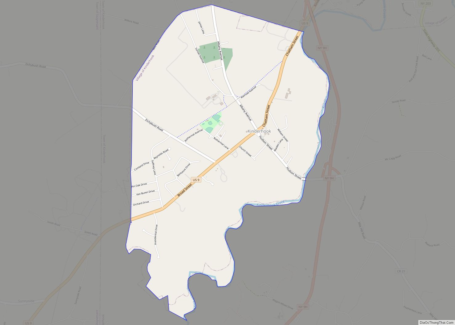
Online Interactive Map
Click on ![]() to view map in "full screen" mode.
to view map in "full screen" mode.
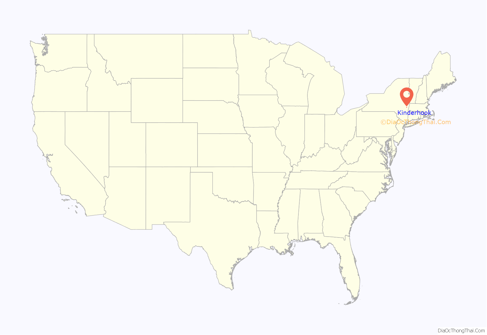
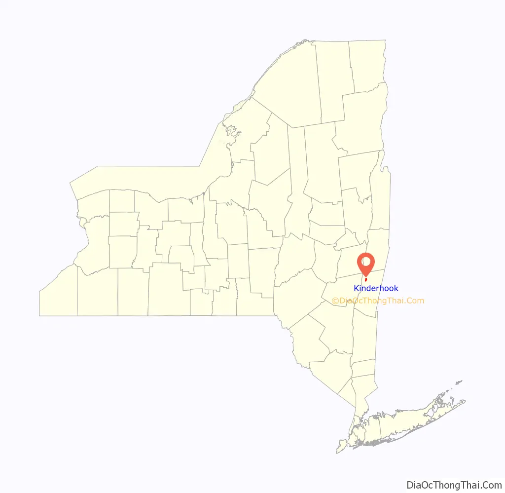
Kinderhook location map. Where is Kinderhook village?
History
The area was named by Henry Hudson in 1609 as Kinderhoek (Dutch for “children’s corner”) because he had seen Native American children frequently playing there. First settled by the Dutch around 1640, the area was surrendered to the English in 1664.
In 1686, the area was granted the Great Kinderhook Patent and organized into one township.
Much of the area’s growth did not occur until the 19th century – in 1813, the village had only twenty dwellings. By 1843, the number had grown to 86, and just seven years later, there were about 200 buildings and 1,400 inhabitants. The size of the village has remained steady since then, and the Kinderhook Village District has been listed on the National Register of Historic Places since 1974. In 1838, Kinderhook was chartered as a village.
United States President Martin Van Buren was born in the town of Kinderhook, and was known as “Old Kinderhook”. The home where he was raised, his father’s tavern, no longer exists; however, a historical marker is located near the site at 46 Hudson Street. The Martin Van Buren National Historic Site, Van Buren’s retirement home is located 1 mile (1.6 km) south of the village and is open to the public. Van Buren’s burial place is in the Kinderhook Reformed Church Cemetery along Albany Avenue in the northwest part of the village, about a half mile from his childhood home.
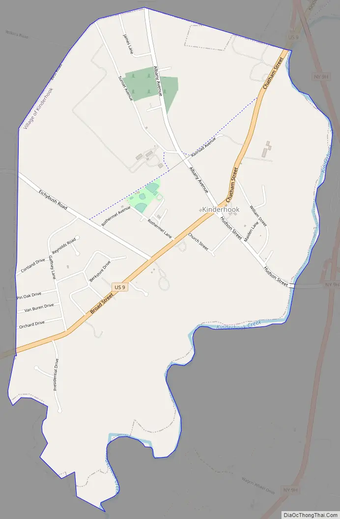
U.S. Route 9 runs through Kinderhook and intersects with Columbia County route 21 at the center of the village. Northwest of the intersection, CR 21 is known as Albany Avenue, while southeast it is called Hudson Street.
Kinderhook Road Map
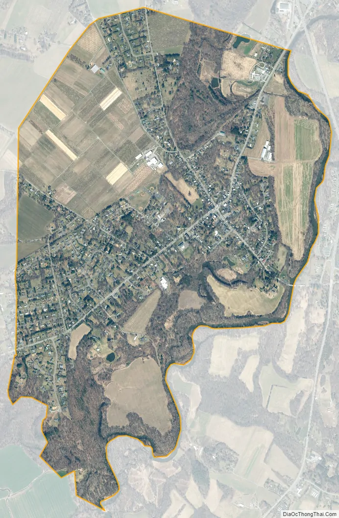
Kinderhook city Satellite Map
Geography
Kinderhook is located at 42°23′37″N 73°42′18″W / 42.39361°N 73.70500°W / 42.39361; -73.70500 (42.393707, -73.705094).
According to the United States Census Bureau, the village has a total area of 2.1 square miles (5.4 km), all land. Kinderhook Creek, a tributary of the Hudson River, forms the southeastern boundary of the village.
See also
Map of New York State and its subdivision:- Albany
- Allegany
- Bronx
- Broome
- Cattaraugus
- Cayuga
- Chautauqua
- Chemung
- Chenango
- Clinton
- Columbia
- Cortland
- Delaware
- Dutchess
- Erie
- Essex
- Franklin
- Fulton
- Genesee
- Greene
- Hamilton
- Herkimer
- Jefferson
- Kings
- Lake Ontario
- Lewis
- Livingston
- Madison
- Monroe
- Montgomery
- Nassau
- New York
- Niagara
- Oneida
- Onondaga
- Ontario
- Orange
- Orleans
- Oswego
- Otsego
- Putnam
- Queens
- Rensselaer
- Richmond
- Rockland
- Saint Lawrence
- Saratoga
- Schenectady
- Schoharie
- Schuyler
- Seneca
- Steuben
- Suffolk
- Sullivan
- Tioga
- Tompkins
- Ulster
- Warren
- Washington
- Wayne
- Westchester
- Wyoming
- Yates
- Alabama
- Alaska
- Arizona
- Arkansas
- California
- Colorado
- Connecticut
- Delaware
- District of Columbia
- Florida
- Georgia
- Hawaii
- Idaho
- Illinois
- Indiana
- Iowa
- Kansas
- Kentucky
- Louisiana
- Maine
- Maryland
- Massachusetts
- Michigan
- Minnesota
- Mississippi
- Missouri
- Montana
- Nebraska
- Nevada
- New Hampshire
- New Jersey
- New Mexico
- New York
- North Carolina
- North Dakota
- Ohio
- Oklahoma
- Oregon
- Pennsylvania
- Rhode Island
- South Carolina
- South Dakota
- Tennessee
- Texas
- Utah
- Vermont
- Virginia
- Washington
- West Virginia
- Wisconsin
- Wyoming