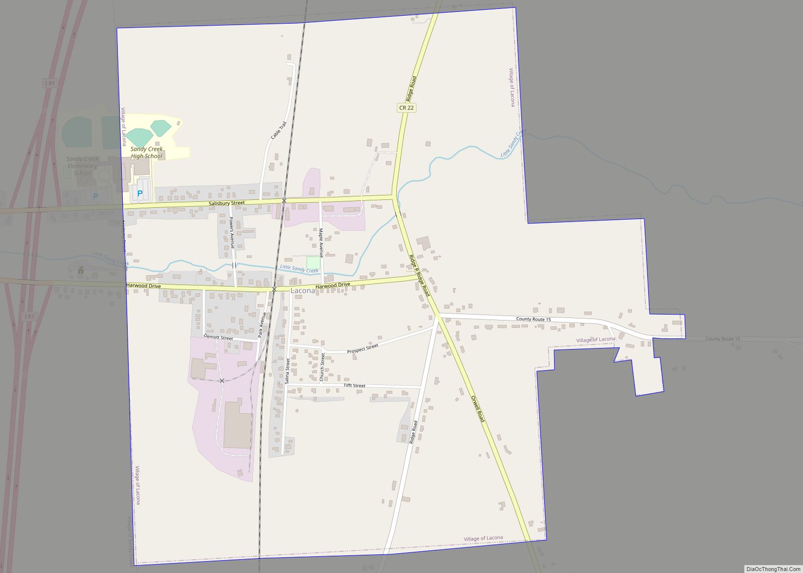
Lacona is a village in Oswego County, New York, United States. The population was 582 at the 2010 census.
The Village of Lacona is inside the Town of Sandy Creek. The village is halfway between Syracuse and Watertown.
| Name: | Lacona village |
|---|---|
| LSAD Code: | 47 |
| LSAD Description: | village (suffix) |
| State: | New York |
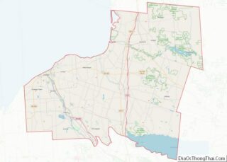
| County: | Oswego County |
| Elevation: | 558 ft (170 m) |
| Total Area: | 1.11 sq mi (2.89 km²) |
| Land Area: | 1.11 sq mi (2.88 km²) |
| Water Area: | 0.00 sq mi (0.01 km²) |
| Total Population: | 657 |
| Population Density: | 590.83/sq mi (228.05/km²) |
| ZIP code: | 13083 |
| Area code: | 315 |
| FIPS code: | 3640200 |
| GNISfeature ID: | 0954867 |
Online Interactive Map
Click on ![]() to view map in "full screen" mode.
to view map in "full screen" mode.
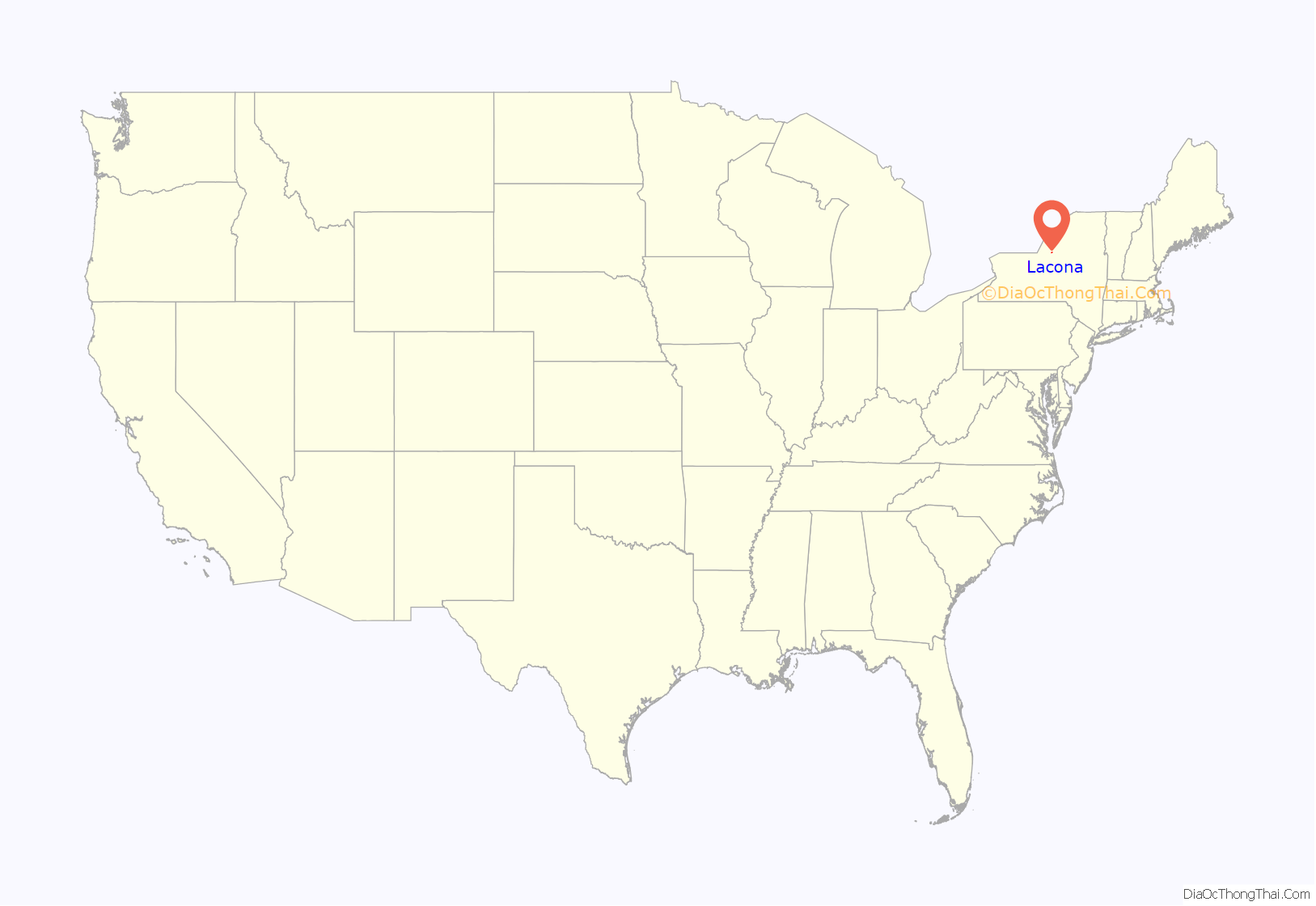
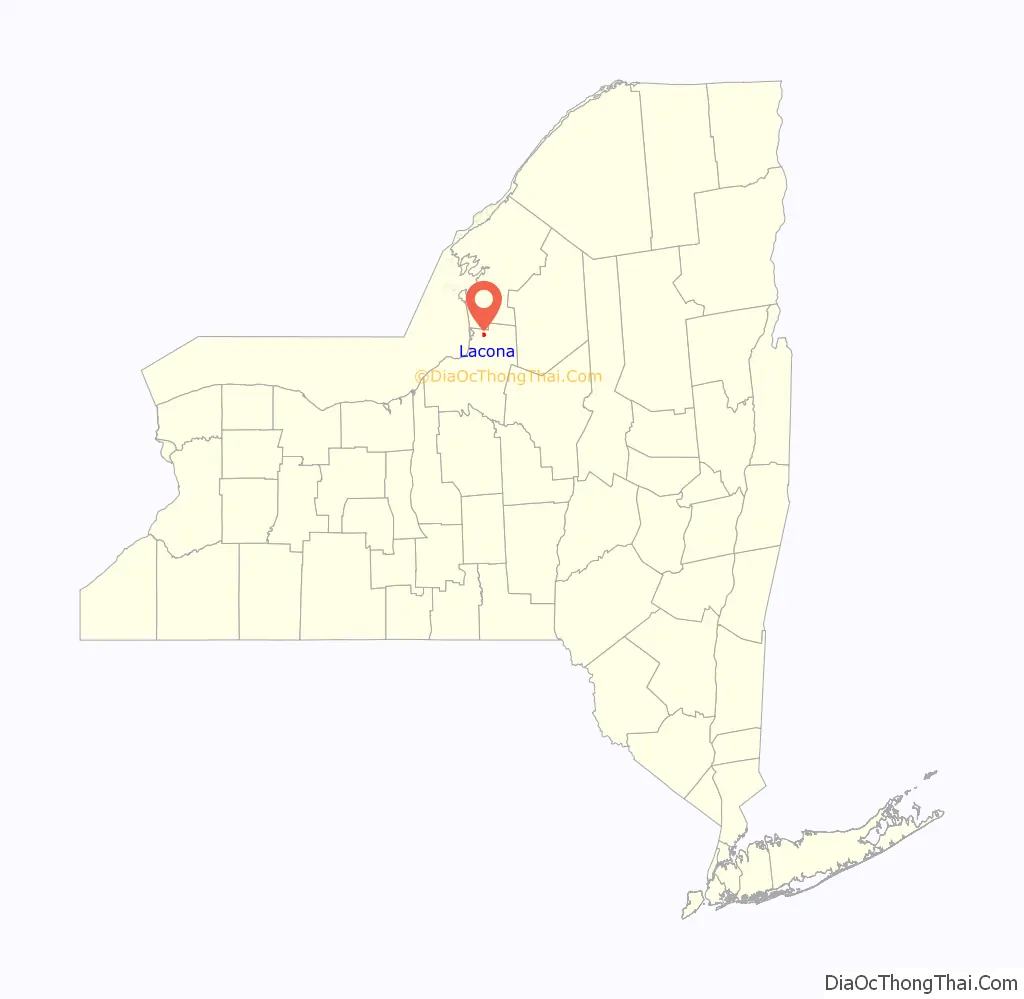
Lacona location map. Where is Lacona village?
History
The village was founded around 1803. Lacona was incorporated as a village in 1880.
The Smith H. Barlow House, First National Bank of Lacona, Lacona Clock Tower, Lacona Railroad Station and Depot, Charles M. Salisbury House, Matthew Shoecraft House, Fred Smart House, and Newman Tuttle House are listed on the National Register of Historic Places.
Lacona Road Map
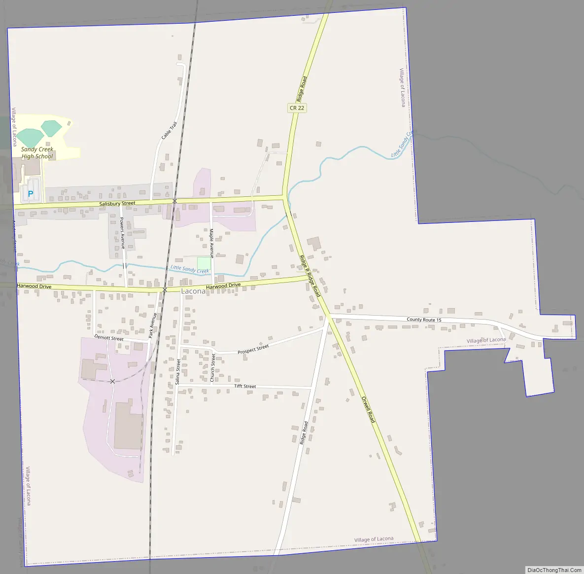
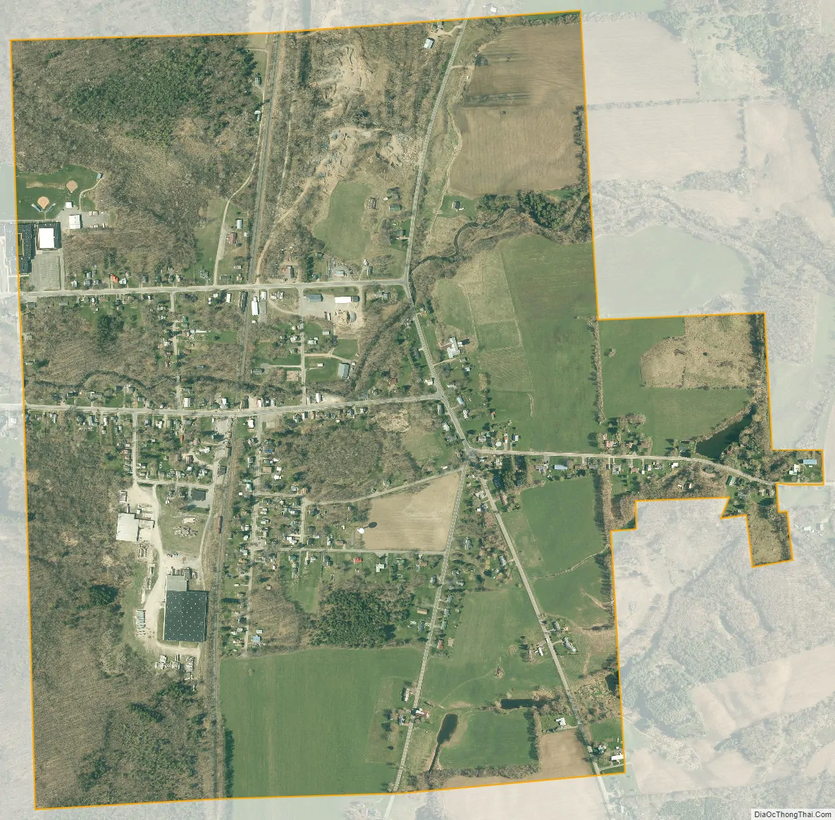
Lacona city Satellite Map
Geography
Lacona is located at 43°38′38″N 76°4′7″W / 43.64389°N 76.06861°W / 43.64389; -76.06861 (43.643791, -76.068562).
According to the United States Census Bureau, the village has a total area of 1.0 square mile (2.6 km), all land.
The village is east of Interstate 81. Little Sandy Creek flows westward through the village and the adjacent Village of Sandy Creek.
See also
Map of New York State and its subdivision:- Albany
- Allegany
- Bronx
- Broome
- Cattaraugus
- Cayuga
- Chautauqua
- Chemung
- Chenango
- Clinton
- Columbia
- Cortland
- Delaware
- Dutchess
- Erie
- Essex
- Franklin
- Fulton
- Genesee
- Greene
- Hamilton
- Herkimer
- Jefferson
- Kings
- Lake Ontario
- Lewis
- Livingston
- Madison
- Monroe
- Montgomery
- Nassau
- New York
- Niagara
- Oneida
- Onondaga
- Ontario
- Orange
- Orleans
- Oswego
- Otsego
- Putnam
- Queens
- Rensselaer
- Richmond
- Rockland
- Saint Lawrence
- Saratoga
- Schenectady
- Schoharie
- Schuyler
- Seneca
- Steuben
- Suffolk
- Sullivan
- Tioga
- Tompkins
- Ulster
- Warren
- Washington
- Wayne
- Westchester
- Wyoming
- Yates
- Alabama
- Alaska
- Arizona
- Arkansas
- California
- Colorado
- Connecticut
- Delaware
- District of Columbia
- Florida
- Georgia
- Hawaii
- Idaho
- Illinois
- Indiana
- Iowa
- Kansas
- Kentucky
- Louisiana
- Maine
- Maryland
- Massachusetts
- Michigan
- Minnesota
- Mississippi
- Missouri
- Montana
- Nebraska
- Nevada
- New Hampshire
- New Jersey
- New Mexico
- New York
- North Carolina
- North Dakota
- Ohio
- Oklahoma
- Oregon
- Pennsylvania
- Rhode Island
- South Carolina
- South Dakota
- Tennessee
- Texas
- Utah
- Vermont
- Virginia
- Washington
- West Virginia
- Wisconsin
- Wyoming