Lakeland is a hamlet (and census-designated place) in Onondaga County, New York, United States. The population was 2,786 at the 2010 census. The community name is derived from its location next to Onondaga Lake.
The community is in the northwest part of the town of Geddes.
| Name: | Lakeland CDP |
|---|---|
| LSAD Code: | 57 |
| LSAD Description: | CDP (suffix) |
| State: | New York |
| County: | Onondaga County |
| Elevation: | 479 ft (146 m) |
| Total Area: | 1.49 sq mi (3.86 km²) |
| Land Area: | 1.49 sq mi (3.86 km²) |
| Water Area: | 0.00 sq mi (0.00 km²) |
| Total Population: | 2,556 |
| Population Density: | 1,714.29/sq mi (661.71/km²) |
| FIPS code: | 3640607 |
| GNISfeature ID: | 0954952 |
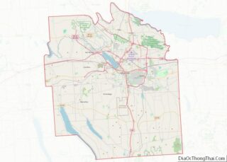
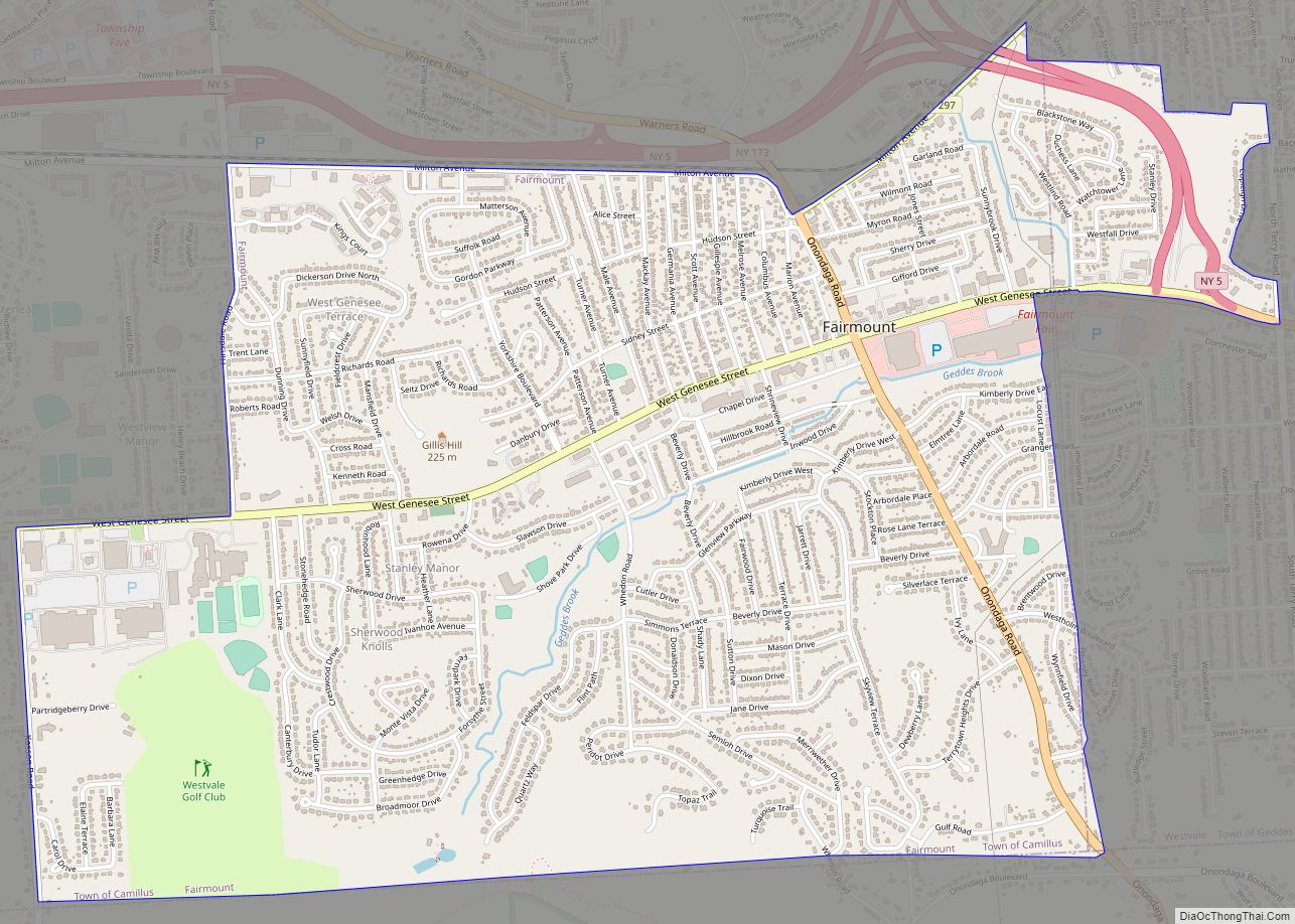
Online Interactive Map
Click on ![]() to view map in "full screen" mode.
to view map in "full screen" mode.
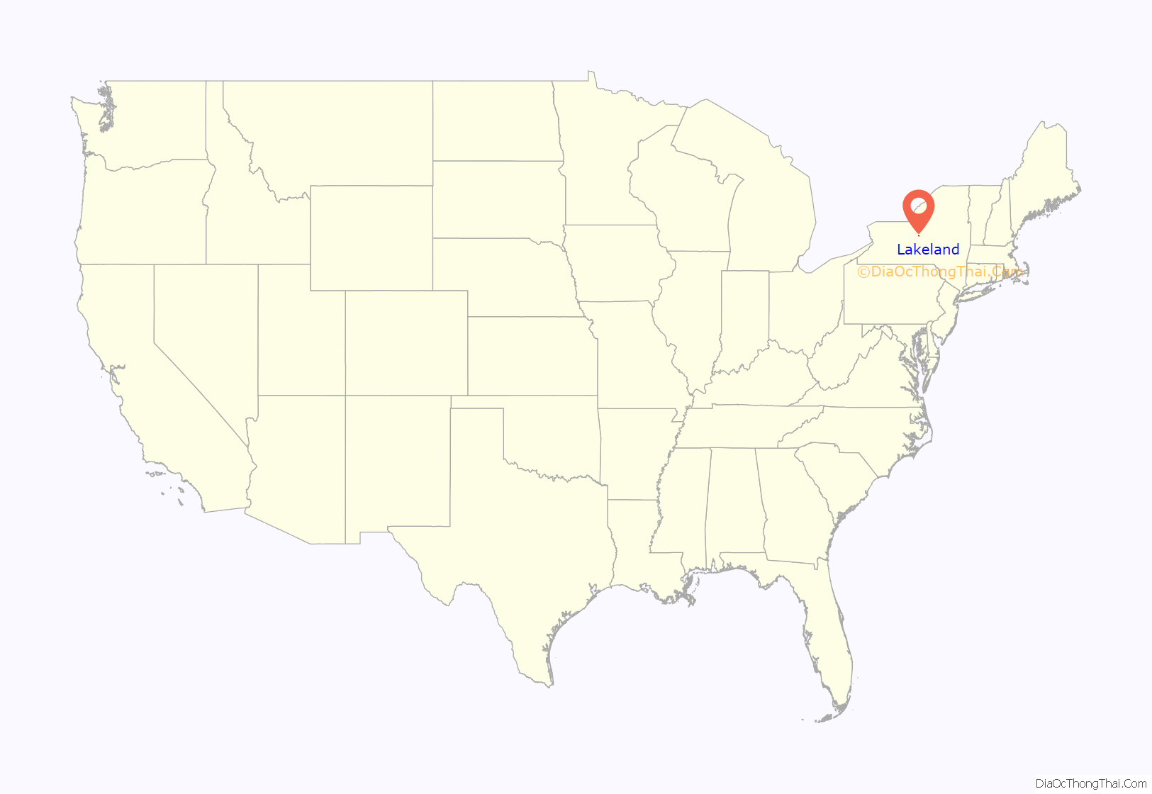
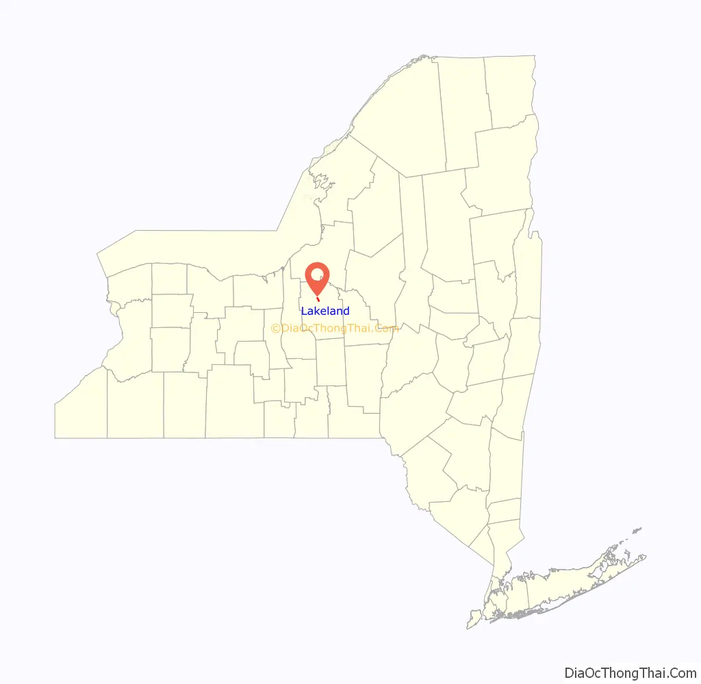
Lakeland location map. Where is Lakeland CDP?
History
From the latter part of the nineteenth century through the early years of the twentieth century, Lakeland was home to several upscale hotels and a small amusement park along the shores of Onondaga Lake. These were served by a trolley car line from Syracuse. However, the resort area began to decline before World War I and was gone by the Great Depression. The former resort area is now largely covered by Interstate 690 and parking areas for the New York State Fair, whose permanent grounds are at the southern edge of Lakeland.
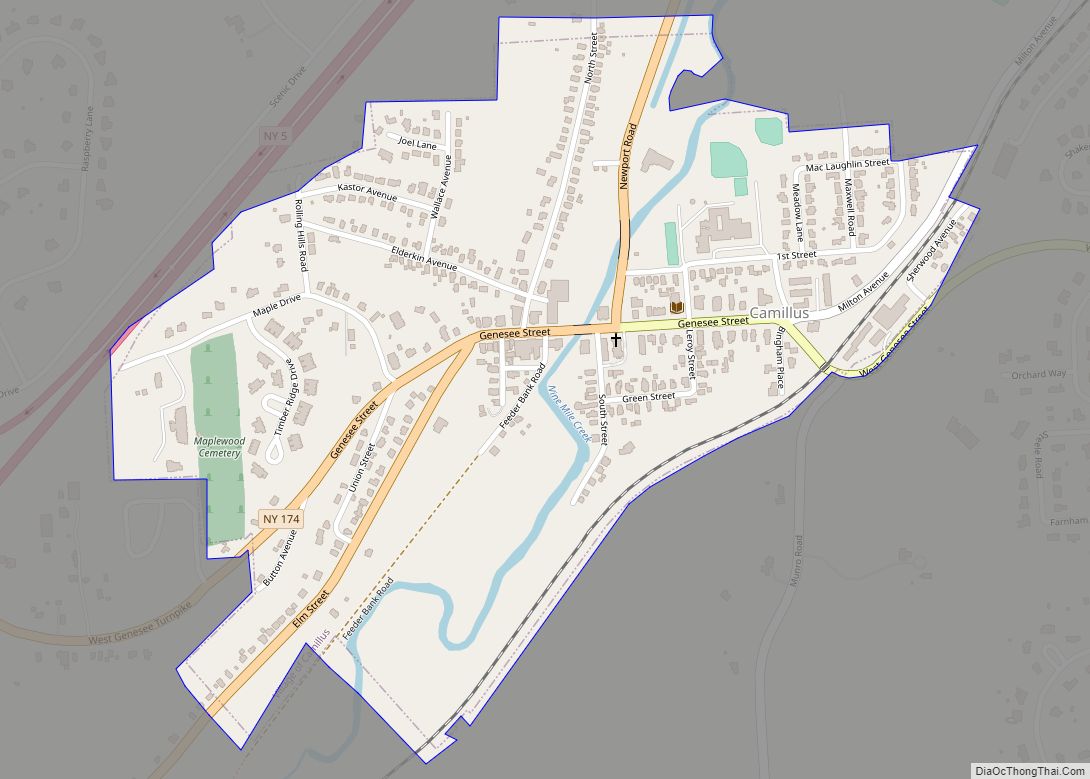
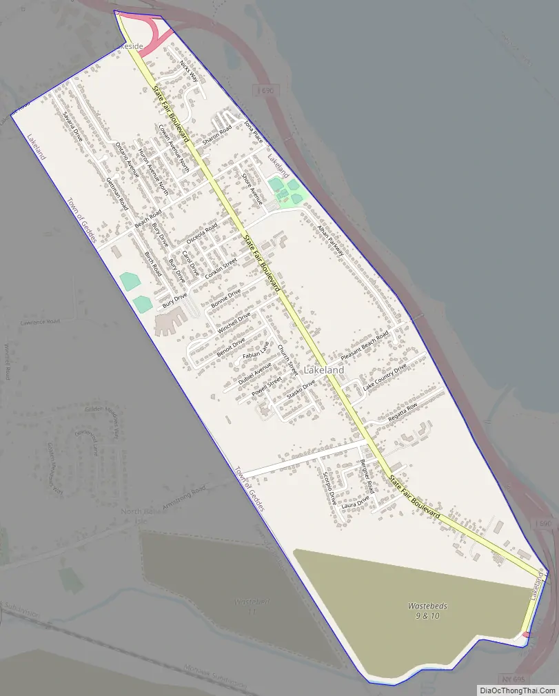
Lakeland Road Map
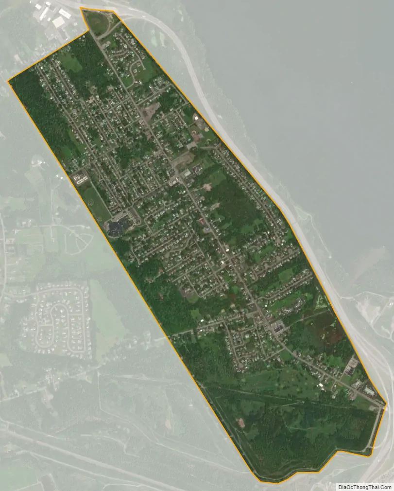
Lakeland city Satellite Map
Geography
Lakeland is located at 43°5′36″N 76°14′45″W / 43.09333°N 76.24583°W / 43.09333; -76.24583 (43.093266, -76.245718).
According to the United States Census Bureau, the CDP has a total area of 1.5 square miles (3.9 km), all land.
Lakeland comprises the area along roughly the northern half of the southwest side of Onondaga Lake (which runs northwest to southeast).
Interstate 690 passes through the community.
See also
Map of New York State and its subdivision:- Albany
- Allegany
- Bronx
- Broome
- Cattaraugus
- Cayuga
- Chautauqua
- Chemung
- Chenango
- Clinton
- Columbia
- Cortland
- Delaware
- Dutchess
- Erie
- Essex
- Franklin
- Fulton
- Genesee
- Greene
- Hamilton
- Herkimer
- Jefferson
- Kings
- Lake Ontario
- Lewis
- Livingston
- Madison
- Monroe
- Montgomery
- Nassau
- New York
- Niagara
- Oneida
- Onondaga
- Ontario
- Orange
- Orleans
- Oswego
- Otsego
- Putnam
- Queens
- Rensselaer
- Richmond
- Rockland
- Saint Lawrence
- Saratoga
- Schenectady
- Schoharie
- Schuyler
- Seneca
- Steuben
- Suffolk
- Sullivan
- Tioga
- Tompkins
- Ulster
- Warren
- Washington
- Wayne
- Westchester
- Wyoming
- Yates
- Alabama
- Alaska
- Arizona
- Arkansas
- California
- Colorado
- Connecticut
- Delaware
- District of Columbia
- Florida
- Georgia
- Hawaii
- Idaho
- Illinois
- Indiana
- Iowa
- Kansas
- Kentucky
- Louisiana
- Maine
- Maryland
- Massachusetts
- Michigan
- Minnesota
- Mississippi
- Missouri
- Montana
- Nebraska
- Nevada
- New Hampshire
- New Jersey
- New Mexico
- New York
- North Carolina
- North Dakota
- Ohio
- Oklahoma
- Oregon
- Pennsylvania
- Rhode Island
- South Carolina
- South Dakota
- Tennessee
- Texas
- Utah
- Vermont
- Virginia
- Washington
- West Virginia
- Wisconsin
- Wyoming