Laurel is a census-designated place (CDP) roughly corresponding to the hamlet of Laurel in Suffolk County, New York, United States. It is located mostly within the Town of Southold, with a small portion in the Town of Riverhead. The population was 1,394 at the 2010 census.
| Name: | Laurel CDP |
|---|---|
| LSAD Code: | 57 |
| LSAD Description: | CDP (suffix) |
| State: | New York |
| County: | Suffolk County |
| Elevation: | 20 ft (6 m) |
| Total Area: | 3.07 sq mi (7.96 km²) |
| Land Area: | 3.00 sq mi (7.77 km²) |
| Water Area: | 0.07 sq mi (0.19 km²) |
| Total Population: | 1,495 |
| Population Density: | 498.33/sq mi (192.41/km²) |
| ZIP code: | 11948 |
| Area code: | 631 |
| FIPS code: | 3641465 |
| GNISfeature ID: | 0955082 |
Online Interactive Map
Click on ![]() to view map in "full screen" mode.
to view map in "full screen" mode.
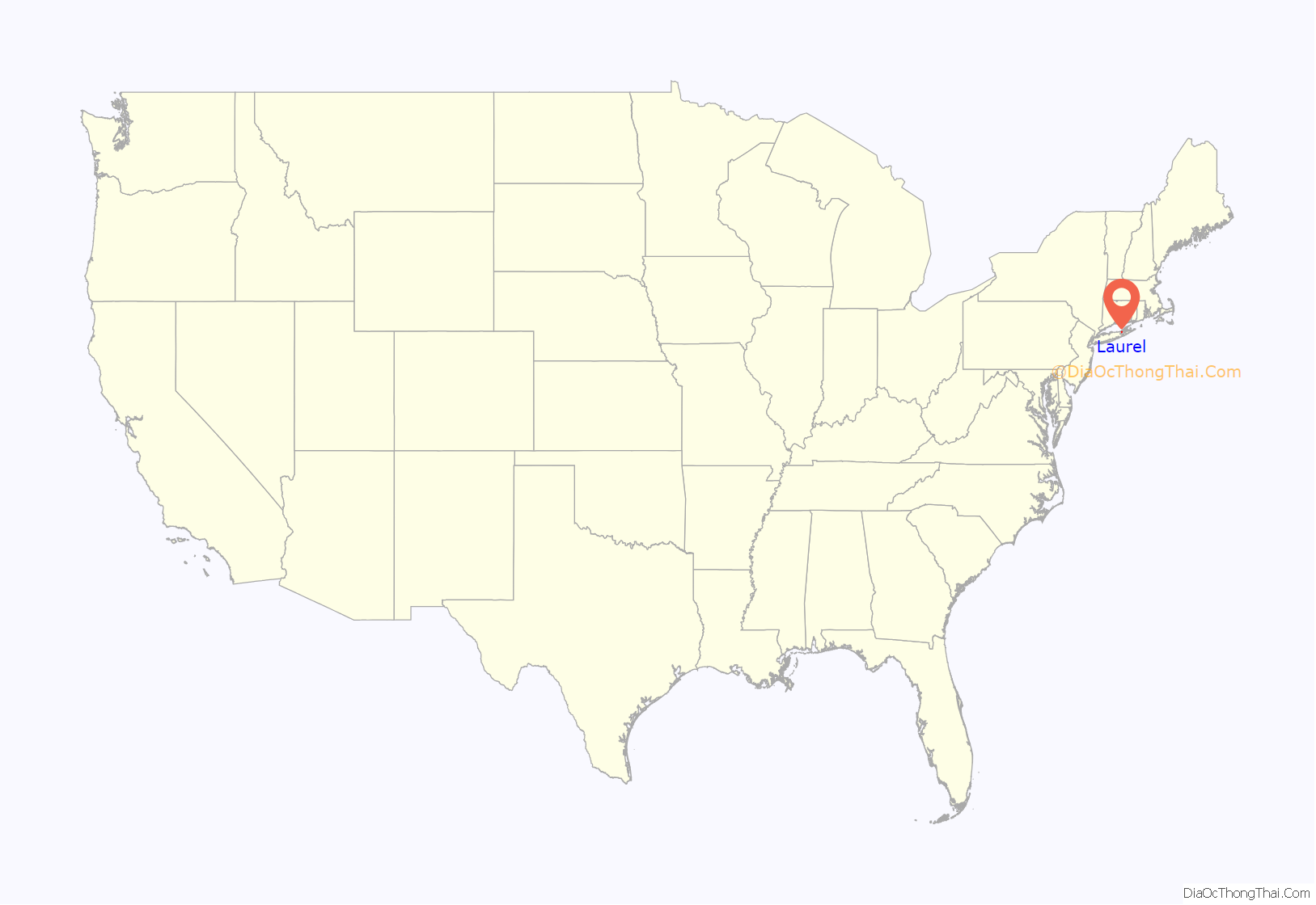
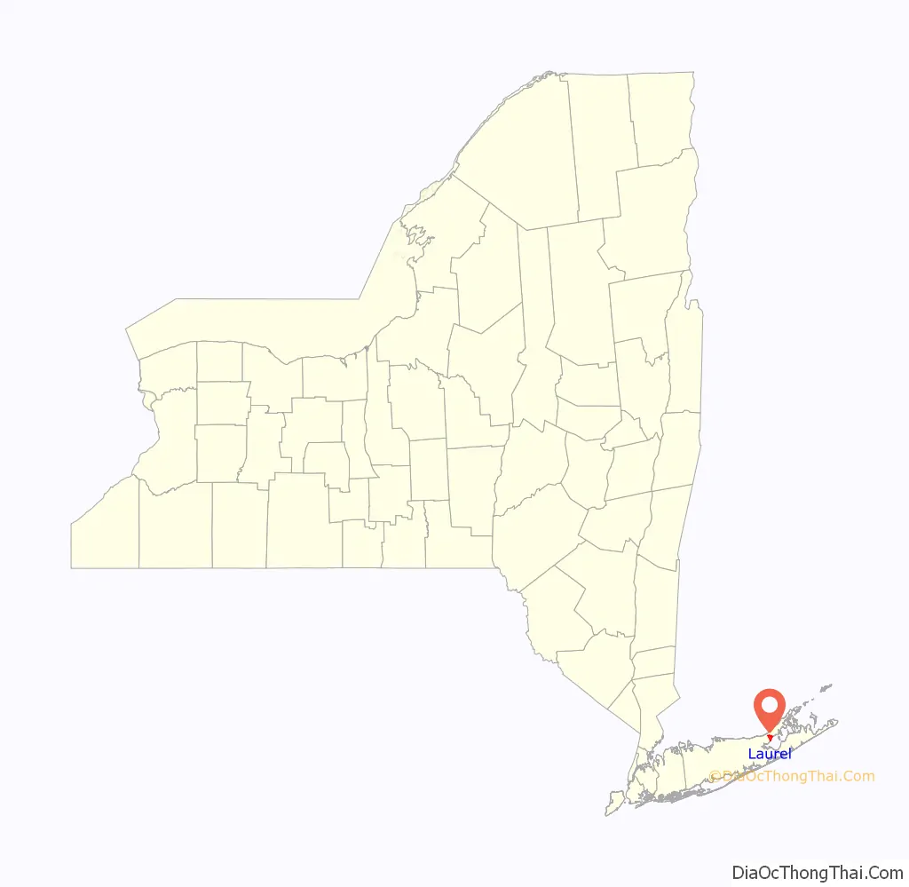
Laurel location map. Where is Laurel CDP?
History
The area was originally known as the “Middle Ground” between Southold and Riverhead. Later it was called Franklinville, but relinquished that name for Laurel due to a conflict of names with another Franklinville.
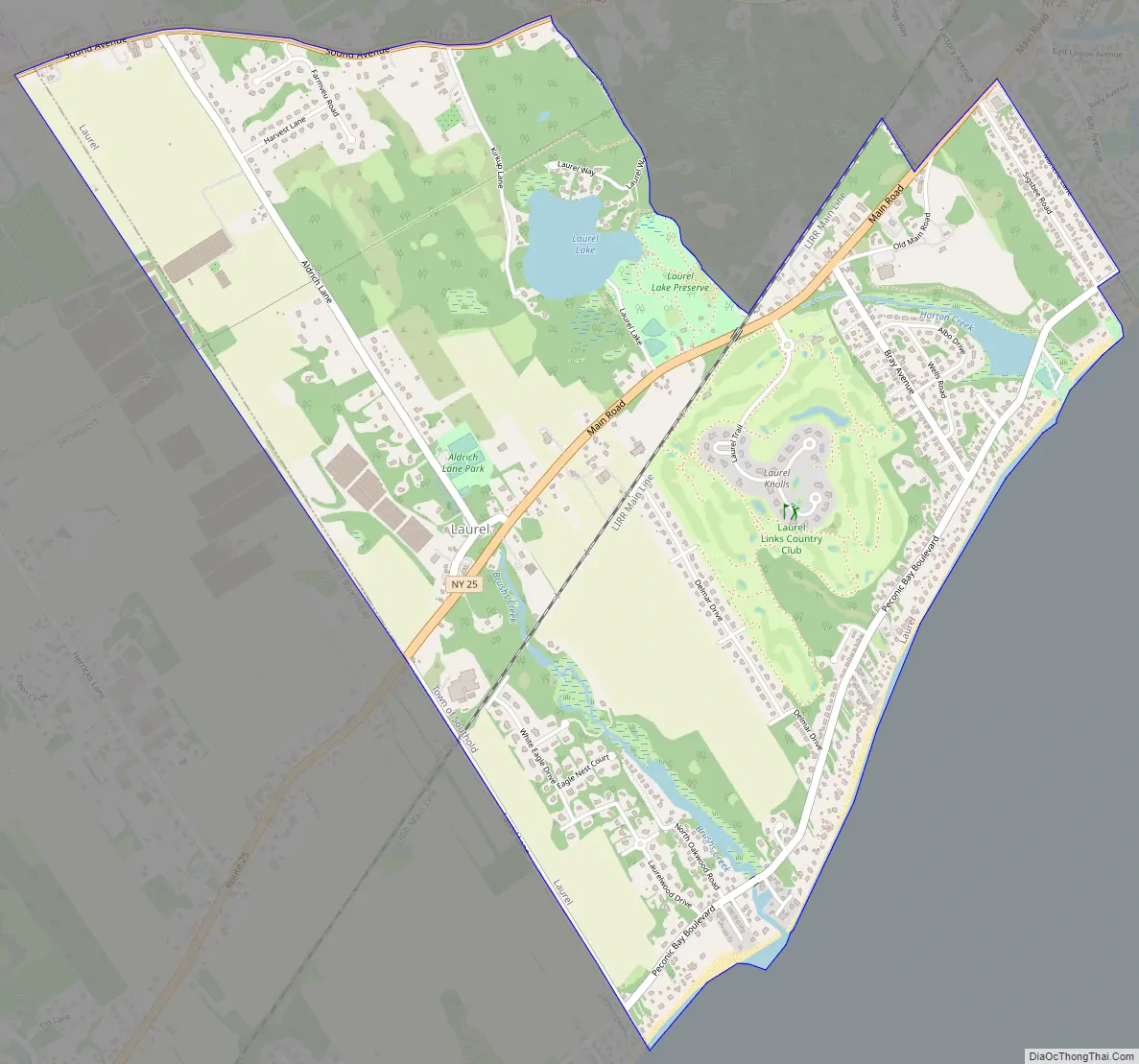
Laurel Road Map
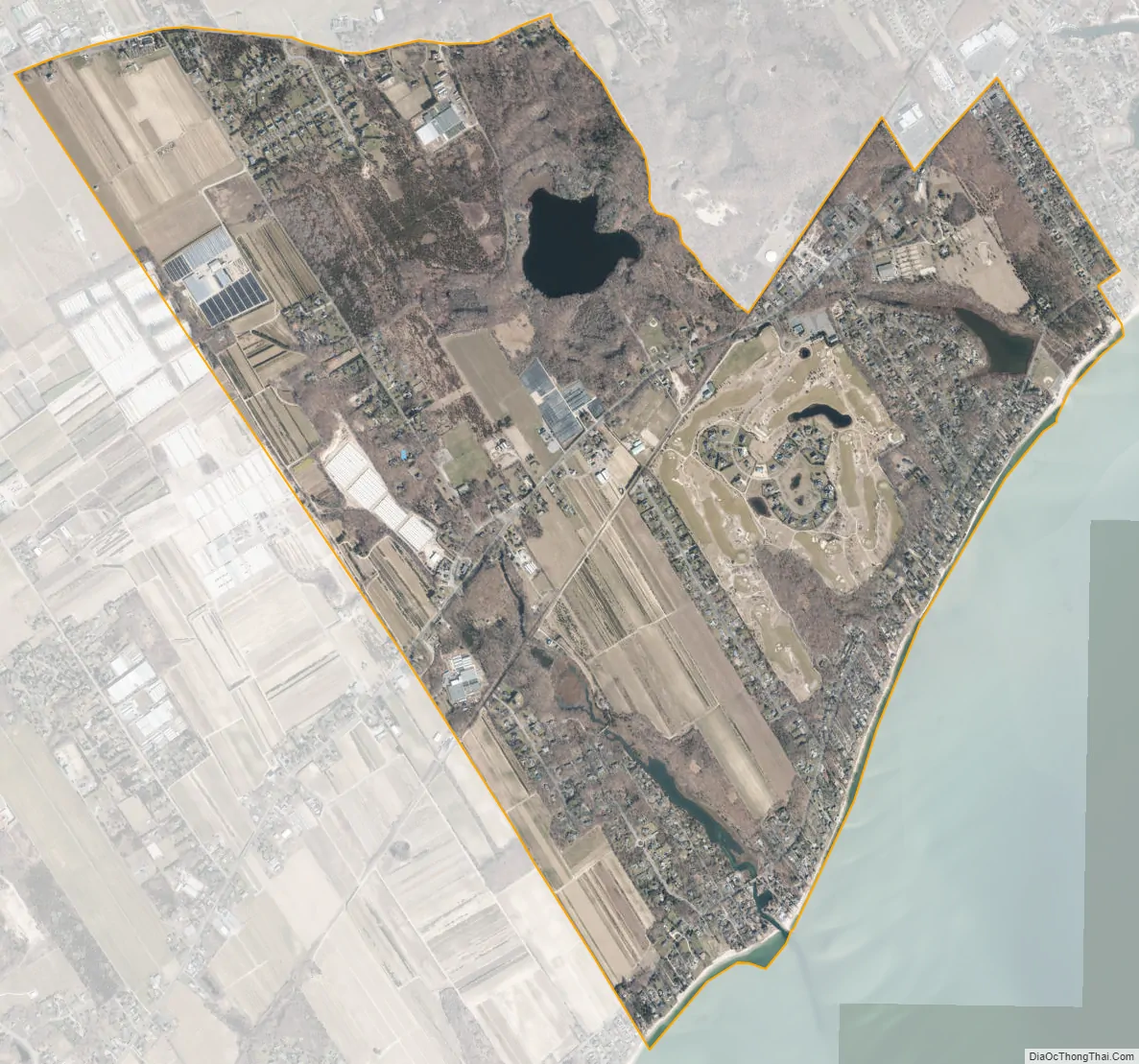
Laurel city Satellite Map
Geography
According to the United States Census Bureau, the community has a total area of 3.1 square miles (8.0 km), of which 3.0 square miles (7.8 km) is land and 0.077 square miles (0.2 km), or 2.39%, is water.
See also
Map of New York State and its subdivision:- Albany
- Allegany
- Bronx
- Broome
- Cattaraugus
- Cayuga
- Chautauqua
- Chemung
- Chenango
- Clinton
- Columbia
- Cortland
- Delaware
- Dutchess
- Erie
- Essex
- Franklin
- Fulton
- Genesee
- Greene
- Hamilton
- Herkimer
- Jefferson
- Kings
- Lake Ontario
- Lewis
- Livingston
- Madison
- Monroe
- Montgomery
- Nassau
- New York
- Niagara
- Oneida
- Onondaga
- Ontario
- Orange
- Orleans
- Oswego
- Otsego
- Putnam
- Queens
- Rensselaer
- Richmond
- Rockland
- Saint Lawrence
- Saratoga
- Schenectady
- Schoharie
- Schuyler
- Seneca
- Steuben
- Suffolk
- Sullivan
- Tioga
- Tompkins
- Ulster
- Warren
- Washington
- Wayne
- Westchester
- Wyoming
- Yates
- Alabama
- Alaska
- Arizona
- Arkansas
- California
- Colorado
- Connecticut
- Delaware
- District of Columbia
- Florida
- Georgia
- Hawaii
- Idaho
- Illinois
- Indiana
- Iowa
- Kansas
- Kentucky
- Louisiana
- Maine
- Maryland
- Massachusetts
- Michigan
- Minnesota
- Mississippi
- Missouri
- Montana
- Nebraska
- Nevada
- New Hampshire
- New Jersey
- New Mexico
- New York
- North Carolina
- North Dakota
- Ohio
- Oklahoma
- Oregon
- Pennsylvania
- Rhode Island
- South Carolina
- South Dakota
- Tennessee
- Texas
- Utah
- Vermont
- Virginia
- Washington
- West Virginia
- Wisconsin
- Wyoming


