Leicester is a village in the town of Leicester, Livingston County, New York, United States. The population was 468 at the 2010 census, out of 2,200 in the entire town of Leicester. The village and town are named after Leicester Phelps, an early inhabitant.
| Name: | Leicester village |
|---|---|
| LSAD Code: | 47 |
| LSAD Description: | village (suffix) |
| State: | New York |
| County: | Livingston County |
| Elevation: | 650 ft (198 m) |
| Total Area: | 0.36 sq mi (0.93 km²) |
| Land Area: | 0.36 sq mi (0.93 km²) |
| Water Area: | 0.00 sq mi (0.00 km²) |
| Total Population: | 440 |
| Population Density: | 1,218.84/sq mi (470.81/km²) |
| ZIP code: | 14481 |
| Area code: | 585 |
| FIPS code: | 3641872 |
| GNISfeature ID: | 2390938 |
| Website: | www.villageofleicester.org |
Online Interactive Map
Click on ![]() to view map in "full screen" mode.
to view map in "full screen" mode.
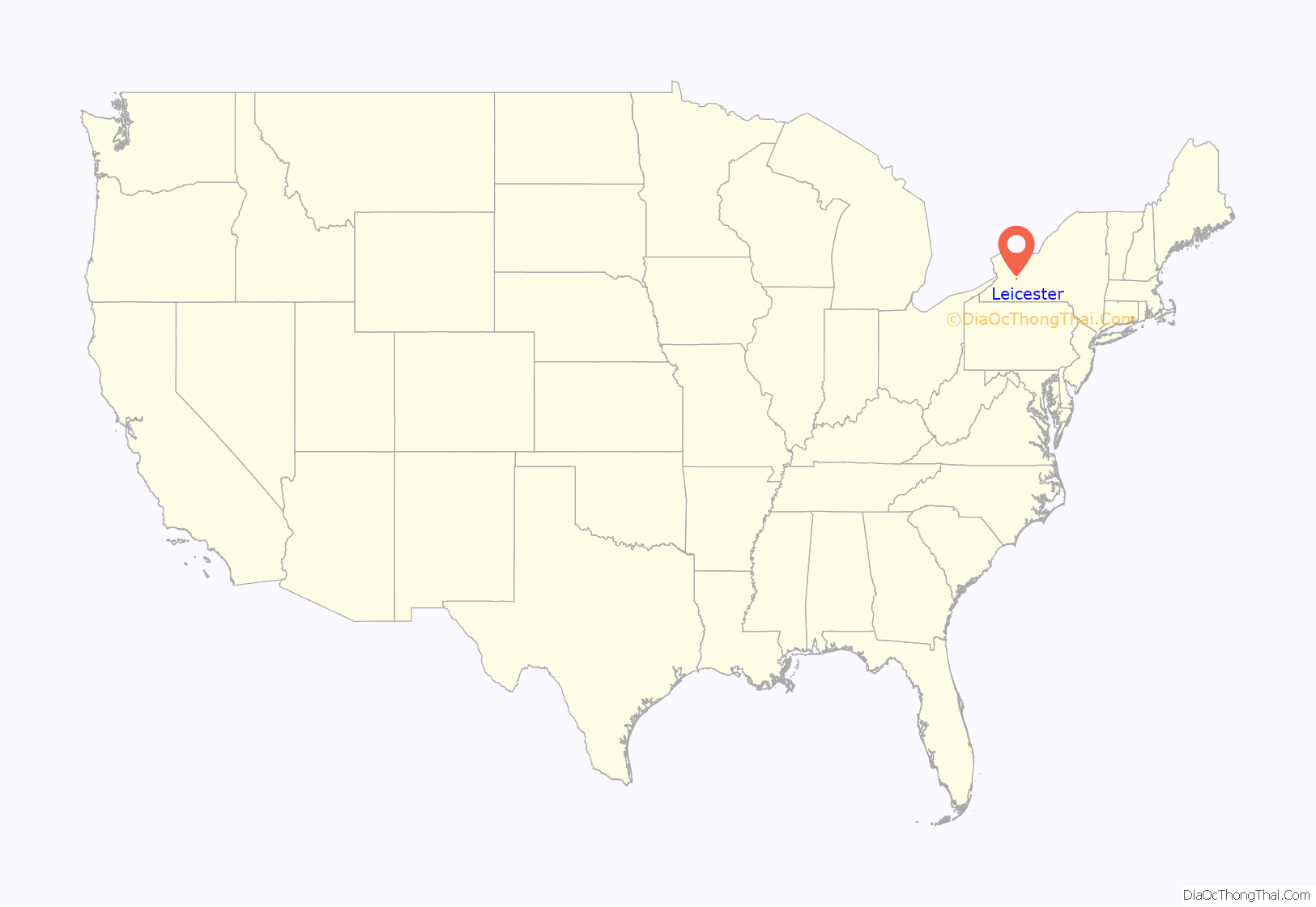
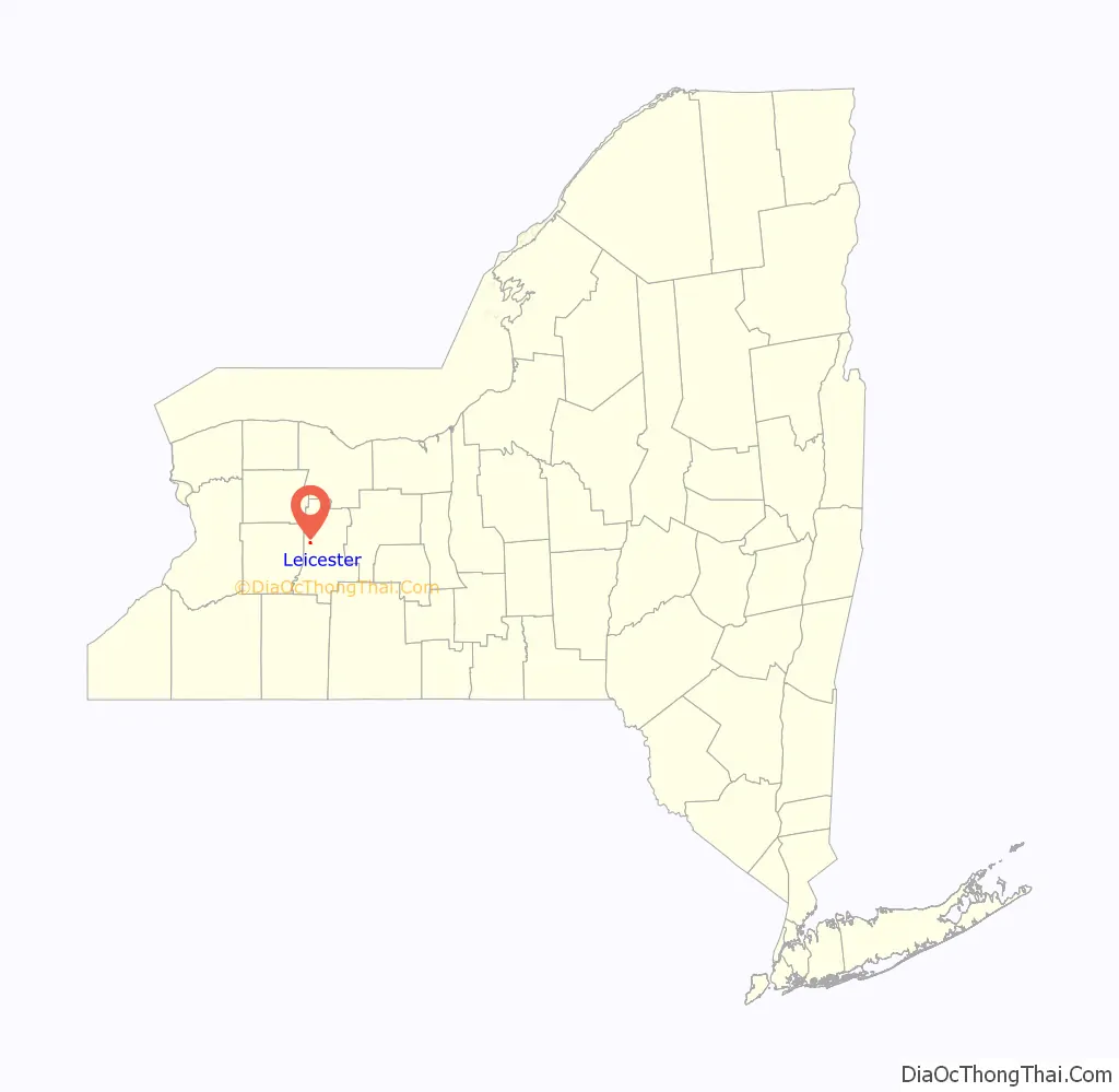
Leicester location map. Where is Leicester village?
History
The village was formerly called “Leister” and “Moscow”. It was incorporated in 1850.
The Delaware, Lackawanna & Western Railroad Station was added to the National Register of Historic Places in 2005.
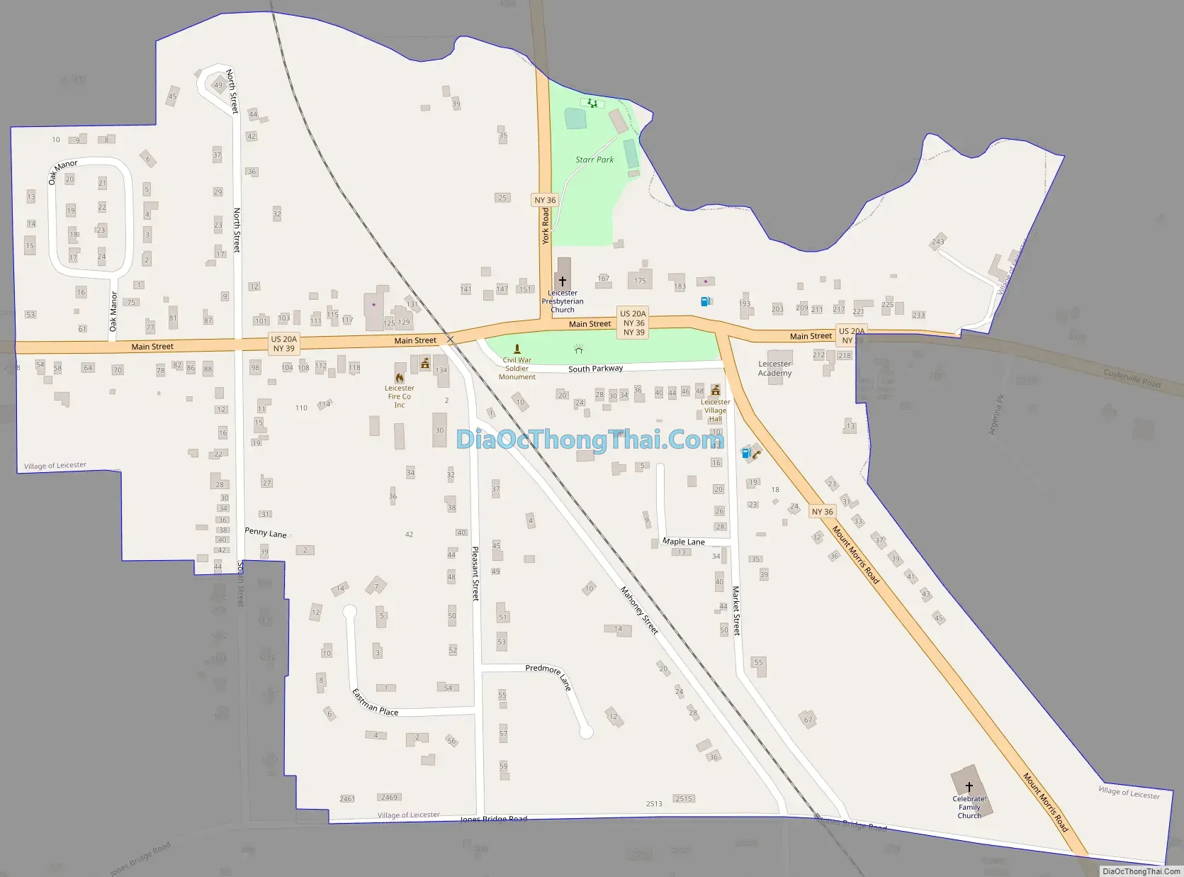
Leicester Road Map
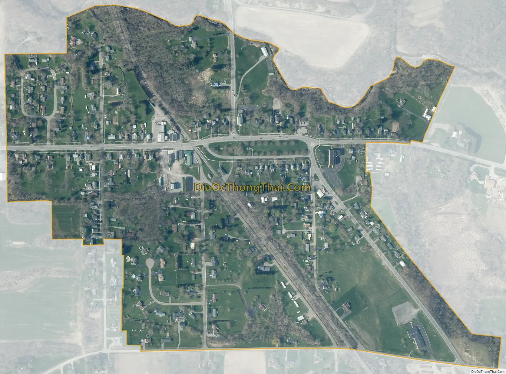
Leicester city Satellite Map
Geography
The village is in western Livingston County, in the center of the town of Leicester. According to the United States Census Bureau, the village has a total area of 0.35 square miles (0.9 km), all land. The northern border of the village is Beards Creek, an east-flowing tributary of the Genesee River.
The village is at the junction of U.S. Route 20A, New York State Route 36, and New York State Route 39. It is 5 miles (8 km) west of Geneseo, the Livingston county seat, and 34 miles (55 km) southwest of Rochester.
The village is 3 miles (5 km) north of Mount Morris Dam at the north end of Letchworth State Park.
See also
Map of New York State and its subdivision:- Albany
- Allegany
- Bronx
- Broome
- Cattaraugus
- Cayuga
- Chautauqua
- Chemung
- Chenango
- Clinton
- Columbia
- Cortland
- Delaware
- Dutchess
- Erie
- Essex
- Franklin
- Fulton
- Genesee
- Greene
- Hamilton
- Herkimer
- Jefferson
- Kings
- Lake Ontario
- Lewis
- Livingston
- Madison
- Monroe
- Montgomery
- Nassau
- New York
- Niagara
- Oneida
- Onondaga
- Ontario
- Orange
- Orleans
- Oswego
- Otsego
- Putnam
- Queens
- Rensselaer
- Richmond
- Rockland
- Saint Lawrence
- Saratoga
- Schenectady
- Schoharie
- Schuyler
- Seneca
- Steuben
- Suffolk
- Sullivan
- Tioga
- Tompkins
- Ulster
- Warren
- Washington
- Wayne
- Westchester
- Wyoming
- Yates
- Alabama
- Alaska
- Arizona
- Arkansas
- California
- Colorado
- Connecticut
- Delaware
- District of Columbia
- Florida
- Georgia
- Hawaii
- Idaho
- Illinois
- Indiana
- Iowa
- Kansas
- Kentucky
- Louisiana
- Maine
- Maryland
- Massachusetts
- Michigan
- Minnesota
- Mississippi
- Missouri
- Montana
- Nebraska
- Nevada
- New Hampshire
- New Jersey
- New Mexico
- New York
- North Carolina
- North Dakota
- Ohio
- Oklahoma
- Oregon
- Pennsylvania
- Rhode Island
- South Carolina
- South Dakota
- Tennessee
- Texas
- Utah
- Vermont
- Virginia
- Washington
- West Virginia
- Wisconsin
- Wyoming


