Manhasset is a hamlet and census-designated place (CDP) in Nassau County, on the North Shore of Long Island, in New York, United States. It is considered the anchor community of the Greater Manhasset area. The population was 8,176 at the 2020 census.
As with other unincorporated communities in New York, its local affairs are administered by the town in which it is located, the Town of North Hempstead, whose town hall is in Manhasset, making the hamlet the town seat.
| Name: | Manhasset CDP |
|---|---|
| LSAD Code: | 57 |
| LSAD Description: | CDP (suffix) |
| State: | New York |
| County: | Nassau County |
| Elevation: | 95 ft (29 m) |
| Total Area: | 2.42 sq mi (6.27 km²) |
| Land Area: | 2.38 sq mi (6.18 km²) |
| Water Area: | 0.03 sq mi (0.09 km²) |
| Total Population: | 8,176 |
| Population Density: | 3,428.09/sq mi (1,323.55/km²) |
| ZIP code: | 11030 |
| FIPS code: | 3644897 |
| GNISfeature ID: | 0956342 |
| Website: | manhassetny.org |
Online Interactive Map
Click on ![]() to view map in "full screen" mode.
to view map in "full screen" mode.
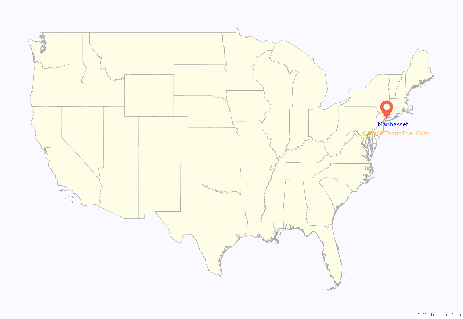
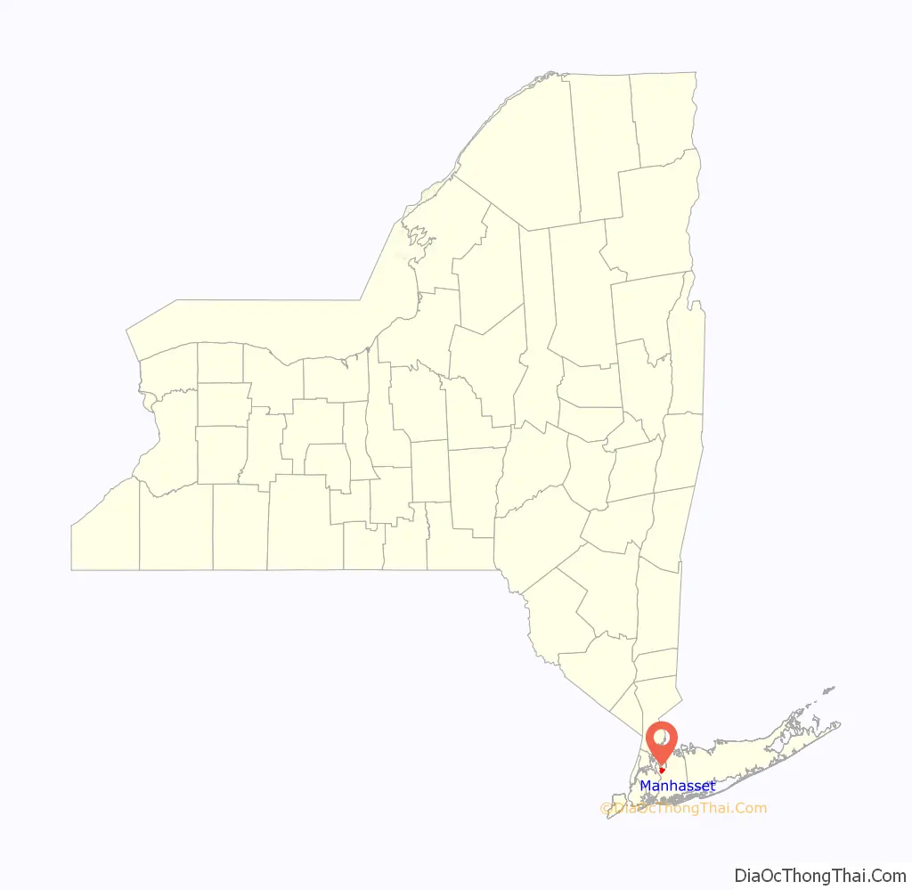
Manhasset location map. Where is Manhasset CDP?
History
The Matinecock had a village on Manhasset Bay. These Native Americans called the area Sint Sink, meaning “place of small stones”. They made wampum from oyster shells. In 1623, the area was claimed by the Dutch West India Company and they began forcing English settlers to leave in 1640. A 1643 land purchase made it possible for English settlers to return to Cow Neck (the peninsula where present-day Port Washington, Manhasset, and surrounding villages are located.).
Manhasset Bay was previously known as Schout’s Bay (a schout being roughly the Dutch equivalent of a sheriff), Martin Garretson’s Bay (Martin Garretson was the Schout at one point), and later Cow Bay or Cow Harbor. Cow Neck was so called because it offered good grazing land. By 1659, there were over 300 cows and 5 mi (8 km) fence separating Cow Neck from the areas to the south. The settlers came to an agreement that each of them could have one cow on the neck for each section of fence the individual had constructed. The area was more formally divided among the settlers when the fence was removed in 1677. Manhasset took on the name Little Cow Neck, Port Washington was known as Upper Cow Neck.
During the American Revolution, Little Cow Neck suffered at the hands of the British. Many structures and properties, such as the 1719 Quaker Meeting House were burned, seized or damaged. The Town of North Hempstead separated from the Town of Hempstead in 1784 because the South, inhabited mainly by Church of England people, was loyal to the king. The Northern communities and villages, dominated by Yankee Congregationalists supported independence.
In 1801, it cost two cents to travel between Roslyn and Spinney Hill on the North Hempstead Turnpike, the newly opened toll road (now Northern Boulevard).
The Manhasset name was adopted in 1840 and comes from the native word “Manhanset”, roughly meaning “the island neighborhood.” Dairy farming was still a major endeavor, but the oyster industry was also on the rise. In 1898, the Long Island Railroad arrived, bringing with it wealthy New Yorkers looking for country homes with easy transportation to more urban areas of New York City. Manhasset Valley and Spinney Hill attracted a number of skilled workers and immigrant families.
The North Hempstead Town Hall opened in Manhasset on Plandome Road in 1907. Town councilmen had previously been meeting in Roslyn taverns after North Hempstead split away from Hempstead in 1775.
The Manhasset Valley School, originally built to serve the children of the help on the local Gold Coast Estates, eventually came to serve Manhasset’s African American community, and was closed in the 1960s by a desegregation lawsuit. It is still standing and is currently used as a community center. The centrally located but antiquated Plandome Road School was demolished in the early 1970s, having been replaced by the new Shelter Rock Elementary School in North Hills by 1969. Currently, Mary Jane Davies Green sits on the site of the old school.
Manhasset is served by the Nassau County Police Department, with the Sixth Precinct station house located on Community Drive, just south of Northern Boulevard. RMPs 608 and 616 are the cars assigned to patrol duties in Manhasset. In 2005, a Wall Street Journal article ranked Manhasset as the best town for raising a family in the New York metropolitan area. The Manhasset area, settled by 1680, grew quickly after it began being served by the Long Island Rail Road in 1898. The LIRR provides access to New York City via the Manhasset station with an approximately 40 minute commute to Penn Station. Express trains, which run during rush hour, make the trip in less than 30 minutes. The hamlet of Manhasset is located 19.5 miles (29.2 km) away from midtown Manhattan.
In the 2010s and 2020s, talks have been restarted to connect the businesses on Plandome Road to sanitary sewers operated by the Great Neck Water Pollution Control District. These proposals have been discussed for decades but historically had been met with opposition, ultimately killing some of the earlier plans.
Failed incorporation attempts
There have been several unsuccessful attempts over the years – especially throughout the 1940s – for some or all of the unincorporated areas of Manhasset to incorporate as villages. The most recent proposal to incorporate the hamlet took place in 2016.
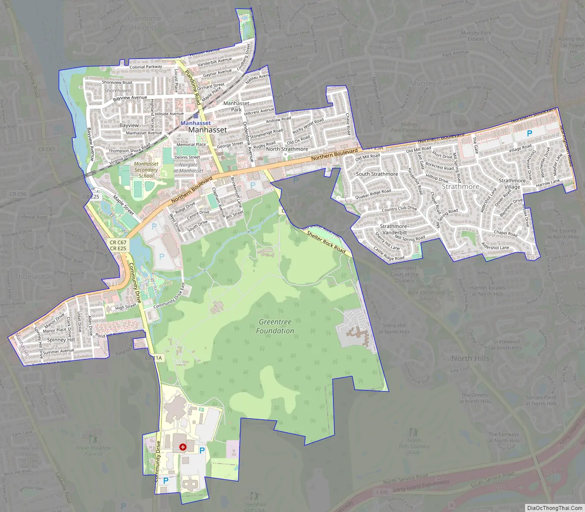
Manhasset Road Map
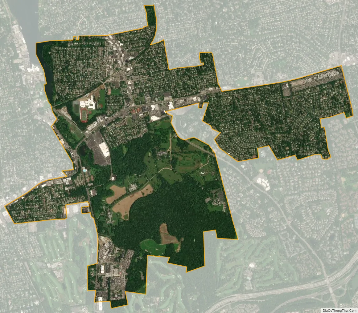
Manhasset city Satellite Map
Geography
According to the U.S. Census Bureau, the CDP has a total area of 2.4 square miles (6.2 km), of which 2.4 square miles (6.2 km) is land and 0.04 square miles (0.10 km), or 1.24%, is water.
Greater Manhasset area
In addition to the unincorporated areas of Manhasset proper (Bayview, the Strathmores (North and South Strathmore, Strathmore Village, and Strathmore–Vanderbilt), Shorehaven, Terrace Manor, Manhasset Park, Manhasset Gardens, and Norgate), the Greater Manhasset area also includes three incorporated villages: Munsey Park, Plandome, and Plandome Heights; and parts of three others: Flower Hill, Plandome Manor, and North Hills.
See also
Map of New York State and its subdivision:- Albany
- Allegany
- Bronx
- Broome
- Cattaraugus
- Cayuga
- Chautauqua
- Chemung
- Chenango
- Clinton
- Columbia
- Cortland
- Delaware
- Dutchess
- Erie
- Essex
- Franklin
- Fulton
- Genesee
- Greene
- Hamilton
- Herkimer
- Jefferson
- Kings
- Lake Ontario
- Lewis
- Livingston
- Madison
- Monroe
- Montgomery
- Nassau
- New York
- Niagara
- Oneida
- Onondaga
- Ontario
- Orange
- Orleans
- Oswego
- Otsego
- Putnam
- Queens
- Rensselaer
- Richmond
- Rockland
- Saint Lawrence
- Saratoga
- Schenectady
- Schoharie
- Schuyler
- Seneca
- Steuben
- Suffolk
- Sullivan
- Tioga
- Tompkins
- Ulster
- Warren
- Washington
- Wayne
- Westchester
- Wyoming
- Yates
- Alabama
- Alaska
- Arizona
- Arkansas
- California
- Colorado
- Connecticut
- Delaware
- District of Columbia
- Florida
- Georgia
- Hawaii
- Idaho
- Illinois
- Indiana
- Iowa
- Kansas
- Kentucky
- Louisiana
- Maine
- Maryland
- Massachusetts
- Michigan
- Minnesota
- Mississippi
- Missouri
- Montana
- Nebraska
- Nevada
- New Hampshire
- New Jersey
- New Mexico
- New York
- North Carolina
- North Dakota
- Ohio
- Oklahoma
- Oregon
- Pennsylvania
- Rhode Island
- South Carolina
- South Dakota
- Tennessee
- Texas
- Utah
- Vermont
- Virginia
- Washington
- West Virginia
- Wisconsin
- Wyoming


