Matinecock is a village located within the Town of Oyster Bay in Nassau County, on Long Island, in New York, United States. The population was 810 at the 2010 census.
| Name: | Matinecock village |
|---|---|
| LSAD Code: | 47 |
| LSAD Description: | village (suffix) |
| State: | New York |
| County: | Nassau County |
| Incorporated: | April 2,1928 |
| Elevation: | 89 ft (27 m) |
| Total Area: | 2.67 sq mi (6.92 km²) |
| Land Area: | 2.67 sq mi (6.91 km²) |
| Water Area: | 0.01 sq mi (0.01 km²) |
| Total Population: | 847 |
| Population Density: | 317.47/sq mi (122.59/km²) |
| ZIP code: | 11560 |
| Area code: | 516 |
| FIPS code: | 3646107 |
| GNISfeature ID: | 0956671 |
| Website: | www.matinecockvillage.org |
Online Interactive Map
Click on ![]() to view map in "full screen" mode.
to view map in "full screen" mode.
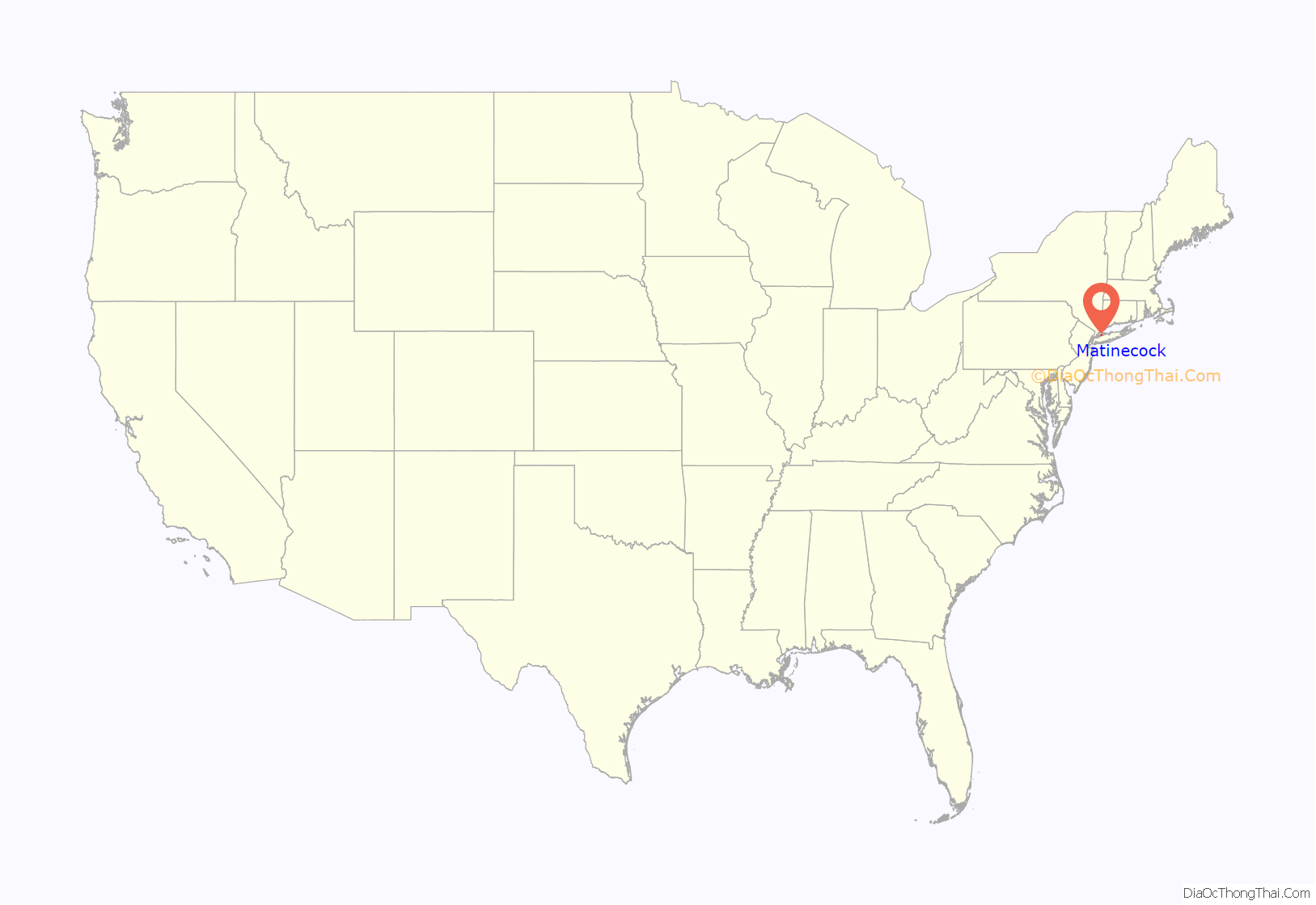
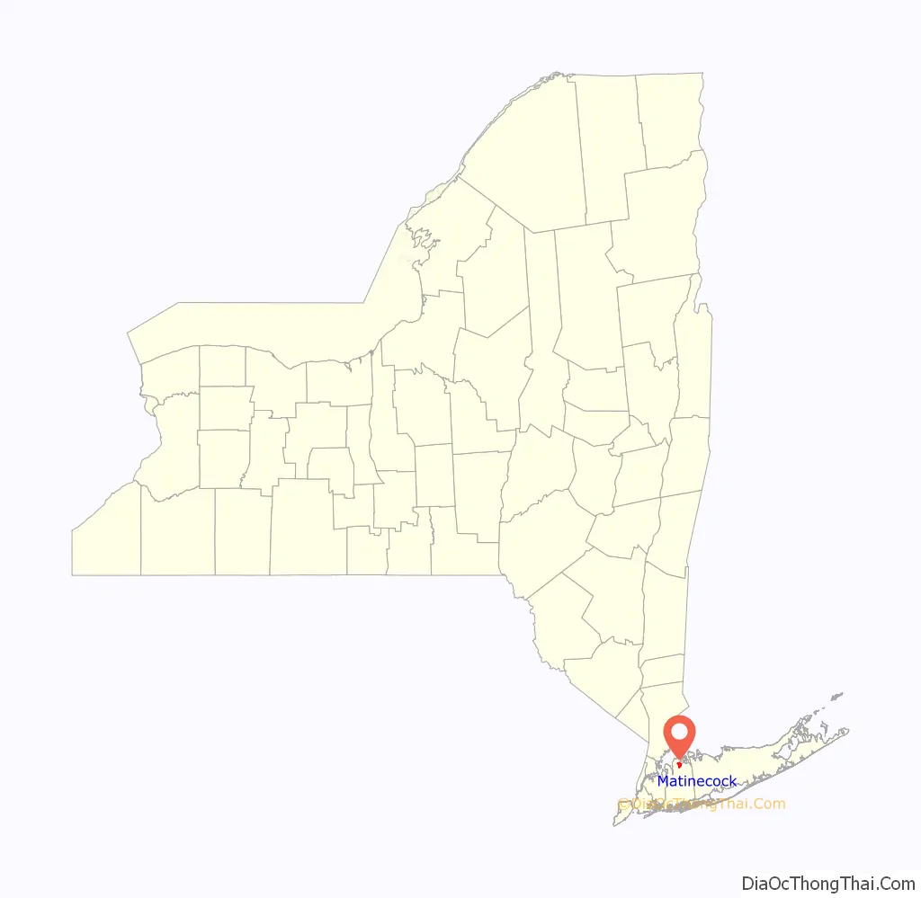
Matinecock location map. Where is Matinecock village?
History
Matinecock incorporated as a village on April 2, 1928, in order to gain home rule powers.
The village is named for the Matinecock Nation, which inhabited much of the area. “Matinecock” roughly translates to “the Hill Country,” and was the Matinecock Nation’s name for much of the area.
In May 1998, Worth Magazine ranked Matinecock as the fifth richest town in America and the richest town in New York.
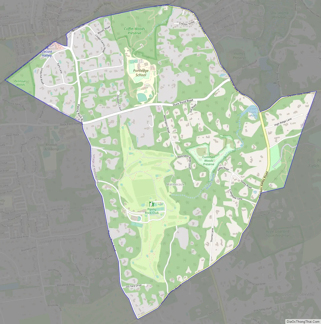
Matinecock Road Map
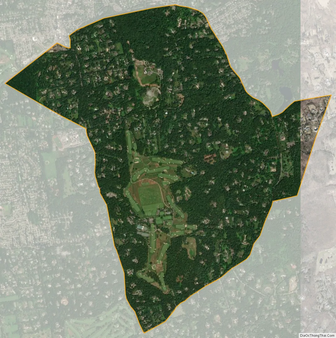
Matinecock city Satellite Map
Geography
According to the United States Census Bureau, the village has a total area of 2.7 square miles (7.0 km), all land.
See also
Map of New York State and its subdivision:- Albany
- Allegany
- Bronx
- Broome
- Cattaraugus
- Cayuga
- Chautauqua
- Chemung
- Chenango
- Clinton
- Columbia
- Cortland
- Delaware
- Dutchess
- Erie
- Essex
- Franklin
- Fulton
- Genesee
- Greene
- Hamilton
- Herkimer
- Jefferson
- Kings
- Lake Ontario
- Lewis
- Livingston
- Madison
- Monroe
- Montgomery
- Nassau
- New York
- Niagara
- Oneida
- Onondaga
- Ontario
- Orange
- Orleans
- Oswego
- Otsego
- Putnam
- Queens
- Rensselaer
- Richmond
- Rockland
- Saint Lawrence
- Saratoga
- Schenectady
- Schoharie
- Schuyler
- Seneca
- Steuben
- Suffolk
- Sullivan
- Tioga
- Tompkins
- Ulster
- Warren
- Washington
- Wayne
- Westchester
- Wyoming
- Yates
- Alabama
- Alaska
- Arizona
- Arkansas
- California
- Colorado
- Connecticut
- Delaware
- District of Columbia
- Florida
- Georgia
- Hawaii
- Idaho
- Illinois
- Indiana
- Iowa
- Kansas
- Kentucky
- Louisiana
- Maine
- Maryland
- Massachusetts
- Michigan
- Minnesota
- Mississippi
- Missouri
- Montana
- Nebraska
- Nevada
- New Hampshire
- New Jersey
- New Mexico
- New York
- North Carolina
- North Dakota
- Ohio
- Oklahoma
- Oregon
- Pennsylvania
- Rhode Island
- South Carolina
- South Dakota
- Tennessee
- Texas
- Utah
- Vermont
- Virginia
- Washington
- West Virginia
- Wisconsin
- Wyoming


