Munsey Park is a village in Nassau County, on the North Shore of Long Island, in New York, United States. It is considered part of the Greater Manhasset area, which is anchored by Manhasset. The population was 2,809 at the 2020 census.
The Incorporated Village of Munsey Park is located within the Town of North Hempstead and has been recognized as a Tree City USA since 1983.
| Name: | Munsey Park village |
|---|---|
| LSAD Code: | 47 |
| LSAD Description: | village (suffix) |
| State: | New York |
| County: | Nassau County |
| Incorporated: | 1930 |
| Elevation: | 157 ft (48 m) |
| Total Area: | 0.52 sq mi (1.34 km²) |
| Land Area: | 0.52 sq mi (1.34 km²) |
| Water Area: | 0.00 sq mi (0.00 km²) |
| Total Population: | 2,809 |
| Population Density: | 5,443.80/sq mi (2,101.37/km²) |
| ZIP code: | 11030 |
| FIPS code: | 3649231 |
| GNISfeature ID: | 0958164 |
| Website: | www.munseypark.org |
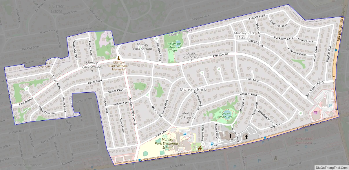
Online Interactive Map
Click on ![]() to view map in "full screen" mode.
to view map in "full screen" mode.
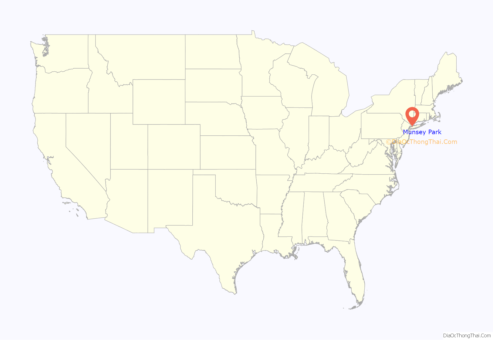
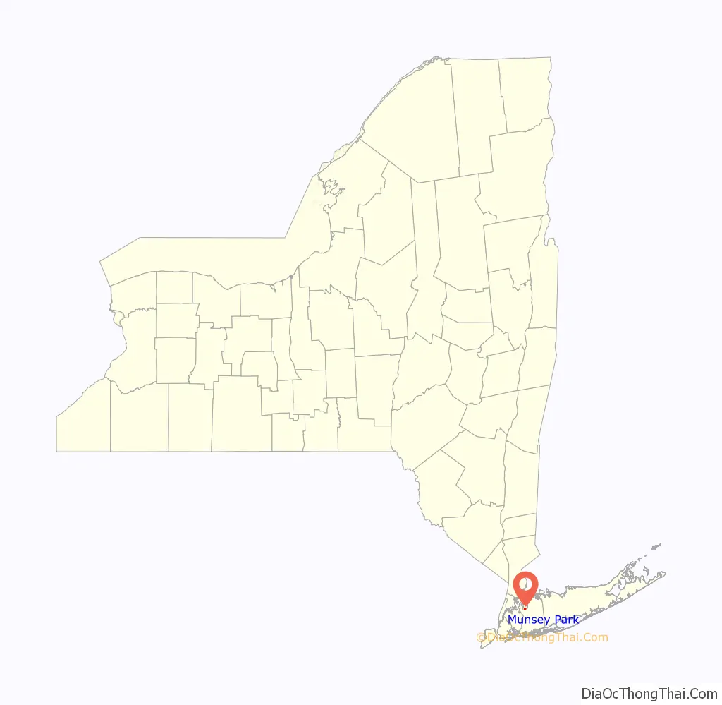
Munsey Park location map. Where is Munsey Park village?
History
The village was first developed in the 1920s on North Shore land previously owned by wealthy publisher Frank Munsey as a commuter town and “model, restricted community” taking advantage of the Long Island Rail Road’s Manhasset station. The land was bequeathed by Munsey to The Metropolitan Museum of Art in 1925, which developed the planned community under the leadership of museum president Robert W. DeForest. It was developed featuring Colonial-style houses and streets named for American artists. Much of the original landscaping was designed by the Olmsted Brothers.
In 1928, Munsey Park’s first model home opened.
In 1930, residents voted 155-to-3 to incorporate their community as a village with its own municipal government and zoning ability. Residents incorporated after learning about the creation of a sewer district serving Greater Manhasset; the proposal led to a significant amount of concern amongst many of the locals, who were opposed to sewering the area.
Since the Village of Munsey Park was located a considerable distance away from the former Plandome Road School, the Manhasset Union Free School District built the Munsey Park Elementary School within the village in the 1930s.
On December 8, 1974, Munsey Park Village Hall opened. It is located at 1777 Northern Boulevard and was built to conform to the style of residential homes in the village.
Munsey Park was first designated as a Tree City USA by the National Arbor Day Foundation in 1983, and has been recognized as such ever since.
In 2008, the Village of Munsey Park was ranked as the 13th (tied) Wealthiest Town in America by BusinessWeek.
The name of the community was originally to be Munsey Meadows – but this name was changed to Munsey Park; it is named in honor of Frank Munsey.
Munsey Park Road Map
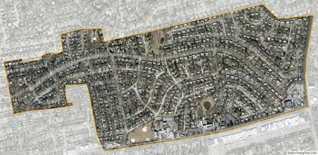
Munsey Park city Satellite Map
Geography
According to the United States Census Bureau, the village has a total area of 0.5 square miles (1.3 km), all land.
Munsey Park is split between two drainage areas: Leeds Pond and Whitney Pond. These two drainage areas are sub-watersheds of the larger Manhasset Bay Watershed, which in turn is part of the larger Long Island Sound/Atlantic Ocean Watershed, which covers all of Nassau and Suffolk Counties.
Munsey Park, in its entirety, uses the Manhasset 11030 postal code and is served by the Manhasset Post Office.
See also
Map of New York State and its subdivision:- Albany
- Allegany
- Bronx
- Broome
- Cattaraugus
- Cayuga
- Chautauqua
- Chemung
- Chenango
- Clinton
- Columbia
- Cortland
- Delaware
- Dutchess
- Erie
- Essex
- Franklin
- Fulton
- Genesee
- Greene
- Hamilton
- Herkimer
- Jefferson
- Kings
- Lake Ontario
- Lewis
- Livingston
- Madison
- Monroe
- Montgomery
- Nassau
- New York
- Niagara
- Oneida
- Onondaga
- Ontario
- Orange
- Orleans
- Oswego
- Otsego
- Putnam
- Queens
- Rensselaer
- Richmond
- Rockland
- Saint Lawrence
- Saratoga
- Schenectady
- Schoharie
- Schuyler
- Seneca
- Steuben
- Suffolk
- Sullivan
- Tioga
- Tompkins
- Ulster
- Warren
- Washington
- Wayne
- Westchester
- Wyoming
- Yates
- Alabama
- Alaska
- Arizona
- Arkansas
- California
- Colorado
- Connecticut
- Delaware
- District of Columbia
- Florida
- Georgia
- Hawaii
- Idaho
- Illinois
- Indiana
- Iowa
- Kansas
- Kentucky
- Louisiana
- Maine
- Maryland
- Massachusetts
- Michigan
- Minnesota
- Mississippi
- Missouri
- Montana
- Nebraska
- Nevada
- New Hampshire
- New Jersey
- New Mexico
- New York
- North Carolina
- North Dakota
- Ohio
- Oklahoma
- Oregon
- Pennsylvania
- Rhode Island
- South Carolina
- South Dakota
- Tennessee
- Texas
- Utah
- Vermont
- Virginia
- Washington
- West Virginia
- Wisconsin
- Wyoming


