New Cassel is a hamlet and census-designated place (CDP) in the Town of North Hempstead in Nassau County, on Long Island, in New York, United States. The population was 14,059 at the 2010 census, representing a net gain of 761 over the 2000 census.
| Name: | New Cassel CDP |
|---|---|
| LSAD Code: | 57 |
| LSAD Description: | CDP (suffix) |
| State: | New York |
| County: | Nassau County |
| Elevation: | 121 ft (37 m) |
| Total Area: | 1.49 sq mi (3.87 km²) |
| Land Area: | 1.49 sq mi (3.87 km²) |
| Water Area: | 0.00 sq mi (0.00 km²) |
| Total Population: | 14,199 |
| Population Density: | 9,510.38/sq mi (3,671.21/km²) |
| ZIP code: | 11590 |
| Area code: | 516 |
| FIPS code: | 3650067 |
| GNISfeature ID: | 0958399 |
Online Interactive Map
Click on ![]() to view map in "full screen" mode.
to view map in "full screen" mode.
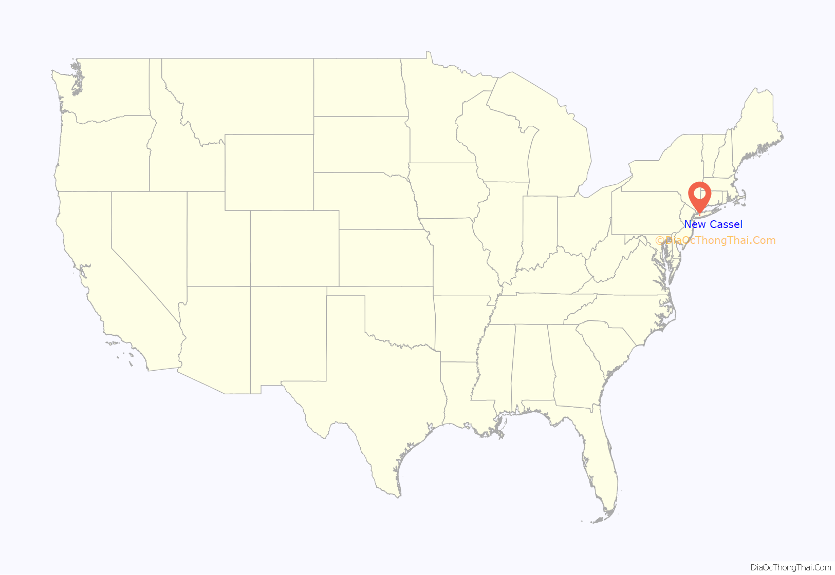
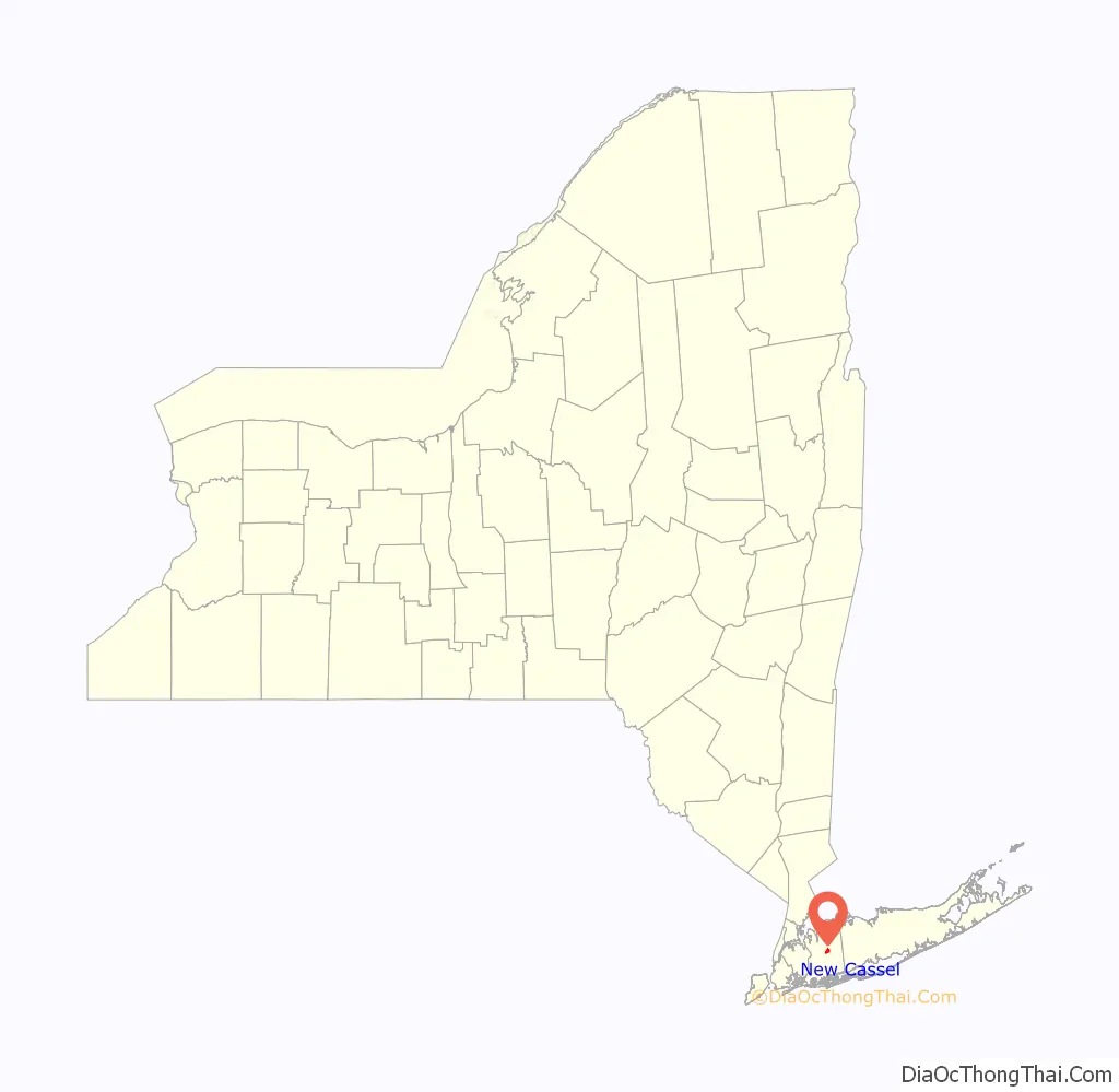
New Cassel location map. Where is New Cassel CDP?
History
When the adjacent village of Westbury incorporated in 1932, New Cassel chose not to be absorbed over fears that taxes would rise. As such, it would remain an unincorporated hamlet directly governed by the Town of North Hempstead in Manhasset.
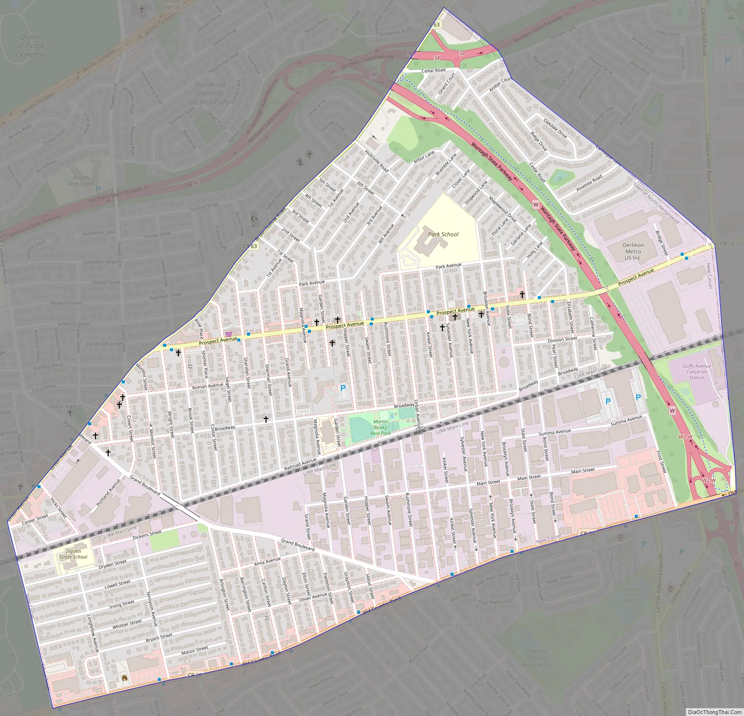
New Cassel Road Map
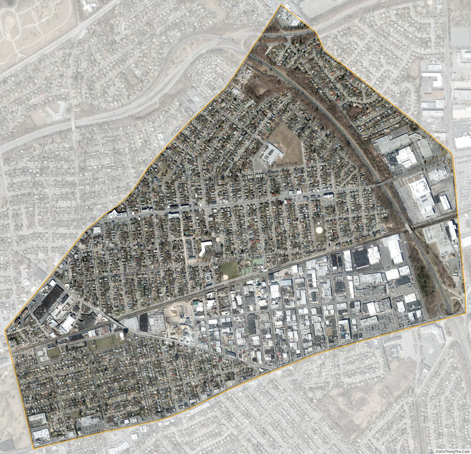
New Cassel city Satellite Map
Geography
According to the United States Census Bureau, the CDP has a total area of 1.5 square miles (3.9 km), all land.
See also
Map of New York State and its subdivision:- Albany
- Allegany
- Bronx
- Broome
- Cattaraugus
- Cayuga
- Chautauqua
- Chemung
- Chenango
- Clinton
- Columbia
- Cortland
- Delaware
- Dutchess
- Erie
- Essex
- Franklin
- Fulton
- Genesee
- Greene
- Hamilton
- Herkimer
- Jefferson
- Kings
- Lake Ontario
- Lewis
- Livingston
- Madison
- Monroe
- Montgomery
- Nassau
- New York
- Niagara
- Oneida
- Onondaga
- Ontario
- Orange
- Orleans
- Oswego
- Otsego
- Putnam
- Queens
- Rensselaer
- Richmond
- Rockland
- Saint Lawrence
- Saratoga
- Schenectady
- Schoharie
- Schuyler
- Seneca
- Steuben
- Suffolk
- Sullivan
- Tioga
- Tompkins
- Ulster
- Warren
- Washington
- Wayne
- Westchester
- Wyoming
- Yates
- Alabama
- Alaska
- Arizona
- Arkansas
- California
- Colorado
- Connecticut
- Delaware
- District of Columbia
- Florida
- Georgia
- Hawaii
- Idaho
- Illinois
- Indiana
- Iowa
- Kansas
- Kentucky
- Louisiana
- Maine
- Maryland
- Massachusetts
- Michigan
- Minnesota
- Mississippi
- Missouri
- Montana
- Nebraska
- Nevada
- New Hampshire
- New Jersey
- New Mexico
- New York
- North Carolina
- North Dakota
- Ohio
- Oklahoma
- Oregon
- Pennsylvania
- Rhode Island
- South Carolina
- South Dakota
- Tennessee
- Texas
- Utah
- Vermont
- Virginia
- Washington
- West Virginia
- Wisconsin
- Wyoming


