North Bellport is a hamlet and census-designated place (CDP) located within the Town of Brookhaven, New York, United States. The population was 11,545 at the 2010 census.
| Name: | North Bellport CDP |
|---|---|
| LSAD Code: | 57 |
| LSAD Description: | CDP (suffix) |
| State: | New York |
| County: | Suffolk County |
| Elevation: | 46 ft (14 m) |
| Total Area: | 4.91 sq mi (12.71 km²) |
| Land Area: | 4.91 sq mi (12.71 km²) |
| Water Area: | 0.00 sq mi (0.00 km²) |
| Total Population: | 11,900 |
| Population Density: | 2,424.12/sq mi (935.93/km²) |
| ZIP code: | 11713 |
| Area code: | 631, 934 |
| FIPS code: | 3651528 |
| GNISfeature ID: | 0958685 |
Online Interactive Map
Click on ![]() to view map in "full screen" mode.
to view map in "full screen" mode.
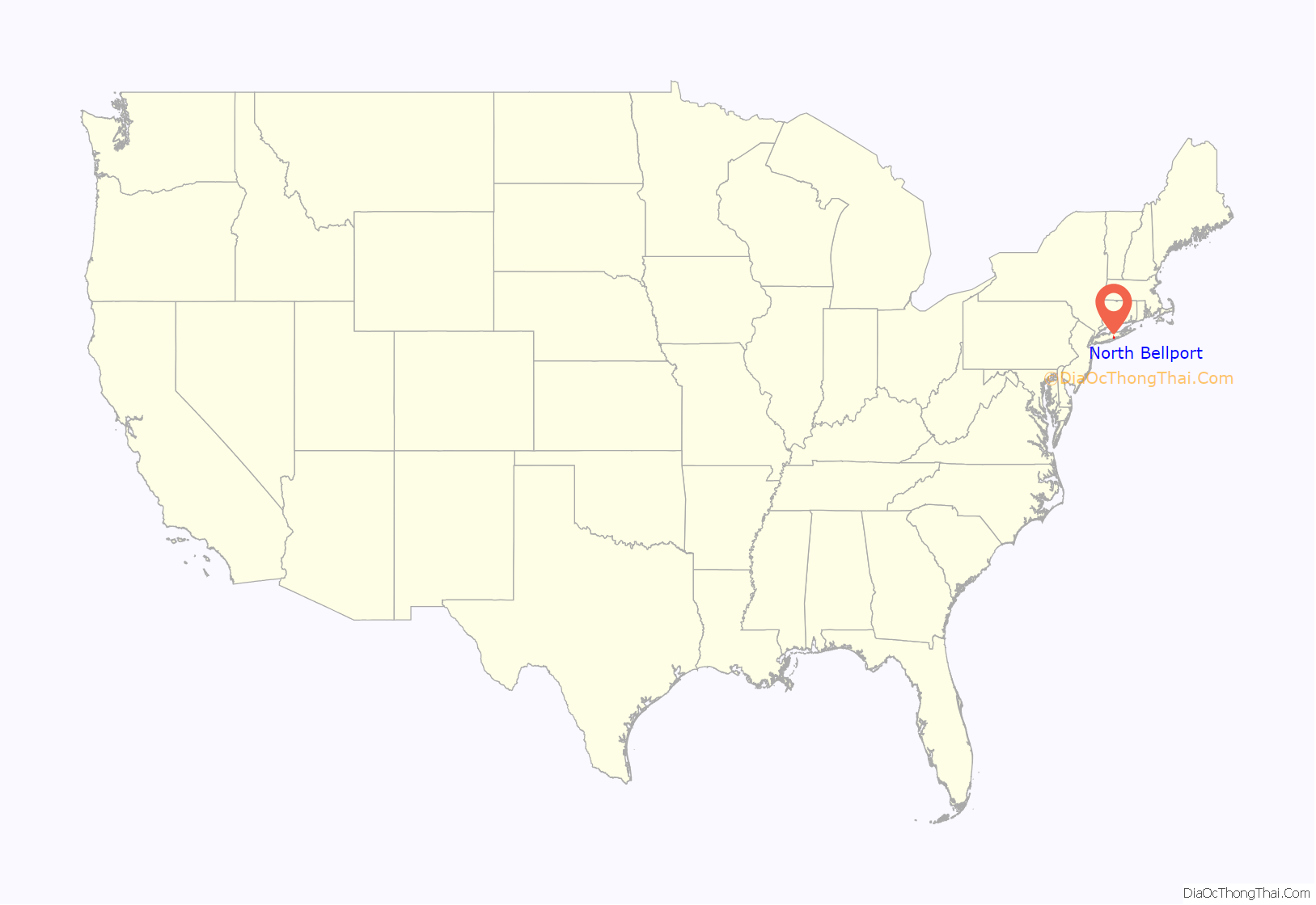
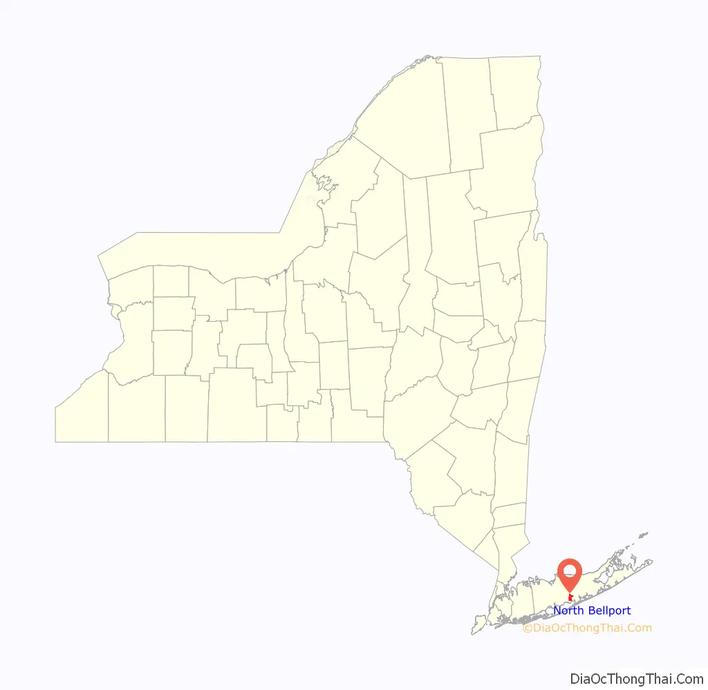
North Bellport location map. Where is North Bellport CDP?
History
North Bellport was built by the Hagerman Land Company, named after the neighboring hamlet of Hagerman. Originally a predominantly white community, North Bellport was blockbusted during the early 1960s, resulting in a major influx of African Americans into the community. In 1962, the community was the subject of first of several notable court cases concerning the practice of blockbusting by real estate agents in New York.
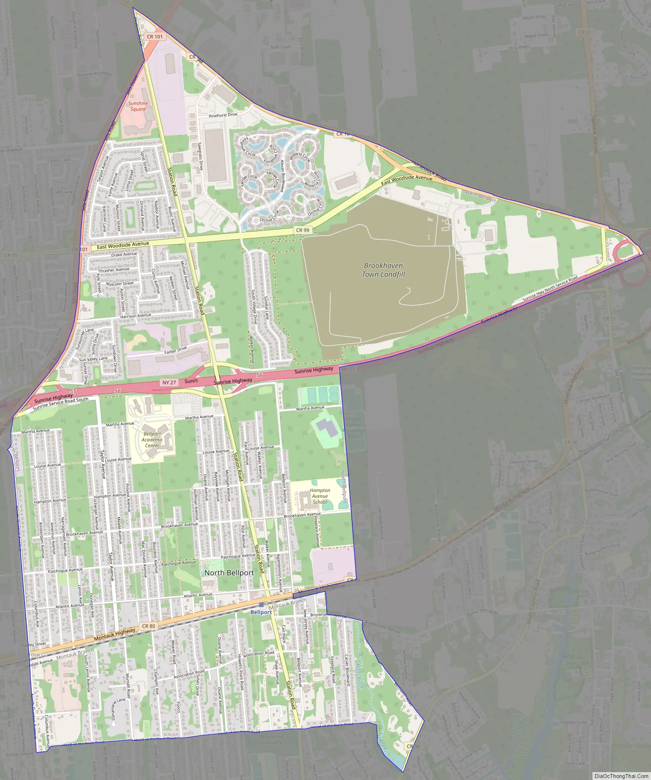
North Bellport Road Map
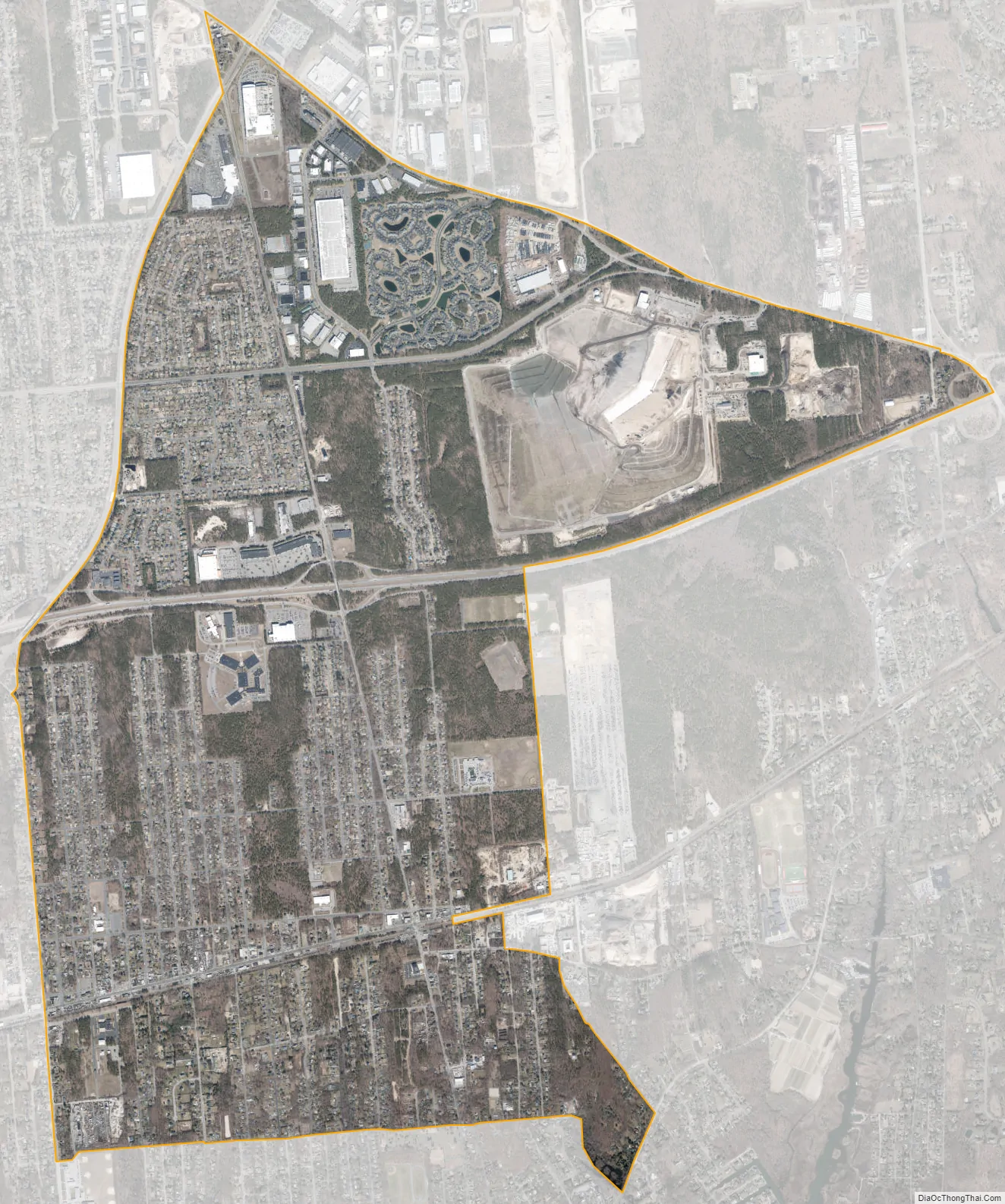
North Bellport city Satellite Map
Geography
According to the United States Census Bureau, the CDP has a total area of 4.9 square miles (12.8 km), all land.
See also
Map of New York State and its subdivision:- Albany
- Allegany
- Bronx
- Broome
- Cattaraugus
- Cayuga
- Chautauqua
- Chemung
- Chenango
- Clinton
- Columbia
- Cortland
- Delaware
- Dutchess
- Erie
- Essex
- Franklin
- Fulton
- Genesee
- Greene
- Hamilton
- Herkimer
- Jefferson
- Kings
- Lake Ontario
- Lewis
- Livingston
- Madison
- Monroe
- Montgomery
- Nassau
- New York
- Niagara
- Oneida
- Onondaga
- Ontario
- Orange
- Orleans
- Oswego
- Otsego
- Putnam
- Queens
- Rensselaer
- Richmond
- Rockland
- Saint Lawrence
- Saratoga
- Schenectady
- Schoharie
- Schuyler
- Seneca
- Steuben
- Suffolk
- Sullivan
- Tioga
- Tompkins
- Ulster
- Warren
- Washington
- Wayne
- Westchester
- Wyoming
- Yates
- Alabama
- Alaska
- Arizona
- Arkansas
- California
- Colorado
- Connecticut
- Delaware
- District of Columbia
- Florida
- Georgia
- Hawaii
- Idaho
- Illinois
- Indiana
- Iowa
- Kansas
- Kentucky
- Louisiana
- Maine
- Maryland
- Massachusetts
- Michigan
- Minnesota
- Mississippi
- Missouri
- Montana
- Nebraska
- Nevada
- New Hampshire
- New Jersey
- New Mexico
- New York
- North Carolina
- North Dakota
- Ohio
- Oklahoma
- Oregon
- Pennsylvania
- Rhode Island
- South Carolina
- South Dakota
- Tennessee
- Texas
- Utah
- Vermont
- Virginia
- Washington
- West Virginia
- Wisconsin
- Wyoming


