North Collins is a village in Erie County, New York, United States. The population was 1,232 at the 2010 census. The village is in the northwest corner of the town of North Collins.
| Name: | North Collins village |
|---|---|
| LSAD Code: | 47 |
| LSAD Description: | village (suffix) |
| State: | New York |
| County: | Erie County |
| Elevation: | 827 ft (252 m) |
| Total Area: | 0.80 sq mi (2.07 km²) |
| Land Area: | 0.80 sq mi (2.07 km²) |
| Water Area: | 0.00 sq mi (0.00 km²) |
| Total Population: | 1,247 |
| Population Density: | 1,556.80/sq mi (601.05/km²) |
| ZIP code: | 14111 |
| Area code: | 716 |
| FIPS code: | 3651792 |
| GNISfeature ID: | 0958754 |
| Website: | www.villageofnorthcollins.org |
Online Interactive Map
Click on ![]() to view map in "full screen" mode.
to view map in "full screen" mode.
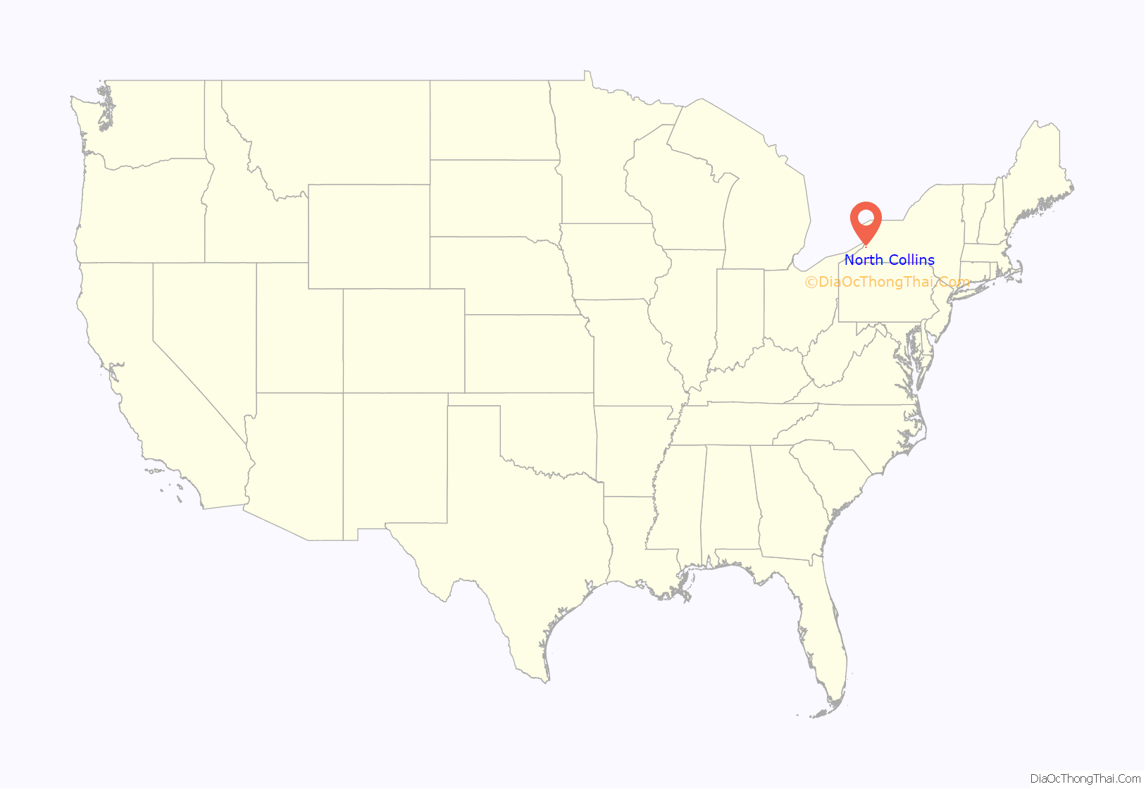
North Collins location map. Where is North Collins village?

History
The community was formerly known as “Rose’s Corners” and “Kerr’s Corners”. The village of North Collins was incorporated in 1911, setting itself off from the town of North Collins.
In May 2008, the village board agreed to move toward dissolution of the village and become again part of the town of North Collins. The resolution presented to the people did not pass and the Village remains a Village.
North Collins Road Map
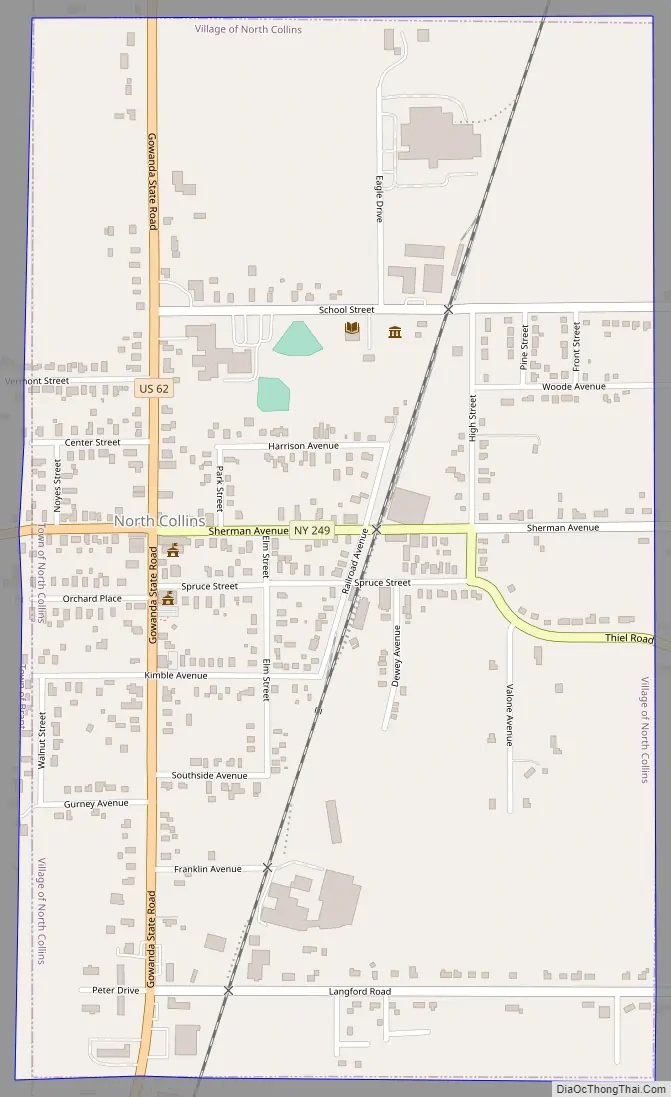
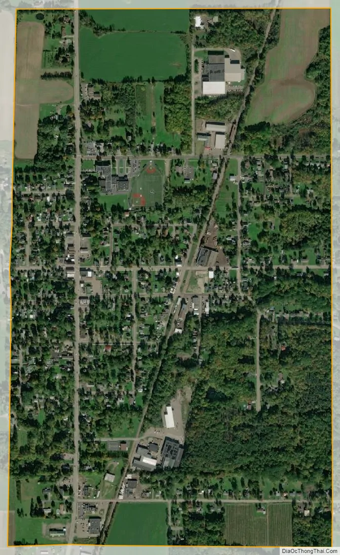
North Collins city Satellite Map
Geography
According to the United States Census Bureau, the village has a total area of 0.8 square miles (2.1 km), all land.
U.S. Route 62 (Main Street) and New York State Route 249 (Brant Road/Sherman Avenue) pass through the village.
See also
Map of New York State and its subdivision:- Albany
- Allegany
- Bronx
- Broome
- Cattaraugus
- Cayuga
- Chautauqua
- Chemung
- Chenango
- Clinton
- Columbia
- Cortland
- Delaware
- Dutchess
- Erie
- Essex
- Franklin
- Fulton
- Genesee
- Greene
- Hamilton
- Herkimer
- Jefferson
- Kings
- Lake Ontario
- Lewis
- Livingston
- Madison
- Monroe
- Montgomery
- Nassau
- New York
- Niagara
- Oneida
- Onondaga
- Ontario
- Orange
- Orleans
- Oswego
- Otsego
- Putnam
- Queens
- Rensselaer
- Richmond
- Rockland
- Saint Lawrence
- Saratoga
- Schenectady
- Schoharie
- Schuyler
- Seneca
- Steuben
- Suffolk
- Sullivan
- Tioga
- Tompkins
- Ulster
- Warren
- Washington
- Wayne
- Westchester
- Wyoming
- Yates
- Alabama
- Alaska
- Arizona
- Arkansas
- California
- Colorado
- Connecticut
- Delaware
- District of Columbia
- Florida
- Georgia
- Hawaii
- Idaho
- Illinois
- Indiana
- Iowa
- Kansas
- Kentucky
- Louisiana
- Maine
- Maryland
- Massachusetts
- Michigan
- Minnesota
- Mississippi
- Missouri
- Montana
- Nebraska
- Nevada
- New Hampshire
- New Jersey
- New Mexico
- New York
- North Carolina
- North Dakota
- Ohio
- Oklahoma
- Oregon
- Pennsylvania
- Rhode Island
- South Carolina
- South Dakota
- Tennessee
- Texas
- Utah
- Vermont
- Virginia
- Washington
- West Virginia
- Wisconsin
- Wyoming