North Syracuse is a village in Onondaga County, New York, United States. As of the 2020 census, the population was 6,739. North Syracuse is located in the towns of Cicero and Clay, north of the city of Syracuse.
| Name: | North Syracuse village |
|---|---|
| LSAD Code: | 47 |
| LSAD Description: | village (suffix) |
| State: | New York |
| County: | Onondaga County |
| Elevation: | 420 ft (128 m) |
| Total Area: | 1.99 sq mi (5.15 km²) |
| Land Area: | 1.99 sq mi (5.15 km²) |
| Water Area: | 0.00 sq mi (0.00 km²) |
| Total Population: | 6,739 |
| Population Density: | 3,391.55/sq mi (1,309.77/km²) |
| ZIP code: | 13212 |
| Area code: | 315 and 680 |
| FIPS code: | 3653660 |
| GNISfeature ID: | 0958933 |
| Website: | northsyracuseny.org |
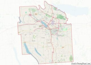
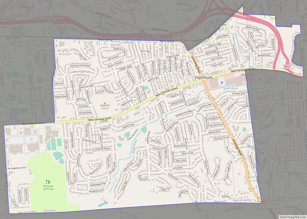
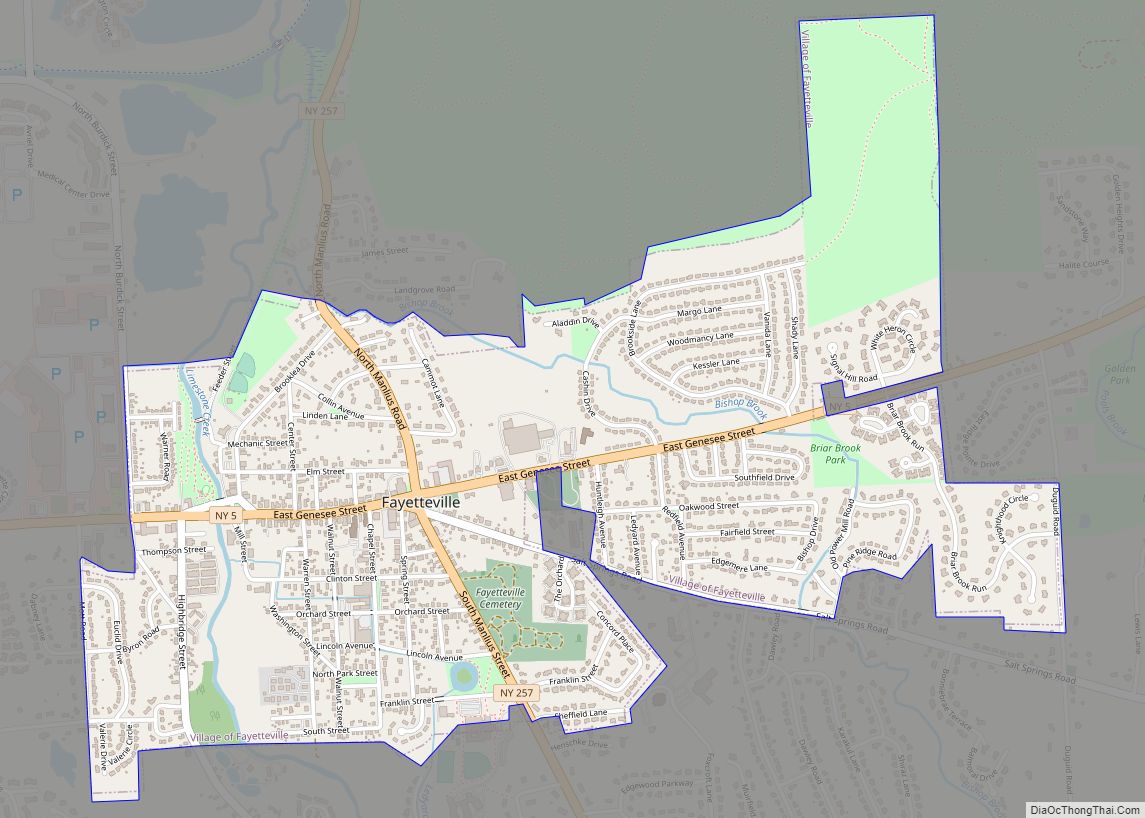
Online Interactive Map
Click on ![]() to view map in "full screen" mode.
to view map in "full screen" mode.
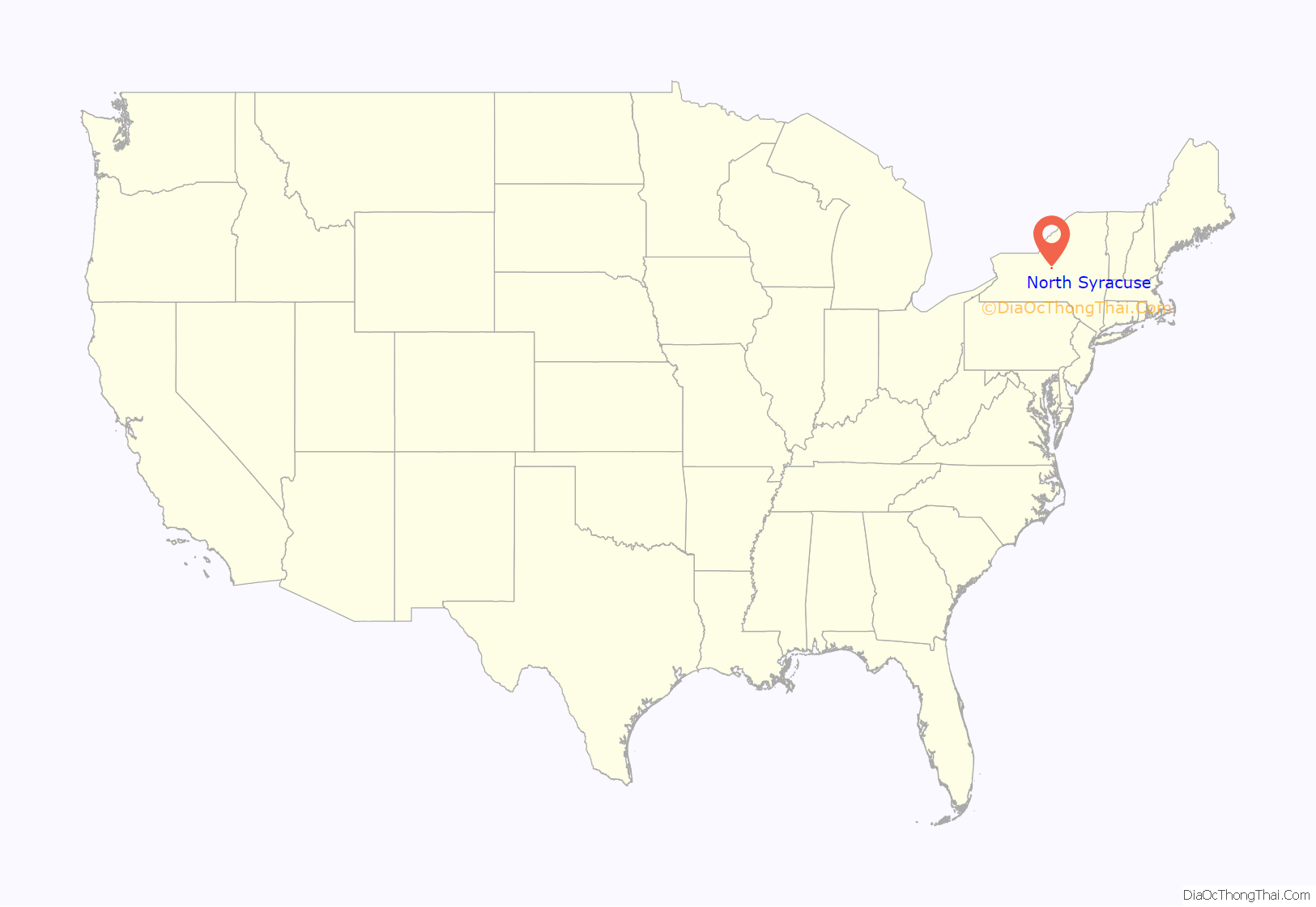
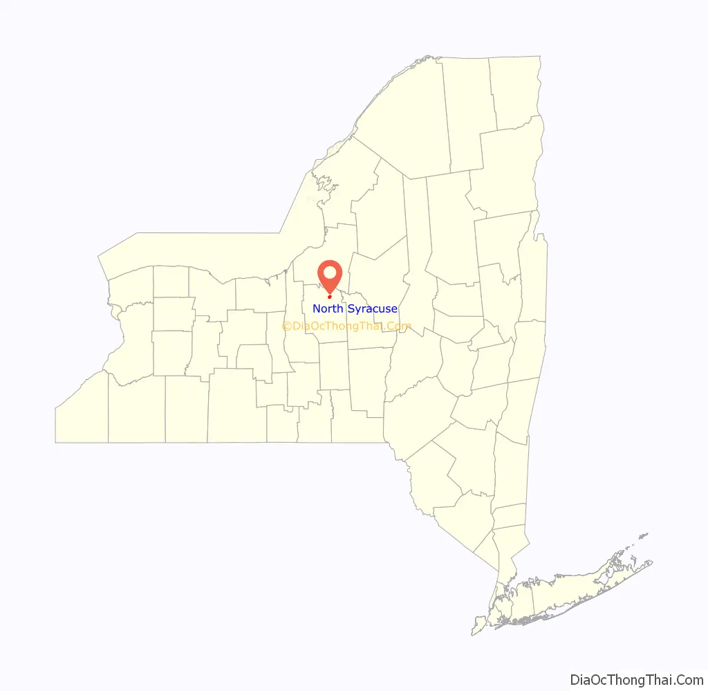
North Syracuse location map. Where is North Syracuse village?
History
The village was originally called Centerville and changed to its present name in 1880. It became an incorporated village in 1925. Among the first settlers, the Fergerson family located there in 1826. They still occupy the same land located in what is now the village center. Many local streets are named in their honor.
On July 18, 1846, the United States’ first plank road opened in North Syracuse, primarily for salt transportation. The road cost $23,000, was 16-1/2 miles long, and was planked its entire length. Thomas Alvord, a state legislator who later became lieutenant governor, helped secure the passage of an act to construct, maintain and collect tolls. There were four tollgates about four miles apart that were operated by the company, a profitable enterprise for many years. The fees were 1 cent per head of cattle, 5 cents for a single horse, and 25 cents for a horse and wagon.
There was a dirt side and planked side to the road; the East Side was dirt and the West Side planked 3″ thick by 8′ long. Loaded wagons had the right of way on the planked side, the other side being reserved for empty wagons, single horses and for passing. Bicycles used the plank side on Sunday for racing. Due to wear and tear by horses’ shoes and iron hoops on wagon wheels, a gang was constantly busy just making repairs.
North Syracuse was also the first New York State village to have its own fire district. The Volunteer Fire Department was established in 1913.
The current mayor of North Syracuse is Gary Butterfield, who has lived in North Syracuse since 1977.
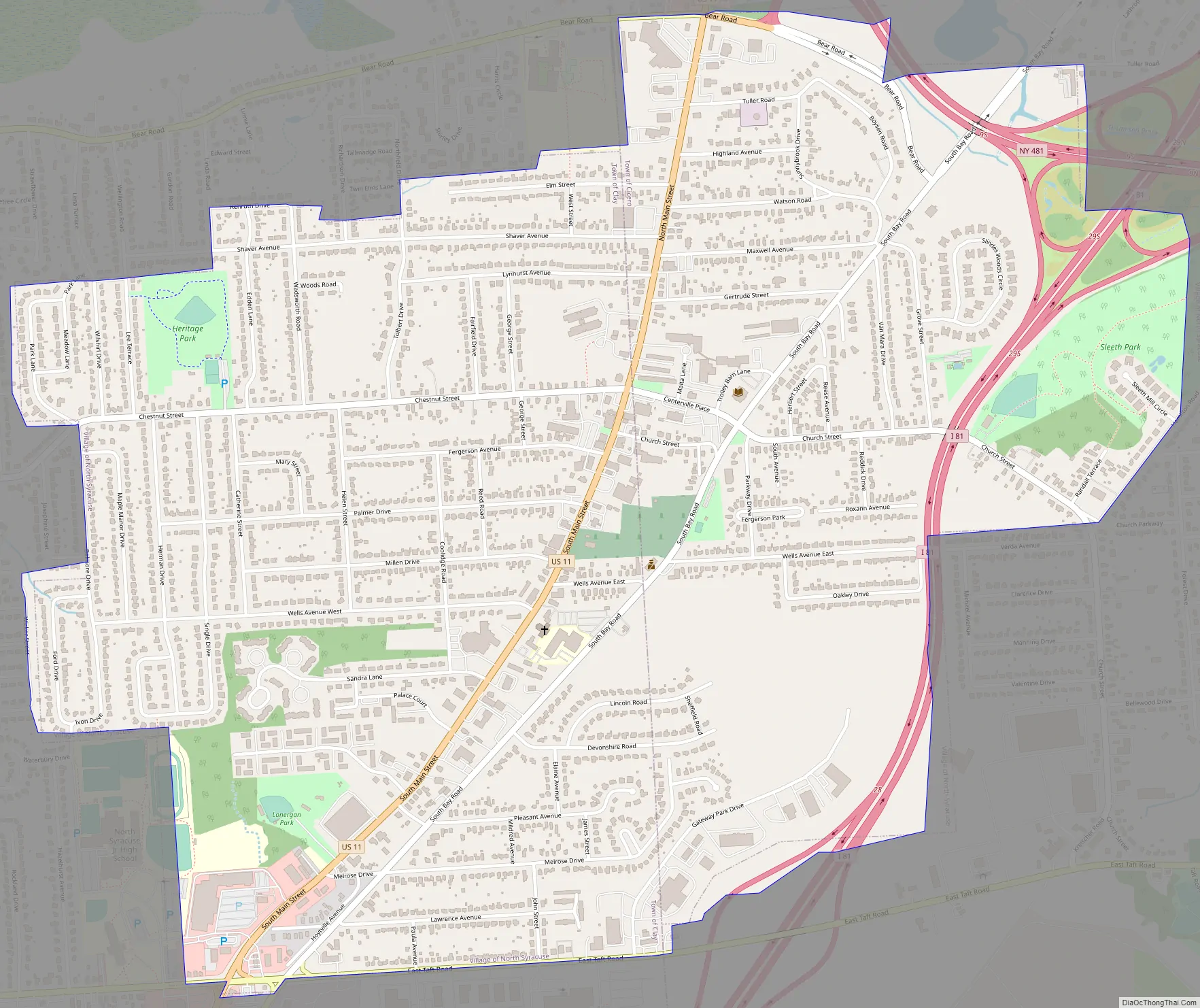
North Syracuse Road Map
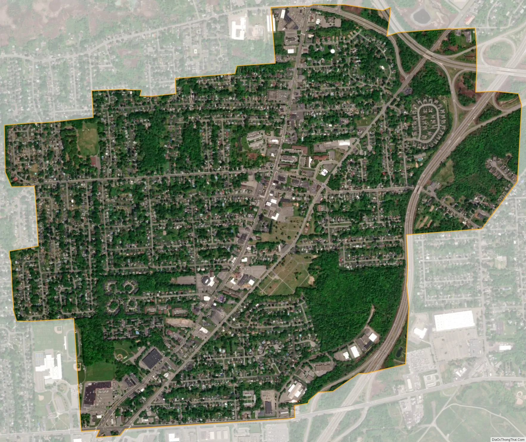
North Syracuse city Satellite Map
Geography
North Syracuse is located at 43°8′0″N 76°7′56″W / 43.13333°N 76.13222°W / 43.13333; -76.13222 (43.133334, -76.132321).
According to the United States Census Bureau, the village has a total area of 2.0 square miles (5.2 km), all land.
U.S. Route 11 passes through the village. Interstate 81 passes along the east side of the village.
See also
Map of New York State and its subdivision:- Albany
- Allegany
- Bronx
- Broome
- Cattaraugus
- Cayuga
- Chautauqua
- Chemung
- Chenango
- Clinton
- Columbia
- Cortland
- Delaware
- Dutchess
- Erie
- Essex
- Franklin
- Fulton
- Genesee
- Greene
- Hamilton
- Herkimer
- Jefferson
- Kings
- Lake Ontario
- Lewis
- Livingston
- Madison
- Monroe
- Montgomery
- Nassau
- New York
- Niagara
- Oneida
- Onondaga
- Ontario
- Orange
- Orleans
- Oswego
- Otsego
- Putnam
- Queens
- Rensselaer
- Richmond
- Rockland
- Saint Lawrence
- Saratoga
- Schenectady
- Schoharie
- Schuyler
- Seneca
- Steuben
- Suffolk
- Sullivan
- Tioga
- Tompkins
- Ulster
- Warren
- Washington
- Wayne
- Westchester
- Wyoming
- Yates
- Alabama
- Alaska
- Arizona
- Arkansas
- California
- Colorado
- Connecticut
- Delaware
- District of Columbia
- Florida
- Georgia
- Hawaii
- Idaho
- Illinois
- Indiana
- Iowa
- Kansas
- Kentucky
- Louisiana
- Maine
- Maryland
- Massachusetts
- Michigan
- Minnesota
- Mississippi
- Missouri
- Montana
- Nebraska
- Nevada
- New Hampshire
- New Jersey
- New Mexico
- New York
- North Carolina
- North Dakota
- Ohio
- Oklahoma
- Oregon
- Pennsylvania
- Rhode Island
- South Carolina
- South Dakota
- Tennessee
- Texas
- Utah
- Vermont
- Virginia
- Washington
- West Virginia
- Wisconsin
- Wyoming