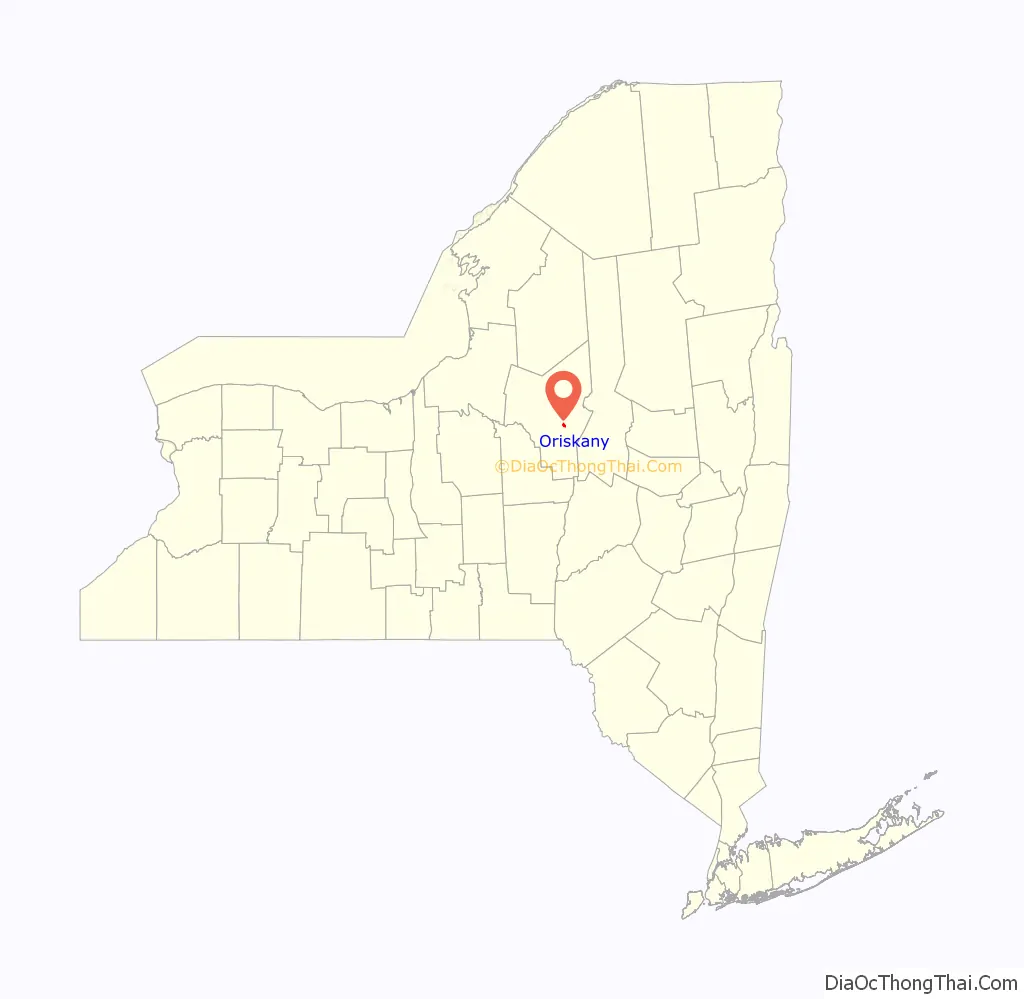
Oriskany (/ɔːrˈɪskəniː/ or /əˈrɪskəniː/) is a village in Oneida County, New York, United States. The population was 1,400 at the 2010 census. The name is derived from the Iroquois word for “nettles”.
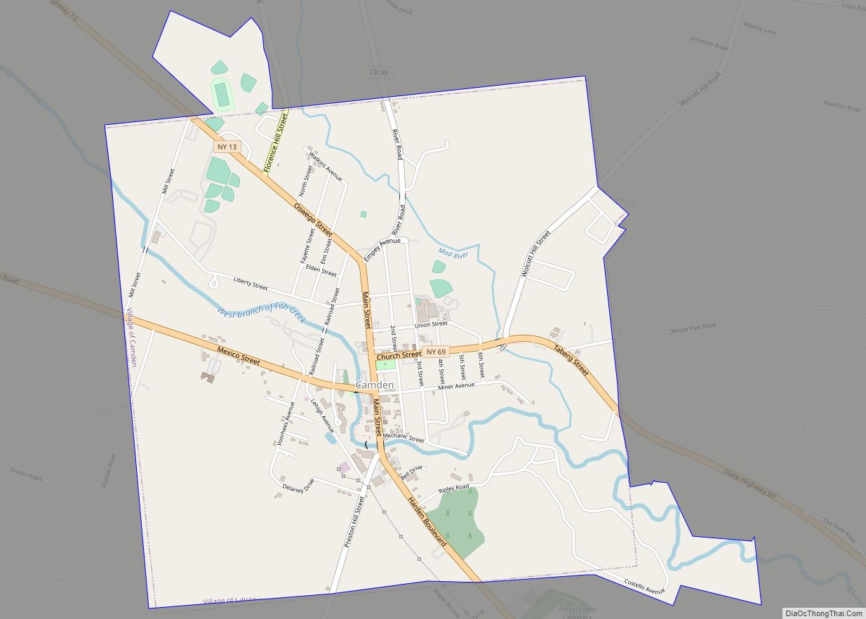
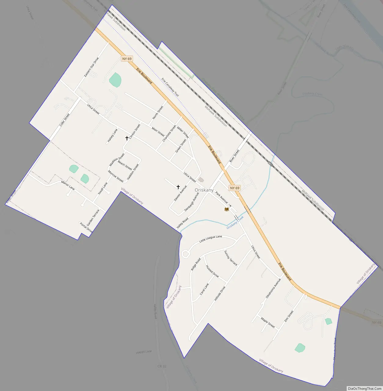
The Village of Oriskany is in the Town of Whitestown, southeast of the City of Rome. NY-69 passes through the village, which is south of the Erie Canal.
| Name: | Oriskany village |
|---|---|
| LSAD Code: | 47 |
| LSAD Description: | village (suffix) |
| State: | New York |
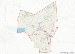
| County: | Oneida County |
| Elevation: | 430 ft (131 m) |
| Total Area: | 0.79 sq mi (2.05 km²) |
| Land Area: | 0.79 sq mi (2.05 km²) |
| Water Area: | 0.00 sq mi (0.00 km²) |
| Total Population: | 1,315 |
| Population Density: | 1,660.35/sq mi (641.39/km²) |
| ZIP code: | 13424 |
| Area code: | 315 |
| FIPS code: | 3655365 |
| GNISfeature ID: | 0959480 |
| Website: | www.oriskany.org |
Online Interactive Map
Click on ![]() to view map in "full screen" mode.
to view map in "full screen" mode.
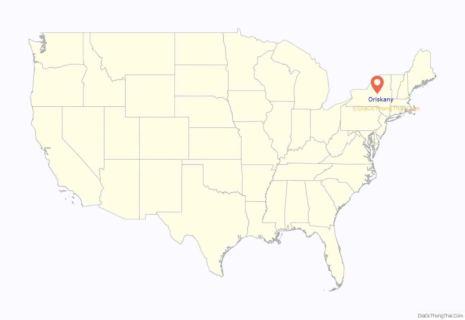
Oriskany location map. Where is Oriskany village?
History
The Oneida village of Oriska was established at the confluence of the Oriskany Creek and the Mohawk River before 1766. Oriska, sometimes also spelled as Ockrisk, Oriska, or Oriske, is believed to be a linguistic corruption of “Ol Hiskè” meaning “a place of nettles.”
On August 5, 1777, during the American Revolution, Oriska was visited by the Tryon County militia led by Brigadier General Nicholas Herkimer. The American-aligned militia was en route to Fort Stanwix to help lift a siege by allied British forces. Several dozen to one hundred Oneida joined Herkimer’s militia for the trip.
On the morning of August 6, 1777, the forces left Oriska for Fort Stanwix but were met by an ambush about three miles outside of Oriska. The location today is marked by the Oriskany Battlefield State Historic Site.
The Tory Mohawk who allied with the British later retaliated against Oriska, destroying “stock and provisions” of the village’s residents.
Records of the village for the remainder of the war remain sparse. In a letter dated 30 November 1778, Major General Philip Schuyler implores General Washington that “for the Support of the Communication and Security of Convoys” between Albany and Oswego “Another post to be Occupied by a like number [of 50 men] should be Established At or near Oriska,” among seven other sites.Founders Online: To George Washington from Major General Philip Schuyler, 30 No …
In June 1785, the area was surveyed by G. Lansing for a map entitled “Surveys & Partition of the Oriskany or Oriskary Patent,” with seven allotments and numerous land claims noted.
Before 1810, the surveyor, Col. Gerritt Lansing, returned to the Oriskany Patent to settle. In 1811, he helped found the Oriskany Manufacturing Company. The company’s year of incorporation is commonly cited as the founding date for the resettled village.
Oriskany Manufacturing Company would operate for several decades. The site later became the Waterbury Felt Mill.
The Erie Canal passed through the village until it was surpassed by the NYS Barge Canal. The path of the earlier canal later became State Route 69.
The naming of the village from Oriska to Oriskany has become something of an urban legend. As the legend goes, there was a mix up at the post office – a missing comma. Instead of “Oriska, NY” the envelope was labeled as “Oriska NY” and shortly after “Oriskany, NY” was born. This post office legend is disproven by several eighteenth century documents that use “Oriskany,” including letters from the Founding Fathers’ papers and several extant maps, which antedate the founding of the local post office by decades.
Oriskany Road Map
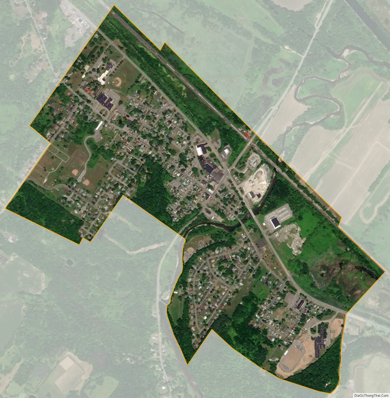
Oriskany city Satellite Map
Geography
Oriskany is located at 43°9.4′N 75°19.9′W / 43.1567°N 75.3317°W / 43.1567; -75.3317 (43.1575,-75.3319).
According to the United States Census Bureau, the village has a total area of 0.8 square miles (2.1 km), all land.
The village is near the confluence of the Mohawk River and Oriskany Creek.
See also
Map of New York State and its subdivision:- Albany
- Allegany
- Bronx
- Broome
- Cattaraugus
- Cayuga
- Chautauqua
- Chemung
- Chenango
- Clinton
- Columbia
- Cortland
- Delaware
- Dutchess
- Erie
- Essex
- Franklin
- Fulton
- Genesee
- Greene
- Hamilton
- Herkimer
- Jefferson
- Kings
- Lake Ontario
- Lewis
- Livingston
- Madison
- Monroe
- Montgomery
- Nassau
- New York
- Niagara
- Oneida
- Onondaga
- Ontario
- Orange
- Orleans
- Oswego
- Otsego
- Putnam
- Queens
- Rensselaer
- Richmond
- Rockland
- Saint Lawrence
- Saratoga
- Schenectady
- Schoharie
- Schuyler
- Seneca
- Steuben
- Suffolk
- Sullivan
- Tioga
- Tompkins
- Ulster
- Warren
- Washington
- Wayne
- Westchester
- Wyoming
- Yates
- Alabama
- Alaska
- Arizona
- Arkansas
- California
- Colorado
- Connecticut
- Delaware
- District of Columbia
- Florida
- Georgia
- Hawaii
- Idaho
- Illinois
- Indiana
- Iowa
- Kansas
- Kentucky
- Louisiana
- Maine
- Maryland
- Massachusetts
- Michigan
- Minnesota
- Mississippi
- Missouri
- Montana
- Nebraska
- Nevada
- New Hampshire
- New Jersey
- New Mexico
- New York
- North Carolina
- North Dakota
- Ohio
- Oklahoma
- Oregon
- Pennsylvania
- Rhode Island
- South Carolina
- South Dakota
- Tennessee
- Texas
- Utah
- Vermont
- Virginia
- Washington
- West Virginia
- Wisconsin
- Wyoming