Oyster Bay Cove is a village located within the Town of Oyster Bay in Nassau County, on Long island, in New York. The population was 2,197 at the 2010 census.
Youngs Memorial Cemetery, resting place of President Theodore Roosevelt, is located in the village.
| Name: | Oyster Bay Cove village |
|---|---|
| LSAD Code: | 47 |
| LSAD Description: | village (suffix) |
| State: | New York |
| County: | Nassau County |
| Incorporated: | 1931 |
| Elevation: | 59 ft (18 m) |
| Total Area: | 4.25 sq mi (11.02 km²) |
| Land Area: | 4.18 sq mi (10.84 km²) |
| Water Area: | 0.07 sq mi (0.18 km²) |
| Total Population: | 2,265 |
| Population Density: | 541.35/sq mi (209.00/km²) |
| ZIP code: | 11771, 11791 |
| Area code: | 516 |
| FIPS code: | 3656011 |
| GNISfeature ID: | 0959719 |
| Website: | www.oysterbaycove.net |
Online Interactive Map
Click on ![]() to view map in "full screen" mode.
to view map in "full screen" mode.
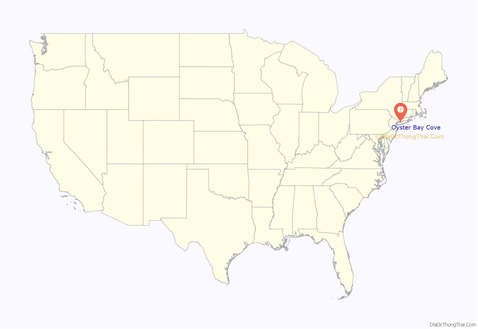
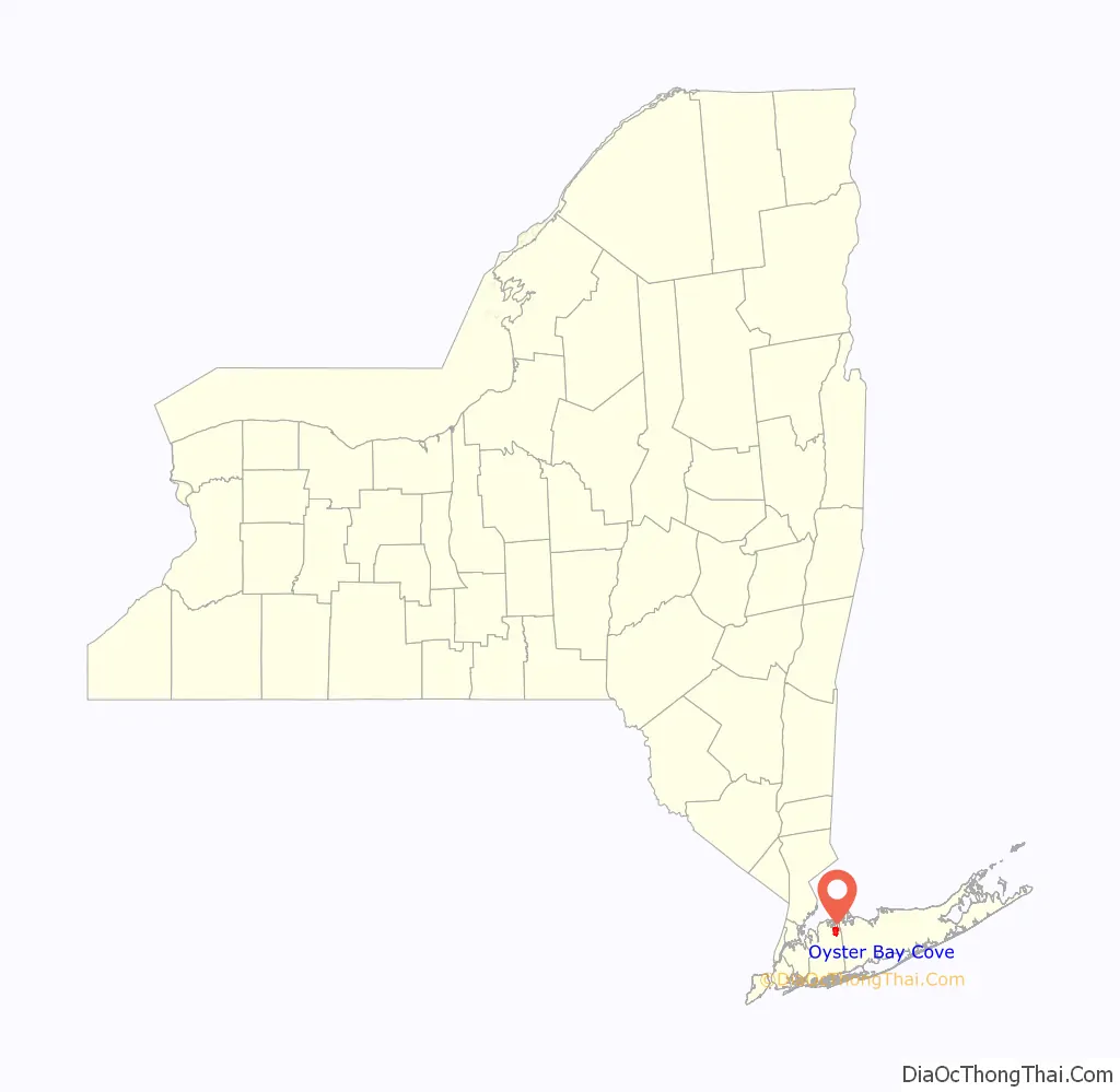
Oyster Bay Cove location map. Where is Oyster Bay Cove village?
History
The village incorporated in 1931, and on January 14, 1932, residents unanimously voted in George T. Bowdoin as the first Mayor of Oyster Bay Cove.
The village expanded its borders through annexations in 1963.
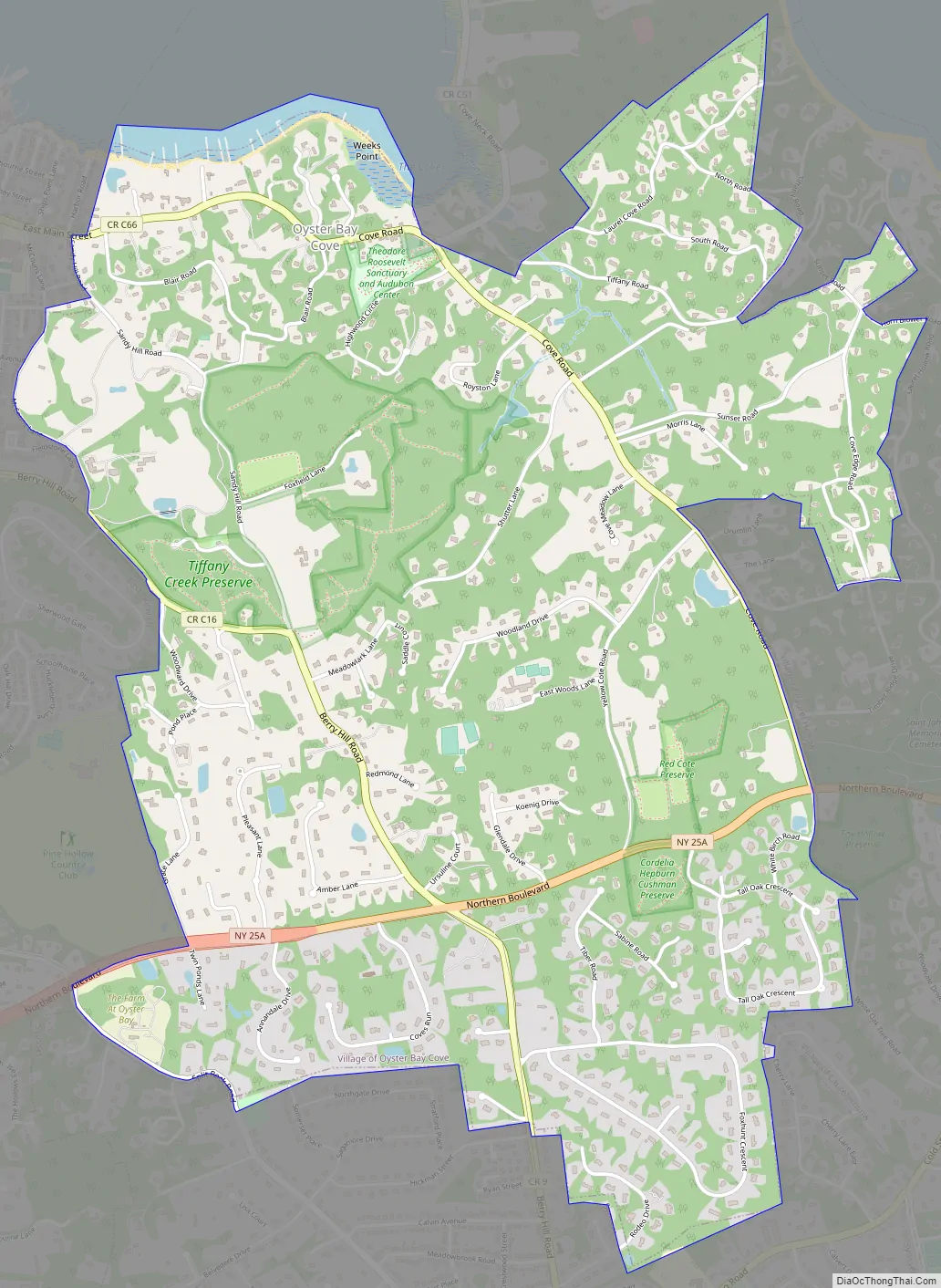
Oyster Bay Cove Road Map
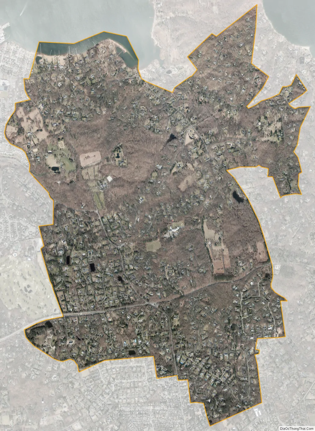
Oyster Bay Cove city Satellite Map
Geography
According to the United States Census Bureau, the village has a total area of 4.3 square miles (11 km), of which 4.2 square miles (11 km) is land and 0.1 square miles (0.26 km) (1.41%) is water.
See also
Map of New York State and its subdivision:- Albany
- Allegany
- Bronx
- Broome
- Cattaraugus
- Cayuga
- Chautauqua
- Chemung
- Chenango
- Clinton
- Columbia
- Cortland
- Delaware
- Dutchess
- Erie
- Essex
- Franklin
- Fulton
- Genesee
- Greene
- Hamilton
- Herkimer
- Jefferson
- Kings
- Lake Ontario
- Lewis
- Livingston
- Madison
- Monroe
- Montgomery
- Nassau
- New York
- Niagara
- Oneida
- Onondaga
- Ontario
- Orange
- Orleans
- Oswego
- Otsego
- Putnam
- Queens
- Rensselaer
- Richmond
- Rockland
- Saint Lawrence
- Saratoga
- Schenectady
- Schoharie
- Schuyler
- Seneca
- Steuben
- Suffolk
- Sullivan
- Tioga
- Tompkins
- Ulster
- Warren
- Washington
- Wayne
- Westchester
- Wyoming
- Yates
- Alabama
- Alaska
- Arizona
- Arkansas
- California
- Colorado
- Connecticut
- Delaware
- District of Columbia
- Florida
- Georgia
- Hawaii
- Idaho
- Illinois
- Indiana
- Iowa
- Kansas
- Kentucky
- Louisiana
- Maine
- Maryland
- Massachusetts
- Michigan
- Minnesota
- Mississippi
- Missouri
- Montana
- Nebraska
- Nevada
- New Hampshire
- New Jersey
- New Mexico
- New York
- North Carolina
- North Dakota
- Ohio
- Oklahoma
- Oregon
- Pennsylvania
- Rhode Island
- South Carolina
- South Dakota
- Tennessee
- Texas
- Utah
- Vermont
- Virginia
- Washington
- West Virginia
- Wisconsin
- Wyoming


