Piffard is a census-designated place (CDP) and hamlet in the town of York, Livingston County, New York, United States. As of the 2010 census, its population was 220. The ZIP Code is 14533.
| Name: | Piffard CDP |
|---|---|
| LSAD Code: | 57 |
| LSAD Description: | CDP (suffix) |
| State: | New York |
| County: | Livingston County |
| Elevation: | 568 ft (173 m) |
| Total Area: | 0.93 sq mi (2.42 km²) |
| Land Area: | 0.93 sq mi (2.42 km²) |
| Water Area: | 0.00 sq mi (0.00 km²) |
| Total Population: | 208 |
| Population Density: | 222.70/sq mi (86.01/km²) |
| Area code: | 585 |
| FIPS code: | 3657804 |
| GNISfeature ID: | 960368 |
Online Interactive Map
Click on ![]() to view map in "full screen" mode.
to view map in "full screen" mode.
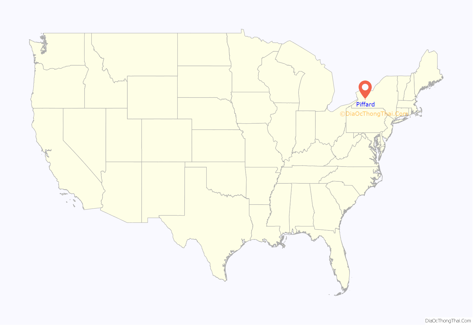
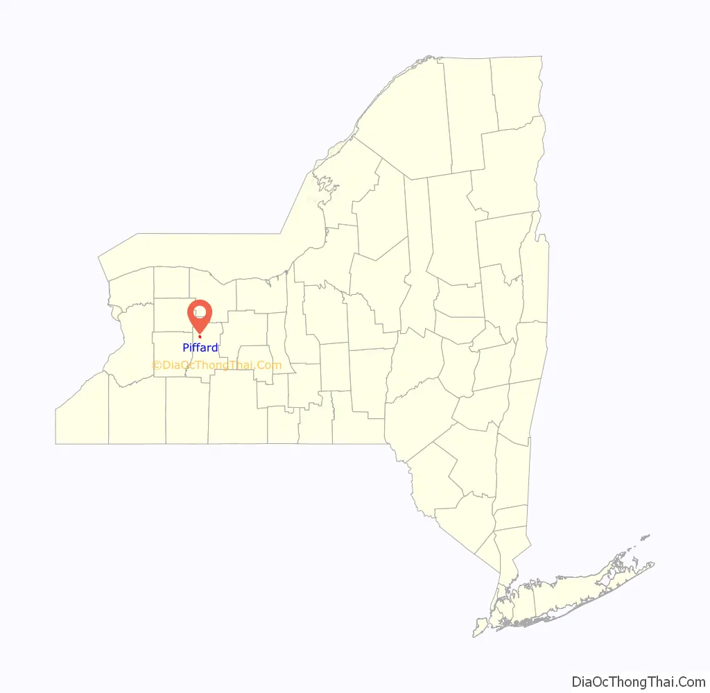
Piffard location map. Where is Piffard CDP?
History
The name is from early settler David Piffard. Westerly, a historic home, was added to the National Register of Historic Places in 1974.
The Roman Catholic Abbey of the Genesee was founded a mile north of Piffard in 1951.
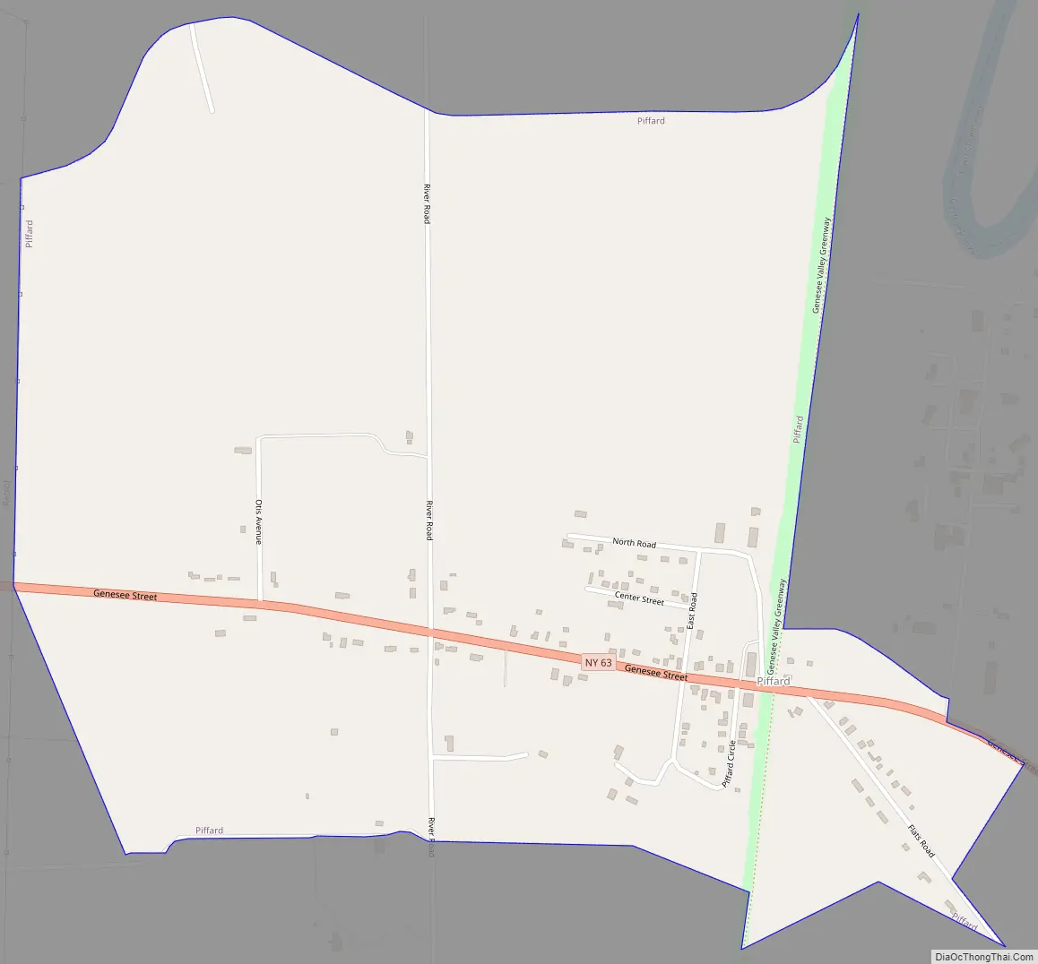
Piffard Road Map
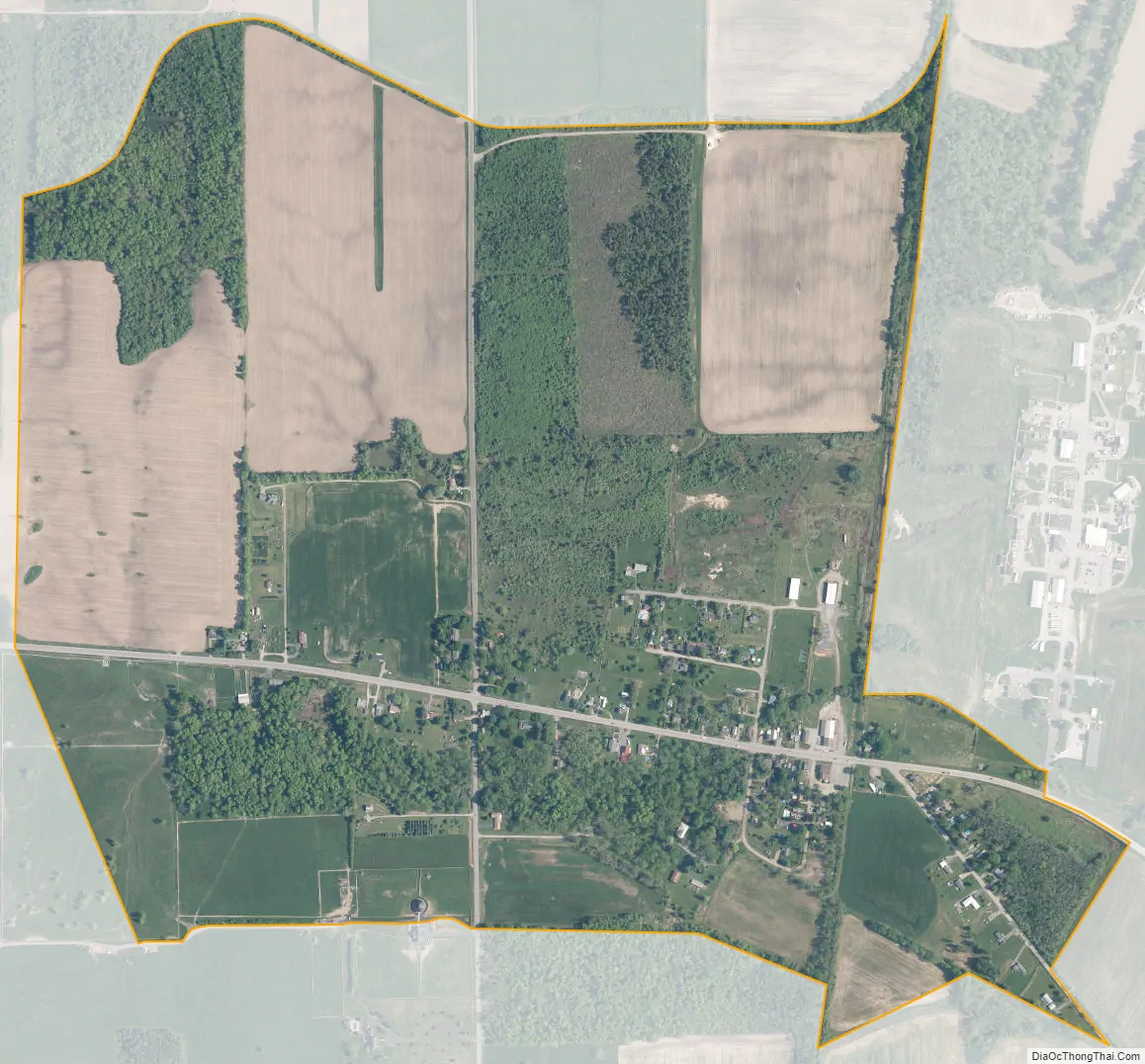
Piffard city Satellite Map
Geography
Piffard is in northwestern Livingston County, in the southeast part of the town of York. It is bordered to the west by the Hamlet of Retsof. New York State Route 63 passes through the Piffard, leading southeast 3 miles (5 km) to Geneseo, the Livingston county seat, and northwest 22 miles (35 km) to Batavia.
According to the U.S. Census Bureau, the Piffard CDP has an area of 0.93 square miles (2.4 km), all land. The community sits on the western edge of the valley of the Genesee River.
See also
Map of New York State and its subdivision:- Albany
- Allegany
- Bronx
- Broome
- Cattaraugus
- Cayuga
- Chautauqua
- Chemung
- Chenango
- Clinton
- Columbia
- Cortland
- Delaware
- Dutchess
- Erie
- Essex
- Franklin
- Fulton
- Genesee
- Greene
- Hamilton
- Herkimer
- Jefferson
- Kings
- Lake Ontario
- Lewis
- Livingston
- Madison
- Monroe
- Montgomery
- Nassau
- New York
- Niagara
- Oneida
- Onondaga
- Ontario
- Orange
- Orleans
- Oswego
- Otsego
- Putnam
- Queens
- Rensselaer
- Richmond
- Rockland
- Saint Lawrence
- Saratoga
- Schenectady
- Schoharie
- Schuyler
- Seneca
- Steuben
- Suffolk
- Sullivan
- Tioga
- Tompkins
- Ulster
- Warren
- Washington
- Wayne
- Westchester
- Wyoming
- Yates
- Alabama
- Alaska
- Arizona
- Arkansas
- California
- Colorado
- Connecticut
- Delaware
- District of Columbia
- Florida
- Georgia
- Hawaii
- Idaho
- Illinois
- Indiana
- Iowa
- Kansas
- Kentucky
- Louisiana
- Maine
- Maryland
- Massachusetts
- Michigan
- Minnesota
- Mississippi
- Missouri
- Montana
- Nebraska
- Nevada
- New Hampshire
- New Jersey
- New Mexico
- New York
- North Carolina
- North Dakota
- Ohio
- Oklahoma
- Oregon
- Pennsylvania
- Rhode Island
- South Carolina
- South Dakota
- Tennessee
- Texas
- Utah
- Vermont
- Virginia
- Washington
- West Virginia
- Wisconsin
- Wyoming


