Port Jefferson, also known as Port Jeff, is an incorporated village in the town of Brookhaven in Suffolk County, New York, on the North Shore of Long Island. Officially known as the Incorporated Village of Port Jefferson, the population was 7,962 as of the 2020 United States census.
Port Jefferson was first settled in the 17th century and remained a rural community until its development as an active shipbuilding center in the mid-19th century. The village has since transitioned to a tourist-based economy. The port remains active as terminus of the Bridgeport & Port Jefferson Ferry, one of two commercial ferry lines between Long Island and Connecticut, and is supplemented by the terminus of the Long Island Rail Road’s Port Jefferson Branch. It is also the center of the Greater Port Jefferson region of northwestern Brookhaven, serving as the cultural, commercial and transportation hub of the neighboring Port Jefferson Station, Belle Terre, Mount Sinai, Miller Place, Poquott, and the Setaukets.
| Name: | Port Jefferson village |
|---|---|
| LSAD Code: | 47 |
| LSAD Description: | village (suffix) |
| State: | New York |
| County: | Suffolk County |
| Elevation: | 12 ft (4 m) |
| Total Area: | 3.09 sq mi (8.00 km²) |
| Land Area: | 3.06 sq mi (7.93 km²) |
| Water Area: | 0.03 sq mi (0.07 km²) |
| Total Population: | 7,962 |
| Population Density: | 2,599.41/sq mi (1,003.55/km²) |
| ZIP code: | 11777 |
| Area code: | 631 and 934 |
| FIPS code: | 3659355 |
| GNISfeature ID: | 0960968 |
| Website: | www.portjeff.com |
Online Interactive Map
Click on ![]() to view map in "full screen" mode.
to view map in "full screen" mode.
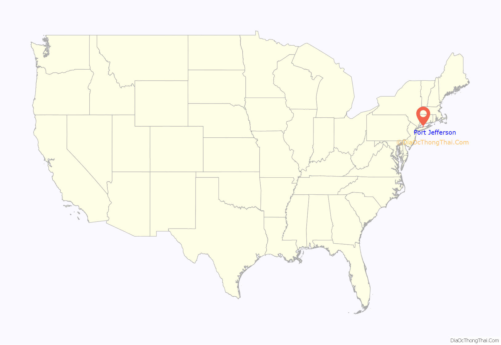
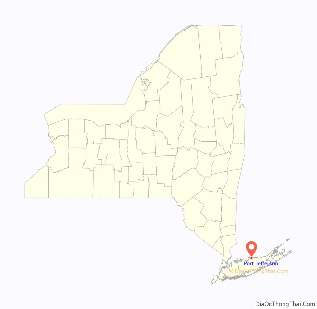
Port Jefferson location map. Where is Port Jefferson village?
History
Colonial and precolonial history
The original settlers of the Town of Brookhaven, based in the neighboring hamlet of Setauket, bought a tract of land from the Setalcott Indians in 1655. The deed included the area of contemporary Port Jefferson along with all other lands along the North Shore from the Nissequogue River eastward to Mount Misery Point.
Port Jefferson’s original name was Sowasset, a Native American term for either “place of small pines” or “where water opens.
The first known home within the present village boundaries was erected in the early 1660s by Captain John Scott, an important leader in Long Island’s early history. This house, named Egerton, was a grand abode on the western end of Mount Sinai Harbor at Mount Misery Neck. The first settler in Port Jefferson’s current downtown was an Irish Protestant shoemaker from Queens named John Roe, who built his still-standing home in 1682. It remained a small community of five homes through the 18th century, and was renamed to “Drowned Meadow” in 1682.
Local lore has it that the pirate Captain Kidd rendezvoused in the harbor on his way to bury treasure at Gardiners Island. Another legend is that: during the Revolutionary War, naval commander John Paul Jones had a ship fitted here. However, there is no factual support for these assertions, and the historical works quoted do not present them as definitive facts. John Paul Jones’s career in particular is well documented, and there are no accounts of him visiting the village, which was under British control during the time he served as a commanding officer.
Development as a shipbuilding village
In 1797, when the entire town had five houses, its first shipyard was built. By 1825, several shipbuilding firms were located there, which attracted new residents and commerce.
During the War of 1812, British interference on Long Island Sound upset local shipping routes. On one occasion, two British warships, the frigate HMS Pomone and brig HMS Despatch sent their boats into the harbor under cover of darkness, capturing seven sloops. To protect local interests, a small fortress was set up on the west side of Port Jefferson Harbor.
In 1836 the local leadership initiated the community’s transition from a “swampish hamlet” to a busy port town. The 22 acres of the harborfront, which flooded at high tide, were brought to a stable elevation with the construction of a causeway. The village changed its name from “Drowned Meadow” to “Port Jefferson”, in honor of Thomas Jefferson.
Numerous shipyards developed along Port Jefferson’s harbor, and the village’s shipbuilding industry became the largest in Suffolk County. Two whaling vessels were built for New Bedford at Port Jefferson in 1877 (ship Horatio and bark Fleetwing), and a Port Jefferson-built schooner (La Ninfa) was later converted into a whaling vessel at San Francisco. Port Jefferson’s primary role as a port in the 19th century was to build and support vessels engaged in the coastal freighting trades. Many of Port Jefferson’s remaining homes from this period were owned by shipbuilders and captains. This includes the Mather House Museum, a mid-19th century home once owned by the Mather shipbuilding family that now serves as the center of a museum complex and headquarters for the Historical Society of Greater Port Jefferson.
P. T. Barnum, the famous circus owner, owned a tract of land which ran through the village. His intention was to make Port Jefferson the home base for his circus, founded in 1871. The residents blocked his plans, and he eventually sold his land. Barnum Avenue now runs through the area that was once Barnum’s.
The section of town at the intersection of the two streets, then known as Hotel Square, became an active center of Port Jefferson’s early tourism industry in the mid-19th century,with a variety of hotels and restaurants. This included the John Roe house, which was converted into the Townsend House hotel. The village’s first post office was added to this intersection in 1855.
With the 1923 sale of the Bayles Shipyard to the Standard Oil Company and demolition of all but two of its structures, Port Jefferson’s shipbuilding industry came to a close. This resulted in an economic downturn, and the closing of many of the grand hotels in Hotel Square, as tourism declined along with the industry. Port Jefferson Harbor then became a depot for the oil transportation and gravel industries, and, since the 1940s, the site of a Long Island Lighting Company coal-fired power plant. The harbor also had activity as a rum-running center during the Prohibition era. Decades later, Port Jefferson’s economy had recovered, with tourism as its base.
After incorporation
The village of Port Jefferson was incorporated in 1963. The revitalization of lower Port Jefferson soon followed as local tourism brought increased revenues and the village adjusted itself to its new economic role. One such transformation was the 1976 redevelopment of the defunct Mather & Jones Shipyard into a shop-lined promenade known as Chandler Square.
A result of the transition is new public access to much of the waterfront, as several industrial lots had previously stood in the way. Danfords Hotel and Marina was one major waterfront project, which integrated several new and historical structures into a luxury hotel. Danfords includes a commercial marina and walkable pier, marking an aspect of the harbor’s transformation from industrial to recreational use.
Harborfront Park, a project completed in 2004, similarly transitioned the site of a shipyard turned Mobil Oil terminal into a public park with picnic grounds, a seasonal ice skating rink and a promenade. Concurrent to the park’s construction was the rebuilding of a former shipyard warehouse into the Port Jefferson Village Center, a new public space for events and recreation.
A number of historic buildings were included in the Port Jefferson Village Historic District, listed on the National Register of Historic Places in 2005. Separately listed are the Bayles Shipyard and First National Bank of Port Jefferson building.
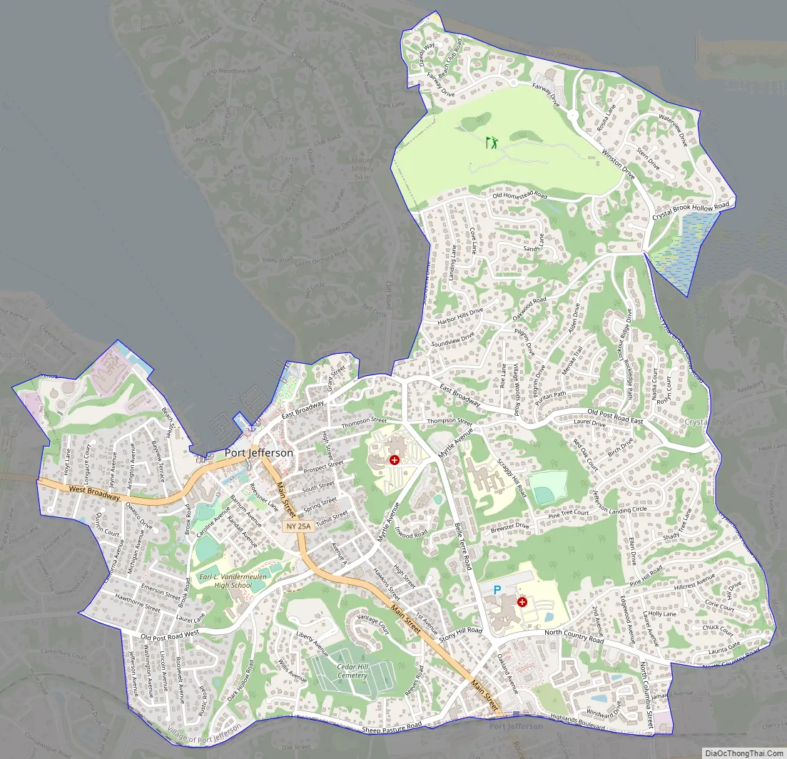
Port Jefferson Road Map
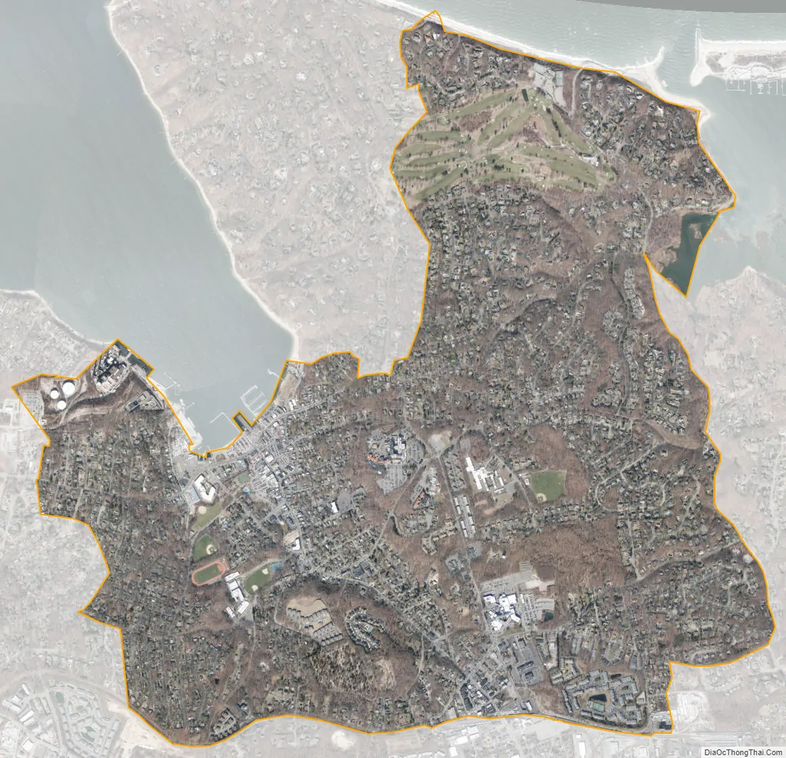
Port Jefferson city Satellite Map
Geography
The village’s commerce is divided into two centers that lie one mile apart along Main Street and at differing elevations. These are known as Lower Port Jefferson and Upper Port Jefferson, respectively the waterfront and the railroad station sections of town. The first is currently the center of tourism, while the latter is undergoing plans for revitalization to the economic viability of its historic self. Further from Main Street, the remainder of Port Jefferson consists of several residential neighborhoods defined by the hills on which they sit. In the northeastern corner of the village is the neighborhood of Harbor Hills. This neighborhood occupies the western edge of Mount Sinai Harbor and contains the Port Jefferson Country Club at Harbor Hills. Brick Hill is the neighborhood directly west of the Lower Port Jefferson commercial center and was first developed by the noted circus owner P. T. Barnum. West of Upper Port Jefferson is Cedar Hill, which is topped by the c. 1859 Cedar Hill Cemetery where residents formerly would bask while enjoying views over the village from its highest point.
Within Port Jefferson is Port Jefferson Harbor, a natural deepwater harbor. Setauket Harbor branches off to the west from the harbor. One notable geographic feature is The Cove, a small cove dredged in the early 20th century by the Seaboard Dredging Company. The original name was Seaboard Hole, but it was changed for the sake of appealing to tourists, and several large sand dunes artificially created by the dredging can also be found here.
See also
Map of New York State and its subdivision:- Albany
- Allegany
- Bronx
- Broome
- Cattaraugus
- Cayuga
- Chautauqua
- Chemung
- Chenango
- Clinton
- Columbia
- Cortland
- Delaware
- Dutchess
- Erie
- Essex
- Franklin
- Fulton
- Genesee
- Greene
- Hamilton
- Herkimer
- Jefferson
- Kings
- Lake Ontario
- Lewis
- Livingston
- Madison
- Monroe
- Montgomery
- Nassau
- New York
- Niagara
- Oneida
- Onondaga
- Ontario
- Orange
- Orleans
- Oswego
- Otsego
- Putnam
- Queens
- Rensselaer
- Richmond
- Rockland
- Saint Lawrence
- Saratoga
- Schenectady
- Schoharie
- Schuyler
- Seneca
- Steuben
- Suffolk
- Sullivan
- Tioga
- Tompkins
- Ulster
- Warren
- Washington
- Wayne
- Westchester
- Wyoming
- Yates
- Alabama
- Alaska
- Arizona
- Arkansas
- California
- Colorado
- Connecticut
- Delaware
- District of Columbia
- Florida
- Georgia
- Hawaii
- Idaho
- Illinois
- Indiana
- Iowa
- Kansas
- Kentucky
- Louisiana
- Maine
- Maryland
- Massachusetts
- Michigan
- Minnesota
- Mississippi
- Missouri
- Montana
- Nebraska
- Nevada
- New Hampshire
- New Jersey
- New Mexico
- New York
- North Carolina
- North Dakota
- Ohio
- Oklahoma
- Oregon
- Pennsylvania
- Rhode Island
- South Carolina
- South Dakota
- Tennessee
- Texas
- Utah
- Vermont
- Virginia
- Washington
- West Virginia
- Wisconsin
- Wyoming


