Port Jefferson Station is a hamlet and census-designated place (CDP) in the Town of Brookhaven, in Suffolk County, in New York, United States. The population was 7,838 as of the 2010 census.
| Name: | Port Jefferson Station CDP |
|---|---|
| LSAD Code: | 57 |
| LSAD Description: | CDP (suffix) |
| State: | New York |
| County: | Suffolk County |
| Elevation: | 177 ft (54 m) |
| Total Area: | 2.64 sq mi (6.84 km²) |
| Land Area: | 2.64 sq mi (6.84 km²) |
| Water Area: | 0.00 sq mi (0.00 km²) |
| Total Population: | 7,950 |
| Population Density: | 3,010.22/sq mi (1,162.23/km²) |
| Area code: | 631, 934 |
| FIPS code: | 3659377 |
| GNISfeature ID: | 0960970 |
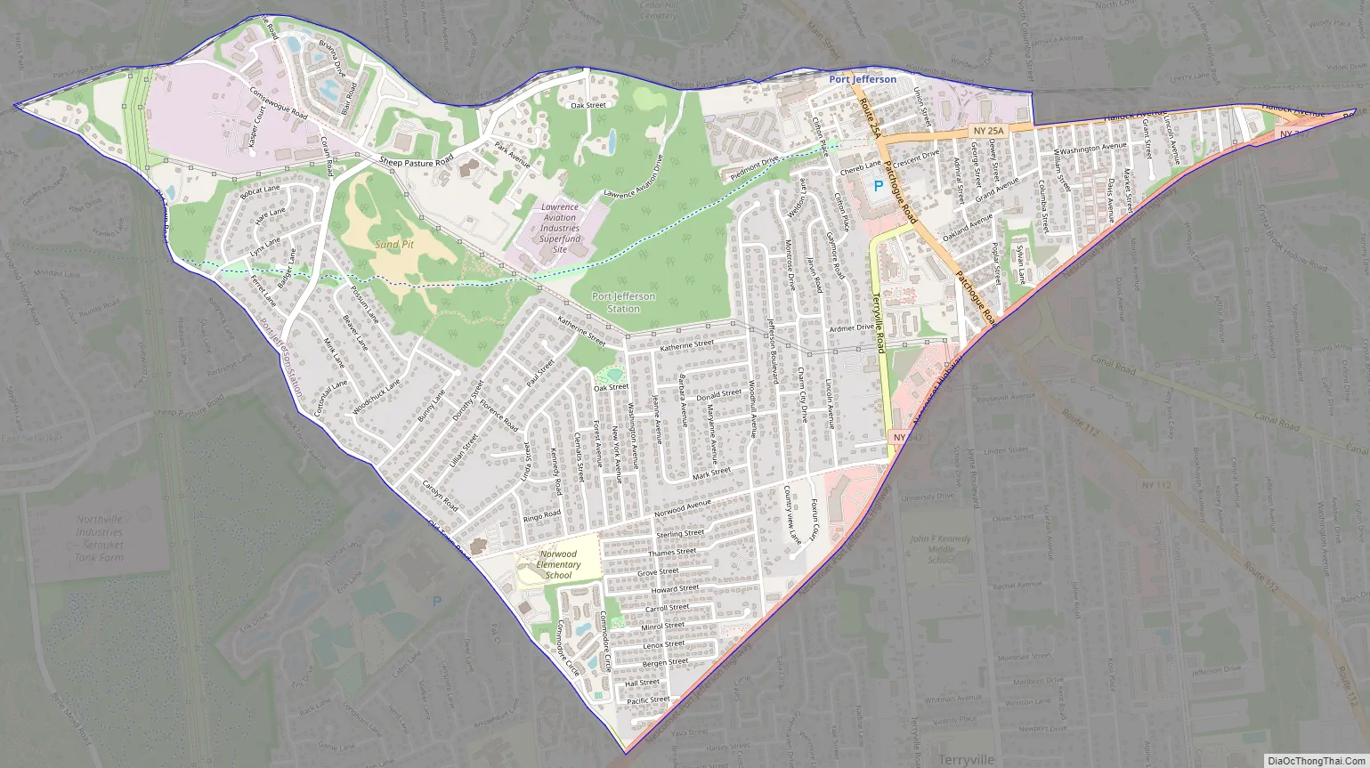
Online Interactive Map
Click on ![]() to view map in "full screen" mode.
to view map in "full screen" mode.
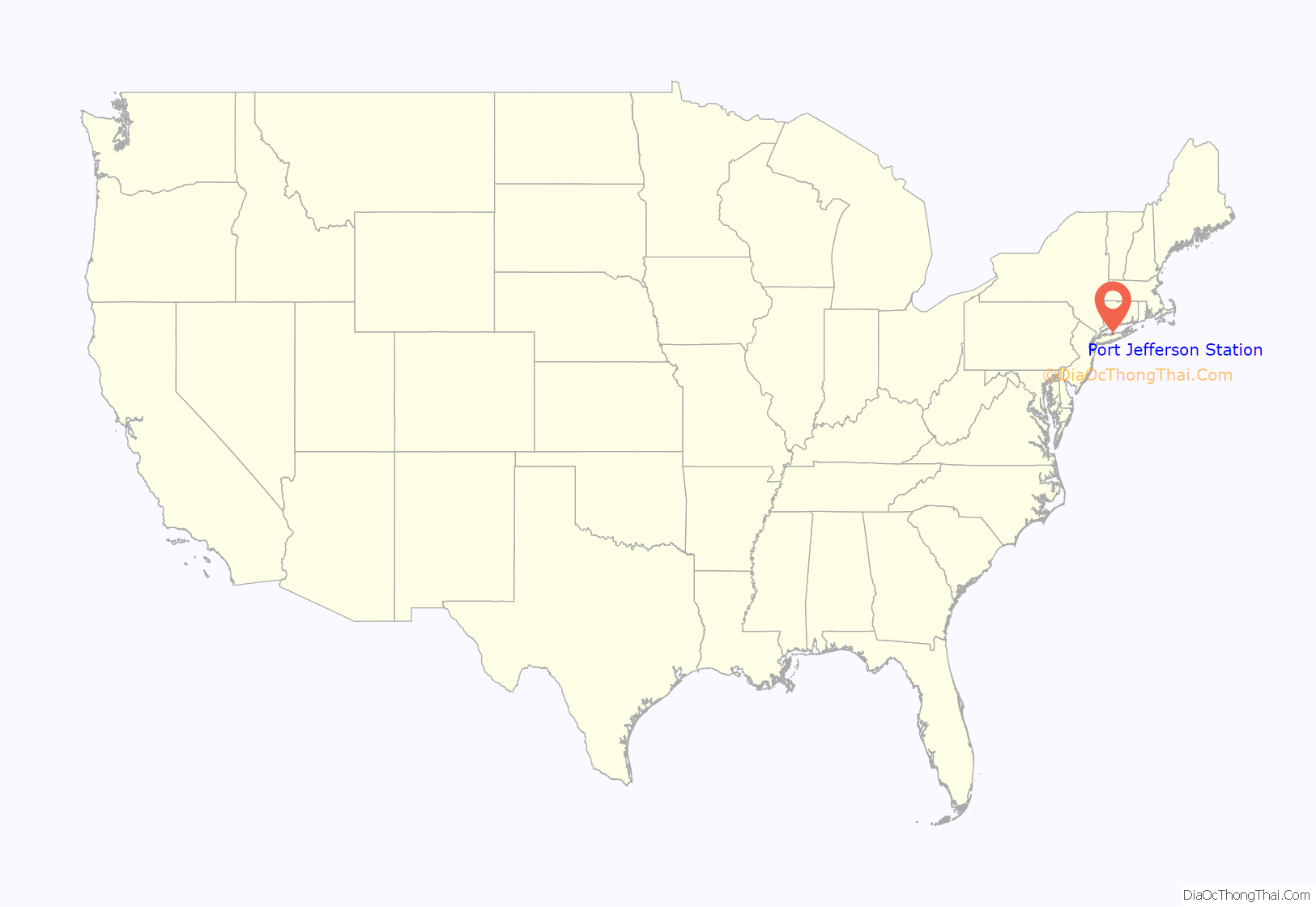
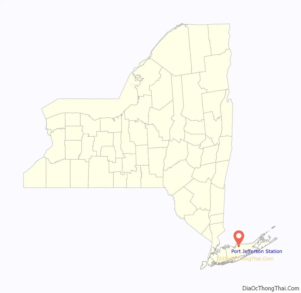
Port Jefferson Station location map. Where is Port Jefferson Station CDP?
History
The area now known as Port Jefferson Station was first called by the Native American name Comsewogue. The name “Echo” was also used. The first Colonial resident, William Tooker, had arrived by 1750.
In 1873, the Long Island Rail Road arrived to provide service to nearby Port Jefferson, providing the hamlet with its present-day name.
The primarily farming community began to experience suburban growth following the construction of Nesconset Highway in the mid 1950s. By the early 1970s, it had become a primarily suburban community.
Port Jefferson Station Road Map
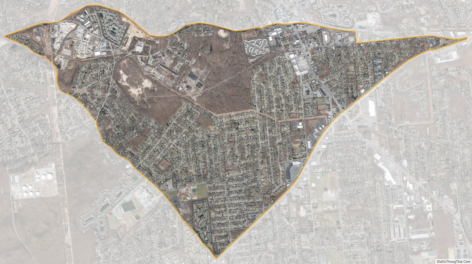
Port Jefferson Station city Satellite Map
Geography
According to the United States Census Bureau, the CDP has a total area of 2.6 square miles (6.7 km), all land.
The train tracks mark the northern boundary of Port Jefferson Station, separating it from the Village of Port Jefferson. Nesconset Highway to the south forms a boundary with Terryville.
See also
Map of New York State and its subdivision:- Albany
- Allegany
- Bronx
- Broome
- Cattaraugus
- Cayuga
- Chautauqua
- Chemung
- Chenango
- Clinton
- Columbia
- Cortland
- Delaware
- Dutchess
- Erie
- Essex
- Franklin
- Fulton
- Genesee
- Greene
- Hamilton
- Herkimer
- Jefferson
- Kings
- Lake Ontario
- Lewis
- Livingston
- Madison
- Monroe
- Montgomery
- Nassau
- New York
- Niagara
- Oneida
- Onondaga
- Ontario
- Orange
- Orleans
- Oswego
- Otsego
- Putnam
- Queens
- Rensselaer
- Richmond
- Rockland
- Saint Lawrence
- Saratoga
- Schenectady
- Schoharie
- Schuyler
- Seneca
- Steuben
- Suffolk
- Sullivan
- Tioga
- Tompkins
- Ulster
- Warren
- Washington
- Wayne
- Westchester
- Wyoming
- Yates
- Alabama
- Alaska
- Arizona
- Arkansas
- California
- Colorado
- Connecticut
- Delaware
- District of Columbia
- Florida
- Georgia
- Hawaii
- Idaho
- Illinois
- Indiana
- Iowa
- Kansas
- Kentucky
- Louisiana
- Maine
- Maryland
- Massachusetts
- Michigan
- Minnesota
- Mississippi
- Missouri
- Montana
- Nebraska
- Nevada
- New Hampshire
- New Jersey
- New Mexico
- New York
- North Carolina
- North Dakota
- Ohio
- Oklahoma
- Oregon
- Pennsylvania
- Rhode Island
- South Carolina
- South Dakota
- Tennessee
- Texas
- Utah
- Vermont
- Virginia
- Washington
- West Virginia
- Wisconsin
- Wyoming


