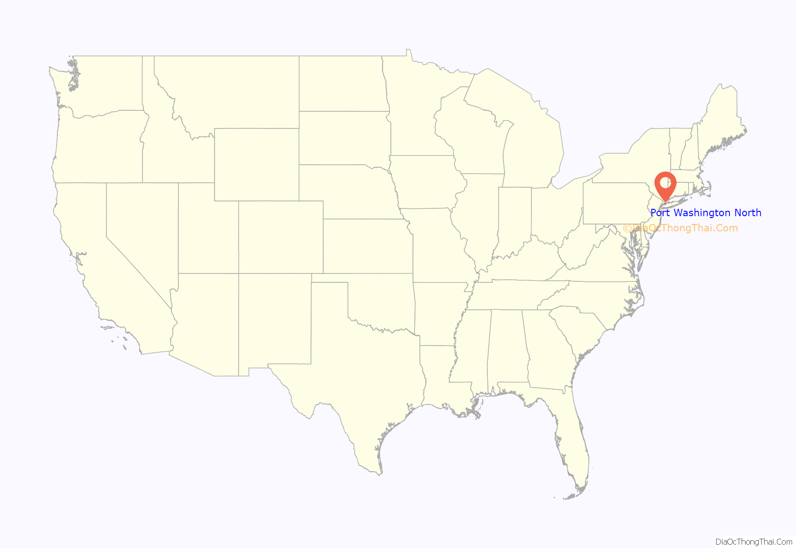
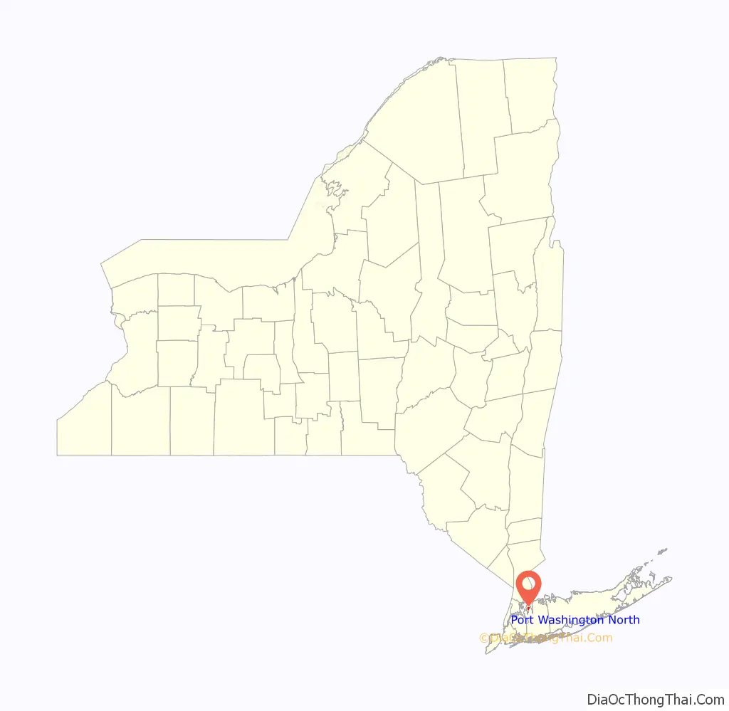
Port Washington North is a village in Nassau County, on the North Shore of Long Island, in New York, United States. It is considered part of the Greater Port Washington area, which is anchored by Port Washington. The population was 3,154 at the 2010 census.
The Incorporated Village of Port Washington North is located on the Cow Neck Peninsula, within the Town of North Hempstead.
| Name: | Port Washington North village |
|---|---|
| LSAD Code: | 47 |
| LSAD Description: | village (suffix) |
| State: | New York |
| County: | Nassau County |
| Incorporated: | 1932 |
| Elevation: | 26 ft (8 m) |
| Total Area: | 0.50 sq mi (1.29 km²) |
| Land Area: | 0.48 sq mi (1.24 km²) |
| Water Area: | 0.02 sq mi (0.05 km²) |
| Total Population: | 3,160 |
| Population Density: | 6,597.08/sq mi (2,549.32/km²) |
| FIPS code: | 3659531 |
| GNISfeature ID: | 0960980 |
| Website: | www.portwashingtonnorth.org |
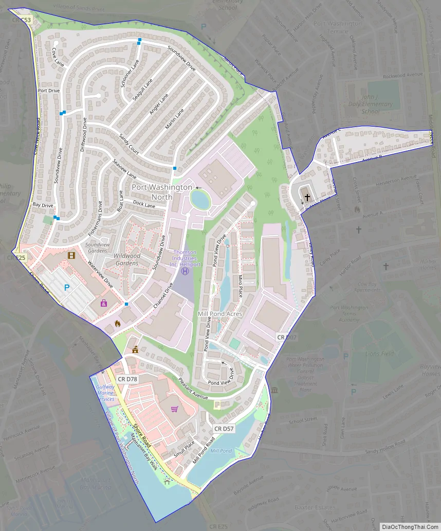
Online Interactive Map
Click on ![]() to view map in "full screen" mode.
to view map in "full screen" mode.
Port Washington North location map. Where is Port Washington North village?
History
Port Washington North incorporated in 1932 after residents of the area unanimously voted in favor of incorporating on July 6 of that year. Its first Mayor, John Cocks, led the movement to incorporate; he was elected on August 2, 1932.
In 1931, one year prior to Port Washington North incorporating itself as a village, the adjacent village, Manorhaven, unsuccessfully attempted to annex the area. Manorhaven was unsuccessful due to the fact that the residents in what would ultimately become Port Washington North preferred incorporating as a separate village.
In 1953, an area of sand mine along Cow Neck Road, which was uninhabited, was annexed by the village.
By the late 1950s, the Colonial Sand and Gravel Company began selling tracts of their land to developers. In 1959, the green light was given by the village for developers to begin constructing the first section of Port Washington North’s Soundview Village subdivision.
In 1982, the Village of Port Washington North celebrated its 50th Anniversary.
The name of the village reflects its geographic location in the northern part of the Greater Port Washington area.
Port Washington North Road Map
Port Washington North city Satellite Map
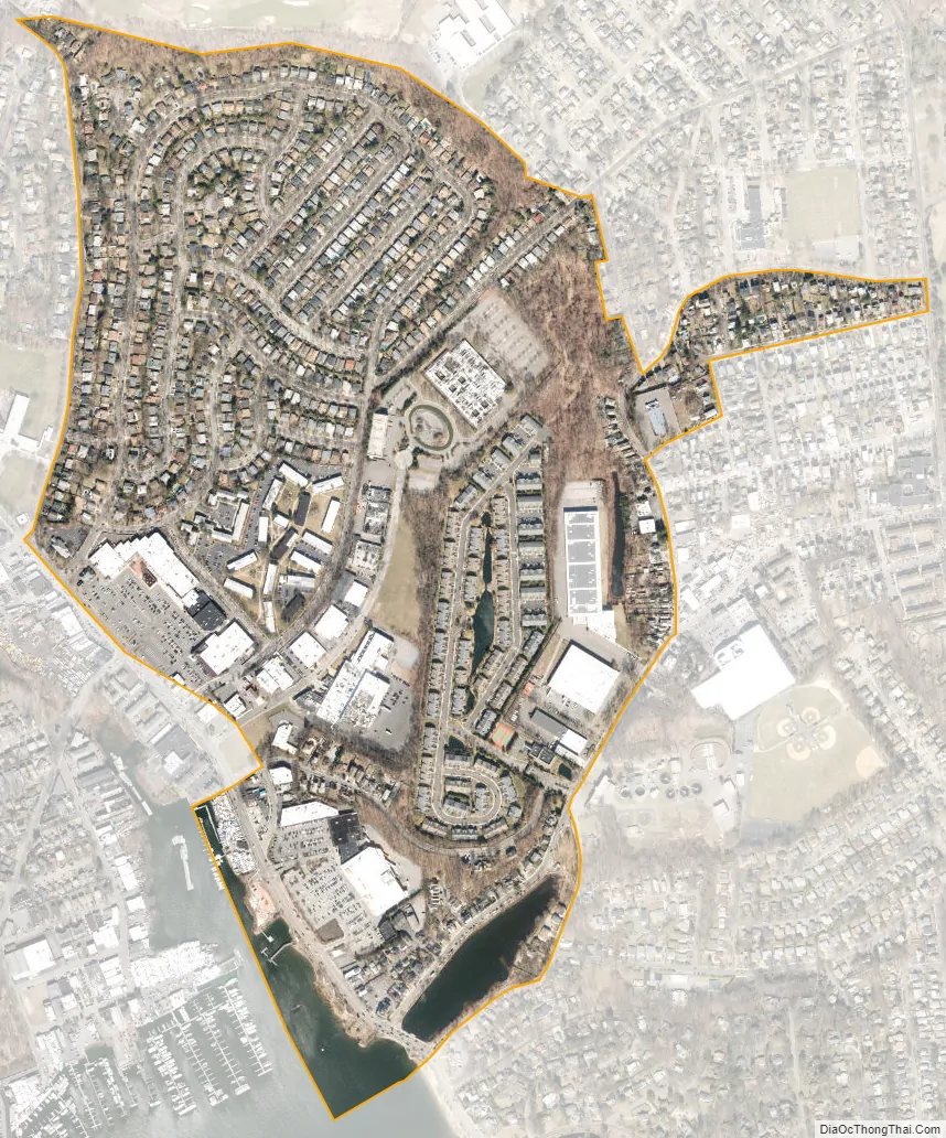
Geography
According to the United States Census Bureau, the village has a total area of 0.5 square miles (1.3 km), of which 0.5 square miles (1.3 km) is land and 0.04 square miles (0.10 km), or 4.00%, is water.
Port Washington North is located within the Manhasset Bay Watershed, which in turn is located within the larger Long Island Sound/Atlantic Ocean Watershed.
According to the United States Environmental Protection Agency and the United States Geological Survey, the highest point in Port Washington North is located at the Port Washington North–Sands Point border on Middle Neck Road, at approximately 100–110 feet (30–34 m), and the lowest point is Manhasset Bay, which is at sea level.
See also
Map of New York State and its subdivision:- Albany
- Allegany
- Bronx
- Broome
- Cattaraugus
- Cayuga
- Chautauqua
- Chemung
- Chenango
- Clinton
- Columbia
- Cortland
- Delaware
- Dutchess
- Erie
- Essex
- Franklin
- Fulton
- Genesee
- Greene
- Hamilton
- Herkimer
- Jefferson
- Kings
- Lake Ontario
- Lewis
- Livingston
- Madison
- Monroe
- Montgomery
- Nassau
- New York
- Niagara
- Oneida
- Onondaga
- Ontario
- Orange
- Orleans
- Oswego
- Otsego
- Putnam
- Queens
- Rensselaer
- Richmond
- Rockland
- Saint Lawrence
- Saratoga
- Schenectady
- Schoharie
- Schuyler
- Seneca
- Steuben
- Suffolk
- Sullivan
- Tioga
- Tompkins
- Ulster
- Warren
- Washington
- Wayne
- Westchester
- Wyoming
- Yates
- Alabama
- Alaska
- Arizona
- Arkansas
- California
- Colorado
- Connecticut
- Delaware
- District of Columbia
- Florida
- Georgia
- Hawaii
- Idaho
- Illinois
- Indiana
- Iowa
- Kansas
- Kentucky
- Louisiana
- Maine
- Maryland
- Massachusetts
- Michigan
- Minnesota
- Mississippi
- Missouri
- Montana
- Nebraska
- Nevada
- New Hampshire
- New Jersey
- New Mexico
- New York
- North Carolina
- North Dakota
- Ohio
- Oklahoma
- Oregon
- Pennsylvania
- Rhode Island
- South Carolina
- South Dakota
- Tennessee
- Texas
- Utah
- Vermont
- Virginia
- Washington
- West Virginia
- Wisconsin
- Wyoming


