Rome is a city in Oneida County, New York, United States, located in the central part of the state. The population was 32,127 at the 2020 census. Rome is one of two principal cities in the Utica–Rome Metropolitan Statistical Area, which lies in the “Leatherstocking Country” made famous by James Fenimore Cooper’s Leatherstocking Tales, set in frontier days before the American Revolutionary War. Rome is in New York’s 22nd congressional district.
The city developed at an ancient portage site of Native Americans, including the historic Iroquois nations. This portage continued to be strategically important to Europeans, who also used the main 18th and 19th-century waterways, based on the Mohawk and Hudson rivers, that connected New York City and the Atlantic seaboard to the Great Lakes. The original European settlements developed around fortifications erected in the 1750s to defend the waterway, in particular the British Fort Stanwix (1763) built in New York.
Following the American Revolution, the settlement began to grow with the construction of the Rome Canal in 1796, to connect Wood Creek (leading from Lake Ontario) and the headwaters of the Mohawk River. In the same year the state created the Town of Rome as a section of Oneida County. For a time, the small community next to the canal was informally known as Lynchville, after the original owner of the property, the prominent wine merchant Dominick Lynch.
The New York State Legislature converted the Town of Rome into a city on February 23, 1870. The residents have called Rome the City of American History.
| Name: | Rome city |
|---|---|
| LSAD Code: | 25 |
| LSAD Description: | city (suffix) |
| State: | New York |
| County: | Oneida County |
| Incorporated: | 1870 |
| Elevation: | 456 ft (139 m) |
| Total Area: | 75.66 sq mi (195.95 km²) |
| Land Area: | 74.85 sq mi (193.87 km²) |
| Water Area: | 0.80 sq mi (2.08 km²) 0.99% |
| Total Population: | 32,127 |
| Population Density: | 429.20/sq mi (165.71/km²) |
| Area code: | 315 |
| FIPS code: | 3663418 |
| GNISfeature ID: | 0962840 |
| Website: | romenewyork.com |
Online Interactive Map
Click on ![]() to view map in "full screen" mode.
to view map in "full screen" mode.
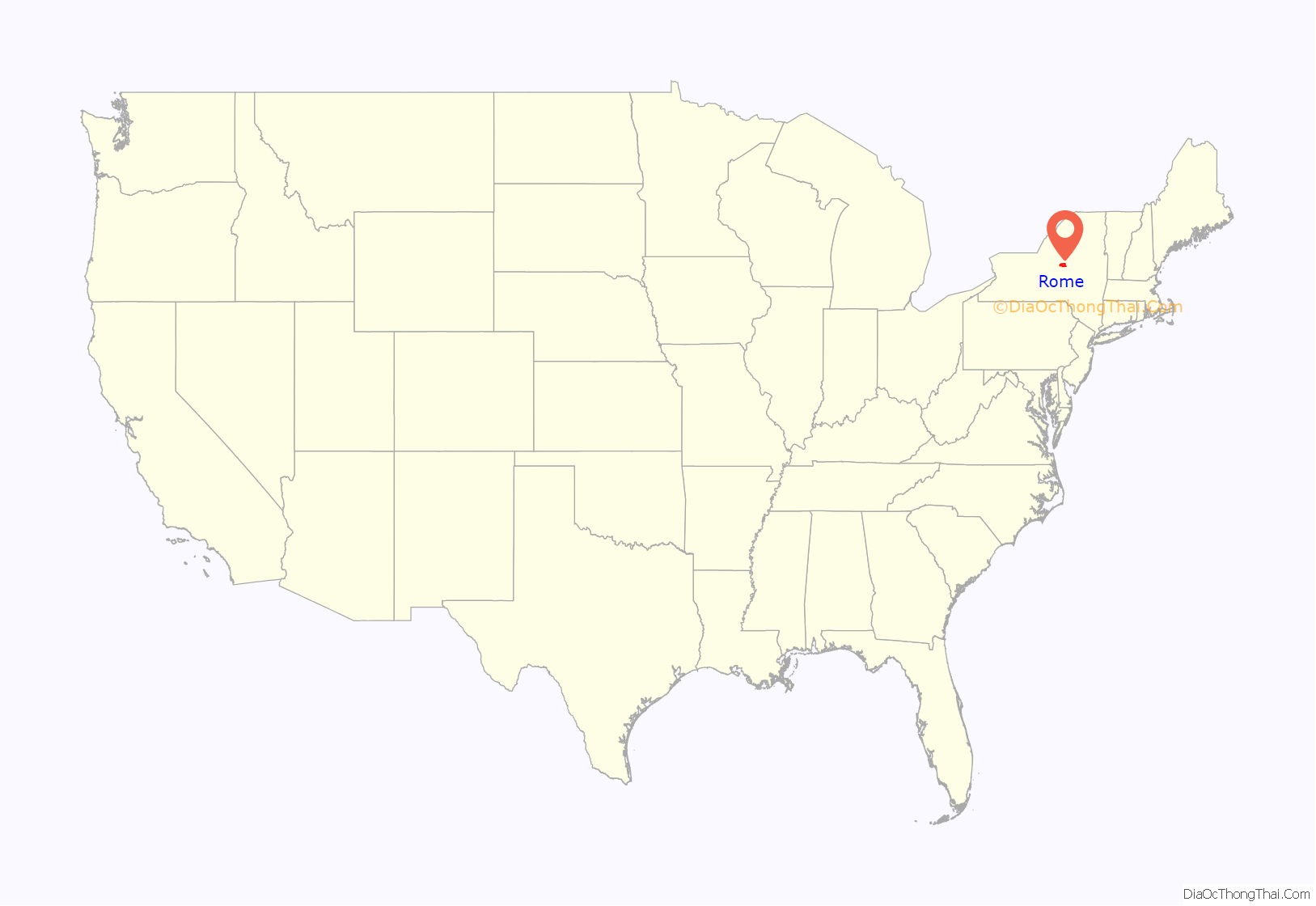
Rome location map. Where is Rome city?
History
Oneida Carrying Place
Rome was founded along an ancient Native American portage path known as the Oneida Carrying Place, Deo-Wain-Sta, or The Great Carrying Place to the Six Nations (Iroquois), or the Haudenosaunee in their language. These names refer to a portage road or path between the Mohawk River to the east, which flows east to the Hudson River; and Wood Creek to the west, which flows into Oneida Lake and, eventually, Lake Ontario via the Oneida and Oswego Rivers. Now located within the modern Rome city limits, this short portage path was the only overland section of a water trade route stretching more than 1,000 miles between Lake Ontario and the lower Hudson. Travelers and traders coming up the Mohawk River from the Hudson had to transfer their cargo and boats and transport them overland between 1.7 and six miles (depending on the season) to continue west on Wood Creek to Oneida Lake which was drained by the Oswego River that ultimately flowed into Lake Ontario. This ancient trade route joined the Great Lakes and Canada via the Mohawk River to the Hudson River and the Atlantic Ocean.
During the French and Indian War, the North American front of the Seven Years’ War, this region was the scene of much fighting. The British colonists had erected several small forts to guard the Oneida Carrying Place and the lucrative fur trade against French incursions from Canada; however, a combined French regular army, Canadian, and allied Native American force overwhelmed and massacred a British force here in the Battle of Fort Bull. Later in 1758, after several abortive attempts to fortify the area, the British sent a very large force to secure the Oneida Carry and build a stronger rampart complex, which they named Fort Stanwix.
Following defeat by the English during the war, the French ceded their territory in North America east of the Mississippi River to England. The English signed the Treaty of Fort Stanwix (1768) with the Iroquois, under the terms of which they promised to preserve areas west of the Appalachian Mountains as an Indian reserve and to prohibit colonial settlement. It has been described as “one of the worst treaties in the History of Anglo-Indian relationships”. The treaty has also been described as “the last desperate effort of the British to create order west of the Appalachians. The British were unable to enforce their promise, as Anglo colonists continued to move west of the Appalachians, causing conflicts with native tribes. The British abandoned Ft. Stanwix after that war; it deteriorated and was eventually torn down, its parts and materials used by settlers for other structures.
Revolutionary War and Fort Stanwix
At the outbreak of the Revolutionary War, American Continental forces took control of the Fort Stanwix site, rebuilding and improving the fort. The installation survived a siege by the British in the Saratoga Campaign of 1777, and it became renowned as “the fort that never surrendered”. Patriot militia, regulars, and their Oneida Nation allies under the command of Col. Peter Gansevoort, successfully repelled a prolonged siege in August 1777 by British, German, Loyalist, and Canadian troops and warriors from several Native American nations, all commanded by British Gen. Barry St. Leger. The failed siege, combined with the battle at nearby Oriskany as well as the battles of Bennington, and Saratoga, thwarted a coordinated British effort to take the northern colonies. Following this success, the Americans were able to gain alliances with France and the Netherlands, as both countries were becoming more confident that the rebels had a chance to win.
After the repulsion of the British at Fort Stanwix, bloody fighting erupted along the American northern frontier and throughout the Mohawk Valley. There were heavy losses for both American settlers and the people of the Six Nations, as each side made retaliatory raids against the other in a round of violence. Because many of the Oneida were fighting with the rebels and against the four nations allied with the British, especially the Mohawk and Seneca, the Iroquois had members attacking each other, which they had avoided doing earlier in this century.
The Americans used Fort Stanwix as the primary staging point for attacks against British loyalist units and their Haudenosaunee allies. The Sullivan Expedition of 1779 was launched from here as a scorched earth campaign against villages of Iroquois nations that were allied with the British. Commander George Washington ordered the campaign in retaliation for the fierce frontier attacks in New York, such as the Cherry Valley Massacre by Loyalist irregulars led by Mohawk Chief Joseph Brant and John Butler. The Sullivan campaign destroyed nearly 50 Iroquois villages and their food stores, leading to starvation of many people of these nations during the following winter. Many Iroquois went to Upper Canada for refuge but struggled with starvation there, too.
The American forces abandoned the fort in 1781. After the war, as the area became settled, pioneers took materials to use in constructing their own homes and barns. They built the Rome Canal along Wood Creek, to connect it to the Mohawk River and enable continuous passage by water from Lake Ontario via the Mohawk and Hudson rivers to New York City.
After completion of the Erie Canal in 1825, development of Rome increased. The city became an industrial and trade center in the western Mohawk Valley. The fort site was reduced to a mound of dirt, with bushes and grasses growing over it. During the Great Depression in the early 20th century, Congress passed the Fort Stanwix Act of 1935 to establish the fort as a National Monument because of the site’s historic importance. The site was administered by the National Park Service (NPS).
In 1973, the NPS began reconstruction of Fort Stanwix, based on historical evidence related to 18th-century construction and occupation. It was completed in 1976. The fort is operated by the National Park Service as a museum.
On July 2, 2005, the Marinus Willet Center opened on the grounds of the monument. It provides audio-visual programs to orient visitors, as well as secure storage space for the museum’s collection of artifacts and related historic materials.
Commercial growth: Erie Canal
The critical east/west American trade route through the frontier was improved by construction of the Erie Canal. On July 4, 1817, construction on the canal began in Rome. The Erie Canal reaches a summit in Rome, attaining an elevation of 420 feet. The first phase was completed in 1825, connecting the Hudson River by waterway to the Great Lakes. It resulted in an increase in trade and traffic between communities around the Great Lakes and New York City, stimulating development all along the route.
Copper City
In 1851, Jesse Williams founded the first cheese factory in the United States at Rome. Williams also developed the process used today for large-scale cheese manufacturing. During the later 19th century, there were numerous dairy farms in the area and throughout the Mohawk Valley. Many shipped their milk and cheese to customers in New York City.
The City of Rome was incorporated in 1870.
Revere Copper Products, Inc., founded in Rome during 1928 and 1929, is one of the oldest manufacturing companies in the United States. It developed from a series of mergers between several companies, including Revere Copper Company located in Canton, Massachusetts. The first president of Revere Copper Products, Inc, George H. Allen, was formerly the president of Michigan Copper and Brass Company, which was one of the companies included in the merger. The early history of Revere Copper Products, Inc is detailed in the book Copper Heritage: The Story of Revere Copper and Brass, Inc. by Isaac F. Marcosson. At one time, 10 percent of all copper products used in the United States were manufactured in Rome.
Cold War and technology role
From 1951 to 1991, the military Rome Air Development Center (RADC) was located at Griffiss AFB. In 1991, the RADC was redesignated as Rome Laboratory. It has remained active as the Griffiss AFB was closed as part of the Base Realignment and Closure process in 1993. In 1997, Rome Laboratory was made part of the Air Force Research Laboratory and renamed the Rome Research Site. The RADC has been responsible for some of the United States Air Force’s major technological accomplishments, especially in the area of radio communications.
Griffiss Air Force Base consists of 3,552 acres. The Eastern Air Defense Sector (EADS) is also located in Rome, on the site of the former Griffiss Air Force Base.
Woodstock 1999 was held in Rome, at the former Griffiss Air Force Base site. The three-day rock festival was held over the weekend of July 23–25, and drew a crowd of about 200,000 people. Cable network MTV covered the concert extensively, and live coverage of the entire weekend was available on pay-per-view. The festival featured acts including Metallica, Kid Rock, DMX, Red Hot Chili Peppers, Rage Against the Machine, Korn, Limp Bizkit, Alanis Morissette and Wyclef Jean; early reviews for many of the acts were positive. Critics particularly praised performances by George Clinton, Jamiroquai, James Brown, Sheryl Crow, and Rage Against the Machine. However, the festival ended in a violent riot, with bonfires being lit in the crowd, brawls with police, and looting.
In July 2005, New York City developers, Park Drive Estates, purchased the Woodhaven Housing, formerly the base housing for Griffiss Air Force officers and enlisted military members, with the goal of re-developing the property as a resort-style active adult community. Redevelopment stalled. The property was ceded to the City of Rome in 2015. Demolition of the area finished in 2018.
Rome Road Map
Rome city Satellite Map
Geography
Rome is the second-largest city by area in New York State, and the 140th largest city in the United States. According to the United States Census Bureau, the city has a total area of 75.7 square miles (196 km), of which 74.9 square miles (194 km) is land and 0.8 square miles (2.1 km) (0.99%) is water.
Rome averages over 120 inches (3,000 mm) of snowfall each winter, mostly due to its proximity to Lake Ontario and the lake-effect snow that it produces.
New York State Route 26, New York State Route 46, New York State Route 49 and New York State Route 69 converge in downtown Rome and are part of two separate triplexes. New York State Route 233 becomes part of a duplex with NY 69 south of the inner district before meeting its northern terminus at the Utica-Rome Expressway (NY 49). New York State Route 365 passes through the eastern portion of the outer district before becoming part of the Utica-Rome Expressway at an interchange.
See also
Map of New York State and its subdivision:- Albany
- Allegany
- Bronx
- Broome
- Cattaraugus
- Cayuga
- Chautauqua
- Chemung
- Chenango
- Clinton
- Columbia
- Cortland
- Delaware
- Dutchess
- Erie
- Essex
- Franklin
- Fulton
- Genesee
- Greene
- Hamilton
- Herkimer
- Jefferson
- Kings
- Lake Ontario
- Lewis
- Livingston
- Madison
- Monroe
- Montgomery
- Nassau
- New York
- Niagara
- Oneida
- Onondaga
- Ontario
- Orange
- Orleans
- Oswego
- Otsego
- Putnam
- Queens
- Rensselaer
- Richmond
- Rockland
- Saint Lawrence
- Saratoga
- Schenectady
- Schoharie
- Schuyler
- Seneca
- Steuben
- Suffolk
- Sullivan
- Tioga
- Tompkins
- Ulster
- Warren
- Washington
- Wayne
- Westchester
- Wyoming
- Yates
- Alabama
- Alaska
- Arizona
- Arkansas
- California
- Colorado
- Connecticut
- Delaware
- District of Columbia
- Florida
- Georgia
- Hawaii
- Idaho
- Illinois
- Indiana
- Iowa
- Kansas
- Kentucky
- Louisiana
- Maine
- Maryland
- Massachusetts
- Michigan
- Minnesota
- Mississippi
- Missouri
- Montana
- Nebraska
- Nevada
- New Hampshire
- New Jersey
- New Mexico
- New York
- North Carolina
- North Dakota
- Ohio
- Oklahoma
- Oregon
- Pennsylvania
- Rhode Island
- South Carolina
- South Dakota
- Tennessee
- Texas
- Utah
- Vermont
- Virginia
- Washington
- West Virginia
- Wisconsin
- Wyoming
