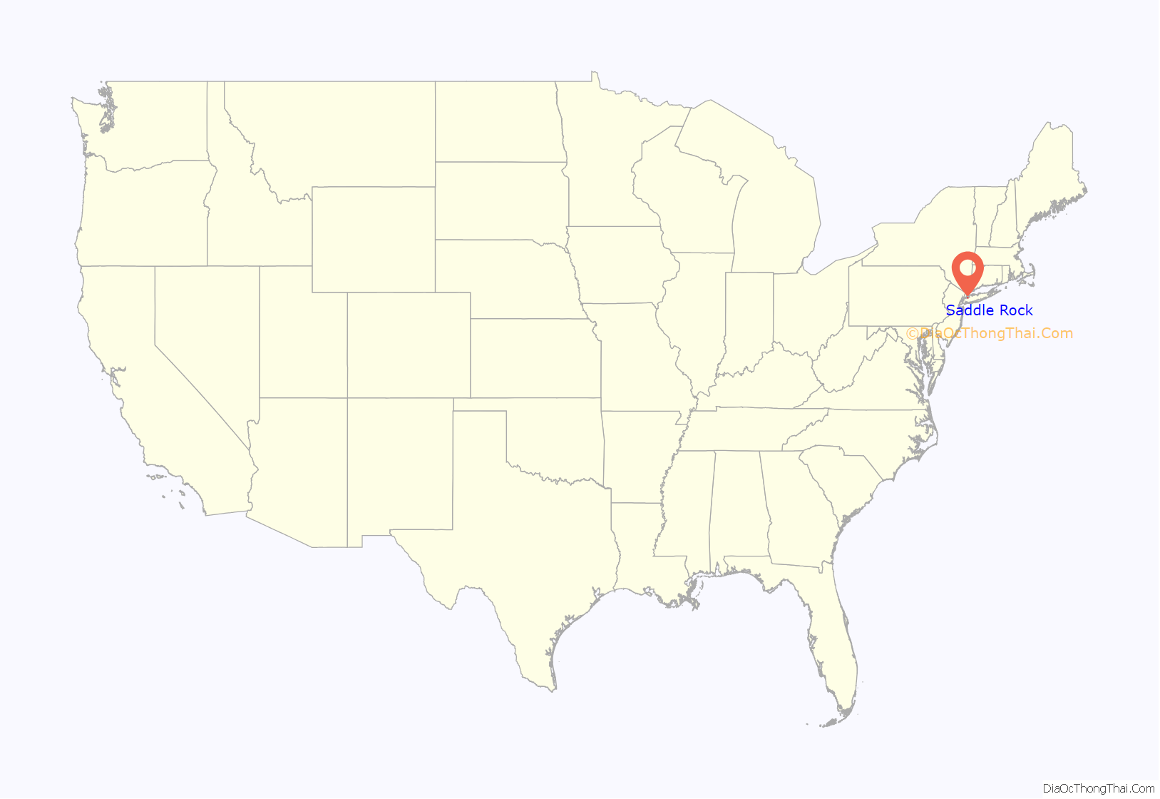
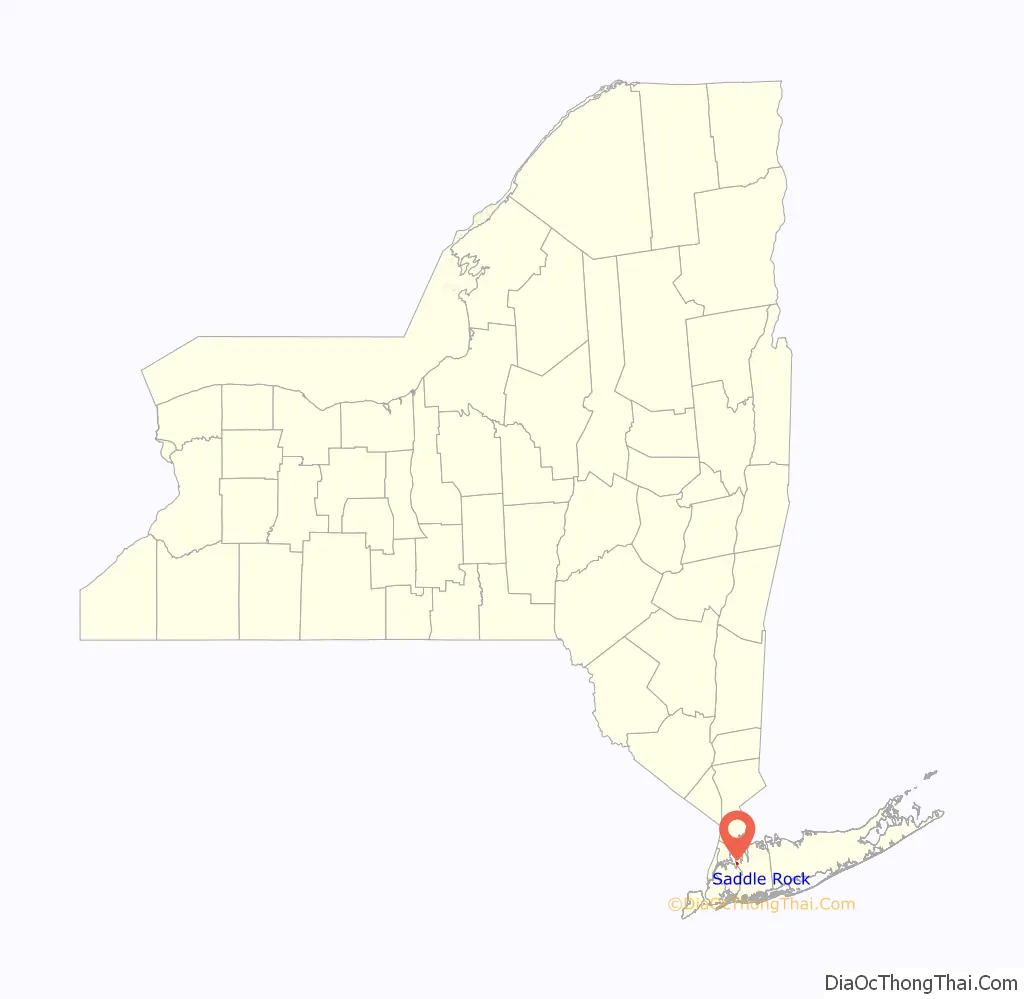
Saddle Rock is a village on the Great Neck Peninsula in the Town of North Hempstead, in Nassau County, on the North Shore of Long Island, in New York, United States. The population was 830 at the 2010 census.
| Name: | Saddle Rock village |
|---|---|
| LSAD Code: | 47 |
| LSAD Description: | village (suffix) |
| State: | New York |
| County: | Nassau County |
| Incorporated: | 1911 |
| Elevation: | 79 ft (24 m) |
| Total Area: | 0.28 sq mi (0.71 km²) |
| Land Area: | 0.25 sq mi (0.65 km²) |
| Water Area: | 0.02 sq mi (0.06 km²) |
| Total Population: | 989 |
| Population Density: | 3,909.09/sq mi (1,511.31/km²) |
| ZIP code: | 11023 |
| Area code: | 516 |
| FIPS code: | 3664430 |
| GNISfeature ID: | 0963208 |
| Website: | saddlerockny.gov |
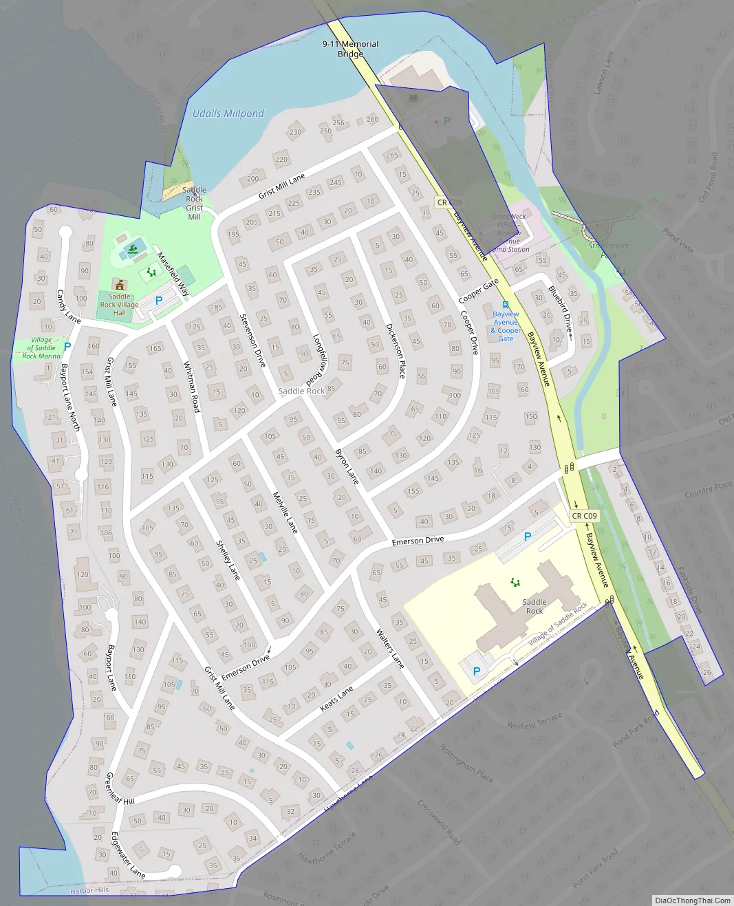
Online Interactive Map
Click on ![]() to view map in "full screen" mode.
to view map in "full screen" mode.
Saddle Rock location map. Where is Saddle Rock village?
History
The first settlers arrived in the 17th century. The Village of Saddle Rock is so named for an offshore boulder that gives the appearance of a saddle, first noted on a map in 1658.
The village is also home to a historic mill. Officially known as the Saddle Rock Grist Mill, it was built circa 1700 and is located inside a small cove that opens onto Little Neck Bay off Long Island Sound. The mill is listed in the National Register of Historic Places and is the oldest continually operating tidal grist mill in the United States. The mill is now owned and operated by Nassau County as a working museum open to the public. The mill has been restored to its mid-19th-century appearance and is located on Grist Mill Lane in Saddle Rock.
The first Mayor of Saddle Rock was Roswell Eldridge, who was appointed “Acting Mayor” after he had incorporated his own private estate as the Village of Saddle Rock in 1911.
In 1926, Eldridge’s wife, Louise Udall Skidmore Eldridge, officially became the first female Mayor of Saddle Rock, and reportedly the first female Mayor in the state of New York. Louise Eldridge served as Mayor from 1926 until her death in 1947. She was also the last private individual to own the grist mill.
Saddle Rock Road Map
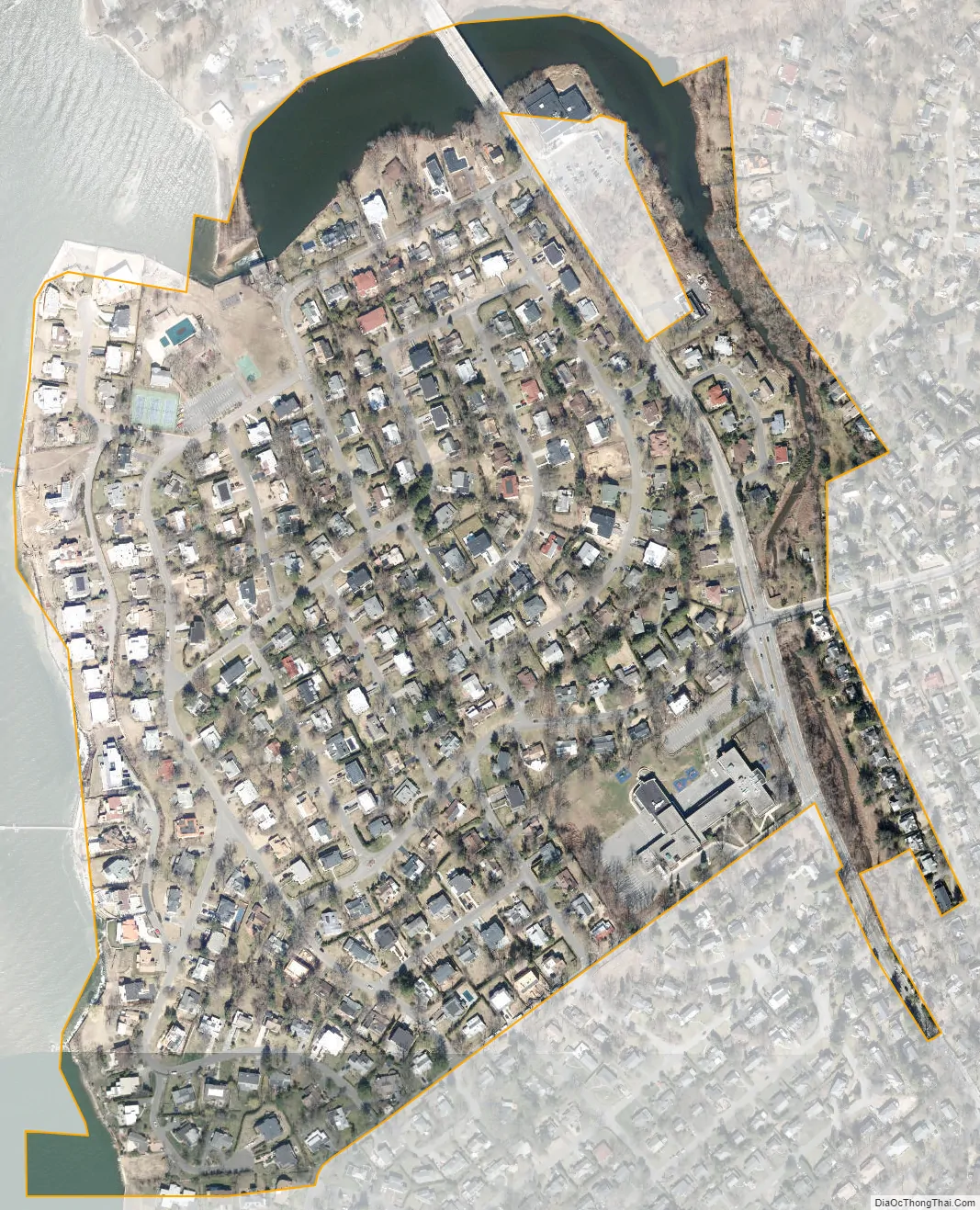
Saddle Rock city Satellite Map
Geography
According to the United States Census Bureau, the village has a total area of 0.3 square miles (0.78 km), of which 0.2 square miles (0.52 km) is land and 0.04 square miles (0.10 km), or 7.69%, is water.
See also
Map of New York State and its subdivision:- Albany
- Allegany
- Bronx
- Broome
- Cattaraugus
- Cayuga
- Chautauqua
- Chemung
- Chenango
- Clinton
- Columbia
- Cortland
- Delaware
- Dutchess
- Erie
- Essex
- Franklin
- Fulton
- Genesee
- Greene
- Hamilton
- Herkimer
- Jefferson
- Kings
- Lake Ontario
- Lewis
- Livingston
- Madison
- Monroe
- Montgomery
- Nassau
- New York
- Niagara
- Oneida
- Onondaga
- Ontario
- Orange
- Orleans
- Oswego
- Otsego
- Putnam
- Queens
- Rensselaer
- Richmond
- Rockland
- Saint Lawrence
- Saratoga
- Schenectady
- Schoharie
- Schuyler
- Seneca
- Steuben
- Suffolk
- Sullivan
- Tioga
- Tompkins
- Ulster
- Warren
- Washington
- Wayne
- Westchester
- Wyoming
- Yates
- Alabama
- Alaska
- Arizona
- Arkansas
- California
- Colorado
- Connecticut
- Delaware
- District of Columbia
- Florida
- Georgia
- Hawaii
- Idaho
- Illinois
- Indiana
- Iowa
- Kansas
- Kentucky
- Louisiana
- Maine
- Maryland
- Massachusetts
- Michigan
- Minnesota
- Mississippi
- Missouri
- Montana
- Nebraska
- Nevada
- New Hampshire
- New Jersey
- New Mexico
- New York
- North Carolina
- North Dakota
- Ohio
- Oklahoma
- Oregon
- Pennsylvania
- Rhode Island
- South Carolina
- South Dakota
- Tennessee
- Texas
- Utah
- Vermont
- Virginia
- Washington
- West Virginia
- Wisconsin
- Wyoming


