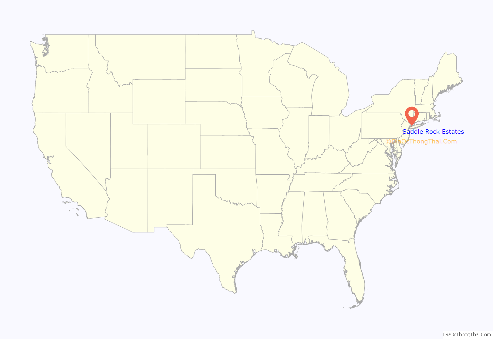
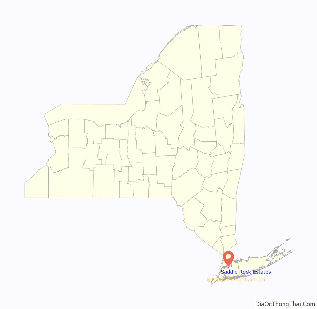
Saddle Rock Estates is a hamlet and census-designated place (CDP) located on the Great Neck Peninsula within the Town of North Hempstead in Nassau County, on the North Shore of Long Island, in New York, United States. The population was 466 at the 2010 census.
| Name: | Saddle Rock Estates CDP |
|---|---|
| LSAD Code: | 57 |
| LSAD Description: | CDP (suffix) |
| State: | New York |
| County: | Nassau County |
| Elevation: | 26 ft (8 m) |
| Total Area: | 0.08 sq mi (0.20 km²) |
| Land Area: | 0.08 sq mi (0.20 km²) |
| Water Area: | 0.00 sq mi (0.00 km²) |
| Total Population: | 428 |
| Population Density: | 5,487.18/sq mi (2,120.71/km²) |
| ZIP code: | 11021 |
| Area code: | 516 |
| FIPS code: | 3664441 |
| GNISfeature ID: | 0963209 |
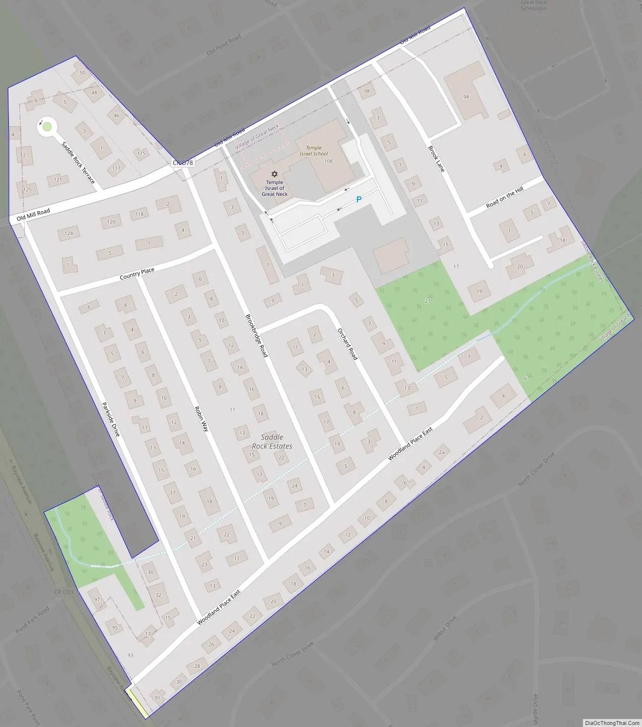
Online Interactive Map
Click on ![]() to view map in "full screen" mode.
to view map in "full screen" mode.
Saddle Rock Estates location map. Where is Saddle Rock Estates CDP?
History
The name of Saddle Rock Estates reflects the fact that it is located adjacent to the Incorporated Village of Saddle Rock. However, Saddle Rock Estates has never been a part of that village, and the hamlet merely took its name from its incorporated neighbor.
In 1941, residents were successful in gaining permission to have the Great Neck Water Pollution Control District expand into their hamlet as part of an extension project. At the time, the then-proposed expansion project was estimated to cost $140,000 (1941 USD).
In the Summer of 1946, the County of Nassau began work on closing the Old Mill Pond Brook and placed it into a boxed-in culvert. Residents had requested for Nassau to place the brook into a culvert since 1943, and cited that the brook often caused road washouts and basement floods.
Saddle Rock Estates Road Map
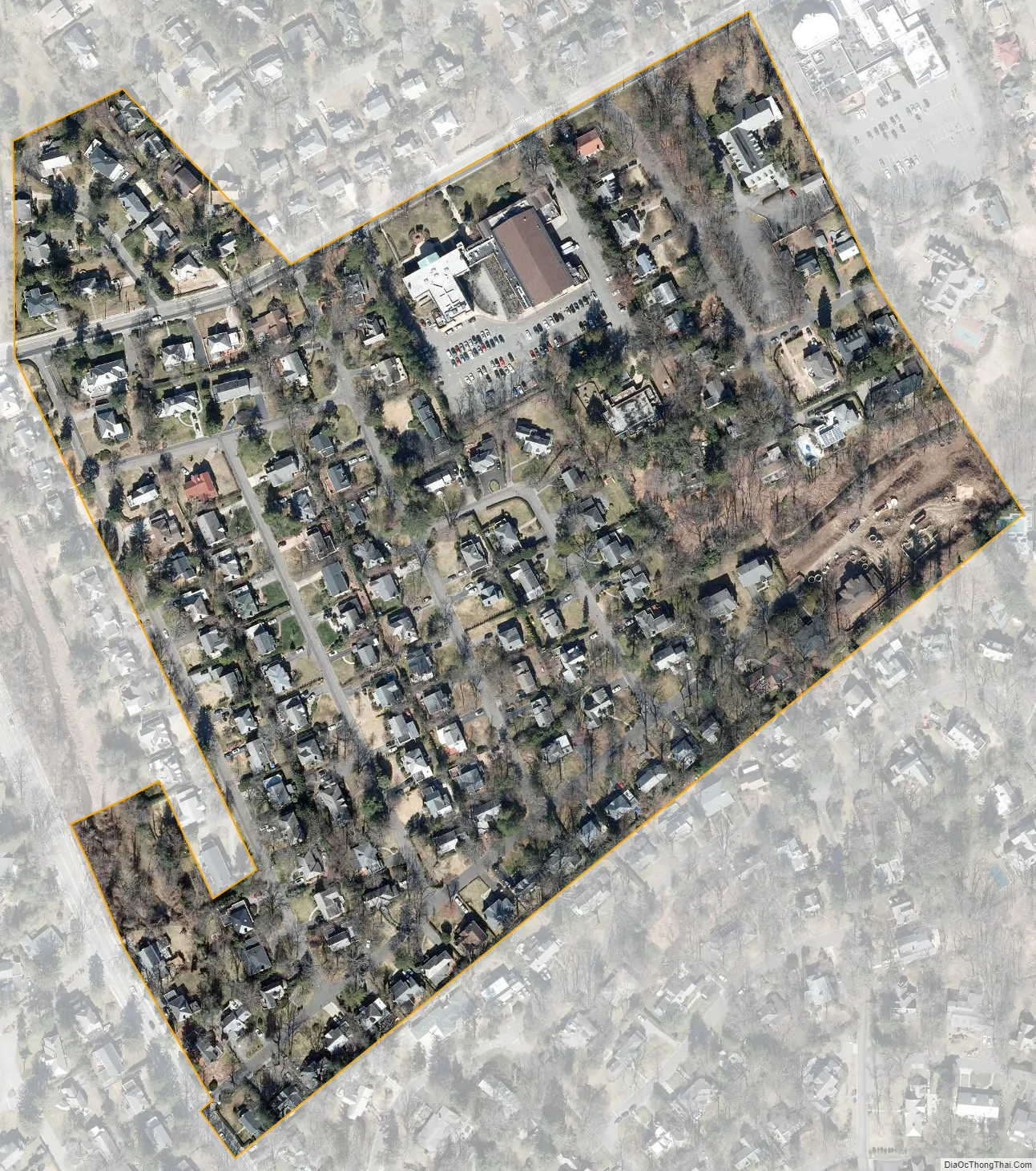
Saddle Rock Estates city Satellite Map
Geography
According to the United States Census Bureau, the CDP has a total area of 0.1 square miles (0.26 km), all land.
See also
Map of New York State and its subdivision:- Albany
- Allegany
- Bronx
- Broome
- Cattaraugus
- Cayuga
- Chautauqua
- Chemung
- Chenango
- Clinton
- Columbia
- Cortland
- Delaware
- Dutchess
- Erie
- Essex
- Franklin
- Fulton
- Genesee
- Greene
- Hamilton
- Herkimer
- Jefferson
- Kings
- Lake Ontario
- Lewis
- Livingston
- Madison
- Monroe
- Montgomery
- Nassau
- New York
- Niagara
- Oneida
- Onondaga
- Ontario
- Orange
- Orleans
- Oswego
- Otsego
- Putnam
- Queens
- Rensselaer
- Richmond
- Rockland
- Saint Lawrence
- Saratoga
- Schenectady
- Schoharie
- Schuyler
- Seneca
- Steuben
- Suffolk
- Sullivan
- Tioga
- Tompkins
- Ulster
- Warren
- Washington
- Wayne
- Westchester
- Wyoming
- Yates
- Alabama
- Alaska
- Arizona
- Arkansas
- California
- Colorado
- Connecticut
- Delaware
- District of Columbia
- Florida
- Georgia
- Hawaii
- Idaho
- Illinois
- Indiana
- Iowa
- Kansas
- Kentucky
- Louisiana
- Maine
- Maryland
- Massachusetts
- Michigan
- Minnesota
- Mississippi
- Missouri
- Montana
- Nebraska
- Nevada
- New Hampshire
- New Jersey
- New Mexico
- New York
- North Carolina
- North Dakota
- Ohio
- Oklahoma
- Oregon
- Pennsylvania
- Rhode Island
- South Carolina
- South Dakota
- Tennessee
- Texas
- Utah
- Vermont
- Virginia
- Washington
- West Virginia
- Wisconsin
- Wyoming


