Salisbury (formerly known as South Westbury) is a hamlet and census-designated place (CDP) in the Town of Hempstead in Nassau County, on Long Island, in New York, United States. The population was 12,093 at the 2010 census.
Many Levitt style homes lie adjacent to Eisenhower Park (formerly known as Salisbury Park).
It is served by the Westbury Railroad Station of the Long Island Railroad and shares fire districts with Westbury and East Meadow.
| Name: | Salisbury CDP |
|---|---|
| LSAD Code: | 57 |
| LSAD Description: | CDP (suffix) |
| State: | New York |
| County: | Nassau County |
| Elevation: | 108 ft (33 m) |
| Total Area: | 1.7 sq mi (4 km²) |
| Land Area: | 1.7 sq mi (4 km²) |
| Water Area: | 0.0 sq mi (0.0 km²) |
| Total Population: | 12,093 |
| Population Density: | 7,100/sq mi (2,700/km²) |
| FIPS code: | 3664842 |
| Website: | eastmeadowchamber.com |
Online Interactive Map
Click on ![]() to view map in "full screen" mode.
to view map in "full screen" mode.
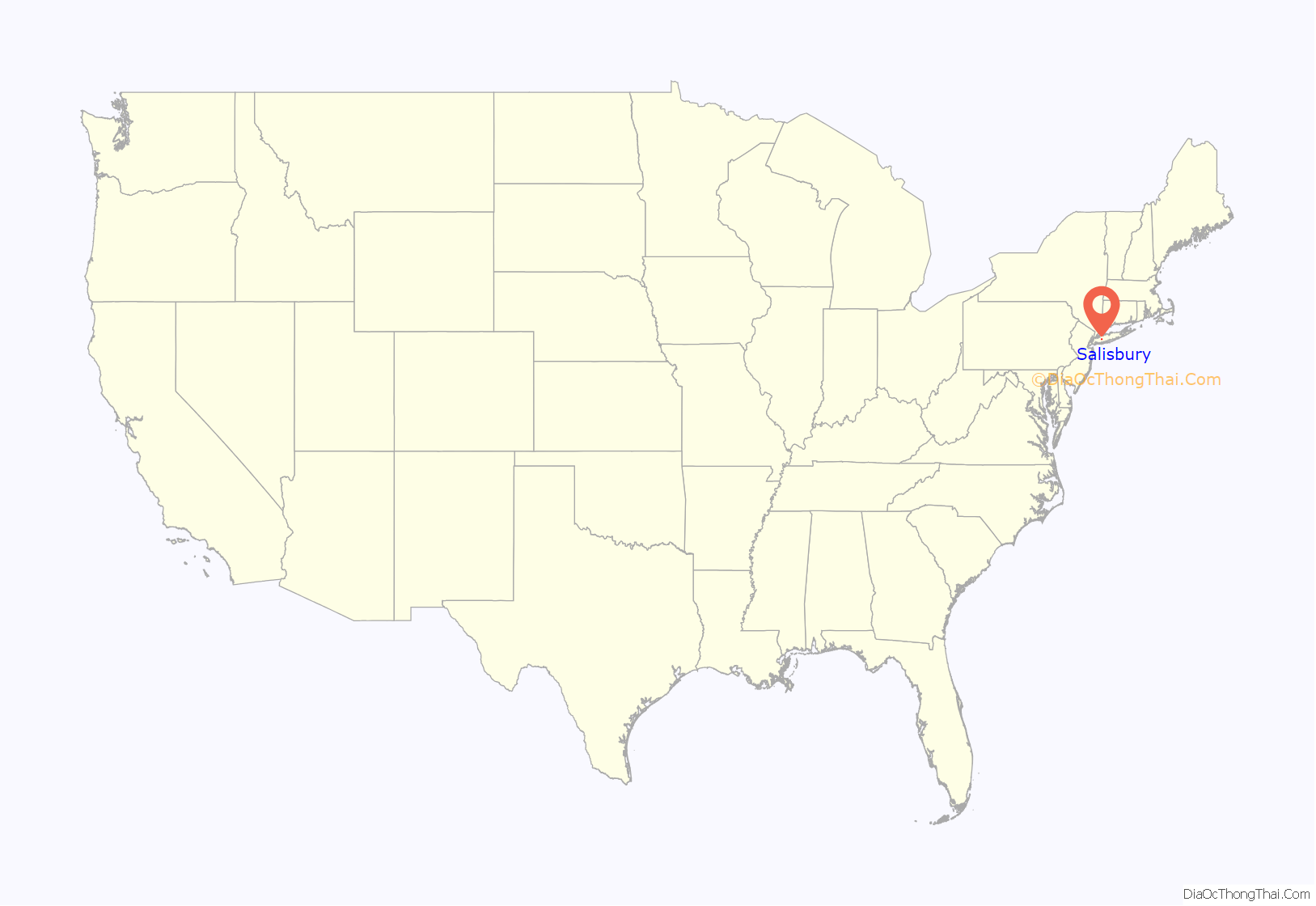
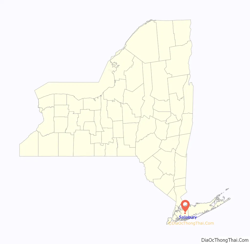
Salisbury location map. Where is Salisbury CDP?
History
Salisbury is so named because it sits on a broad, flat section of the larger Hempstead Plains that reminded late 19th Century Long Islanders of the Salisbury Plain in England, where Stonehenge is located. This name was made the CDP’s official name for the 1990 census, replacing the older name of South Westbury (which referenced its geographic location immediately south of Westbury).
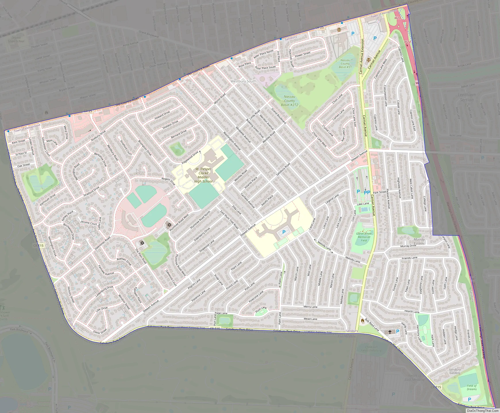
Salisbury Road Map
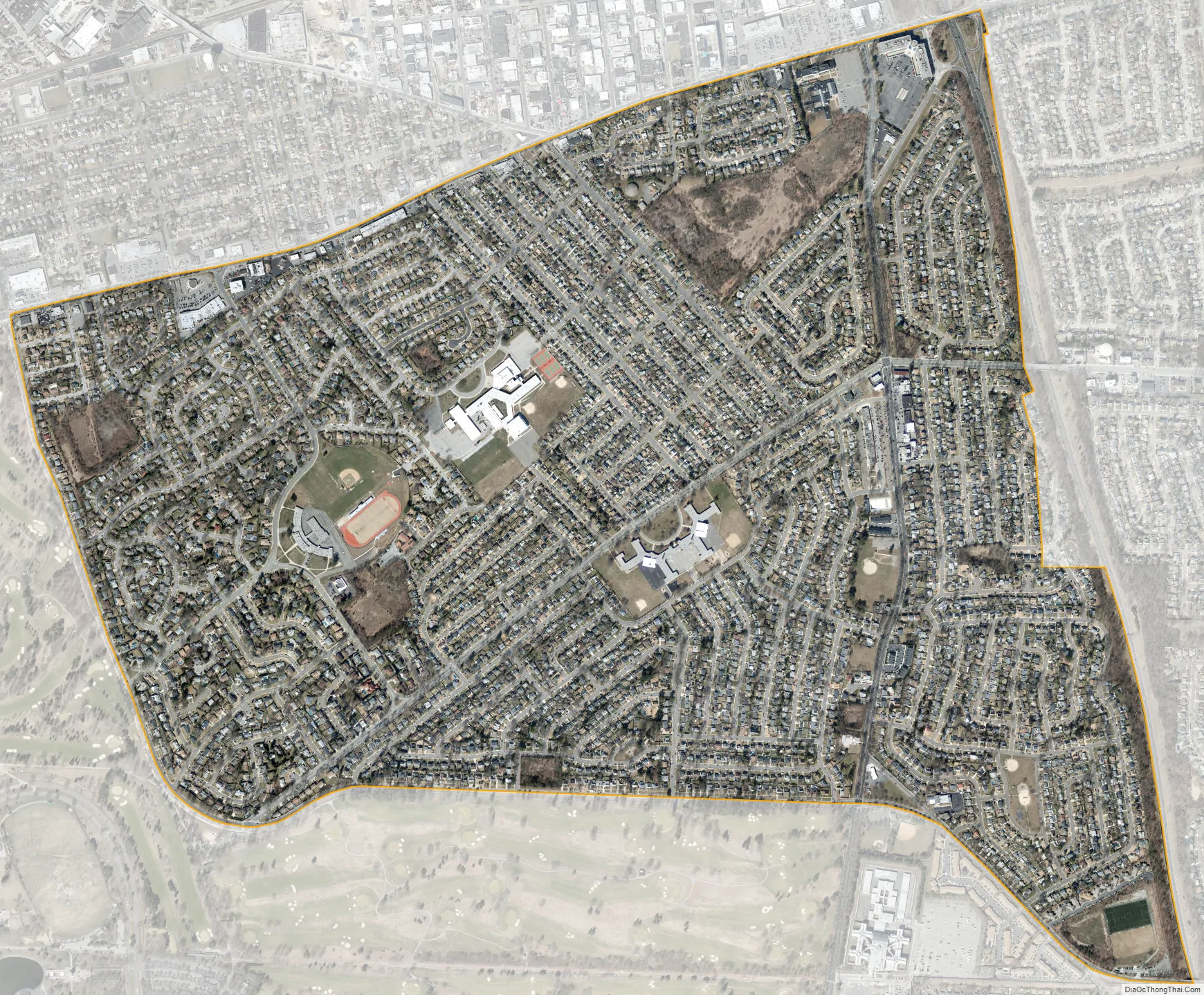
Salisbury city Satellite Map
Geography
According to the United States Census Bureau, the CDP has a total area of 1.7 square miles (4.5 km), of which 1.7 square miles (4.5 km) is land and 0.57% is water.
According to the United States Geological Survey, Salisbury is located at an elevation of 108 feet (33 m).
See also
Map of New York State and its subdivision:- Albany
- Allegany
- Bronx
- Broome
- Cattaraugus
- Cayuga
- Chautauqua
- Chemung
- Chenango
- Clinton
- Columbia
- Cortland
- Delaware
- Dutchess
- Erie
- Essex
- Franklin
- Fulton
- Genesee
- Greene
- Hamilton
- Herkimer
- Jefferson
- Kings
- Lake Ontario
- Lewis
- Livingston
- Madison
- Monroe
- Montgomery
- Nassau
- New York
- Niagara
- Oneida
- Onondaga
- Ontario
- Orange
- Orleans
- Oswego
- Otsego
- Putnam
- Queens
- Rensselaer
- Richmond
- Rockland
- Saint Lawrence
- Saratoga
- Schenectady
- Schoharie
- Schuyler
- Seneca
- Steuben
- Suffolk
- Sullivan
- Tioga
- Tompkins
- Ulster
- Warren
- Washington
- Wayne
- Westchester
- Wyoming
- Yates
- Alabama
- Alaska
- Arizona
- Arkansas
- California
- Colorado
- Connecticut
- Delaware
- District of Columbia
- Florida
- Georgia
- Hawaii
- Idaho
- Illinois
- Indiana
- Iowa
- Kansas
- Kentucky
- Louisiana
- Maine
- Maryland
- Massachusetts
- Michigan
- Minnesota
- Mississippi
- Missouri
- Montana
- Nebraska
- Nevada
- New Hampshire
- New Jersey
- New Mexico
- New York
- North Carolina
- North Dakota
- Ohio
- Oklahoma
- Oregon
- Pennsylvania
- Rhode Island
- South Carolina
- South Dakota
- Tennessee
- Texas
- Utah
- Vermont
- Virginia
- Washington
- West Virginia
- Wisconsin
- Wyoming


