Saltaire is a village located on Fire Island in Islip, Suffolk County, New York, United States. The year-round population was 37 at the 2010 census, which, as a summer beach community, increases many times over in the summer.
| Name: | Saltaire village |
|---|---|
| LSAD Code: | 47 |
| LSAD Description: | village (suffix) |
| State: | New York |
| County: | Suffolk County |
| Elevation: | 3 ft (1 m) |
| Total Area: | 0.28 sq mi (0.74 km²) |
| Land Area: | 0.23 sq mi (0.60 km²) |
| Water Area: | 0.05 sq mi (0.13 km²) |
| Total Population: | 113 |
| Population Density: | 484.98/sq mi (187.43/km²) |
| ZIP code: | 11706 |
| Area code: | 631 |
| FIPS code: | 3664881 |
| GNISfeature ID: | 0964335 |
| Website: | www.saltaire.org |
Online Interactive Map
Click on ![]() to view map in "full screen" mode.
to view map in "full screen" mode.
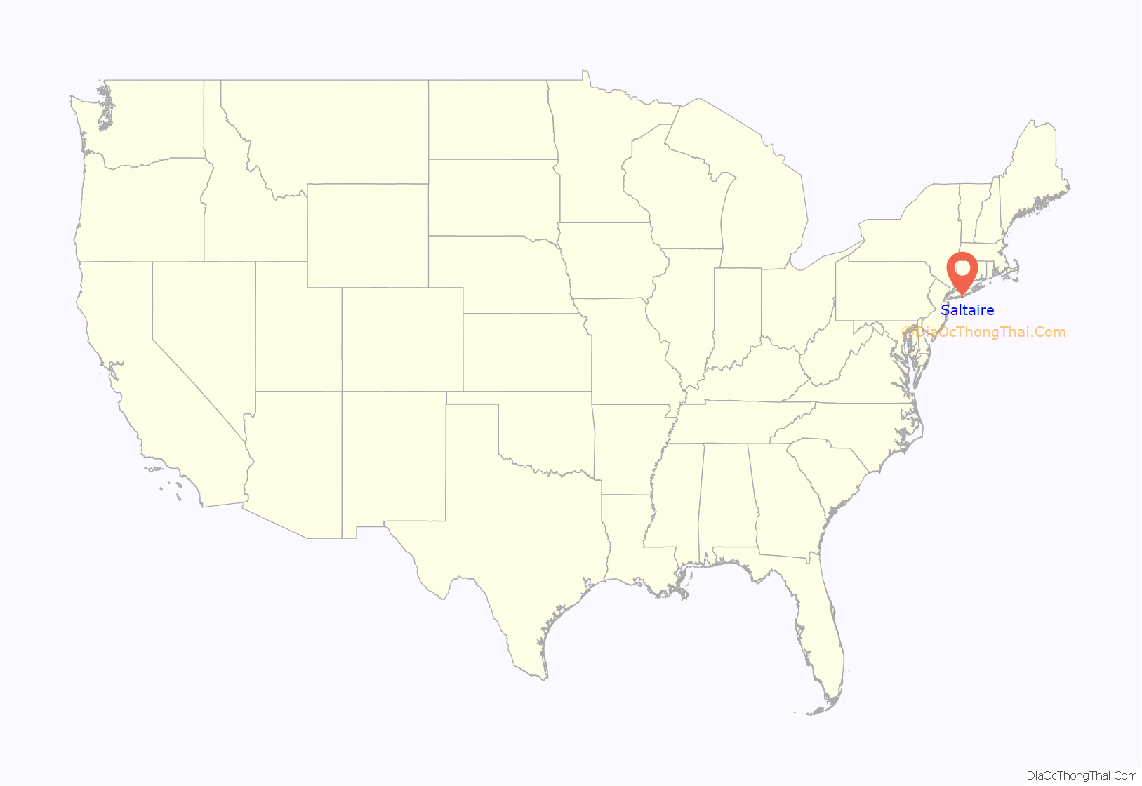
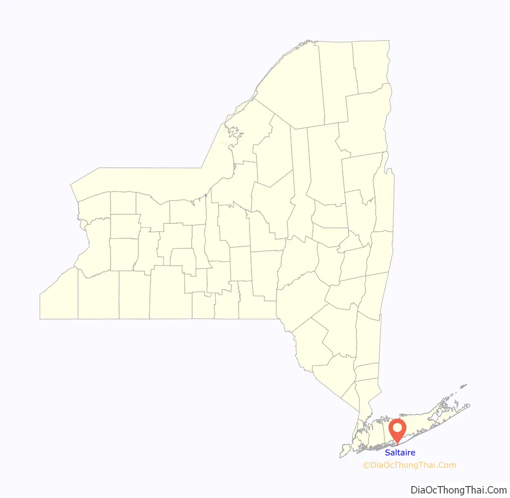
Saltaire location map. Where is Saltaire village?
History
Saltaire was founded in 1910 and incorporated in 1917.
The village was heavily damaged and six residents killed in the Hurricane of 1938.
In early 2009, the village underwent a beach restoration project.
The village sustained damage by Hurricane Sandy in 2012.
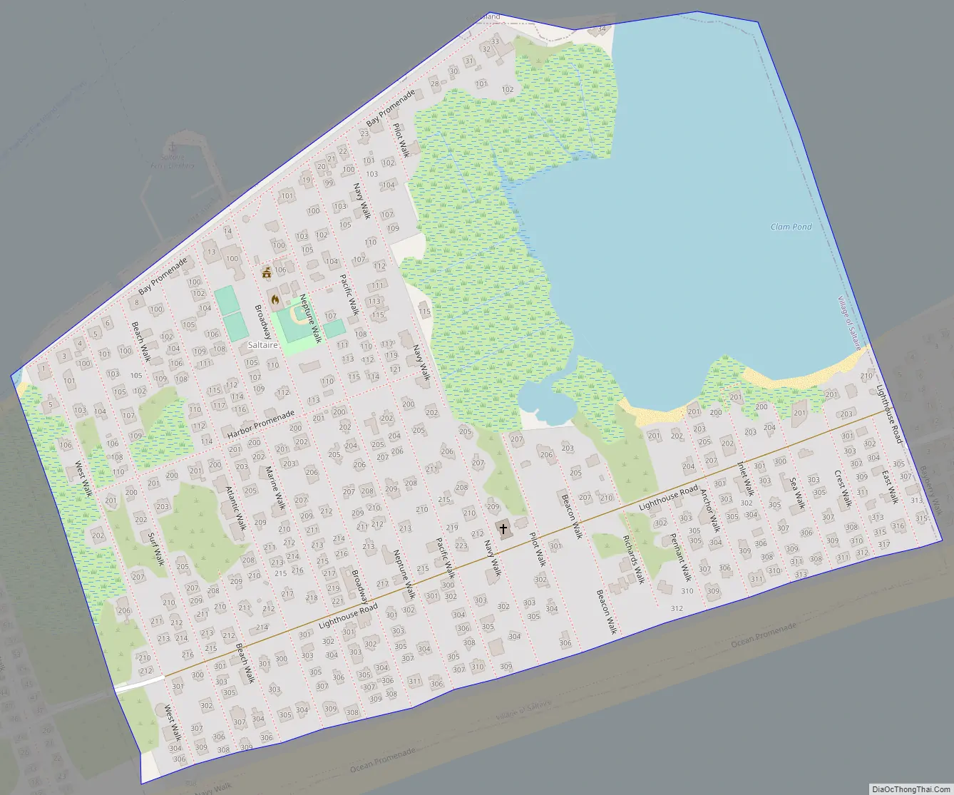
Saltaire Road Map
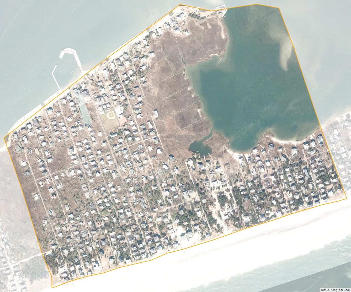
Saltaire city Satellite Map
Geography
Saltaire can be reached by the Fire Island Ferries, by private boat, by walking, or by car. Fire Island Ferry service to Saltaire leaves from the Fire Island ferry terminal in Bay Shore, New York.
The village is located on the western part of Fire Island between the Great South Bay and the Atlantic Ocean and between the hamlets of Kismet (to the west) and Fair Harbor (to the east).
According to the United States Census Bureau, the village has a total area of 0.27 square miles (0.7 km), of which 0.23 square miles (0.6 km) is land and 0.04 square miles (0.1 km), or 18.04%, is water. Among other things, Saltaire is known for its great softball league in the summer. The village encompasses the widest portion of Fire Island at approximately 0.5 miles (0.80 km).
There are 459 housing units in the community, as well as a Village Hall and Court, general market, fire house, two churches, and a members yacht club.
Saltaire is the second largest Fire Island community, and it is situated on the widest area on the Fire Island.
See also
Map of New York State and its subdivision:- Albany
- Allegany
- Bronx
- Broome
- Cattaraugus
- Cayuga
- Chautauqua
- Chemung
- Chenango
- Clinton
- Columbia
- Cortland
- Delaware
- Dutchess
- Erie
- Essex
- Franklin
- Fulton
- Genesee
- Greene
- Hamilton
- Herkimer
- Jefferson
- Kings
- Lake Ontario
- Lewis
- Livingston
- Madison
- Monroe
- Montgomery
- Nassau
- New York
- Niagara
- Oneida
- Onondaga
- Ontario
- Orange
- Orleans
- Oswego
- Otsego
- Putnam
- Queens
- Rensselaer
- Richmond
- Rockland
- Saint Lawrence
- Saratoga
- Schenectady
- Schoharie
- Schuyler
- Seneca
- Steuben
- Suffolk
- Sullivan
- Tioga
- Tompkins
- Ulster
- Warren
- Washington
- Wayne
- Westchester
- Wyoming
- Yates
- Alabama
- Alaska
- Arizona
- Arkansas
- California
- Colorado
- Connecticut
- Delaware
- District of Columbia
- Florida
- Georgia
- Hawaii
- Idaho
- Illinois
- Indiana
- Iowa
- Kansas
- Kentucky
- Louisiana
- Maine
- Maryland
- Massachusetts
- Michigan
- Minnesota
- Mississippi
- Missouri
- Montana
- Nebraska
- Nevada
- New Hampshire
- New Jersey
- New Mexico
- New York
- North Carolina
- North Dakota
- Ohio
- Oklahoma
- Oregon
- Pennsylvania
- Rhode Island
- South Carolina
- South Dakota
- Tennessee
- Texas
- Utah
- Vermont
- Virginia
- Washington
- West Virginia
- Wisconsin
- Wyoming


