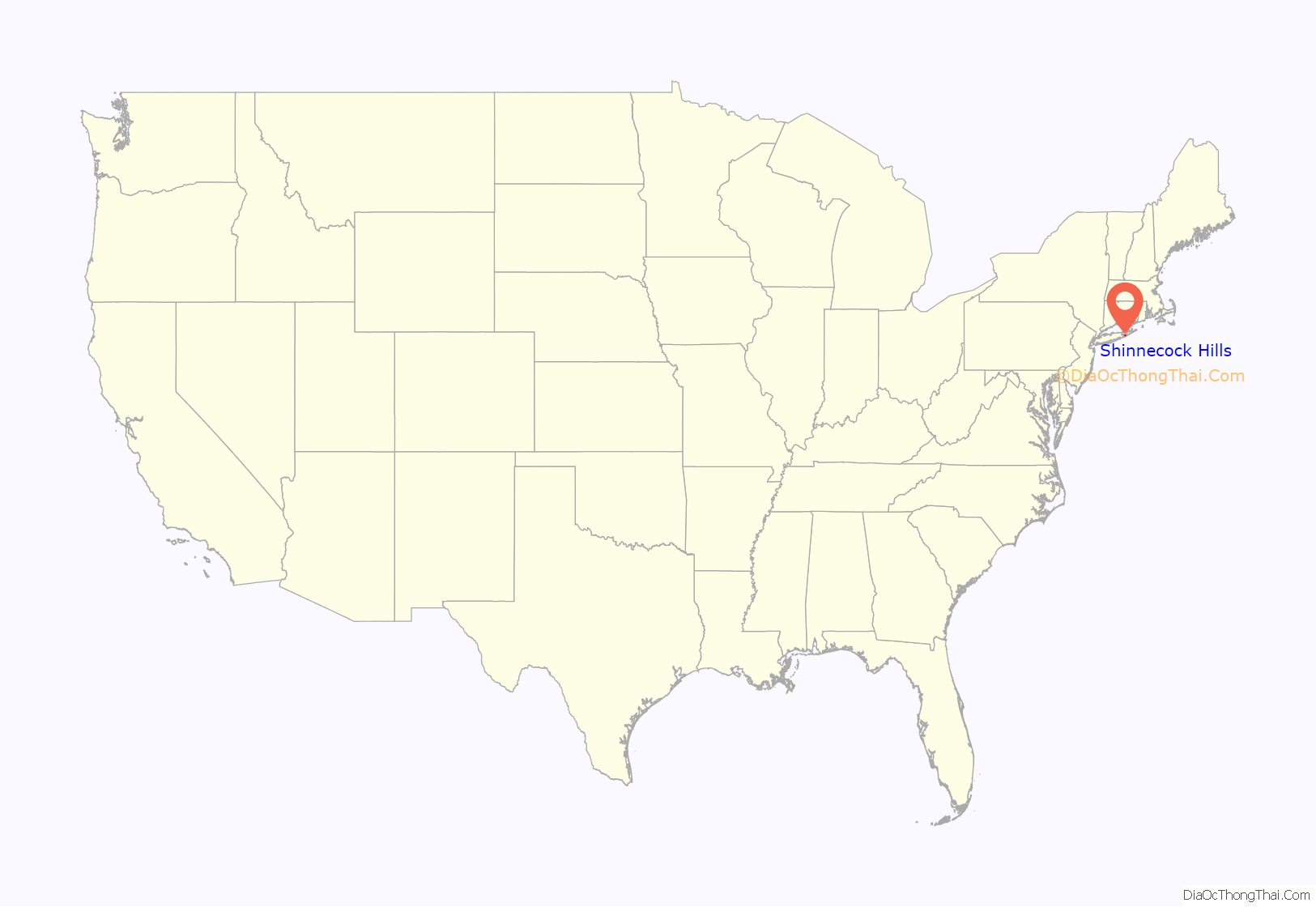
Shinnecock Hills is a hamlet (and census-designated place) in Suffolk County, New York, United States. The population was 2,188 at the 2010 census. It is the home of a leading golf club, Shinnecock Hills Golf Club. Ownership of the area has been the subject of a 2005 lawsuit filed by the Shinnecock Indian Nation.
Shinnecock Hills is in the Town of Southampton.
| Name: | Shinnecock Hills CDP |
|---|---|
| LSAD Code: | 57 |
| LSAD Description: | CDP (suffix) |
| State: | New York |
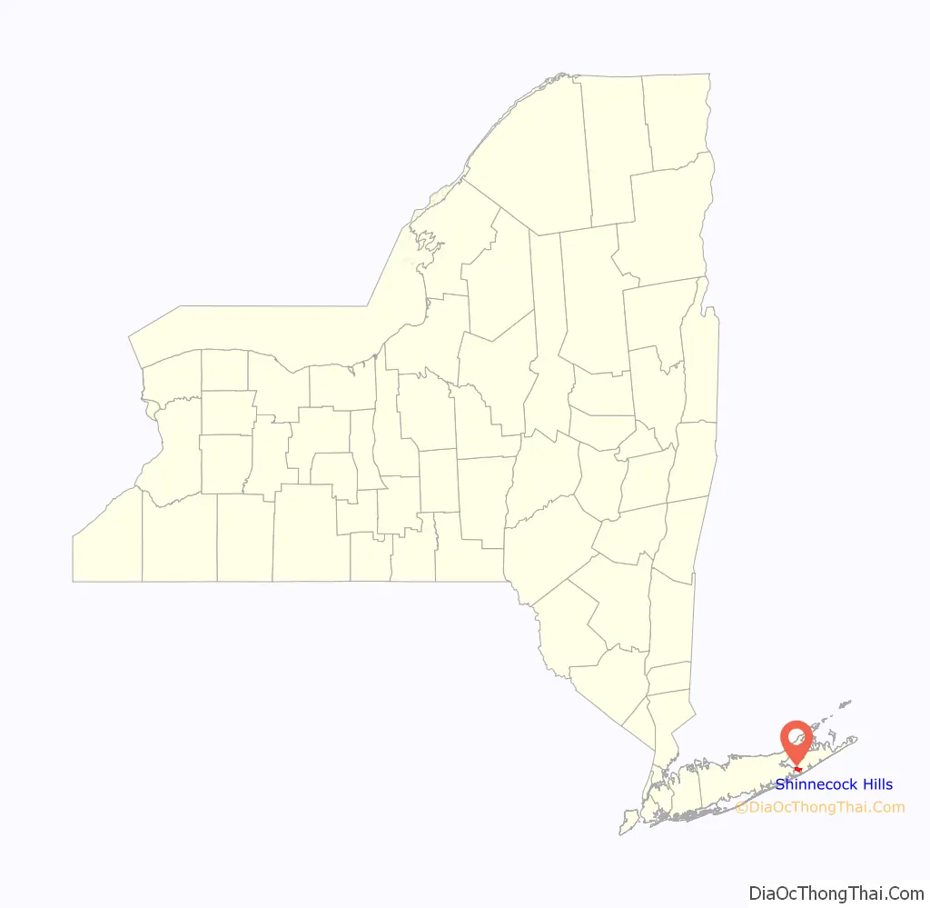
| County: | Suffolk County |
| Elevation: | 79 ft (24 m) |
| Total Area: | 3.02 sq mi (7.82 km²) |
| Land Area: | 2.82 sq mi (7.30 km²) |
| Water Area: | 0.20 sq mi (0.52 km²) |
| Total Population: | 2,282 |
| Population Density: | 810.08/sq mi (312.75/km²) |
| FIPS code: | 3667048 |
| GNISfeature ID: | 0973063 |
Online Interactive Map
Click on ![]() to view map in "full screen" mode.
to view map in "full screen" mode.
Shinnecock Hills location map. Where is Shinnecock Hills CDP?
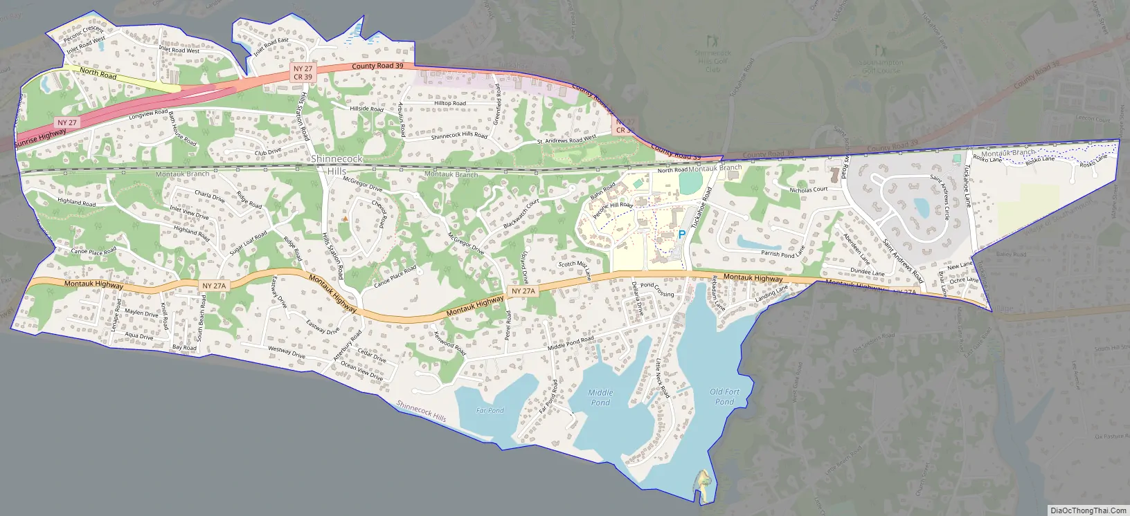
Shinnecock Hills Road Map
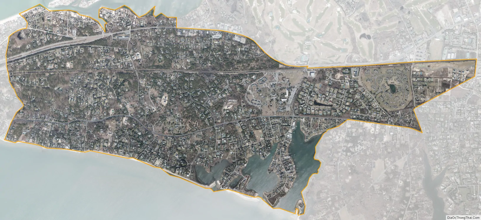
Shinnecock Hills city Satellite Map
Geography
Shinnecock Hills is located at 40°53′17″N 72°27′42″W / 40.88806°N 72.46167°W / 40.88806; -72.46167 (40.888100, -72.461735), immediately east of the Shinnecock Canal.
According to the United States Census Bureau, the CDP has a total area of 3.1 square miles (7.9 km), of which 2.9 square miles (7.4 km) is land and 0.19 square miles (0.5 km), or 6.61%, is water.
The highest point in Shinnecock Hills is 141 feet (43 m) above sea level.
See also
Map of New York State and its subdivision:- Albany
- Allegany
- Bronx
- Broome
- Cattaraugus
- Cayuga
- Chautauqua
- Chemung
- Chenango
- Clinton
- Columbia
- Cortland
- Delaware
- Dutchess
- Erie
- Essex
- Franklin
- Fulton
- Genesee
- Greene
- Hamilton
- Herkimer
- Jefferson
- Kings
- Lake Ontario
- Lewis
- Livingston
- Madison
- Monroe
- Montgomery
- Nassau
- New York
- Niagara
- Oneida
- Onondaga
- Ontario
- Orange
- Orleans
- Oswego
- Otsego
- Putnam
- Queens
- Rensselaer
- Richmond
- Rockland
- Saint Lawrence
- Saratoga
- Schenectady
- Schoharie
- Schuyler
- Seneca
- Steuben
- Suffolk
- Sullivan
- Tioga
- Tompkins
- Ulster
- Warren
- Washington
- Wayne
- Westchester
- Wyoming
- Yates
- Alabama
- Alaska
- Arizona
- Arkansas
- California
- Colorado
- Connecticut
- Delaware
- District of Columbia
- Florida
- Georgia
- Hawaii
- Idaho
- Illinois
- Indiana
- Iowa
- Kansas
- Kentucky
- Louisiana
- Maine
- Maryland
- Massachusetts
- Michigan
- Minnesota
- Mississippi
- Missouri
- Montana
- Nebraska
- Nevada
- New Hampshire
- New Jersey
- New Mexico
- New York
- North Carolina
- North Dakota
- Ohio
- Oklahoma
- Oregon
- Pennsylvania
- Rhode Island
- South Carolina
- South Dakota
- Tennessee
- Texas
- Utah
- Vermont
- Virginia
- Washington
- West Virginia
- Wisconsin
- Wyoming


