Shoreham is an incorporated village in the Town of Brookhaven, Suffolk County, New York, United States. The population was 531 at the 2010 census. It is officially known as the Incorporated Village of Shoreham.
| Name: | Shoreham village |
|---|---|
| LSAD Code: | 47 |
| LSAD Description: | village (suffix) |
| State: | New York |
| County: | Suffolk County |
| Incorporated: | 1913 |
| Elevation: | 66 ft (20 m) |
| Total Area: | 0.45 sq mi (1.18 km²) |
| Land Area: | 0.45 sq mi (1.18 km²) |
| Water Area: | 0.00 sq mi (0.00 km²) |
| Total Population: | 561 |
| Population Density: | 1,235.68/sq mi (477.06/km²) |
| ZIP code: | 11786 |
| Area code: | 631, 934 |
| FIPS code: | 3667191 |
| GNISfeature ID: | 0965160 |
| Website: | shorehamvillage.org |
Online Interactive Map
Click on ![]() to view map in "full screen" mode.
to view map in "full screen" mode.
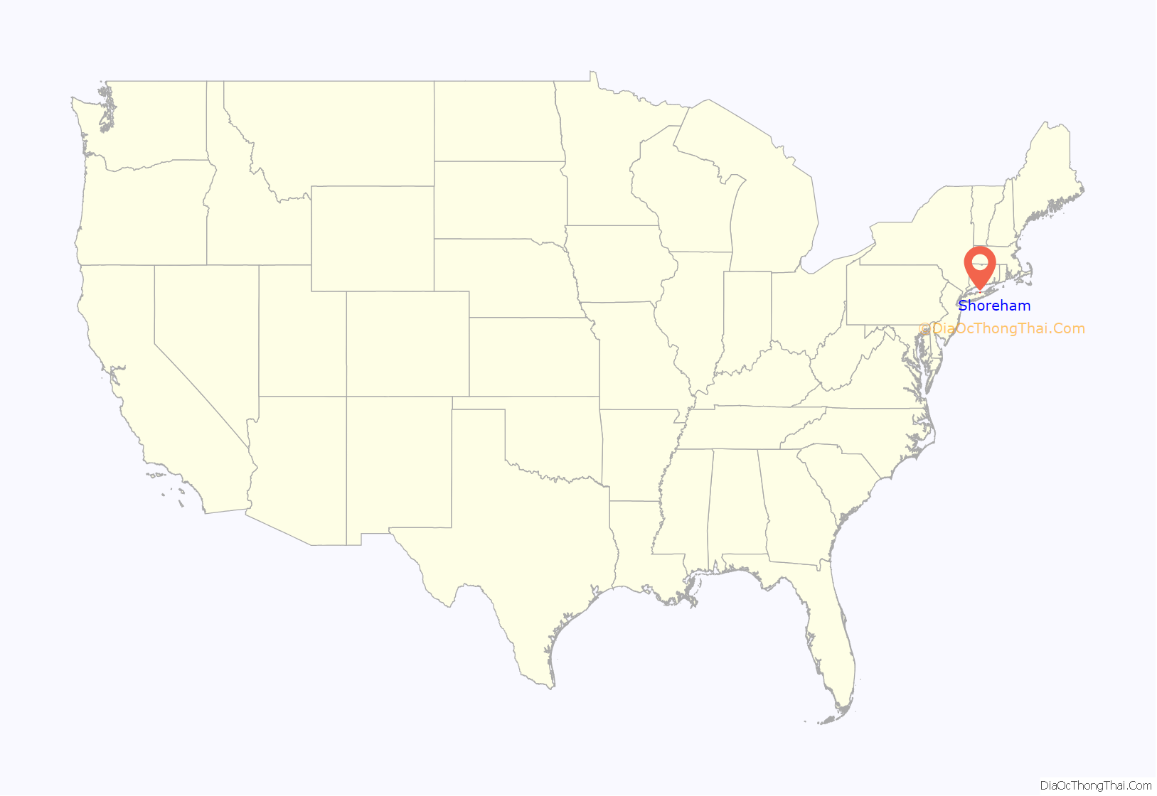
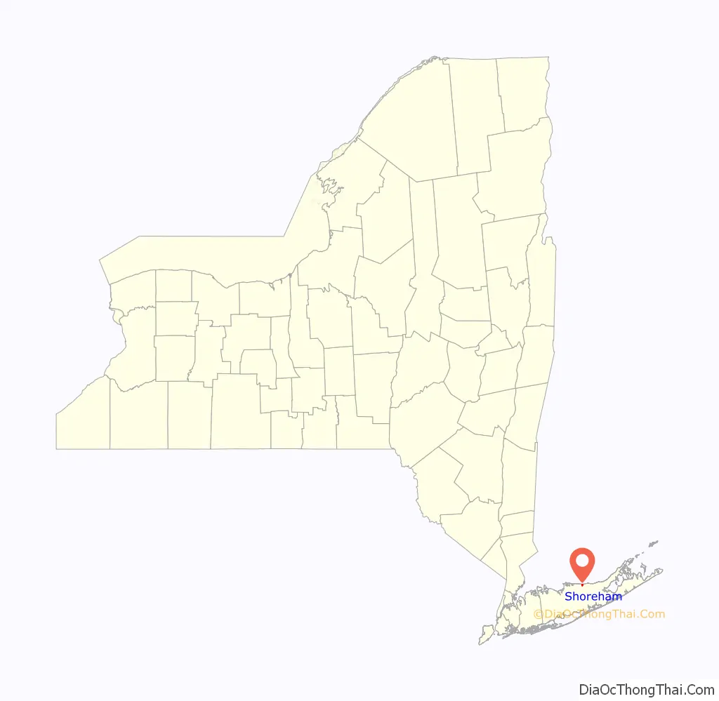
Shoreham location map. Where is Shoreham village?
History
At Shoreham, Nikola Tesla built the Wardenclyffe Tower, which was dismantled in 1917. Nowadays there is the static inverter plant of the HVDC Cross Sound Cable. A non profit organization is in the process of turning Nikola Tesla’s laboratory and the property where the Wardenclyffe Tower was once located into a museum honoring the life and work of Nikola Tesla.
The Shoreham Nuclear Power Plant was approved for Shoreham, but it was later disapproved as the result of public protest. The builder, Long Island Lighting Company (LILCO), was partially reimbursed for money spent on construction. The municipal bonds that were floated to reimburse the builder are being paid off by a special levy on the electric bills of residents of Long Island.
Shoreham was served by the Shoreham LIRR station from 1900 to 1910. It was located near the intersection of North Country Road and Randall Road.
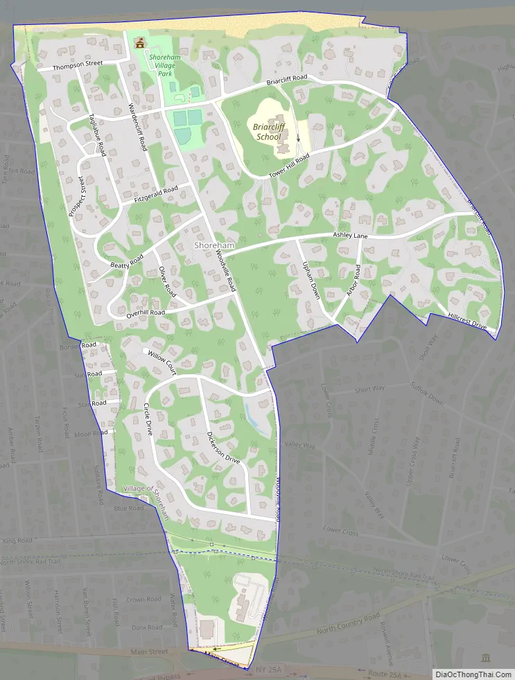
Shoreham Road Map
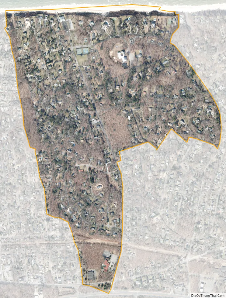
Shoreham city Satellite Map
Geography
Shoreham is located on the North Shore of Long Island. It is approximately 100 km (70 miles) from New York City. According to the United States Census Bureau, the village has a total area of 0.4 square miles (1.0 km), all land. East Shoreham and Shoreham share a post office, which has 11786 as the zip code. Despite the official names, most local people invariably refer to East Shoreham as Shoreham, and to Shoreham as Shoreham Village.
See also
Map of New York State and its subdivision:- Albany
- Allegany
- Bronx
- Broome
- Cattaraugus
- Cayuga
- Chautauqua
- Chemung
- Chenango
- Clinton
- Columbia
- Cortland
- Delaware
- Dutchess
- Erie
- Essex
- Franklin
- Fulton
- Genesee
- Greene
- Hamilton
- Herkimer
- Jefferson
- Kings
- Lake Ontario
- Lewis
- Livingston
- Madison
- Monroe
- Montgomery
- Nassau
- New York
- Niagara
- Oneida
- Onondaga
- Ontario
- Orange
- Orleans
- Oswego
- Otsego
- Putnam
- Queens
- Rensselaer
- Richmond
- Rockland
- Saint Lawrence
- Saratoga
- Schenectady
- Schoharie
- Schuyler
- Seneca
- Steuben
- Suffolk
- Sullivan
- Tioga
- Tompkins
- Ulster
- Warren
- Washington
- Wayne
- Westchester
- Wyoming
- Yates
- Alabama
- Alaska
- Arizona
- Arkansas
- California
- Colorado
- Connecticut
- Delaware
- District of Columbia
- Florida
- Georgia
- Hawaii
- Idaho
- Illinois
- Indiana
- Iowa
- Kansas
- Kentucky
- Louisiana
- Maine
- Maryland
- Massachusetts
- Michigan
- Minnesota
- Mississippi
- Missouri
- Montana
- Nebraska
- Nevada
- New Hampshire
- New Jersey
- New Mexico
- New York
- North Carolina
- North Dakota
- Ohio
- Oklahoma
- Oregon
- Pennsylvania
- Rhode Island
- South Carolina
- South Dakota
- Tennessee
- Texas
- Utah
- Vermont
- Virginia
- Washington
- West Virginia
- Wisconsin
- Wyoming


