South Valley Stream is an unincorporated hamlet and census-designated place (CDP) in the Town of Hempstead in Nassau County, on Long Island, in New York, United States. The population was 5,962 as of the 2010 census.
South Valley Stream is located in the southern part of the Town of Hempstead, and consists of two unincorporated areas, North Woodmere and Mill Brook.
| Name: | South Valley Stream CDP |
|---|---|
| LSAD Code: | 57 |
| LSAD Description: | CDP (suffix) |
| State: | New York |
| County: | Nassau County |
| Elevation: | 7 ft (2 m) |
| Total Area: | 0.87 sq mi (2.25 km²) |
| Land Area: | 0.87 sq mi (2.25 km²) |
| Water Area: | 0.00 sq mi (0.00 km²) |
| Total Population: | 6,386 |
| Population Density: | 7,340.23/sq mi (2,834.86/km²) |
| FIPS code: | 3669892 |
| GNISfeature ID: | 1867419 |
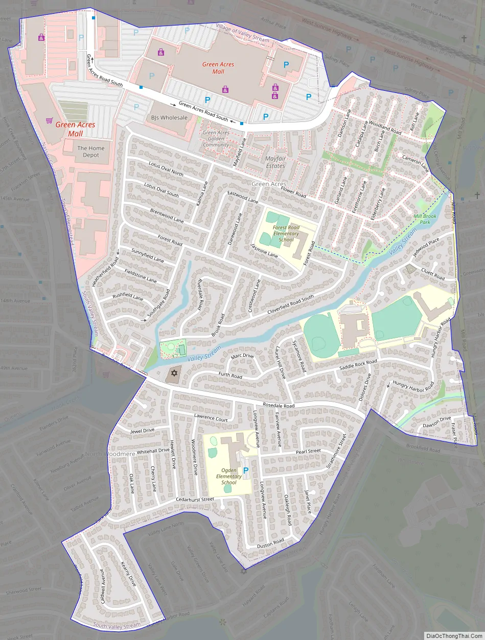
Online Interactive Map
Click on ![]() to view map in "full screen" mode.
to view map in "full screen" mode.
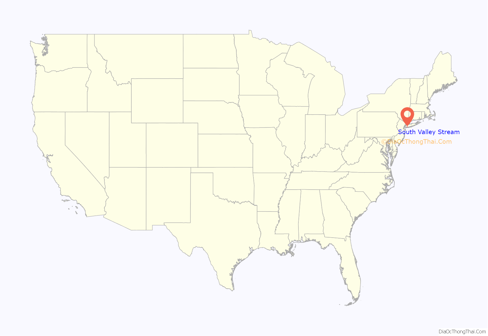
South Valley Stream location map. Where is South Valley Stream CDP?
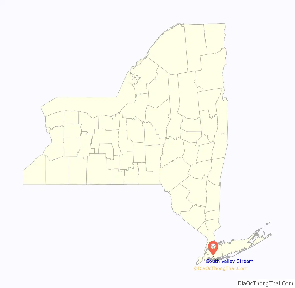
South Valley Stream Road Map
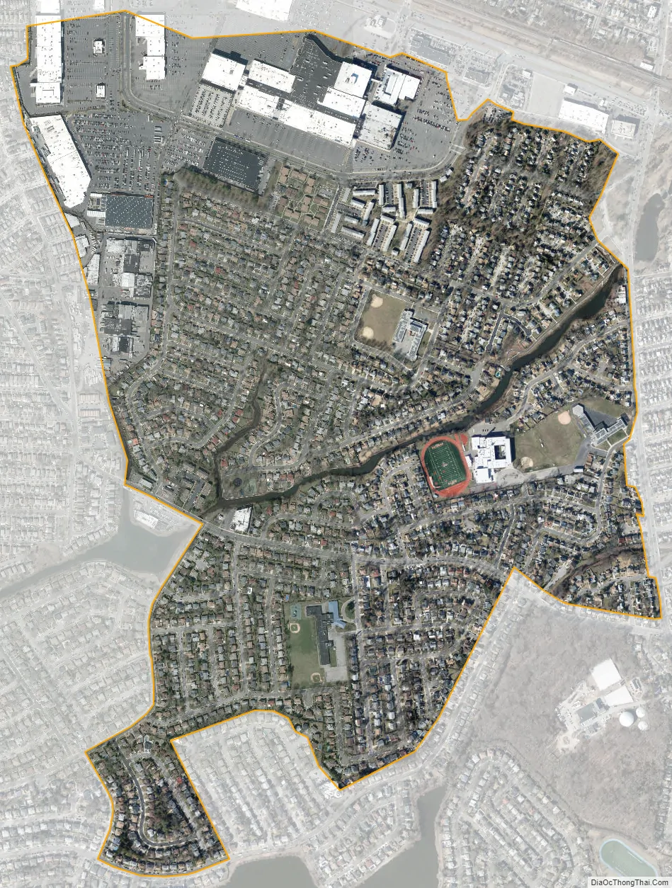
South Valley Stream city Satellite Map
Geography
According to the United States Census Bureau, the CDP has a total area of 0.9 square miles (2.3 km), all land.
See also
Map of New York State and its subdivision:- Albany
- Allegany
- Bronx
- Broome
- Cattaraugus
- Cayuga
- Chautauqua
- Chemung
- Chenango
- Clinton
- Columbia
- Cortland
- Delaware
- Dutchess
- Erie
- Essex
- Franklin
- Fulton
- Genesee
- Greene
- Hamilton
- Herkimer
- Jefferson
- Kings
- Lake Ontario
- Lewis
- Livingston
- Madison
- Monroe
- Montgomery
- Nassau
- New York
- Niagara
- Oneida
- Onondaga
- Ontario
- Orange
- Orleans
- Oswego
- Otsego
- Putnam
- Queens
- Rensselaer
- Richmond
- Rockland
- Saint Lawrence
- Saratoga
- Schenectady
- Schoharie
- Schuyler
- Seneca
- Steuben
- Suffolk
- Sullivan
- Tioga
- Tompkins
- Ulster
- Warren
- Washington
- Wayne
- Westchester
- Wyoming
- Yates
- Alabama
- Alaska
- Arizona
- Arkansas
- California
- Colorado
- Connecticut
- Delaware
- District of Columbia
- Florida
- Georgia
- Hawaii
- Idaho
- Illinois
- Indiana
- Iowa
- Kansas
- Kentucky
- Louisiana
- Maine
- Maryland
- Massachusetts
- Michigan
- Minnesota
- Mississippi
- Missouri
- Montana
- Nebraska
- Nevada
- New Hampshire
- New Jersey
- New Mexico
- New York
- North Carolina
- North Dakota
- Ohio
- Oklahoma
- Oregon
- Pennsylvania
- Rhode Island
- South Carolina
- South Dakota
- Tennessee
- Texas
- Utah
- Vermont
- Virginia
- Washington
- West Virginia
- Wisconsin
- Wyoming


