Valatie (/vəˈleɪʃə/; və-LAY-shə) is a village with several waterfalls in Columbia County, New York, United States. The population was 1,819 at the 2010 census. The village is at the center of the town of Kinderhook on US 9.
| Name: | Valatie village |
|---|---|
| LSAD Code: | 47 |
| LSAD Description: | village (suffix) |
| State: | New York |
| County: | Columbia County |
| Elevation: | 240 ft (73 m) |
| Total Area: | 1.27 sq mi (3.28 km²) |
| Land Area: | 1.25 sq mi (3.25 km²) |
| Water Area: | 0.01 sq mi (0.03 km²) |
| Total Population: | 1,785 |
| Population Density: | 1,423.44/sq mi (549.50/km²) |
| ZIP code: | 12184 |
| Area code: | 518 |
| FIPS code: | 3676617 |
| GNISfeature ID: | 0968342 |
| Website: | www.valatievillage.com |
Online Interactive Map
Click on ![]() to view map in "full screen" mode.
to view map in "full screen" mode.
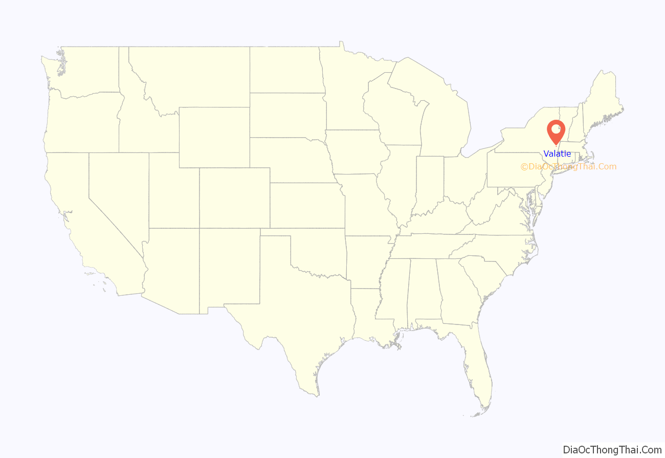
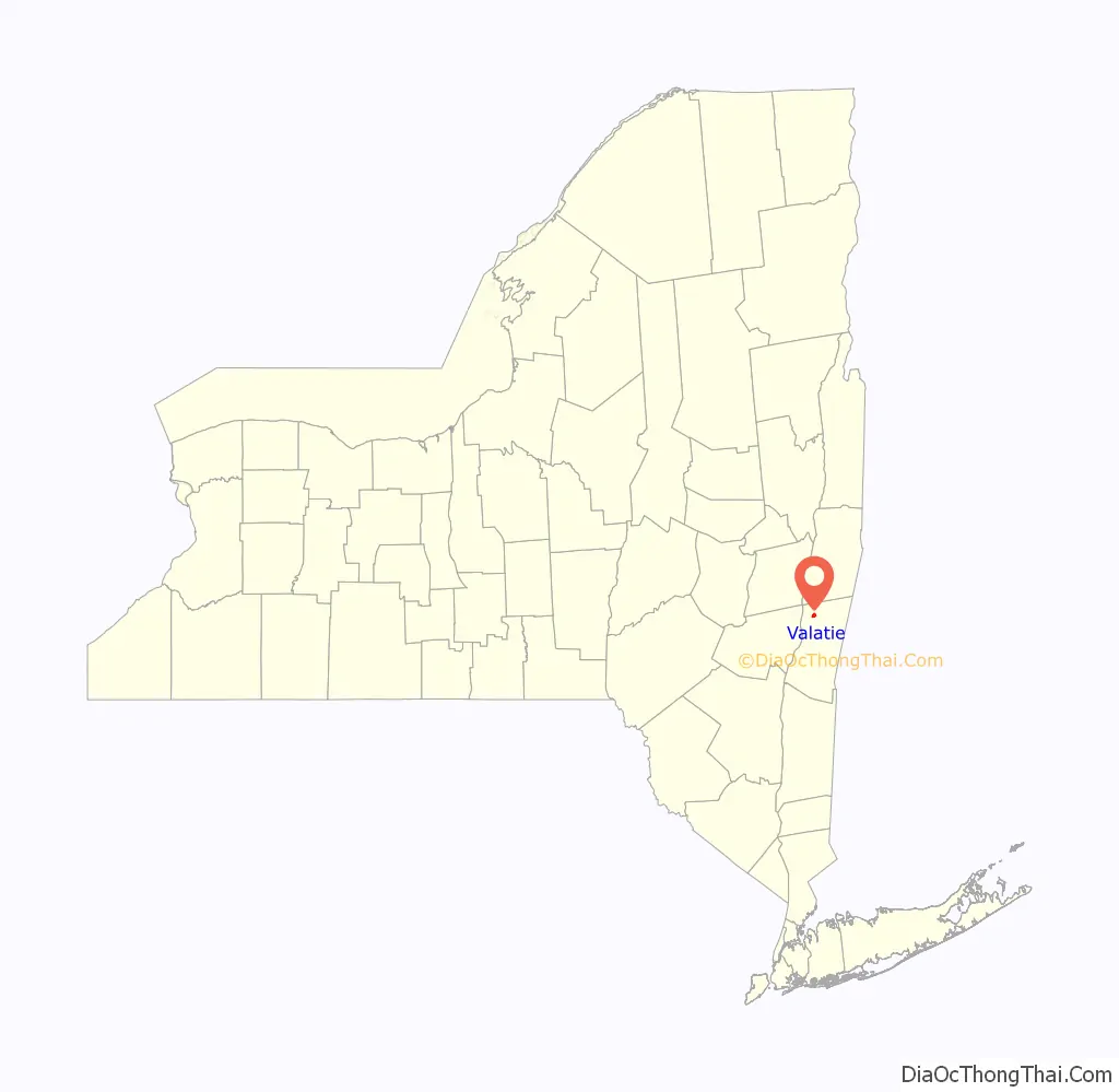
Valatie location map. Where is Valatie village?
History
Valatie was first named Pachaquak, meaning “cleared meadow”, by the earliest Native American settlers—Algonquian Mohicans—who lived along the banks of Valatie’s two waterways now referred to as Valatie Kill and Kinderhook Creek.
Part of the original New Netherland, the first European settlers were the Dutch who settled Kinderhook around 1665, and named this area “Vaaltje”, meaning “little falls”. The first post office was established in 1832. By the early 19th century there were nine cotton mills in Valatje operating on power derived from the famous waterfalls; the village was incorporated in 1856. With a bustling Main Street, Valatie was considered the center of commerce in northern Columbia County throughout the 19th century.
The United States’ first Santa Claus Club was founded in Vatalie in 1946 by fifteen village veterans to provide holiday gifts for several critically ill children. Every Christmas Eve, a Santa travels throughout the village, personally visiting every child under age ten.
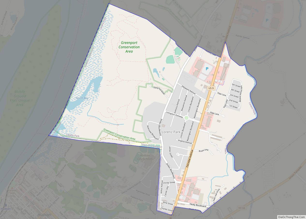
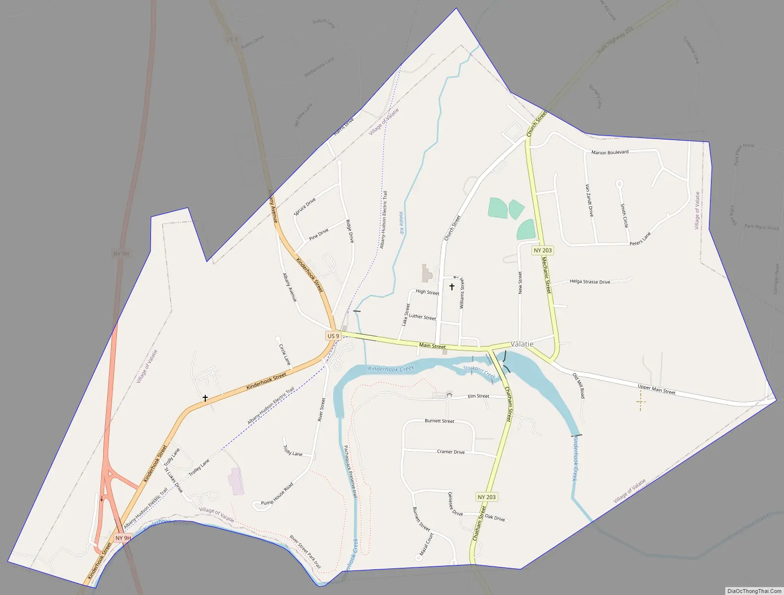
Valatie Road Map
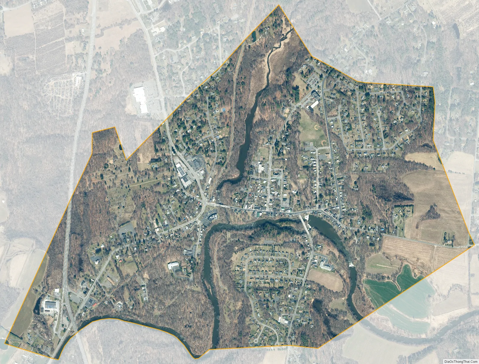
Valatie city Satellite Map
Geography
Valatie is located in the center of the Town of Kinderhook in northern Columbia County. It is part of the Hudson Valley region of New York State. It is 21 miles (34 km) south of Albany, the state capital, and 15 miles (24 km) northeast of Hudson.
According to the United States Census Bureau, the village has a total area of 1.27 square miles (3.28 km), of which 1.25 square miles (3.25 km) is land and 0.01 square miles (0.03 km), or 0.95%, is surface water. The village is located at the juncture of Valatie Kill with Kinderhook Creek, a tributary of the Hudson River. There are three waterfalls in the village, all along Main Street: Valatie Kill Falls/Wild’s Falls, Little Falls Creek/Beaver Mill Falls, and Kinderhook Creek.
Nearby communities within the Town of Kinderhook
- Niverville – A hamlet south of Kinderhook Lake on County Road 28B and New York State Route 203, 2 miles (3 km) northeast of Valatie.
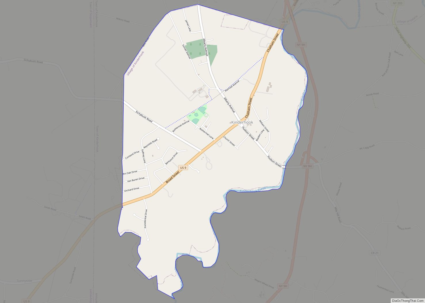
- Kinderhook – A village on U.S. Route 9, 2 miles (3 km) southwest of Valatie.
See also
Map of New York State and its subdivision:- Albany
- Allegany
- Bronx
- Broome
- Cattaraugus
- Cayuga
- Chautauqua
- Chemung
- Chenango
- Clinton
- Columbia
- Cortland
- Delaware
- Dutchess
- Erie
- Essex
- Franklin
- Fulton
- Genesee
- Greene
- Hamilton
- Herkimer
- Jefferson
- Kings
- Lake Ontario
- Lewis
- Livingston
- Madison
- Monroe
- Montgomery
- Nassau
- New York
- Niagara
- Oneida
- Onondaga
- Ontario
- Orange
- Orleans
- Oswego
- Otsego
- Putnam
- Queens
- Rensselaer
- Richmond
- Rockland
- Saint Lawrence
- Saratoga
- Schenectady
- Schoharie
- Schuyler
- Seneca
- Steuben
- Suffolk
- Sullivan
- Tioga
- Tompkins
- Ulster
- Warren
- Washington
- Wayne
- Westchester
- Wyoming
- Yates
- Alabama
- Alaska
- Arizona
- Arkansas
- California
- Colorado
- Connecticut
- Delaware
- District of Columbia
- Florida
- Georgia
- Hawaii
- Idaho
- Illinois
- Indiana
- Iowa
- Kansas
- Kentucky
- Louisiana
- Maine
- Maryland
- Massachusetts
- Michigan
- Minnesota
- Mississippi
- Missouri
- Montana
- Nebraska
- Nevada
- New Hampshire
- New Jersey
- New Mexico
- New York
- North Carolina
- North Dakota
- Ohio
- Oklahoma
- Oregon
- Pennsylvania
- Rhode Island
- South Carolina
- South Dakota
- Tennessee
- Texas
- Utah
- Vermont
- Virginia
- Washington
- West Virginia
- Wisconsin
- Wyoming