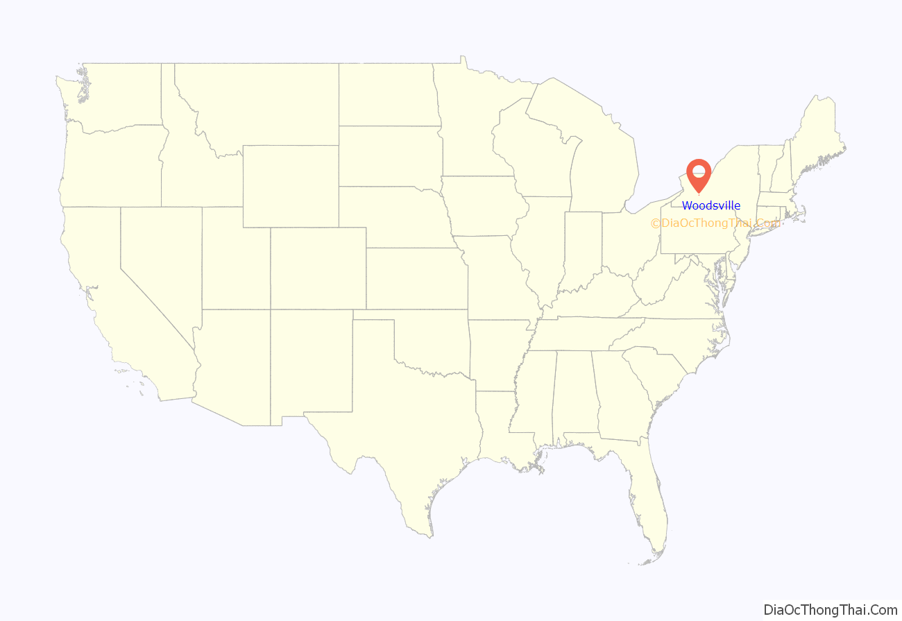
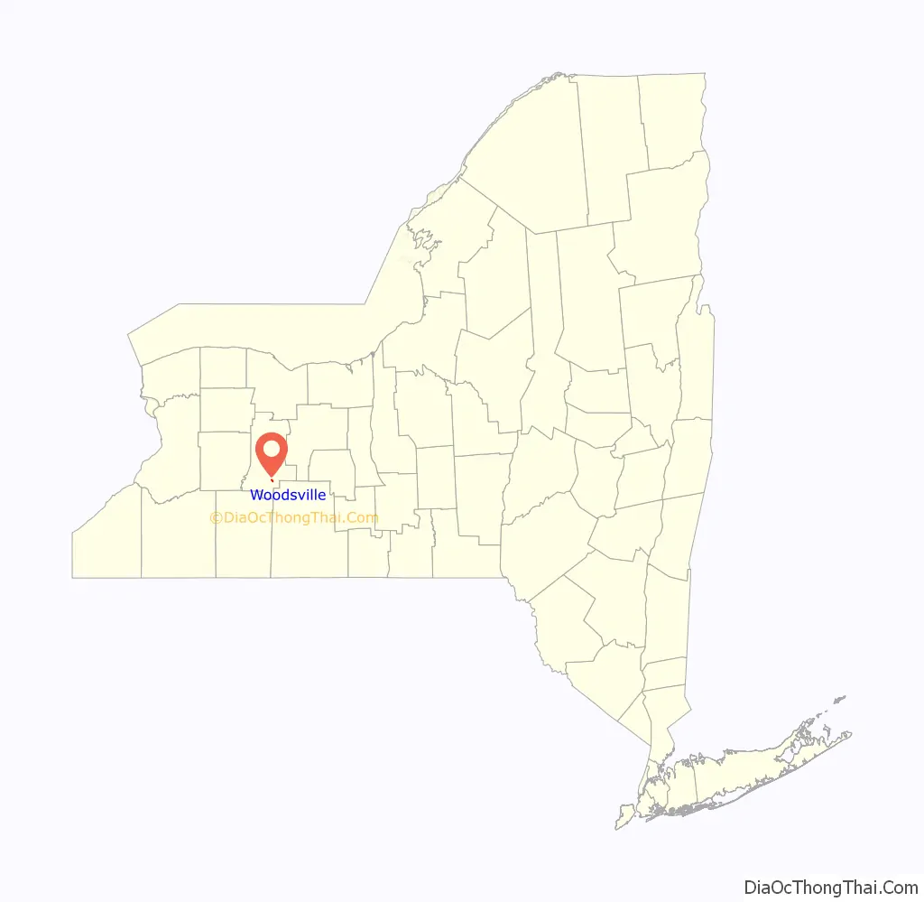
Woodsville is a hamlet and census-designated place (CDP) in Livingston County, New York, United States. Its population was 70 as of the 2020 census. New York State Route 36 passes through the community.
| Name: | Woodsville CDP |
|---|---|
| LSAD Code: | 57 |
| LSAD Description: | CDP (suffix) |
| State: | New York |
| County: | Livingston County |
| Elevation: | 646 ft (197 m) |
| Total Area: | 0.32 sq mi (0.82 km²) |
| Land Area: | 0.32 sq mi (0.82 km²) |
| Water Area: | 0.00 sq mi (0.00 km²) |
| Total Population: | 70 |
| Population Density: | 220.82/sq mi (85.20/km²) |
| Area code: | 585 |
| FIPS code: | 3683063 |
| GNISfeature ID: | 971723 |
Online Interactive Map
Click on ![]() to view map in "full screen" mode.
to view map in "full screen" mode.
Woodsville location map. Where is Woodsville CDP?
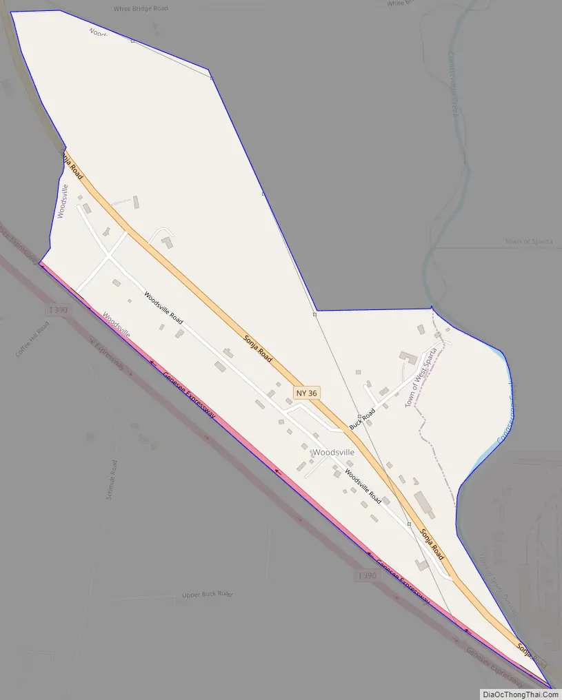
Woodsville Road Map
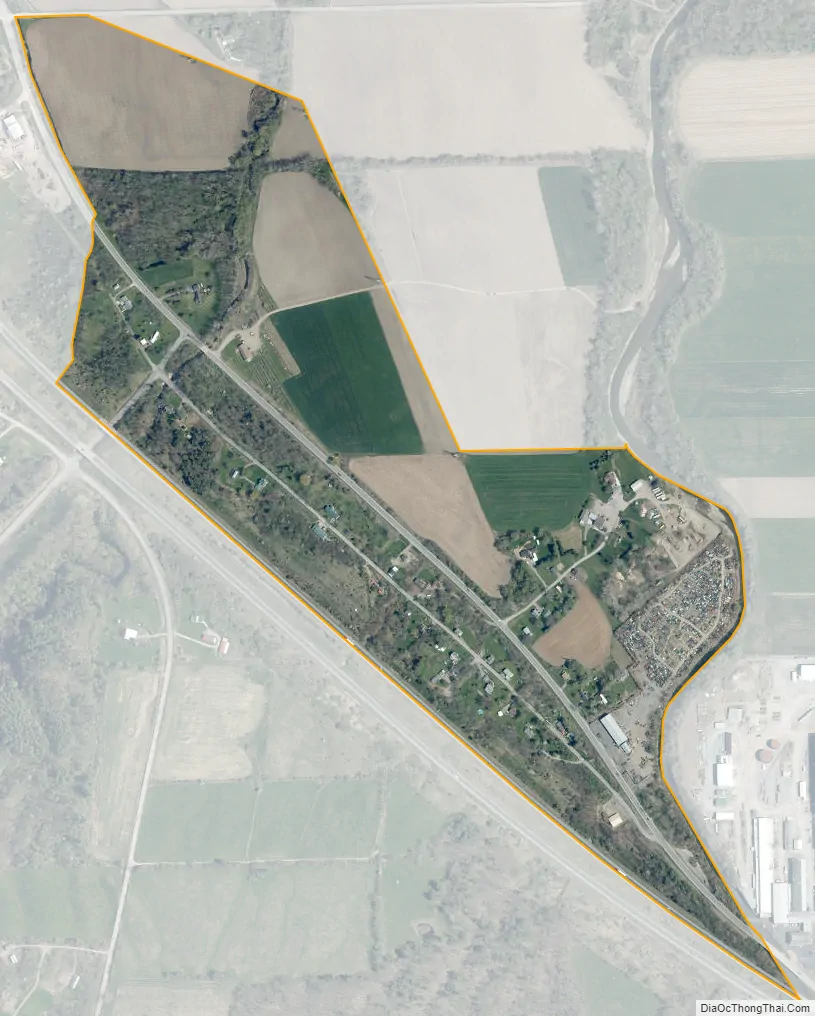
Woodsville city Satellite Map
Geography
Woodsville is in southern Livingston County, mainly in the southeastern corner of the town of West Sparta. A small part of the CDP extends eastward into the town of North Dansville. NY 36 leads southeast 2.5 miles (4.0 km) to Dansville and northwest 13 miles (21 km) to Mount Morris. Interstate 390 runs along the southwestern edge of Woodsville, with access from Exit 5 just southeast of the community. I-390 leads north 50 miles (80 km) to Rochester and southeast 25 miles (40 km) to Interstate 86 in Avoca.
According to the U.S. Census Bureau, the Woodsville CDP has an area of 0.32 square miles (0.83 km), all land.
See also
Map of New York State and its subdivision:- Albany
- Allegany
- Bronx
- Broome
- Cattaraugus
- Cayuga
- Chautauqua
- Chemung
- Chenango
- Clinton
- Columbia
- Cortland
- Delaware
- Dutchess
- Erie
- Essex
- Franklin
- Fulton
- Genesee
- Greene
- Hamilton
- Herkimer
- Jefferson
- Kings
- Lake Ontario
- Lewis
- Livingston
- Madison
- Monroe
- Montgomery
- Nassau
- New York
- Niagara
- Oneida
- Onondaga
- Ontario
- Orange
- Orleans
- Oswego
- Otsego
- Putnam
- Queens
- Rensselaer
- Richmond
- Rockland
- Saint Lawrence
- Saratoga
- Schenectady
- Schoharie
- Schuyler
- Seneca
- Steuben
- Suffolk
- Sullivan
- Tioga
- Tompkins
- Ulster
- Warren
- Washington
- Wayne
- Westchester
- Wyoming
- Yates
- Alabama
- Alaska
- Arizona
- Arkansas
- California
- Colorado
- Connecticut
- Delaware
- District of Columbia
- Florida
- Georgia
- Hawaii
- Idaho
- Illinois
- Indiana
- Iowa
- Kansas
- Kentucky
- Louisiana
- Maine
- Maryland
- Massachusetts
- Michigan
- Minnesota
- Mississippi
- Missouri
- Montana
- Nebraska
- Nevada
- New Hampshire
- New Jersey
- New Mexico
- New York
- North Carolina
- North Dakota
- Ohio
- Oklahoma
- Oregon
- Pennsylvania
- Rhode Island
- South Carolina
- South Dakota
- Tennessee
- Texas
- Utah
- Vermont
- Virginia
- Washington
- West Virginia
- Wisconsin
- Wyoming


