Alger (/ˈældʒər/ AL-jər) is a village in Hardin County, Ohio, United States. The population was 860 at the 2010 census.
| Name: | Alger village |
|---|---|
| LSAD Code: | 47 |
| LSAD Description: | village (suffix) |
| State: | Ohio |
| County: | Hardin County |
| Elevation: | 978 ft (298 m) |
| Total Area: | 0.30 sq mi (0.77 km²) |
| Land Area: | 0.30 sq mi (0.77 km²) |
| Water Area: | 0.00 sq mi (0.00 km²) |
| Total Population: | 837 |
| Population Density: | 2,827.70/sq mi (1,092.41/km²) |
| ZIP code: | 45812 |
| Area code: | 419 |
| FIPS code: | 3901210 |
| GNISfeature ID: | 1064310 |
Online Interactive Map
Click on ![]() to view map in "full screen" mode.
to view map in "full screen" mode.
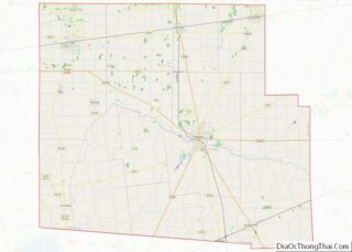
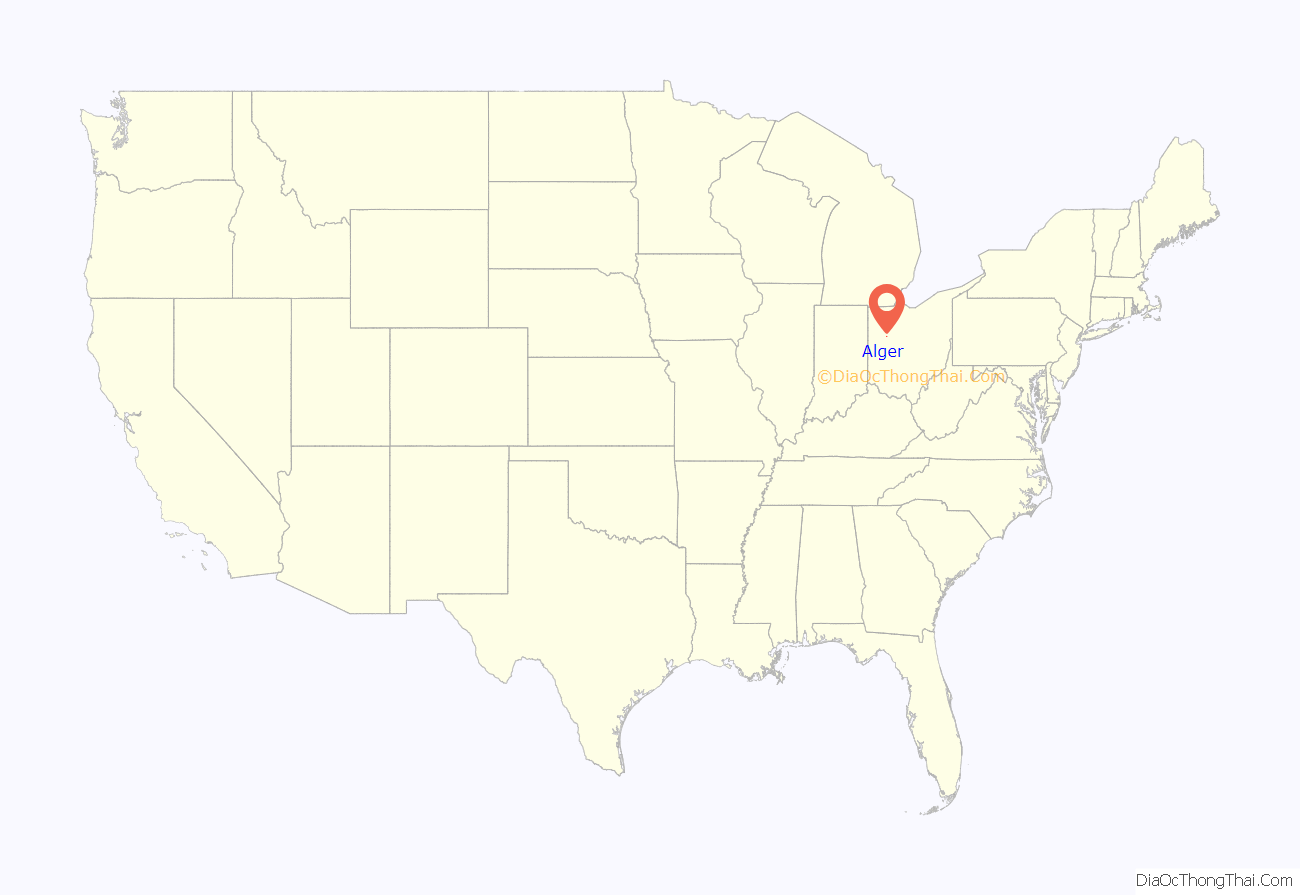
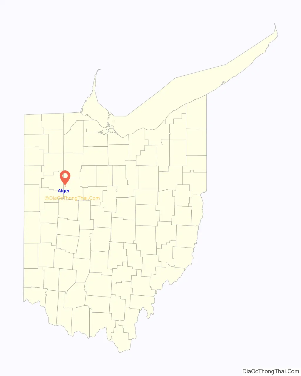
Alger location map. Where is Alger village?
History
Alger was first called Jagger, and under the latter name was laid out in 1882 by Elias Jagger, and named for him. The present name is for Russell A. Alger, 20th Governor of Michigan. The village was incorporated in 1896.
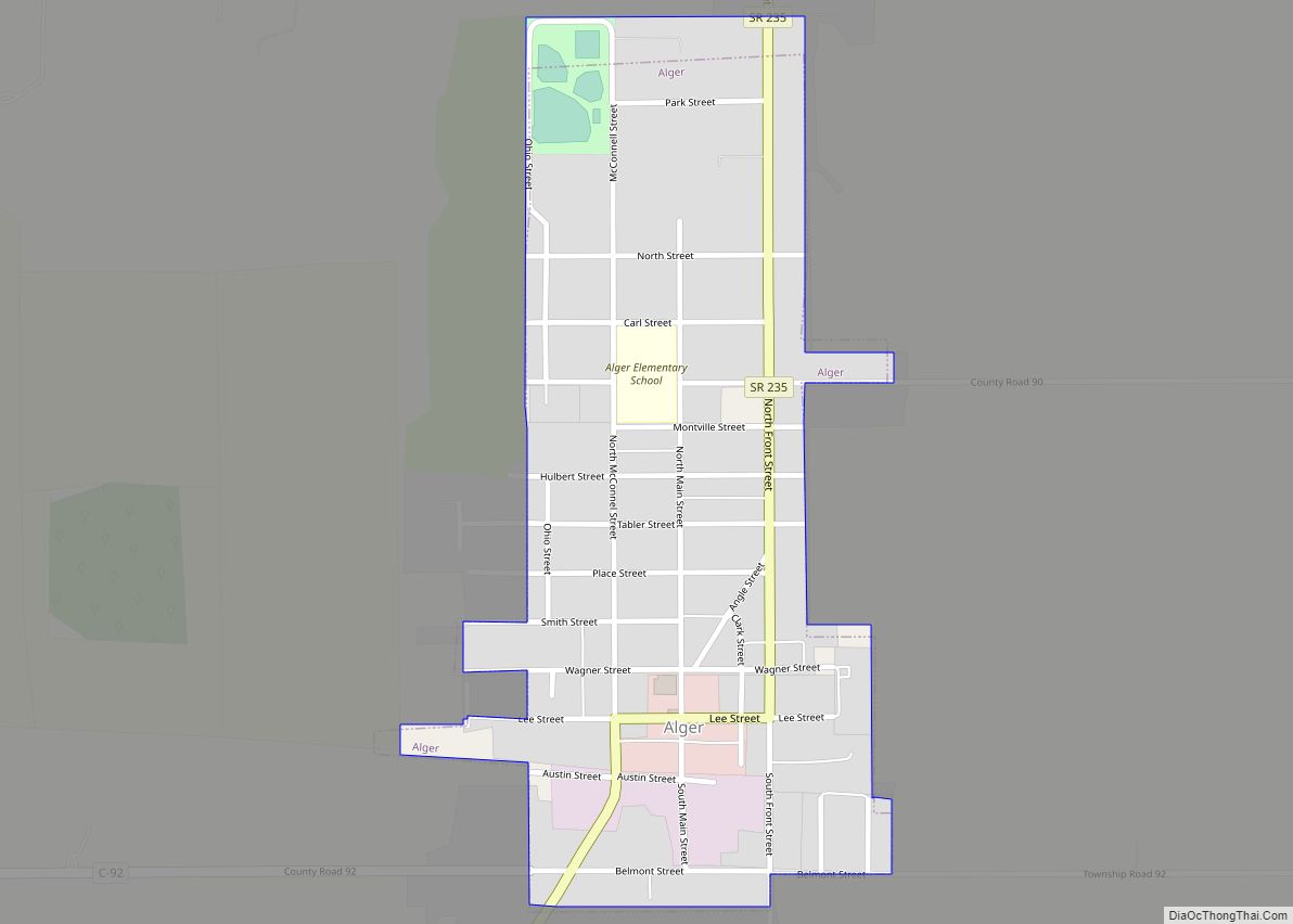
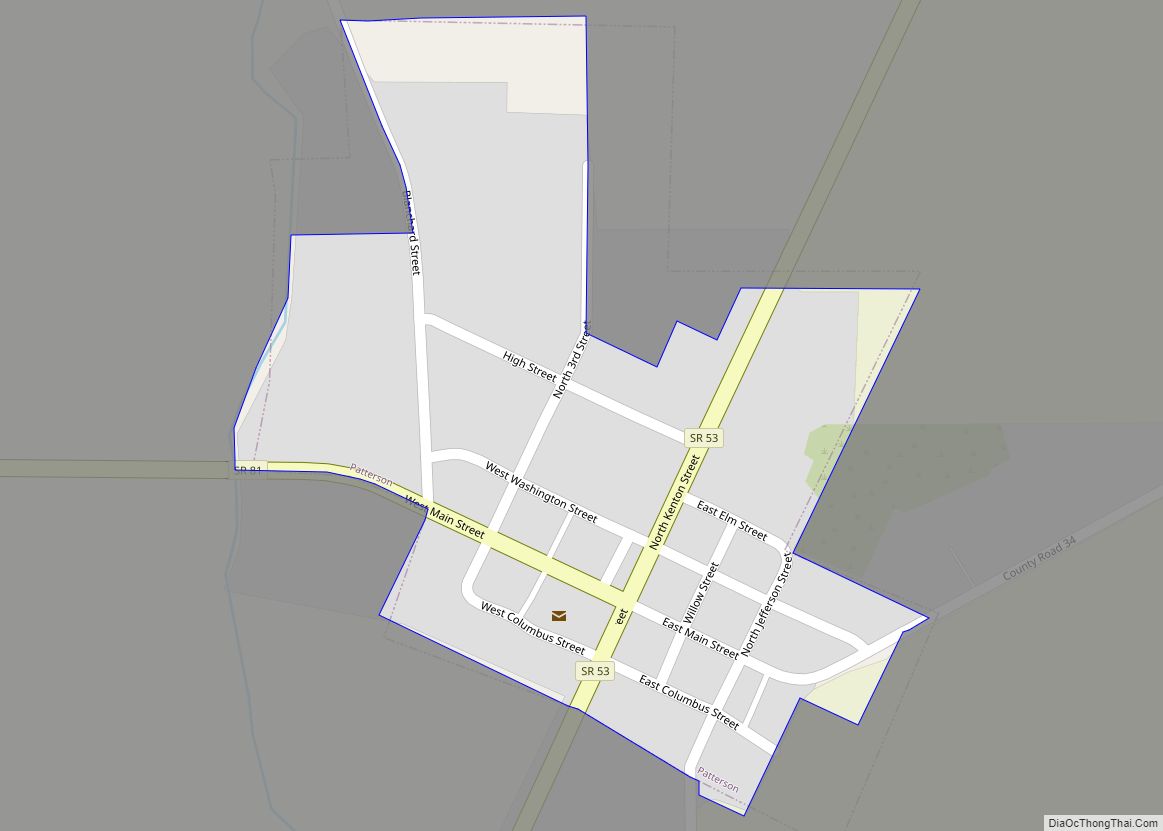
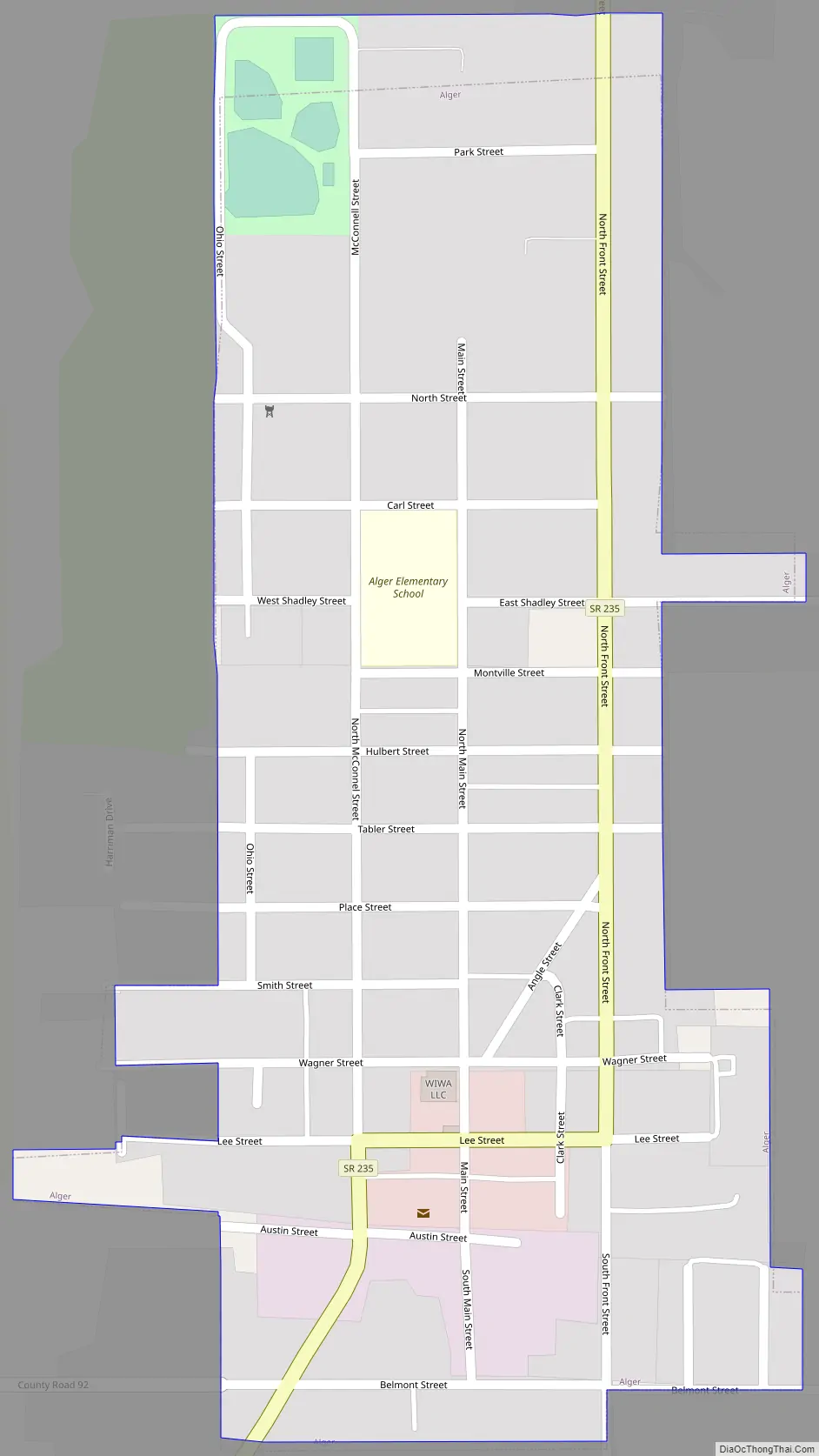
Alger Road Map
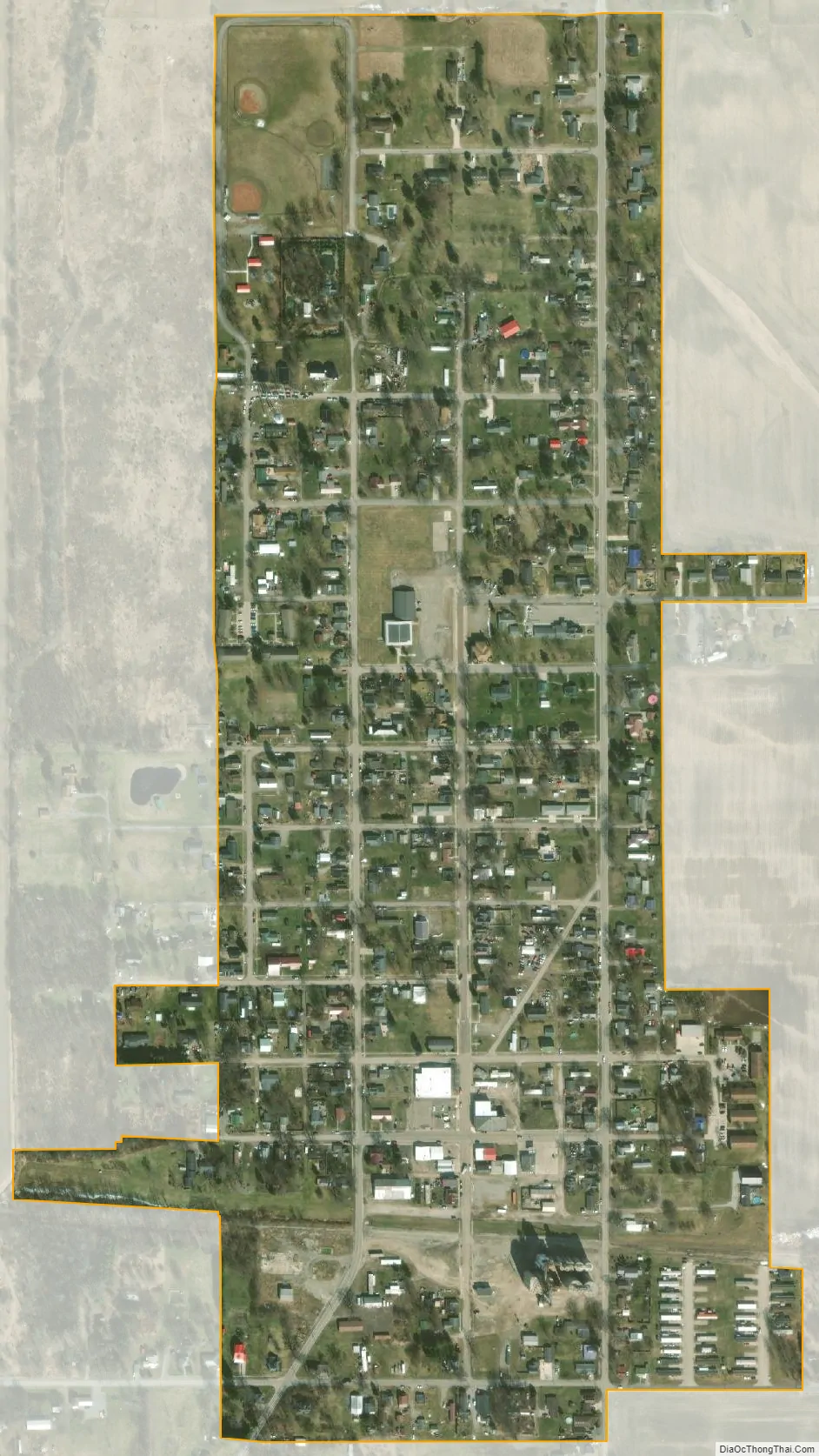
Alger city Satellite Map
Geography
Alger is located on State Route 235 about 4 miles (6.4 km) south of Ada.
According to the United States Census Bureau, the village has a total area of 0.28 square miles (0.73 km), all of it land.
See also
Map of Ohio State and its subdivision:- Adams
- Allen
- Ashland
- Ashtabula
- Athens
- Auglaize
- Belmont
- Brown
- Butler
- Carroll
- Champaign
- Clark
- Clermont
- Clinton
- Columbiana
- Coshocton
- Crawford
- Cuyahoga
- Darke
- Defiance
- Delaware
- Erie
- Fairfield
- Fayette
- Franklin
- Fulton
- Gallia
- Geauga
- Greene
- Guernsey
- Hamilton
- Hancock
- Hardin
- Harrison
- Henry
- Highland
- Hocking
- Holmes
- Huron
- Jackson
- Jefferson
- Knox
- Lake
- Lake Erie
- Lawrence
- Licking
- Logan
- Lorain
- Lucas
- Madison
- Mahoning
- Marion
- Medina
- Meigs
- Mercer
- Miami
- Monroe
- Montgomery
- Morgan
- Morrow
- Muskingum
- Noble
- Ottawa
- Paulding
- Perry
- Pickaway
- Pike
- Portage
- Preble
- Putnam
- Richland
- Ross
- Sandusky
- Scioto
- Seneca
- Shelby
- Stark
- Summit
- Trumbull
- Tuscarawas
- Union
- Van Wert
- Vinton
- Warren
- Washington
- Wayne
- Williams
- Wood
- Wyandot
- Alabama
- Alaska
- Arizona
- Arkansas
- California
- Colorado
- Connecticut
- Delaware
- District of Columbia
- Florida
- Georgia
- Hawaii
- Idaho
- Illinois
- Indiana
- Iowa
- Kansas
- Kentucky
- Louisiana
- Maine
- Maryland
- Massachusetts
- Michigan
- Minnesota
- Mississippi
- Missouri
- Montana
- Nebraska
- Nevada
- New Hampshire
- New Jersey
- New Mexico
- New York
- North Carolina
- North Dakota
- Ohio
- Oklahoma
- Oregon
- Pennsylvania
- Rhode Island
- South Carolina
- South Dakota
- Tennessee
- Texas
- Utah
- Vermont
- Virginia
- Washington
- West Virginia
- Wisconsin
- Wyoming