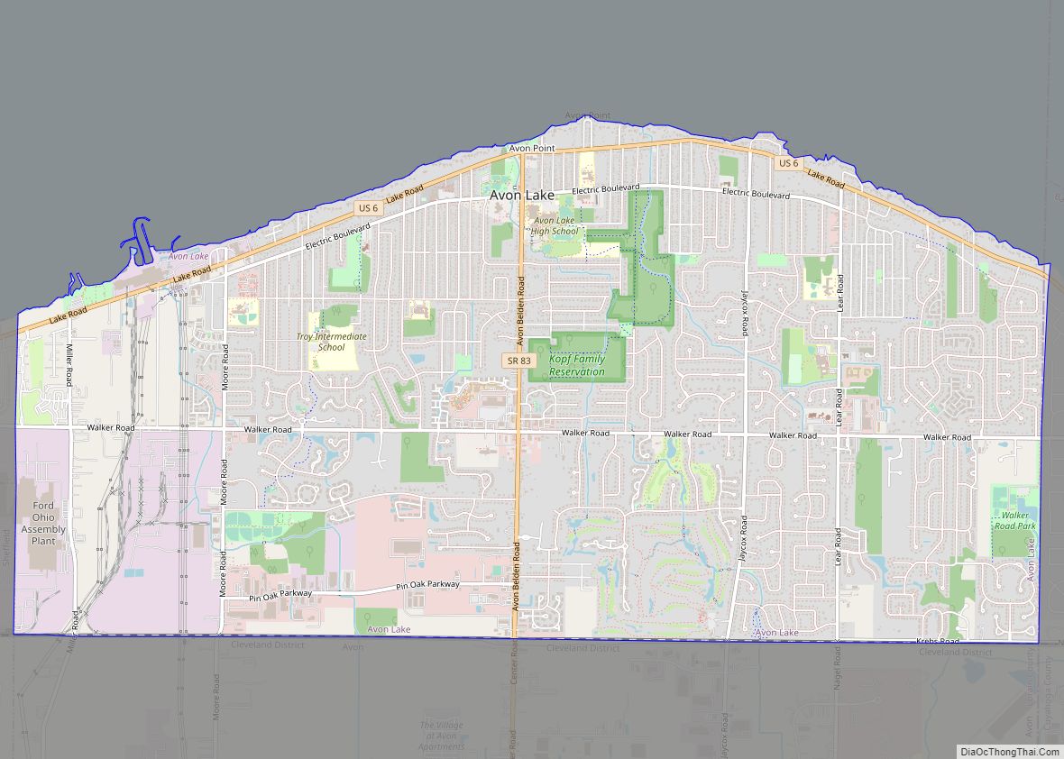
Avon Lake is a city in northeastern Lorain County, Ohio, United States, located on the southern shore of Lake Erie about 17 miles west of Cleveland. The population was 25,206 at the 2020 Census. It is part of the Cleveland metropolitan area.
| Name: | Avon Lake city |
|---|---|
| LSAD Code: | 25 |
| LSAD Description: | city (suffix) |
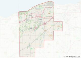
| State: | Ohio |
| County: | Lorain County |
| Elevation: | 600 ft (185 m) |
| Total Area: | 11.13 sq mi (28.83 km²) |
| Land Area: | 11.13 sq mi (28.83 km²) |
| Water Area: | 0.00 sq mi (0.00 km²) 0% |
| Total Population: | 25,206 |
| Population Density: | 2,264.69/sq mi (874.44/km²) |
| Area code: | 440 |
| FIPS code: | 3903464 |
| GNISfeature ID: | 1048474 |
| Website: | https://www.avonlake.org/ |
Online Interactive Map
Click on ![]() to view map in "full screen" mode.
to view map in "full screen" mode.
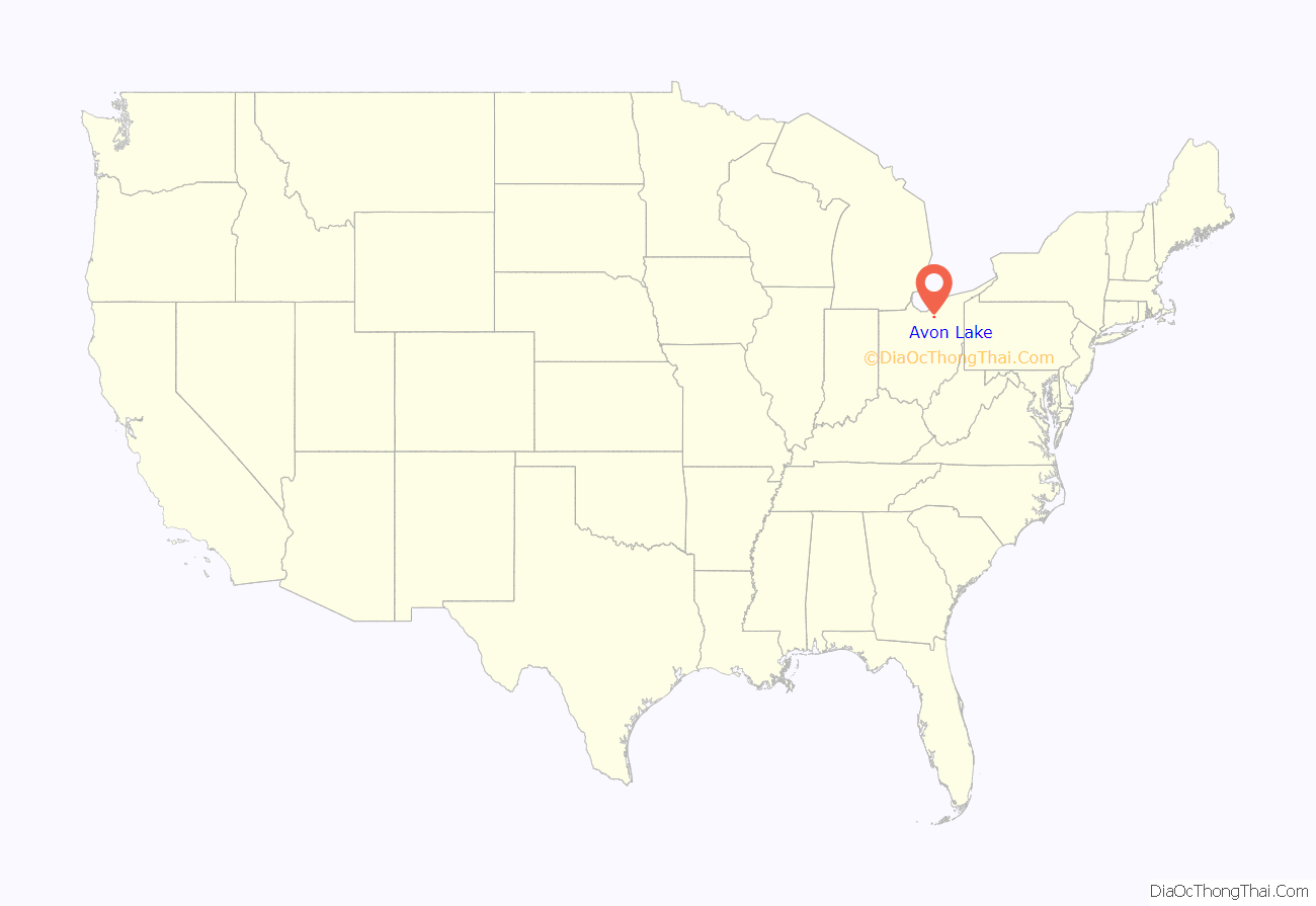
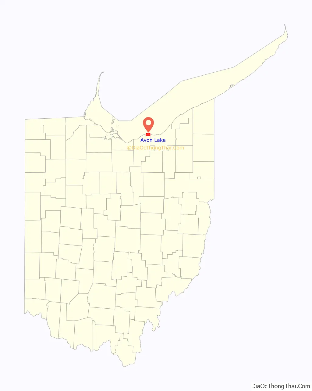
Avon Lake location map. Where is Avon Lake city?
History
Avon Lake was first settled in the 17th century and was, along with Avon, Bay Village, and Westlake, inhabited by the Erie. After the war with the Iroquois in 1656 ended the peoples were largely dispersed or integrated into Iroquois society. The area was then sparsely populated until the Lenape and Wyandot migrated into the area in 1700. The first European settlement in the area was founded in 1786 by Moravian missionaries. The Northwest Indian war resulted in the Indians in the area giving up all land East of Cuyahoga river in the Treaty of Greenville. Undoubtedly this was the start of European contact with the peoples in Avon lake, who now found themselves in the Connecticut Western Reserve. Any remaining Indian claims to their land were removed after the 1818 Treaty of St. Mary’s.
Noah Davis, the first lakeshore dweller, arrived in Avon lake in 1812 and lived in a three-sided cabin near the present-day intersection of Lake and Moore Roads for about a year. Wilbur Cahoon, owner of the land, encountered Davis and moved farther south (on Davis’ advice) in the French Creek precinct where it was not as marshy but more fitting for farming, in 1814. In 1818, Cuyahoga County drew new boundaries, splitting the former entity into two. The west part was Troy Township and the east part was Dover Township. Adam Miller and his family arrived in the following year, and the family has been here ever since. The Millers and others who followed mostly cleared land, sawed timber, and built ships in nearby Black River (eventually renamed Lorain), however Avon Lake’s shorelines also had a number of sawmills and shipyards. In 1822, Lorain County was formed. Troy Township was renamed “Avon Township” by petition in 1824.
In 1915, Avon Lake separated from the rest of the Township of Avon to form the Township of Avon Lake. In 1960, Avon Lake was granted the status of a city. Avon Lake became a qualified Tree City USA as recognized by the National Arbor Day Foundation in 1993.
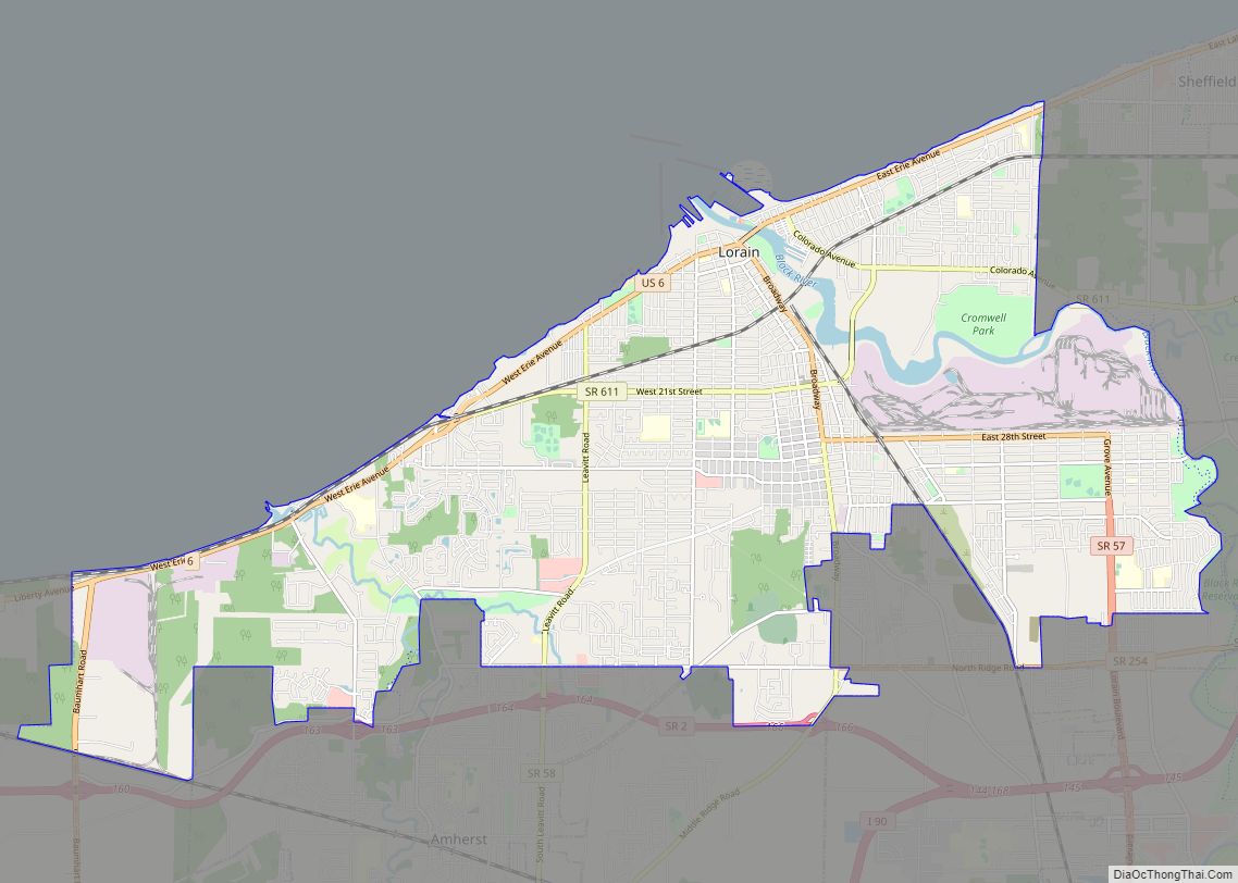
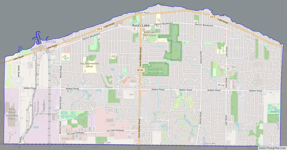
Avon Lake Road Map
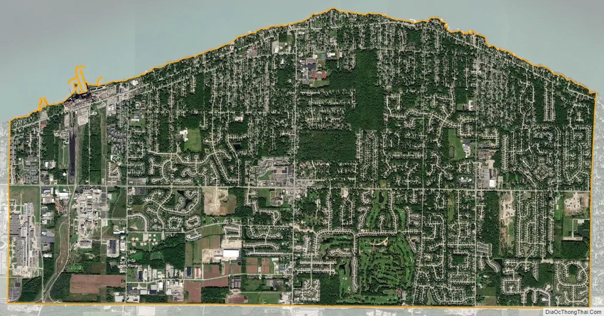
Avon Lake city Satellite Map
Geography
Avon Lake is located at 41°30′6″N 82°0′23″W / 41.50167°N 82.00639°W / 41.50167; -82.00639 (41.501595, -82.006309).
According to the 2010 census, the city has a total area of 11.13 square miles (28.8 km), all land.
Avon Lake is located on Lake Erie.
See also
Map of Ohio State and its subdivision:- Adams
- Allen
- Ashland
- Ashtabula
- Athens
- Auglaize
- Belmont
- Brown
- Butler
- Carroll
- Champaign
- Clark
- Clermont
- Clinton
- Columbiana
- Coshocton
- Crawford
- Cuyahoga
- Darke
- Defiance
- Delaware
- Erie
- Fairfield
- Fayette
- Franklin
- Fulton
- Gallia
- Geauga
- Greene
- Guernsey
- Hamilton
- Hancock
- Hardin
- Harrison
- Henry
- Highland
- Hocking
- Holmes
- Huron
- Jackson
- Jefferson
- Knox
- Lake
- Lake Erie
- Lawrence
- Licking
- Logan
- Lorain
- Lucas
- Madison
- Mahoning
- Marion
- Medina
- Meigs
- Mercer
- Miami
- Monroe
- Montgomery
- Morgan
- Morrow
- Muskingum
- Noble
- Ottawa
- Paulding
- Perry
- Pickaway
- Pike
- Portage
- Preble
- Putnam
- Richland
- Ross
- Sandusky
- Scioto
- Seneca
- Shelby
- Stark
- Summit
- Trumbull
- Tuscarawas
- Union
- Van Wert
- Vinton
- Warren
- Washington
- Wayne
- Williams
- Wood
- Wyandot
- Alabama
- Alaska
- Arizona
- Arkansas
- California
- Colorado
- Connecticut
- Delaware
- District of Columbia
- Florida
- Georgia
- Hawaii
- Idaho
- Illinois
- Indiana
- Iowa
- Kansas
- Kentucky
- Louisiana
- Maine
- Maryland
- Massachusetts
- Michigan
- Minnesota
- Mississippi
- Missouri
- Montana
- Nebraska
- Nevada
- New Hampshire
- New Jersey
- New Mexico
- New York
- North Carolina
- North Dakota
- Ohio
- Oklahoma
- Oregon
- Pennsylvania
- Rhode Island
- South Carolina
- South Dakota
- Tennessee
- Texas
- Utah
- Vermont
- Virginia
- Washington
- West Virginia
- Wisconsin
- Wyoming