Elyria (/əˈlɪəriə/ ə-LEER-ee-ə) is a city in and the county seat of Lorain County, Ohio, United States, located at the forks of the Black River in Northeast Ohio 23 miles (37 km) southwest of Cleveland. As of the 2020 census, the city had a population of 52,656. It is a principal city in the Cleveland metropolitan area. The city is home to Lorain County Community College.
| Name: | Elyria city |
|---|---|
| LSAD Code: | 25 |
| LSAD Description: | city (suffix) |
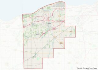
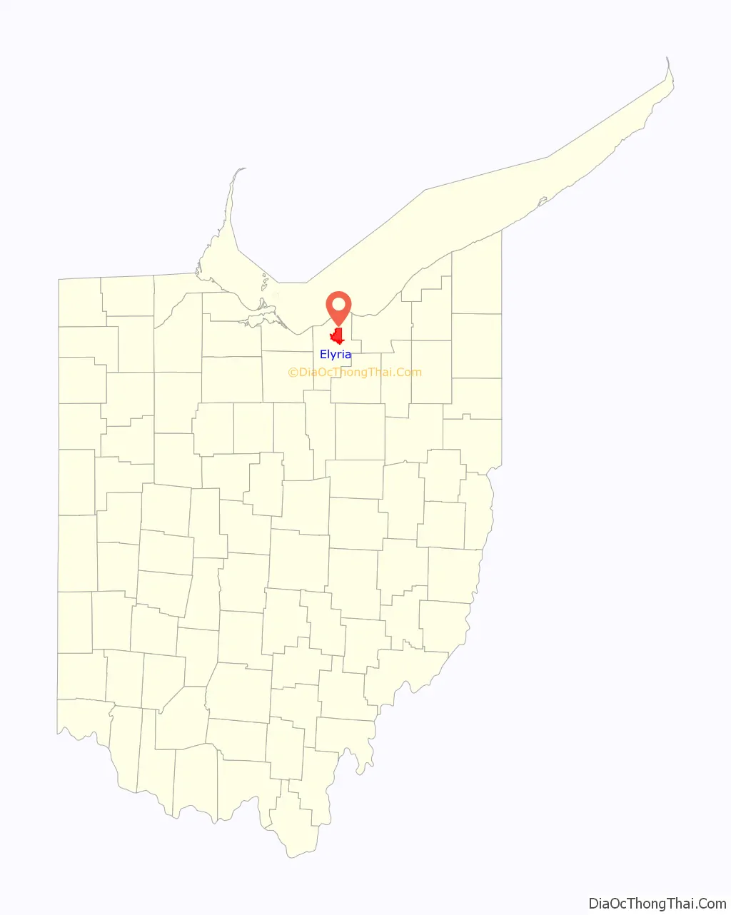
| State: | Ohio |
| County: | Lorain County |
| Founded: | March 1817 |
| Elevation: | 715 ft (218 m) |
| Total Area: | 20.81 sq mi (53.89 km²) |
| Land Area: | 20.55 sq mi (53.22 km²) |
| Water Area: | 0.26 sq mi (0.67 km²) |
| Total Population: | 52,656 |
| Population Density: | 2,562.59/sq mi (989.42/km²) |
| ZIP code: | 44035, 44036, 44039, 44074 |
| Area code: | 440 |
| FIPS code: | 3925256 |
| GNISfeature ID: | 1040177 |
| Website: | https://www.cityofelyria.org/ |
Online Interactive Map
Click on ![]() to view map in "full screen" mode.
to view map in "full screen" mode.
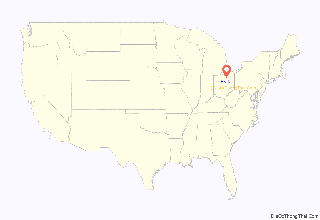
Elyria location map. Where is Elyria city?
History
The village of Elyria was founded in 1817 by Heman Ely, who built a log house, dam, gristmill, and sawmill on the village’s site along the Black River. Ely began to build more houses to accommodate European-American settlers migrating to what was, at that time, within Huron County, Ohio. By the time Ely died in 1852, Elyria had five churches, three grocery stores, three flour mills, a newspaper, and a population of more than 1,500. Early postal service from Cleveland was provided by Artemis Beebe, a rider who held the first contract to deliver mail across this section of the Black River.
By the turn of the 20th century, Elyria was a town of about 8,000. In 1908, Elyria Memorial Hospital was built. In the first half of the 20th century, the town developed some manufacturing, as well as a range of retail businesses.
In August 1967, at the peak of Elyria’s population, Midway Mall was opened. It changed the local economy by attracting local businesses from the town center or causing so much competition they went out of business. Industrial restructuring meant that good jobs left the area, and poverty increased. Three major car plant closings in the area led to economic stagnation and joblessness in the 1970s and 1980s that affected numerous communities. The region was nicknamed “the Rustbelt,” suggesting the decline of its former industries.
In the 1990s, Elyria experienced a minor revival with construction of some new roads and housing. It serves as a residential, suburban “bedroom community” for Cleveland, where new businesses and industries are developing with an increase in new jobs.
In the 2000s and 2010s, companies like Bendix and 3M moved their operations elsewhere. To prepare for this, voters passed Issue 6 in March 2016. Issue 6 increased the city’s income tax by 0.5%. It was used to pay for police, parks, and fiber-optic Internet in the city. With the reconstruction of State Route 57 on the city’s northwest side by Midway Mall, traffic flow was improved.
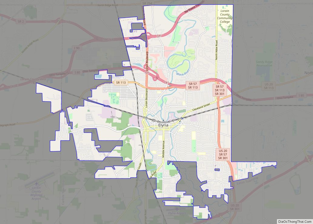
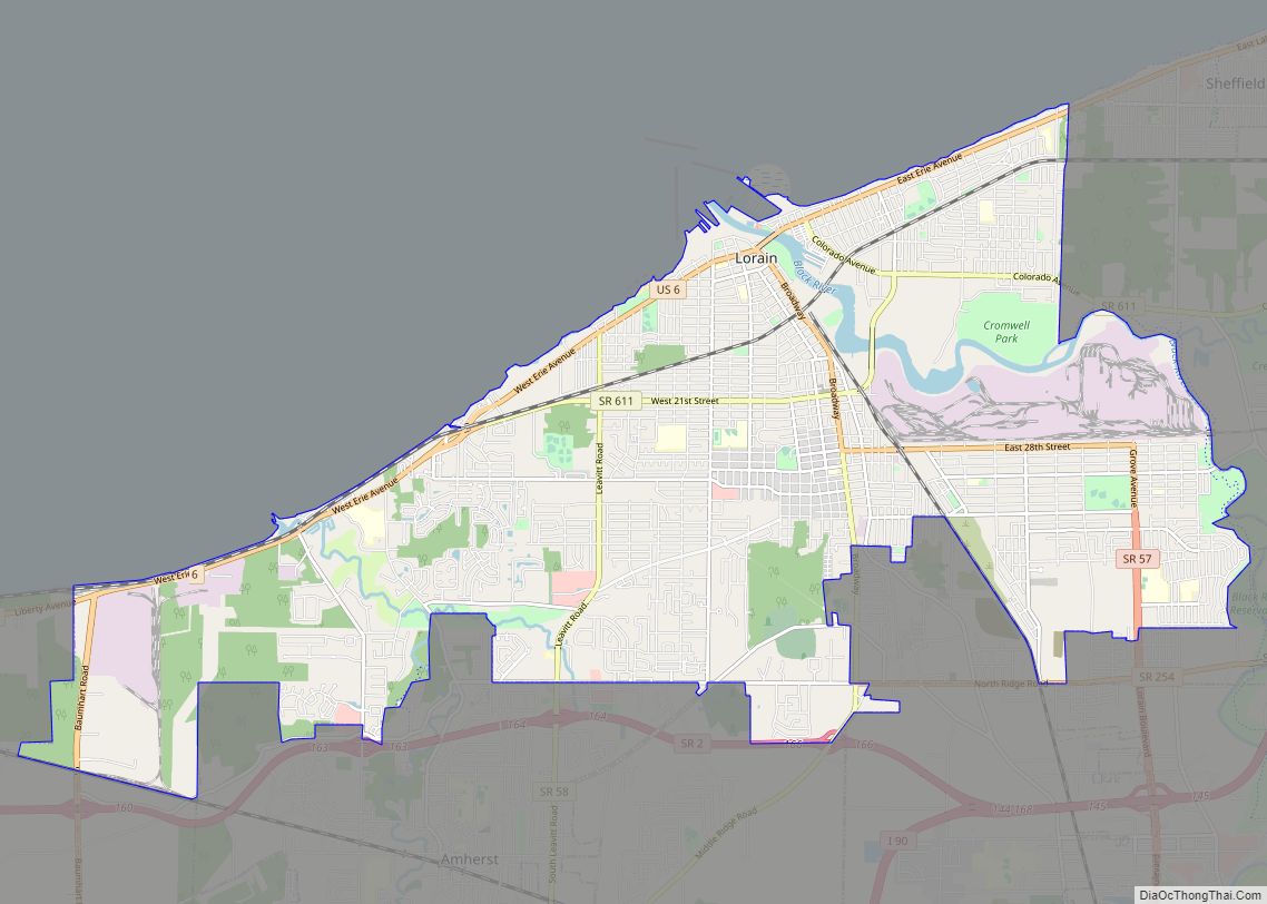
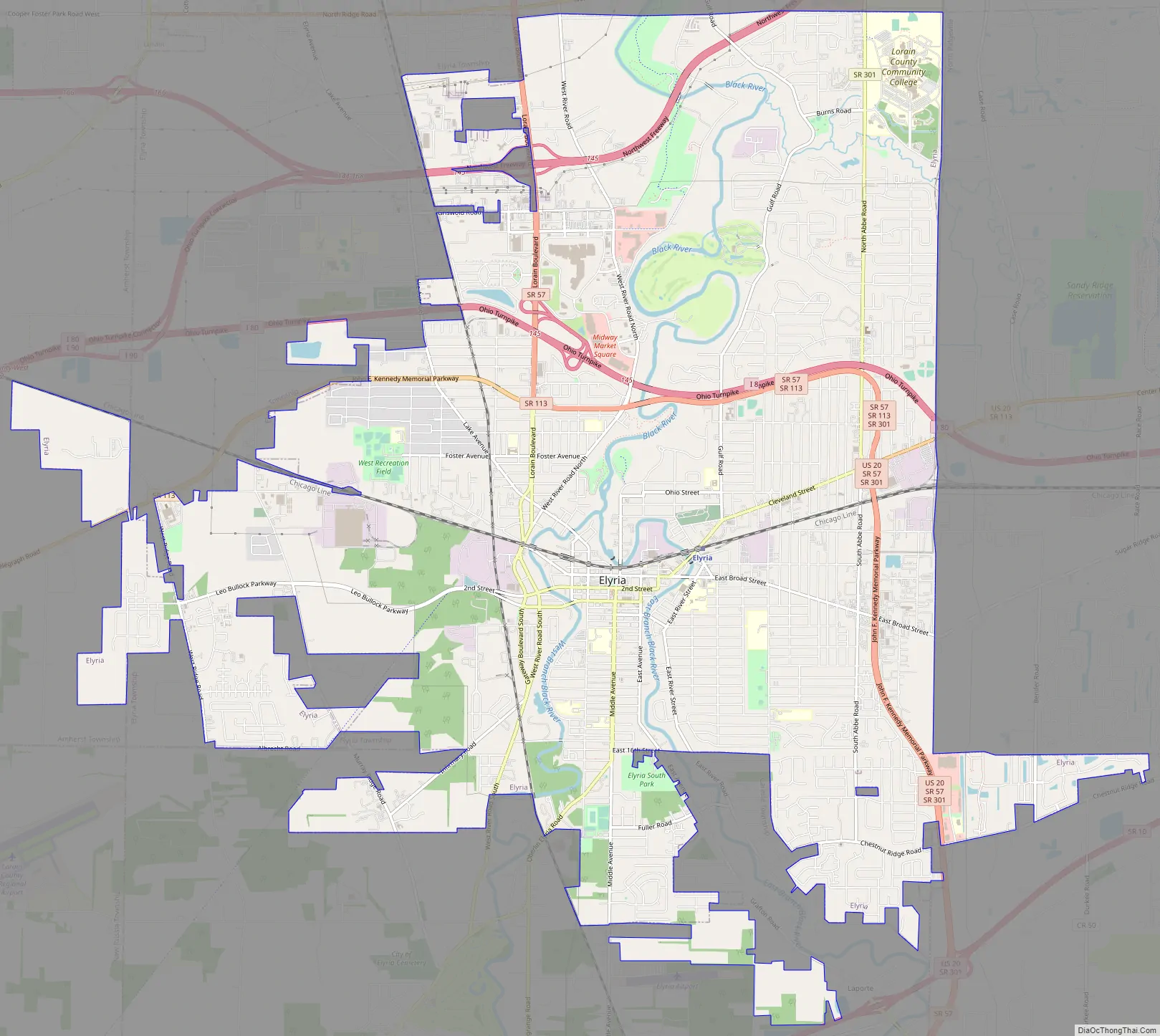
Elyria Road Map
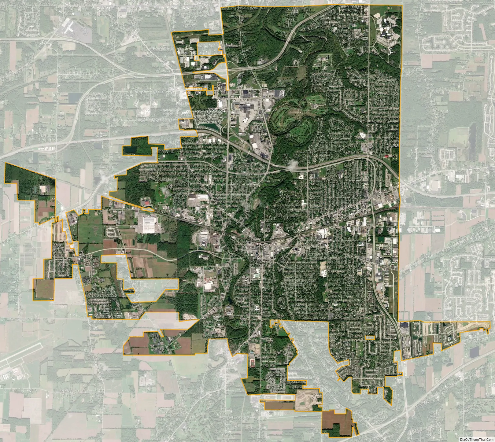
Elyria city Satellite Map
Geography
Elyria, part of the Cleveland–Elyria–Mentor metropolitan area, is located at 41°22′24″N 82°6′6″W / 41.37333°N 82.10167°W / 41.37333; -82.10167 (41.373396, −82.101692). Elyria’s primary zip code is 44035 with post office boxes being assigned the zip code 44036.
According to the United States Census Bureau, the city has a total area of 20.84 square miles (53.98 km), of which 20.57 square miles (53.28 km) is land and 0.27 square miles (0.70 km) is water.
The Black River flows through Elyria.
See also
Map of Ohio State and its subdivision:- Adams
- Allen
- Ashland
- Ashtabula
- Athens
- Auglaize
- Belmont
- Brown
- Butler
- Carroll
- Champaign
- Clark
- Clermont
- Clinton
- Columbiana
- Coshocton
- Crawford
- Cuyahoga
- Darke
- Defiance
- Delaware
- Erie
- Fairfield
- Fayette
- Franklin
- Fulton
- Gallia
- Geauga
- Greene
- Guernsey
- Hamilton
- Hancock
- Hardin
- Harrison
- Henry
- Highland
- Hocking
- Holmes
- Huron
- Jackson
- Jefferson
- Knox
- Lake
- Lake Erie
- Lawrence
- Licking
- Logan
- Lorain
- Lucas
- Madison
- Mahoning
- Marion
- Medina
- Meigs
- Mercer
- Miami
- Monroe
- Montgomery
- Morgan
- Morrow
- Muskingum
- Noble
- Ottawa
- Paulding
- Perry
- Pickaway
- Pike
- Portage
- Preble
- Putnam
- Richland
- Ross
- Sandusky
- Scioto
- Seneca
- Shelby
- Stark
- Summit
- Trumbull
- Tuscarawas
- Union
- Van Wert
- Vinton
- Warren
- Washington
- Wayne
- Williams
- Wood
- Wyandot
- Alabama
- Alaska
- Arizona
- Arkansas
- California
- Colorado
- Connecticut
- Delaware
- District of Columbia
- Florida
- Georgia
- Hawaii
- Idaho
- Illinois
- Indiana
- Iowa
- Kansas
- Kentucky
- Louisiana
- Maine
- Maryland
- Massachusetts
- Michigan
- Minnesota
- Mississippi
- Missouri
- Montana
- Nebraska
- Nevada
- New Hampshire
- New Jersey
- New Mexico
- New York
- North Carolina
- North Dakota
- Ohio
- Oklahoma
- Oregon
- Pennsylvania
- Rhode Island
- South Carolina
- South Dakota
- Tennessee
- Texas
- Utah
- Vermont
- Virginia
- Washington
- West Virginia
- Wisconsin
- Wyoming