Barnesville is a village in Belmont County, Ohio, United States. It is located in the central portion of Warren Township in Belmont County and is part of the Wheeling metropolitan area. The population was 4,008 at the 2020 census.
| Name: | Barnesville village |
|---|---|
| LSAD Code: | 47 |
| LSAD Description: | village (suffix) |
| State: | Ohio |
| County: | Belmont County |
| Elevation: | 1,270 ft (387 m) |
| Total Area: | 2.08 sq mi (5.38 km²) |
| Land Area: | 2.05 sq mi (5.31 km²) |
| Water Area: | 0.03 sq mi (0.07 km²) |
| Total Population: | 4,008 |
| Population Density: | 1,955.12/sq mi (754.76/km²) |
| ZIP code: | 43713 |
| Area code: | 740 |
| FIPS code: | 3903926 |
| GNISfeature ID: | 1064381 |
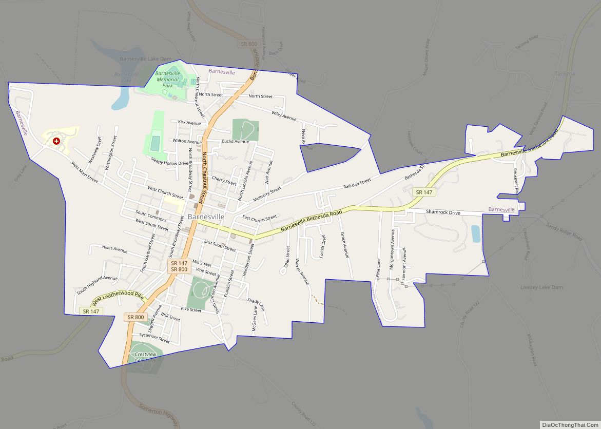
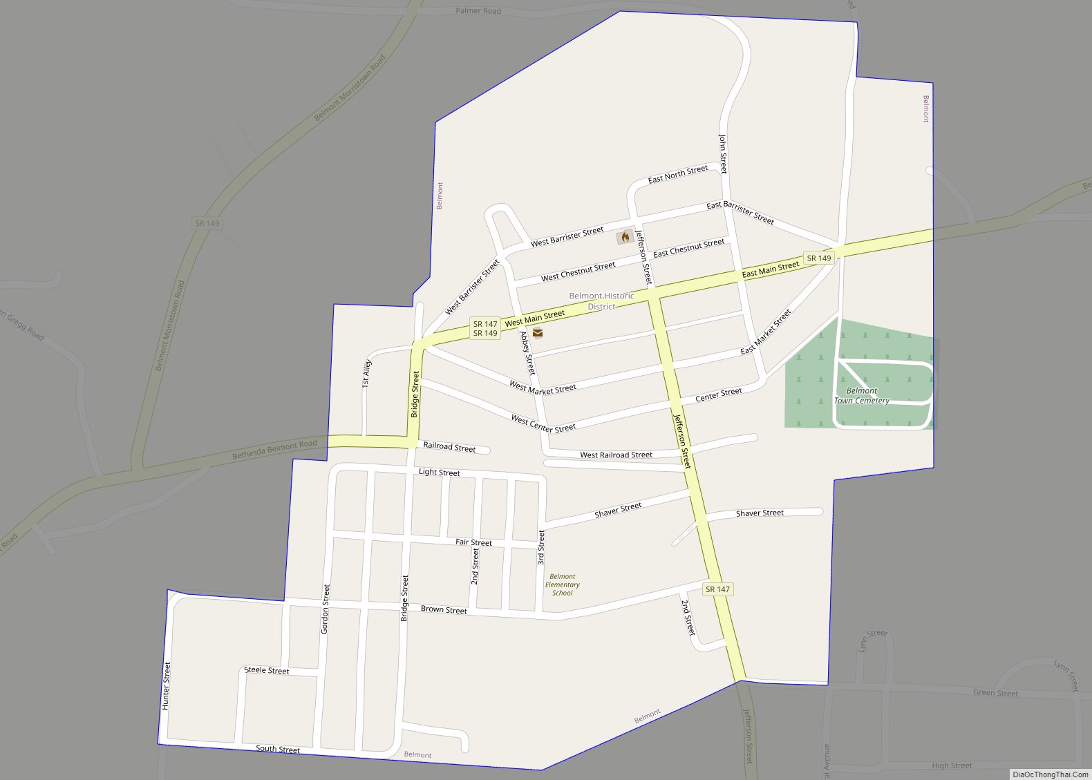
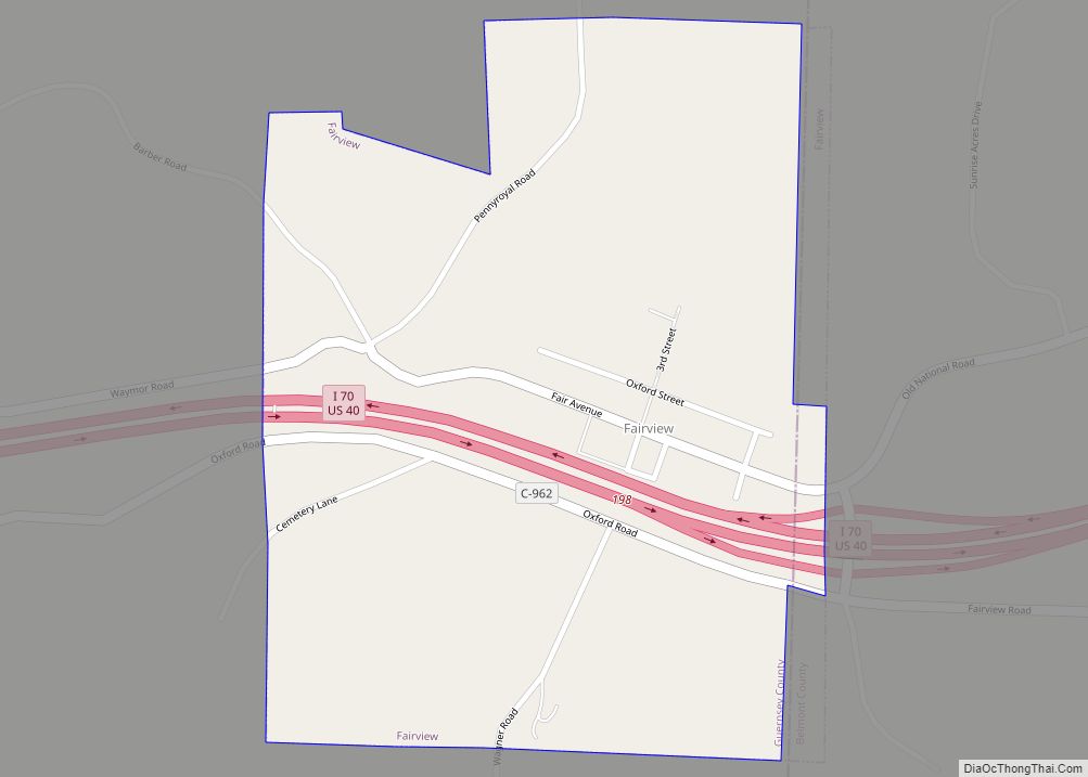
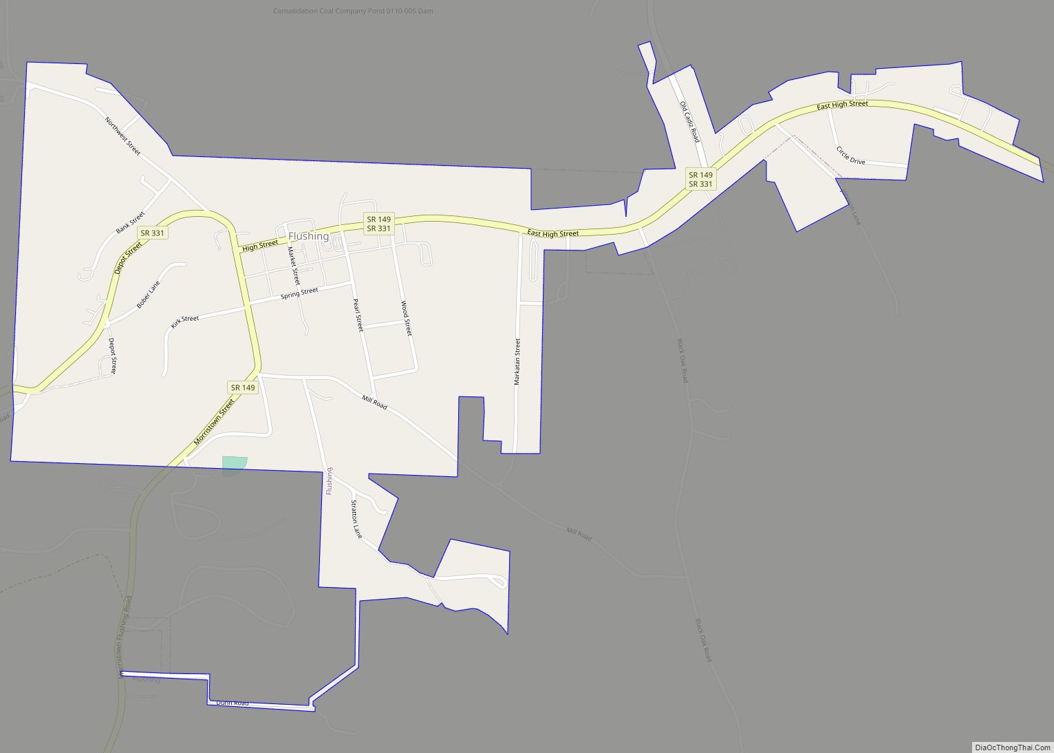
Online Interactive Map
Click on ![]() to view map in "full screen" mode.
to view map in "full screen" mode.
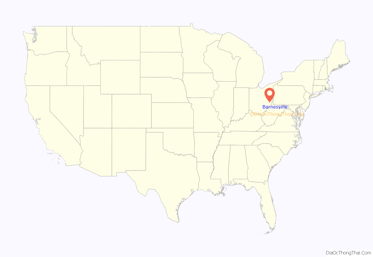
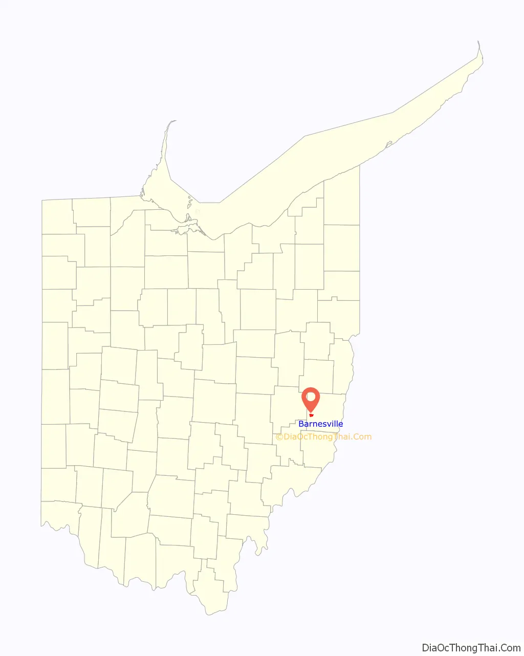
Barnesville location map. Where is Barnesville village?
History
The town was named after James Barnes, who was the first settler. Barnes was born in Montgomery County, Maryland and was married to Nancy Harrison, “an intelligent Quaker lady”. Barnes owned a farm in Montgomery County, and later laid out a town there, also known as Barnesville, Maryland, where he operated a country store for a while.
In 1803 he moved to St. Clairsville, Ohio where he operated a tavern and general store. In 1806 Barnes settled in Warren Township in Belmont County where he cleared forest, built a house, established a tannery and general store and planted orchards. In November 1808, the town of Barnesville was laid out, and four years later Mr. Barnes and his family became permanent residents of the new village. Barnesville was described in 1833 as having six stores and a steam mill.
Barnesville was incorporated as a village in 1835.
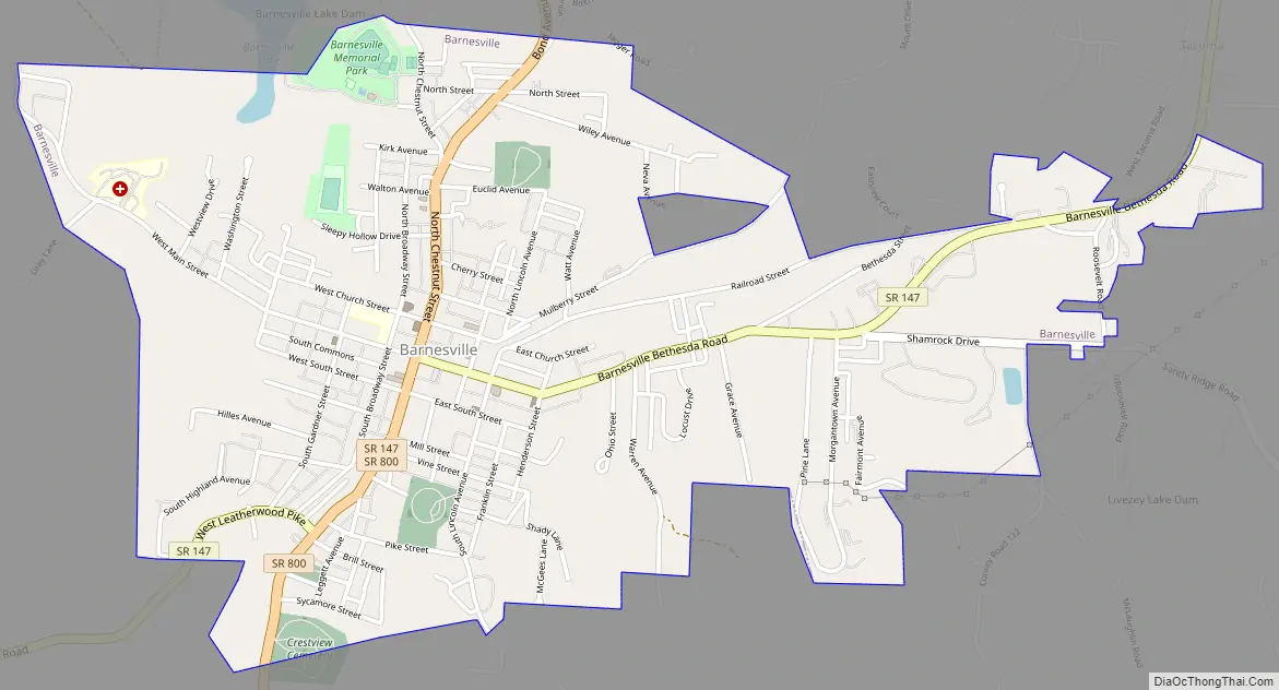
Barnesville Road Map
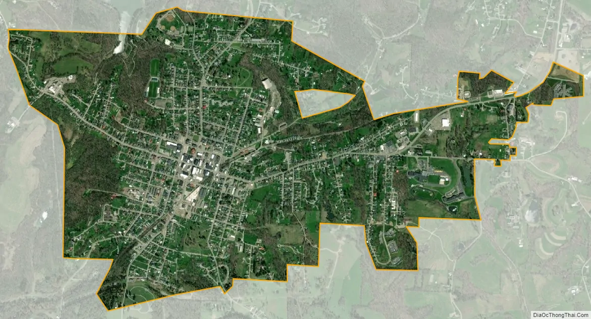
Barnesville city Satellite Map
Geography
Barnesville is located at 39°59′17″N 81°10′32″W / 39.988129°N 81.175483°W / 39.988129; -81.175483.
According to the United States Census Bureau, the village has a total area of 1.95 square miles (5.05 km), of which, 1.94 square miles (5.02 km) is land and 0.01 square miles (0.03 km) is water.
Climate
See also
Map of Ohio State and its subdivision:- Adams
- Allen
- Ashland
- Ashtabula
- Athens
- Auglaize
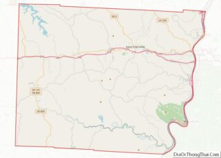
- Belmont
- Brown
- Butler
- Carroll
- Champaign
- Clark
- Clermont
- Clinton
- Columbiana
- Coshocton
- Crawford
- Cuyahoga
- Darke
- Defiance
- Delaware
- Erie
- Fairfield
- Fayette
- Franklin
- Fulton
- Gallia
- Geauga
- Greene
- Guernsey
- Hamilton
- Hancock
- Hardin
- Harrison
- Henry
- Highland
- Hocking
- Holmes
- Huron
- Jackson
- Jefferson
- Knox
- Lake
- Lake Erie
- Lawrence
- Licking
- Logan
- Lorain
- Lucas
- Madison
- Mahoning
- Marion
- Medina
- Meigs
- Mercer
- Miami
- Monroe
- Montgomery
- Morgan
- Morrow
- Muskingum
- Noble
- Ottawa
- Paulding
- Perry
- Pickaway
- Pike
- Portage
- Preble
- Putnam
- Richland
- Ross
- Sandusky
- Scioto
- Seneca
- Shelby
- Stark
- Summit
- Trumbull
- Tuscarawas
- Union
- Van Wert
- Vinton
- Warren
- Washington
- Wayne
- Williams
- Wood
- Wyandot
- Alabama
- Alaska
- Arizona
- Arkansas
- California
- Colorado
- Connecticut
- Delaware
- District of Columbia
- Florida
- Georgia
- Hawaii
- Idaho
- Illinois
- Indiana
- Iowa
- Kansas
- Kentucky
- Louisiana
- Maine
- Maryland
- Massachusetts
- Michigan
- Minnesota
- Mississippi
- Missouri
- Montana
- Nebraska
- Nevada
- New Hampshire
- New Jersey
- New Mexico
- New York
- North Carolina
- North Dakota
- Ohio
- Oklahoma
- Oregon
- Pennsylvania
- Rhode Island
- South Carolina
- South Dakota
- Tennessee
- Texas
- Utah
- Vermont
- Virginia
- Washington
- West Virginia
- Wisconsin
- Wyoming