Beaverdam is a village in Richland Township, Allen County, Ohio, United States. Its population was 319 at the 2020 census. Beaverdam is part of the Lima, Ohio Metropolitan Statistical Area.
| Name: | Beaverdam village |
|---|---|
| LSAD Code: | 47 |
| LSAD Description: | village (suffix) |
| State: | Ohio |
| County: | Allen County |
| Elevation: | 856 ft (261 m) |
| Total Area: | 0.63 sq mi (1.63 km²) |
| Land Area: | 0.63 sq mi (1.63 km²) |
| Water Area: | 0.00 sq mi (0.00 km²) |
| Total Population: | 319 |
| Population Density: | 506.35/sq mi (195.54/km²) |
| ZIP code: | 45808 |
| Area code: | 419 |
| FIPS code: | 3904752 |
| GNISfeature ID: | 1058166 |
| Website: | www.beaverdamoh.com |
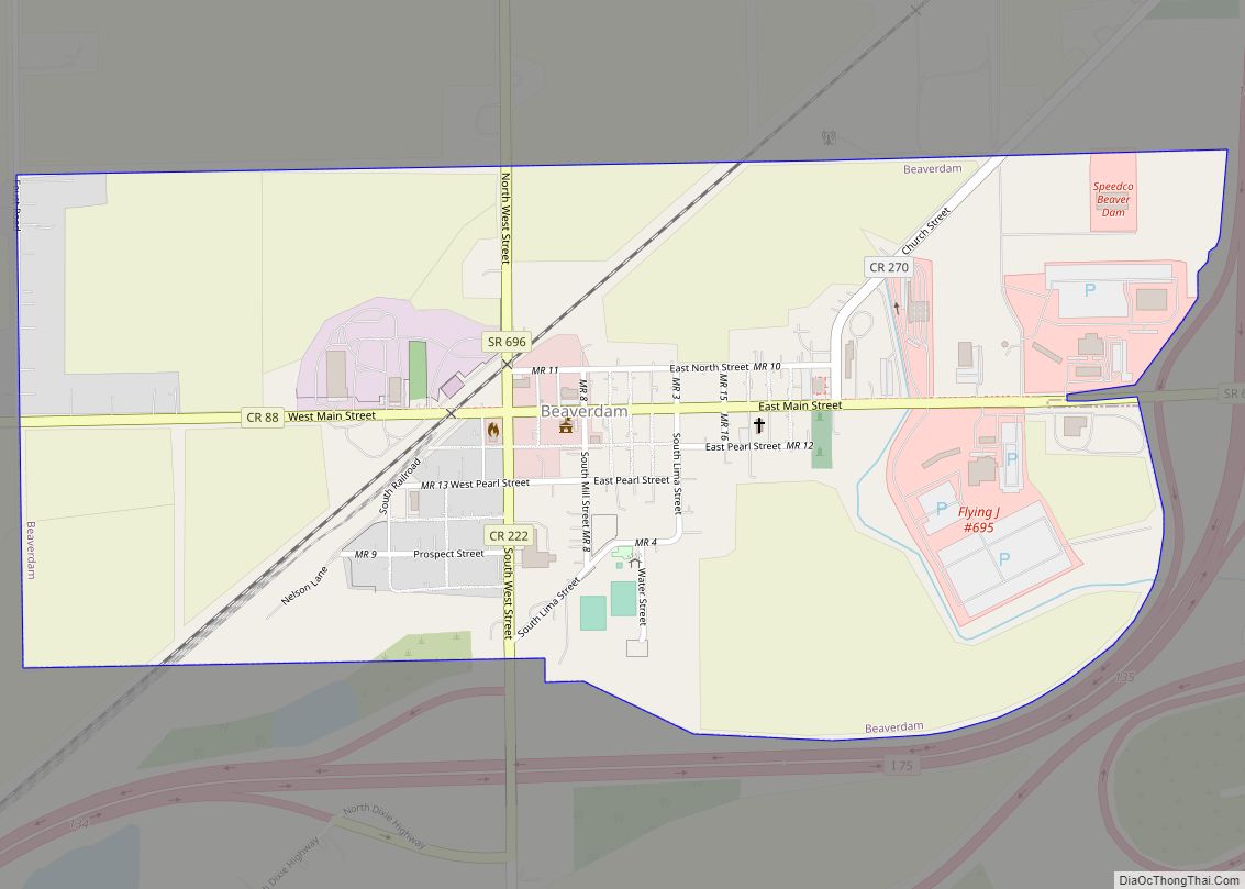
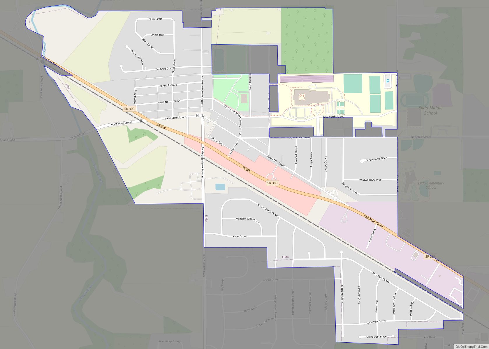
Online Interactive Map
Click on ![]() to view map in "full screen" mode.
to view map in "full screen" mode.
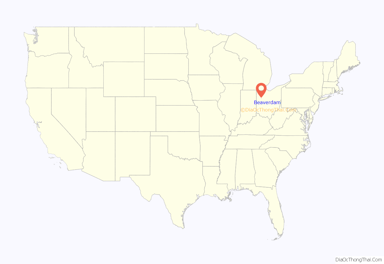
Beaverdam location map. Where is Beaverdam village?
History
Beaverdam was laid out in 1853. The village was so named on account of there being beaver dams near the original town site. A post office called Beaver Dam was established in 1850, the name was changed to Beaverdam in 1895, and the post office closed in 2006. The village was incorporated in 1878.
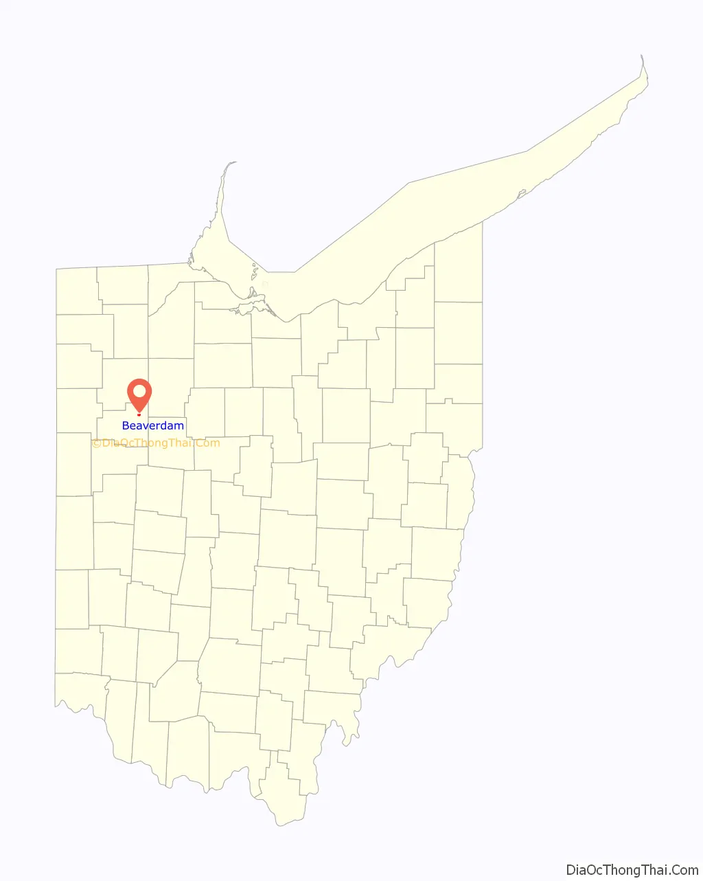
Beaverdam Road Map
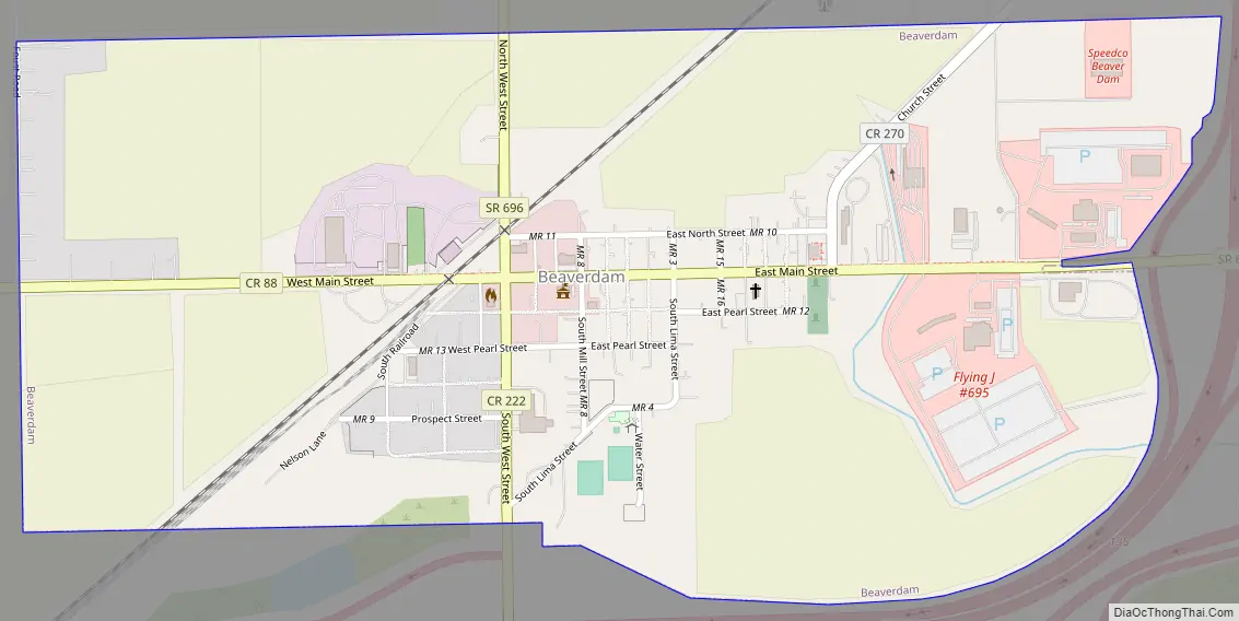
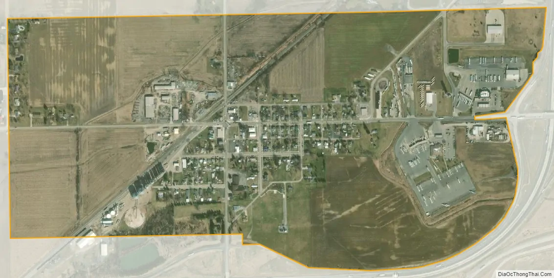
Beaverdam city Satellite Map
Geography
Beaverdam is located at 40°49′57″N 83°58′24″W / 40.83250°N 83.97333°W / 40.83250; -83.97333 (40.832363, -83.973430).
According to the United States Census Bureau, the village has a total area of 0.61 square miles (1.58 km), all land.
Transportation
Beaverdam lies at the junction of the old Lincoln Highway and the Dixie Highway. These early highways were begun in 1914.
Currently Beaverdam’s economy is dominated by three large truck stops on what is now the junction of Interstate 75 and U.S. Route 30. Beaverdam was the eastern terminus of the four lane section of US 30. This meant that vehicular traffic going east on the four lane portion of US 30 that extended from Fort Wayne, Indiana had to exit the four-lane road and shift to a two-lane road. This required exit enhanced the village’s function as an area for refueling of vehicles. US 30 is now a continuous four-lane highway in this part of Ohio that bypasses Beaverdam, but the significance of the junction as a major fuel stop has not been diminished. In the summer of 2006 the exit ramps and overpass on I-75 were widened to accommodate heavy truck and car traffic to the truck stops.
See also
Map of Ohio State and its subdivision:- Adams
- Allen
- Ashland
- Ashtabula
- Athens
- Auglaize
- Belmont
- Brown
- Butler
- Carroll
- Champaign
- Clark
- Clermont
- Clinton
- Columbiana
- Coshocton
- Crawford
- Cuyahoga
- Darke
- Defiance
- Delaware
- Erie
- Fairfield
- Fayette
- Franklin
- Fulton
- Gallia
- Geauga
- Greene
- Guernsey
- Hamilton
- Hancock
- Hardin
- Harrison
- Henry
- Highland
- Hocking
- Holmes
- Huron
- Jackson
- Jefferson
- Knox
- Lake
- Lake Erie
- Lawrence
- Licking
- Logan
- Lorain
- Lucas
- Madison
- Mahoning
- Marion
- Medina
- Meigs
- Mercer
- Miami
- Monroe
- Montgomery
- Morgan
- Morrow
- Muskingum
- Noble
- Ottawa
- Paulding
- Perry
- Pickaway
- Pike
- Portage
- Preble
- Putnam
- Richland
- Ross
- Sandusky
- Scioto
- Seneca
- Shelby
- Stark
- Summit
- Trumbull
- Tuscarawas
- Union
- Van Wert
- Vinton
- Warren
- Washington
- Wayne
- Williams
- Wood
- Wyandot
- Alabama
- Alaska
- Arizona
- Arkansas
- California
- Colorado
- Connecticut
- Delaware
- District of Columbia
- Florida
- Georgia
- Hawaii
- Idaho
- Illinois
- Indiana
- Iowa
- Kansas
- Kentucky
- Louisiana
- Maine
- Maryland
- Massachusetts
- Michigan
- Minnesota
- Mississippi
- Missouri
- Montana
- Nebraska
- Nevada
- New Hampshire
- New Jersey
- New Mexico
- New York
- North Carolina
- North Dakota
- Ohio
- Oklahoma
- Oregon
- Pennsylvania
- Rhode Island
- South Carolina
- South Dakota
- Tennessee
- Texas
- Utah
- Vermont
- Virginia
- Washington
- West Virginia
- Wisconsin
- Wyoming