Beckett Ridge is a census-designated place (CDP) in West Chester Township, Butler County, Ohio, United States. The population was 9,187 at the 2010 census.
| Name: | Beckett Ridge CDP |
|---|---|
| LSAD Code: | 57 |
| LSAD Description: | CDP (suffix) |
| State: | Ohio |
| County: | Butler County |
| Elevation: | 817 ft (249 m) |
| Total Area: | 4.80 sq mi (12.44 km²) |
| Land Area: | 4.80 sq mi (12.44 km²) |
| Water Area: | 0.00 sq mi (0.00 km²) |
| Total Population: | 9,192 |
| Population Density: | 1,914.20/sq mi (739.14/km²) |
| FIPS code: | 3904840 |
| GNISfeature ID: | 1867445 |
Online Interactive Map
Click on ![]() to view map in "full screen" mode.
to view map in "full screen" mode.
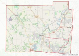
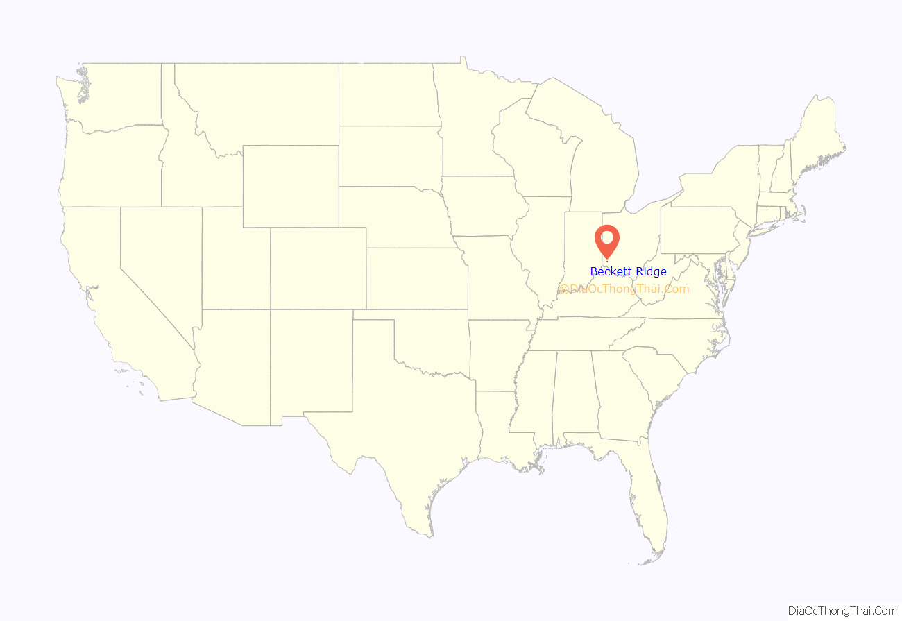
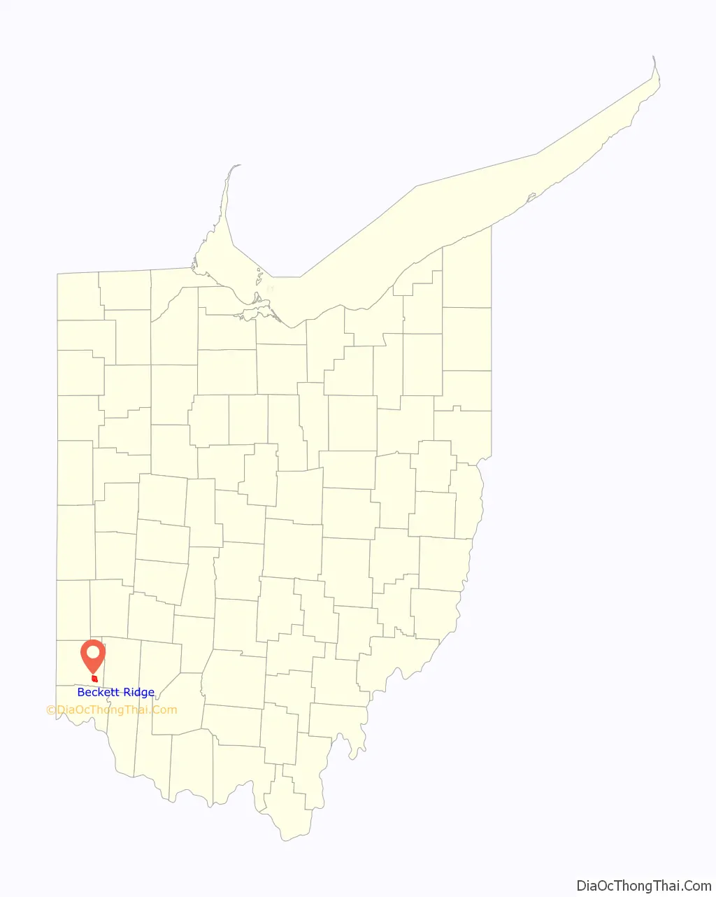
Beckett Ridge location map. Where is Beckett Ridge CDP?
History
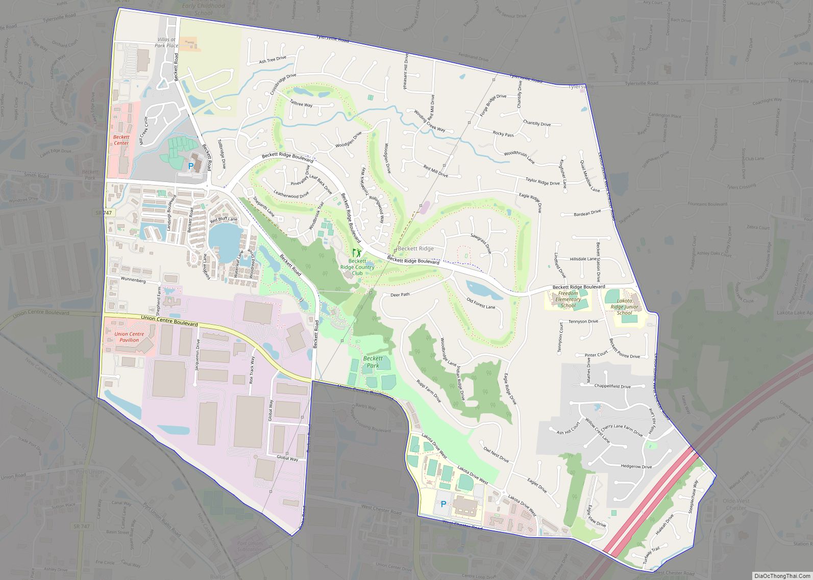
Beckett Ridge began as a planned community in the 1970s. Beckett Ridge occupies an area once operated as a farm by the Beckett family. Beckett Ridge was developed by Gary L. Schottenstein, chairman and CEO of Schottenstein Real Estate Group. It was the largest planned unit development in Ohio at the time.
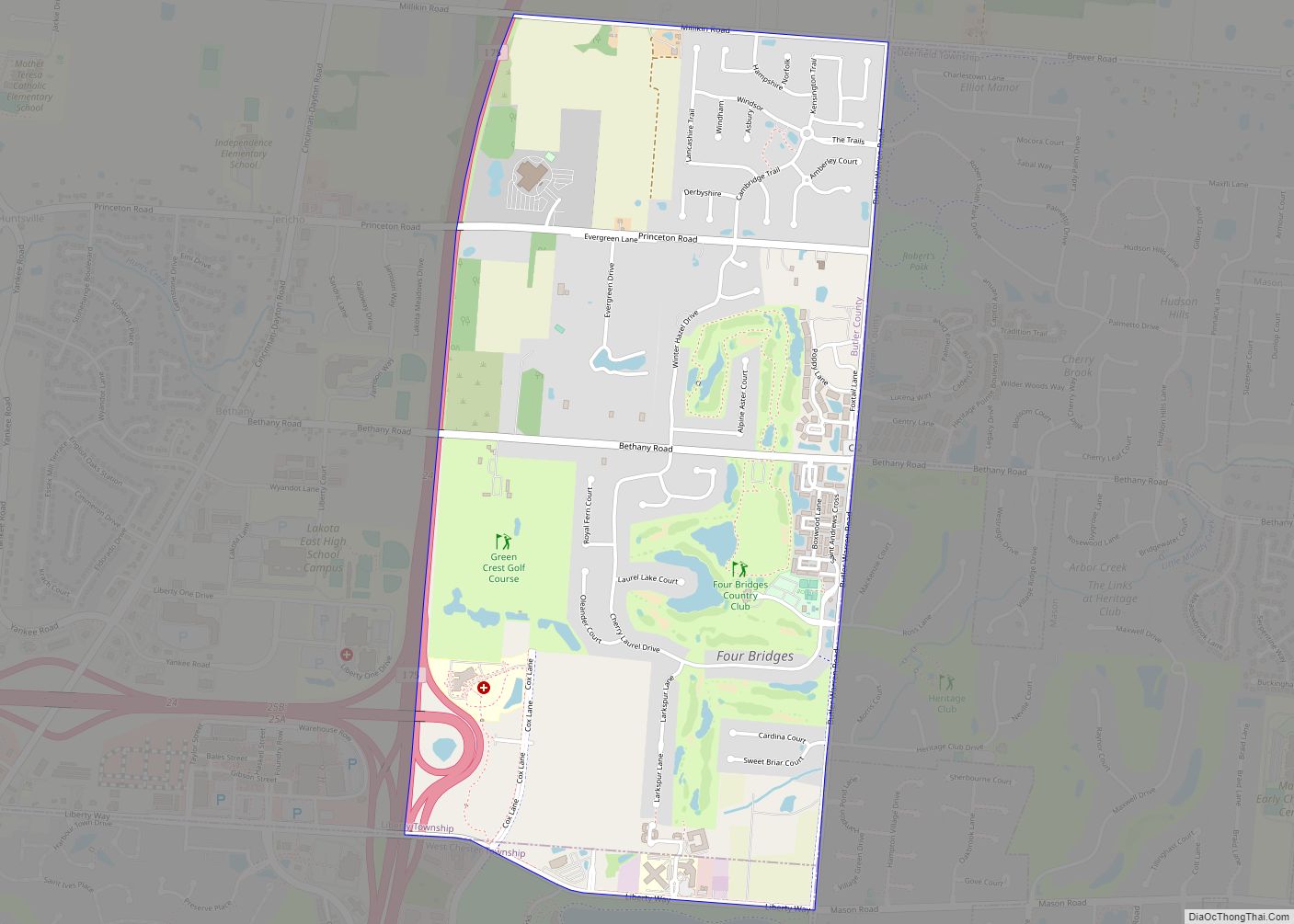
Beckett Ridge Road Map
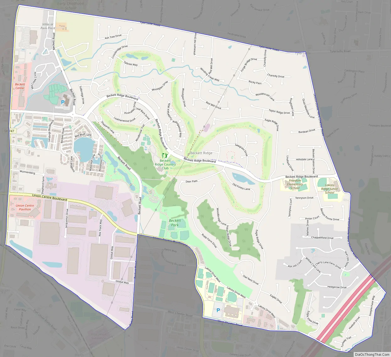
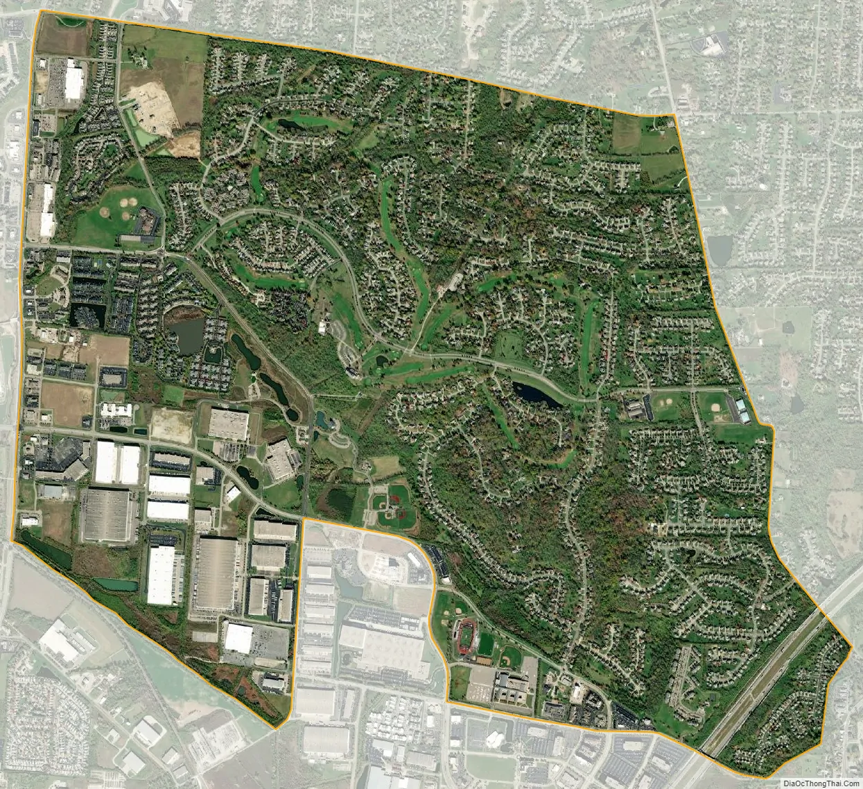
Beckett Ridge city Satellite Map
Geography
Beckett Ridge is located in southeastern Butler County, in the west-central part of West Chester Township at 39°20′57″N 84°26′20″W / 39.34917°N 84.43889°W / 39.34917; -84.43889Coordinates: 39°20′57″N 84°26′20″W / 39.34917°N 84.43889°W / 39.34917; -84.43889 (39.349272, -84.438855). It is centered on the Beckett Ridge Golf Club, occupying high ground to the north of the valley of Mill Creek.
Interstate 75 cuts across the southeast corner of the CDP, with the closest access from Exit 19 (Union Centre Boulevard). State Route 747 forms the western edge of the CDP, leading south into Glendale and north towards Middletown.
According to the United States Census Bureau, the CDP has a total area of 4.8 square miles (12.4 km), all land.
See also
Map of Ohio State and its subdivision:- Adams
- Allen
- Ashland
- Ashtabula
- Athens
- Auglaize
- Belmont
- Brown
- Butler
- Carroll
- Champaign
- Clark
- Clermont
- Clinton
- Columbiana
- Coshocton
- Crawford
- Cuyahoga
- Darke
- Defiance
- Delaware
- Erie
- Fairfield
- Fayette
- Franklin
- Fulton
- Gallia
- Geauga
- Greene
- Guernsey
- Hamilton
- Hancock
- Hardin
- Harrison
- Henry
- Highland
- Hocking
- Holmes
- Huron
- Jackson
- Jefferson
- Knox
- Lake
- Lake Erie
- Lawrence
- Licking
- Logan
- Lorain
- Lucas
- Madison
- Mahoning
- Marion
- Medina
- Meigs
- Mercer
- Miami
- Monroe
- Montgomery
- Morgan
- Morrow
- Muskingum
- Noble
- Ottawa
- Paulding
- Perry
- Pickaway
- Pike
- Portage
- Preble
- Putnam
- Richland
- Ross
- Sandusky
- Scioto
- Seneca
- Shelby
- Stark
- Summit
- Trumbull
- Tuscarawas
- Union
- Van Wert
- Vinton
- Warren
- Washington
- Wayne
- Williams
- Wood
- Wyandot
- Alabama
- Alaska
- Arizona
- Arkansas
- California
- Colorado
- Connecticut
- Delaware
- District of Columbia
- Florida
- Georgia
- Hawaii
- Idaho
- Illinois
- Indiana
- Iowa
- Kansas
- Kentucky
- Louisiana
- Maine
- Maryland
- Massachusetts
- Michigan
- Minnesota
- Mississippi
- Missouri
- Montana
- Nebraska
- Nevada
- New Hampshire
- New Jersey
- New Mexico
- New York
- North Carolina
- North Dakota
- Ohio
- Oklahoma
- Oregon
- Pennsylvania
- Rhode Island
- South Carolina
- South Dakota
- Tennessee
- Texas
- Utah
- Vermont
- Virginia
- Washington
- West Virginia
- Wisconsin
- Wyoming