Blacklick Estates is a census-designated place (CDP) in Franklin County, Ohio, United States: partly in Madison Township and partly in Truro Township. As of the 2010 census the population was 8,682, down from 9,518 at the 2000 census.
| Name: | Blacklick Estates CDP |
|---|---|
| LSAD Code: | 57 |
| LSAD Description: | CDP (suffix) |
| State: | Ohio |
| County: | Franklin County |
| Elevation: | 751 ft (229 m) |
| Total Area: | 1.91 sq mi (4.94 km²) |
| Land Area: | 1.89 sq mi (4.89 km²) |
| Water Area: | 0.02 sq mi (0.05 km²) |
| Total Population: | 8,990 |
| Population Density: | 4,761.65/sq mi (1,838.41/km²) |
| FIPS code: | 3906670 |
| GNISfeature ID: | 1867447 |
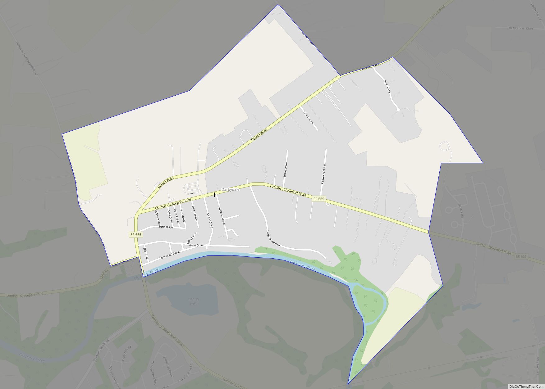
Online Interactive Map
Click on ![]() to view map in "full screen" mode.
to view map in "full screen" mode.
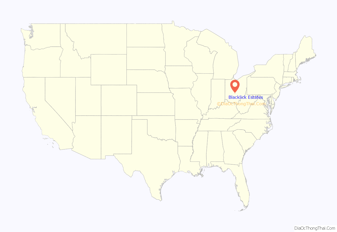
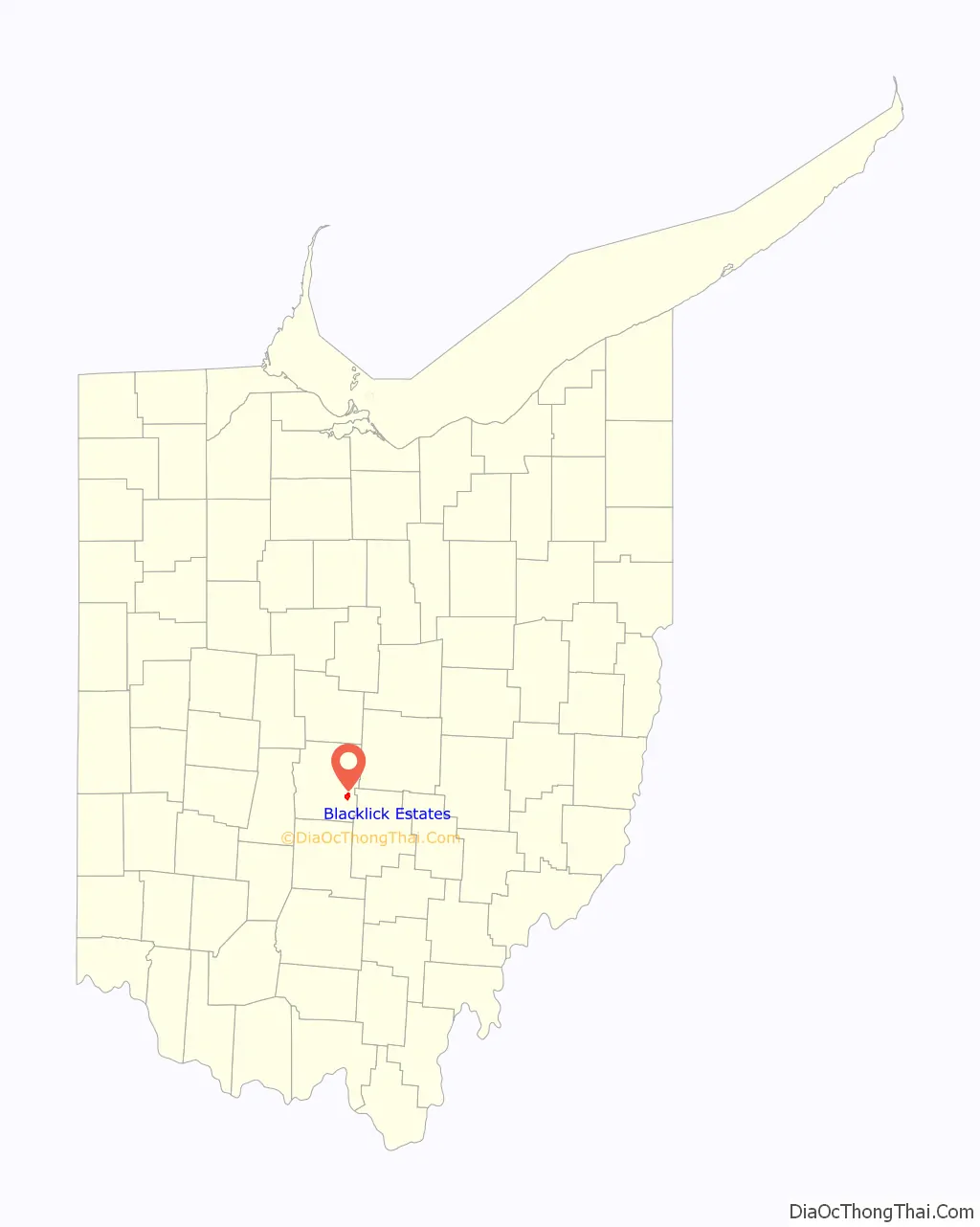
Blacklick Estates location map. Where is Blacklick Estates CDP?
History
Three hundred homes in Blacklick Estates were flooded on September 14, 1979, when Blacklick Creek topped a levee due to heavy rains from Hurricane Frederic.
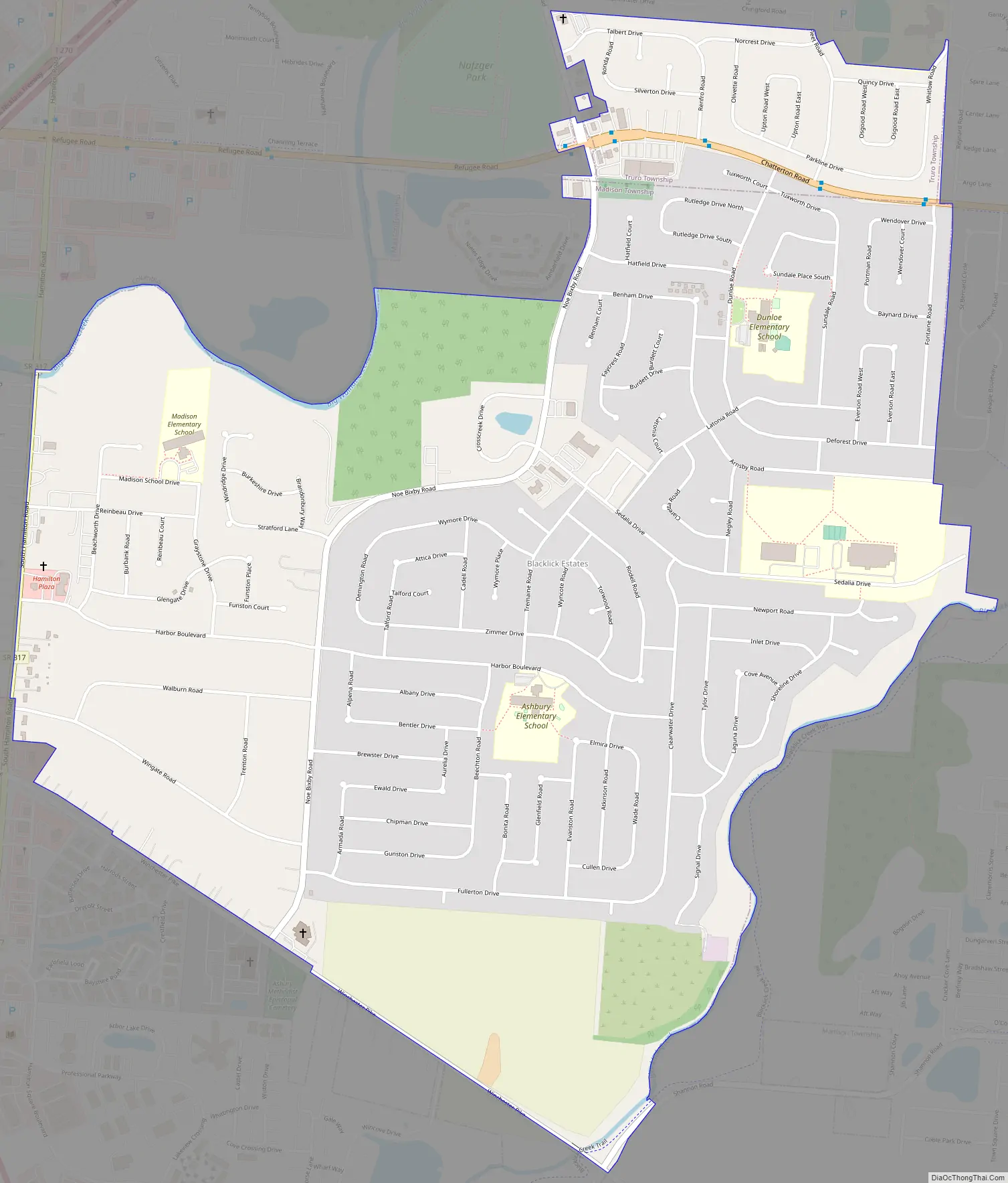
Blacklick Estates Road Map
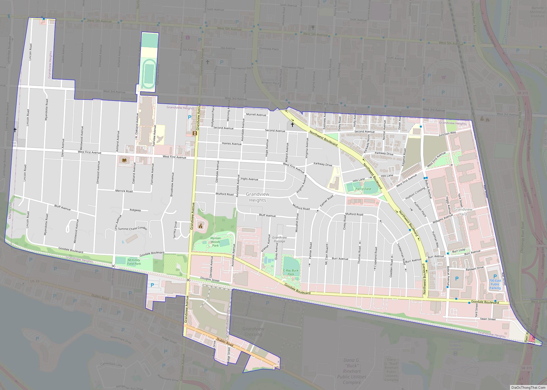
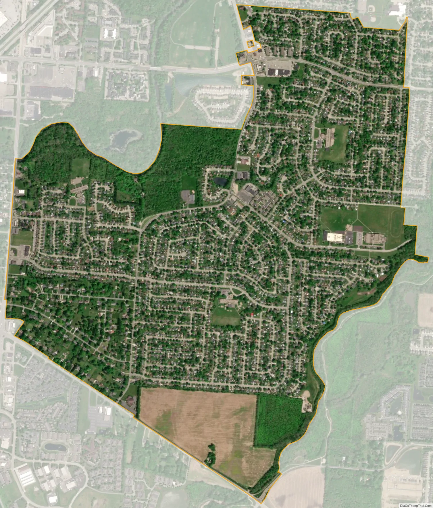
Blacklick Estates city Satellite Map
Geography
Blacklick Estates is located in southeastern Franklin County at 39°54′25″N 82°51′47″W / 39.90694°N 82.86306°W / 39.90694; -82.86306 (39.907034, -82.863025). It is bordered to the north, east, and south by the city of Columbus, and to the west by unincorporated land in Madison Township. Ohio State Route 317 (S. Hamilton Road) forms the western edge of the CDP. Downtown Columbus is 10 miles (16 km) to the northwest.
According to the United States Census Bureau, the CDP has a total area of 1.92 square miles (4.96 km), of which 0.023 square miles (0.06 km), or 1.25%, is water.
See also
Map of Ohio State and its subdivision:- Adams
- Allen
- Ashland
- Ashtabula
- Athens
- Auglaize
- Belmont
- Brown
- Butler
- Carroll
- Champaign
- Clark
- Clermont
- Clinton
- Columbiana
- Coshocton
- Crawford
- Cuyahoga
- Darke
- Defiance
- Delaware
- Erie
- Fairfield
- Fayette
- Franklin
- Fulton
- Gallia
- Geauga
- Greene
- Guernsey
- Hamilton
- Hancock
- Hardin
- Harrison
- Henry
- Highland
- Hocking
- Holmes
- Huron
- Jackson
- Jefferson
- Knox
- Lake
- Lake Erie
- Lawrence
- Licking
- Logan
- Lorain
- Lucas
- Madison
- Mahoning
- Marion
- Medina
- Meigs
- Mercer
- Miami
- Monroe
- Montgomery
- Morgan
- Morrow
- Muskingum
- Noble
- Ottawa
- Paulding
- Perry
- Pickaway
- Pike
- Portage
- Preble
- Putnam
- Richland
- Ross
- Sandusky
- Scioto
- Seneca
- Shelby
- Stark
- Summit
- Trumbull
- Tuscarawas
- Union
- Van Wert
- Vinton
- Warren
- Washington
- Wayne
- Williams
- Wood
- Wyandot
- Alabama
- Alaska
- Arizona
- Arkansas
- California
- Colorado
- Connecticut
- Delaware
- District of Columbia
- Florida
- Georgia
- Hawaii
- Idaho
- Illinois
- Indiana
- Iowa
- Kansas
- Kentucky
- Louisiana
- Maine
- Maryland
- Massachusetts
- Michigan
- Minnesota
- Mississippi
- Missouri
- Montana
- Nebraska
- Nevada
- New Hampshire
- New Jersey
- New Mexico
- New York
- North Carolina
- North Dakota
- Ohio
- Oklahoma
- Oregon
- Pennsylvania
- Rhode Island
- South Carolina
- South Dakota
- Tennessee
- Texas
- Utah
- Vermont
- Virginia
- Washington
- West Virginia
- Wisconsin
- Wyoming