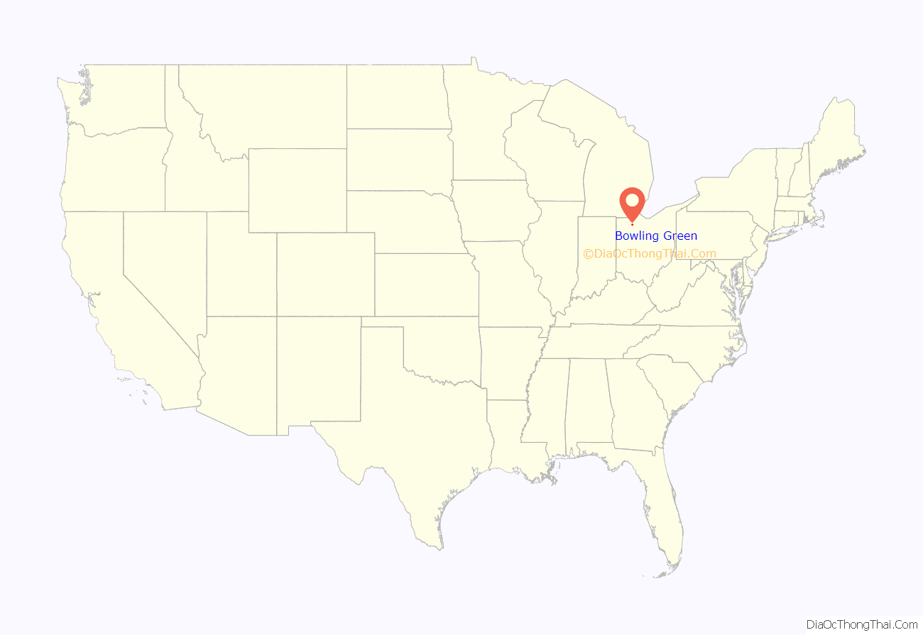
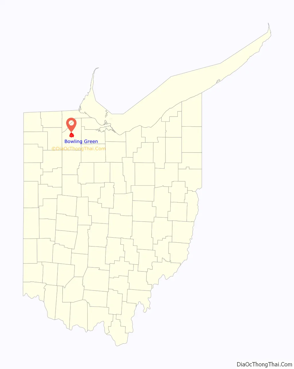
Bowling Green is a city in and the county seat of Wood County, Ohio, United States, located 20 miles (32 km) southwest of Toledo. The population was 30,808 at the 2020 census. It is part of the Toledo Metropolitan Area and a member of the Toledo Metropolitan Area Council of Governments. Bowling Green is the home of Bowling Green State University.
| Name: | Bowling Green city |
|---|---|
| LSAD Code: | 25 |
| LSAD Description: | city (suffix) |
| State: | Ohio |
| County: | Wood County |
| Incorporated: | 1901 |
| Elevation: | 696 ft (212 m) |
| Land Area: | 12.86 sq mi (33.32 km²) |
| Water Area: | 0.05 sq mi (0.12 km²) 0.40% |
| Population Density: | 2,395.09/sq mi (924.72/km²) |
| Area code: | 419, 567 |
| FIPS code: | 3907972 |
| GNISfeature ID: | 1048538 |
| Website: | https://www.bgohio.org |
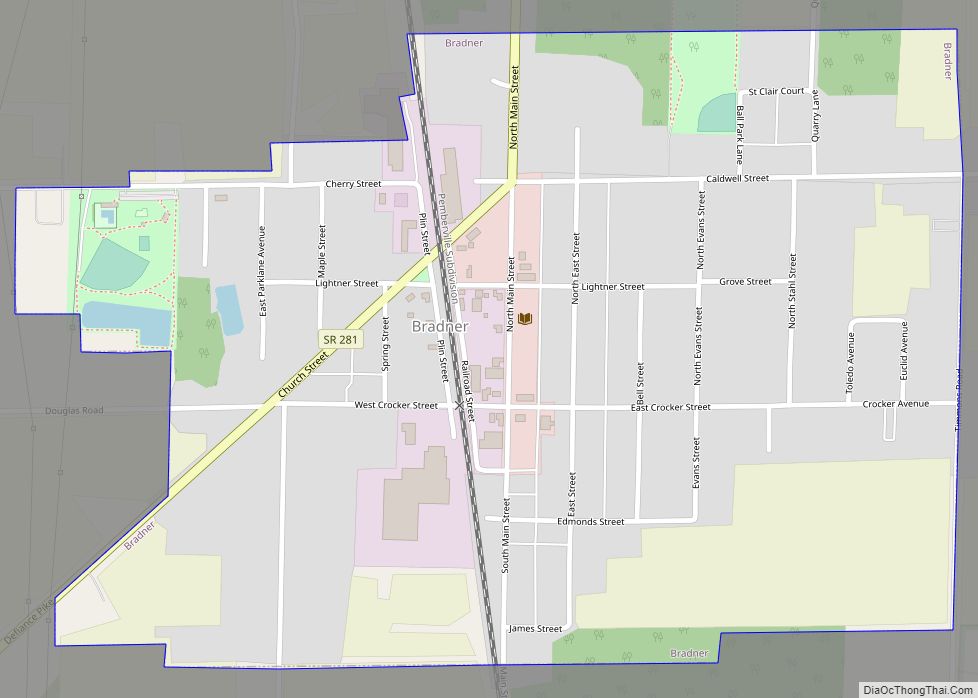
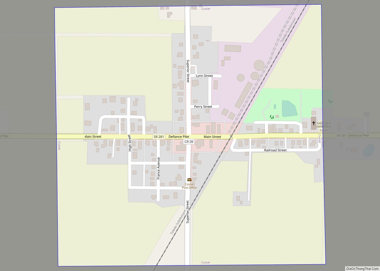
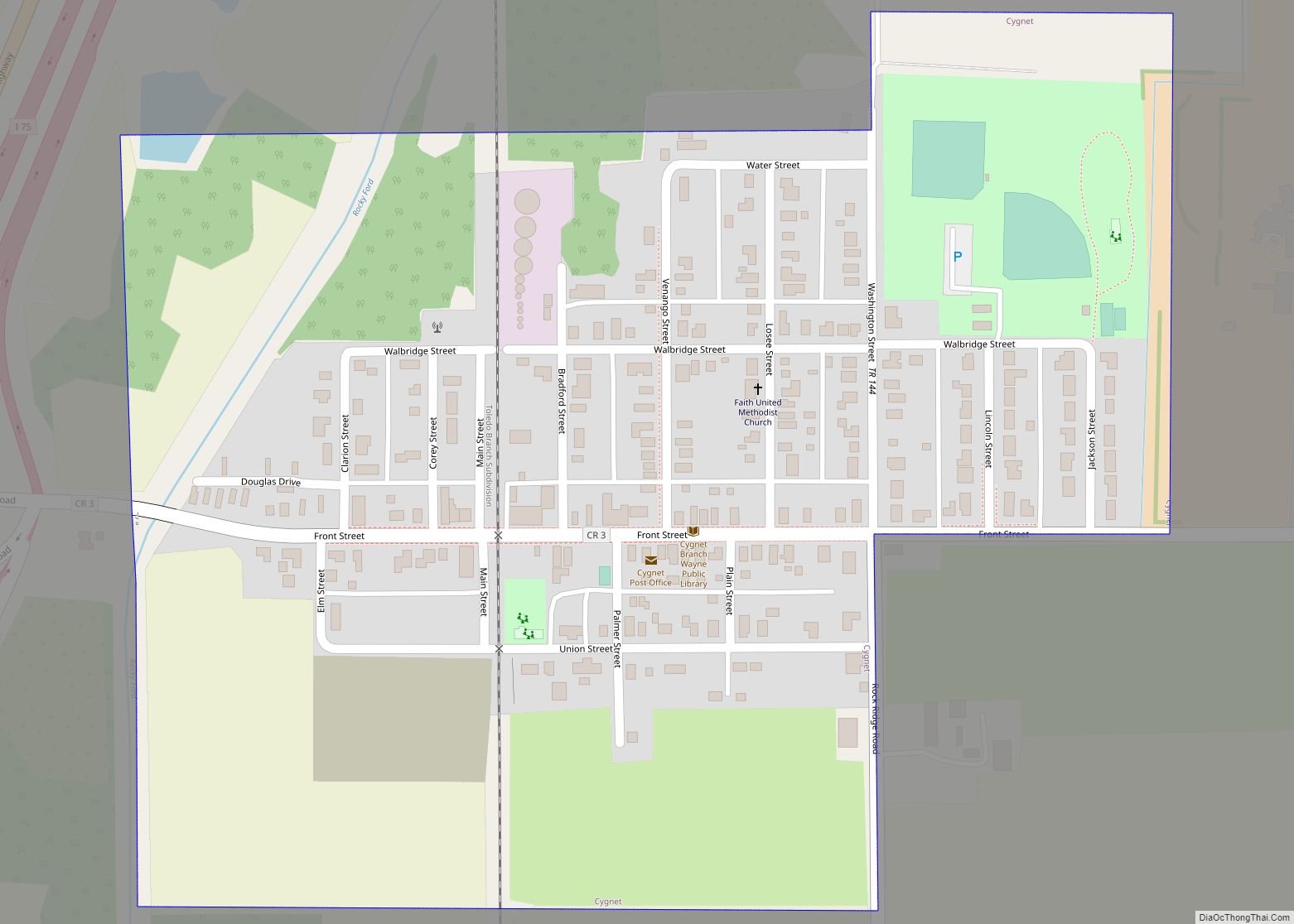
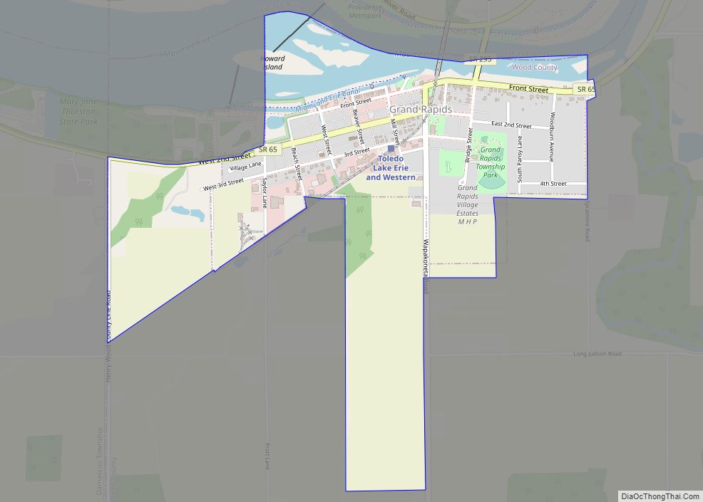
Online Interactive Map
Click on ![]() to view map in "full screen" mode.
to view map in "full screen" mode.
Bowling Green location map. Where is Bowling Green city?
History
Settlement
Bowling Green was first settled in 1832, was incorporated as a town in 1855, and became a city in 1901. The village was named after Bowling Green, Kentucky, by a retired postal worker who had once delivered mail there.
Growth and Oil boom
In 1868 Bowling Green was designated as the county seat, succeeding Perrysburg.
With the discovery of oil in the area in the late 19th and early 20th century, Bowling Green enjoyed a boom to its economy. The results of wealth generated at the time can still be seen in the downtown storefronts, and along Wooster Street, where many of the oldest and largest homes were built. A new county courthouse was also constructed in the 1890s. The Neoclassical US post office was erected in 1913.
Industrialization
This period was followed by an expansion of the automobile industry. In late 1922 or early 1923, Coats Steam Car moved to the area and hired numerous workers. It eventually went out of business as the industry became centralized in Detroit, Michigan.
Bank robbers Pretty Boy Floyd and Billy the Killer encountered police in Bowling Green in April 1931. Their armed confrontation resulted in the death of Billy the Killer.
During World War II Italian and German prisoners of war were held nearby. They were used to staff the Heinz Tomato Ketchup factory in town. The ketchup factory closed in 1975.
A runaway freight train carrying hazardous liquids passed through Bowling Green in 2001, in what is known as the known as the CSX 8888 incident. It traveled more than 65 miles south of Toledo before being stopped by a veteran railroad worker near Kenton; he jumped into the train while it was moving. No one was hurt and there was no property damage in the incident.
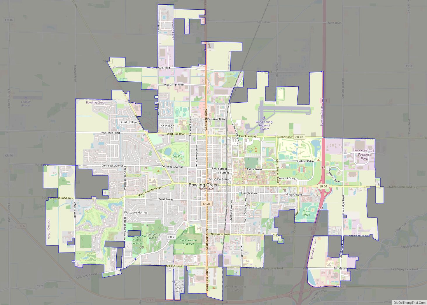
Bowling Green Road Map
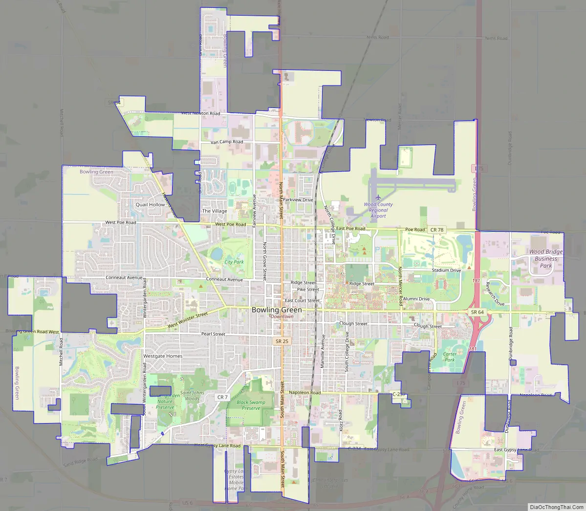
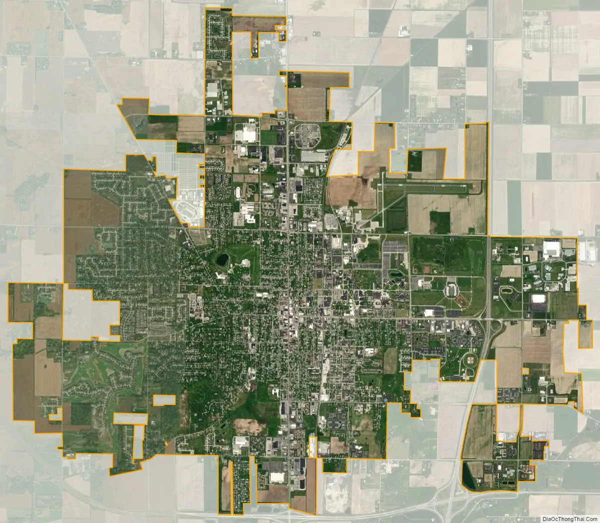
Bowling Green city Satellite Map
Geography
According to the United States Census Bureau, the city has a total area of 12.61 square miles (32.66 km), of which 12.56 square miles (32.53 km) is land and 0.05 square miles (0.13 km) is water. Bowling Green is within an area of land that was once the Great Black Swamp which was drained and settled in the 19th century. The nutrient-rich soil makes for highly productive farm land. Bowling Green, Ohio is in the North Western hemisphere at approximately 41.376132°N, -83.623897°W.
Climate
See also
Map of Ohio State and its subdivision:- Adams
- Allen
- Ashland
- Ashtabula
- Athens
- Auglaize
- Belmont
- Brown
- Butler
- Carroll
- Champaign
- Clark
- Clermont
- Clinton
- Columbiana
- Coshocton
- Crawford
- Cuyahoga
- Darke
- Defiance
- Delaware
- Erie
- Fairfield
- Fayette
- Franklin
- Fulton
- Gallia
- Geauga
- Greene
- Guernsey
- Hamilton
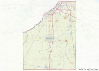
- Hancock
- Hardin
- Harrison
- Henry
- Highland
- Hocking
- Holmes
- Huron
- Jackson
- Jefferson
- Knox
- Lake
- Lake Erie
- Lawrence
- Licking
- Logan
- Lorain
- Lucas
- Madison
- Mahoning
- Marion
- Medina
- Meigs
- Mercer
- Miami
- Monroe
- Montgomery
- Morgan
- Morrow
- Muskingum
- Noble
- Ottawa
- Paulding
- Perry
- Pickaway
- Pike
- Portage
- Preble
- Putnam
- Richland
- Ross
- Sandusky
- Scioto
- Seneca
- Shelby
- Stark
- Summit
- Trumbull
- Tuscarawas
- Union
- Van Wert
- Vinton
- Warren
- Washington
- Wayne
- Williams
- Wood
- Wyandot
- Alabama
- Alaska
- Arizona
- Arkansas
- California
- Colorado
- Connecticut
- Delaware
- District of Columbia
- Florida
- Georgia
- Hawaii
- Idaho
- Illinois
- Indiana
- Iowa
- Kansas
- Kentucky
- Louisiana
- Maine
- Maryland
- Massachusetts
- Michigan
- Minnesota
- Mississippi
- Missouri
- Montana
- Nebraska
- Nevada
- New Hampshire
- New Jersey
- New Mexico
- New York
- North Carolina
- North Dakota
- Ohio
- Oklahoma
- Oregon
- Pennsylvania
- Rhode Island
- South Carolina
- South Dakota
- Tennessee
- Texas
- Utah
- Vermont
- Virginia
- Washington
- West Virginia
- Wisconsin
- Wyoming