Byesville /ˈbaɪzvɪl/ is a village in Guernsey County, Ohio, United States, along Wills Creek. The population was 2,438 at the 2010 census.
| Name: | Byesville village |
|---|---|
| LSAD Code: | 47 |
| LSAD Description: | village (suffix) |
| State: | Ohio |
| County: | Guernsey County |
| Incorporated: | 1882 |
| Elevation: | 817 ft (249 m) |
| Total Area: | 1.21 sq mi (3.12 km²) |
| Land Area: | 1.20 sq mi (3.10 km²) |
| Water Area: | 0.01 sq mi (0.02 km²) |
| Total Population: | 2,364 |
| Population Density: | 1,973.29/sq mi (761.75/km²) |
| ZIP code: | 43723 |
| Area code: | 740 |
| FIPS code: | 3910716 |
| GNISfeature ID: | 1056747 |
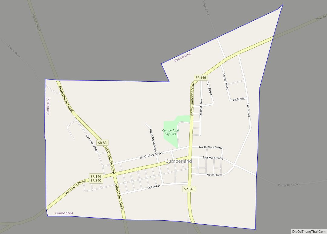
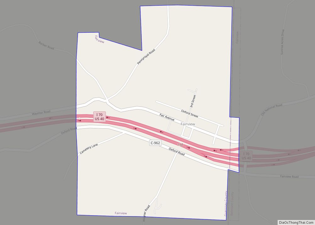
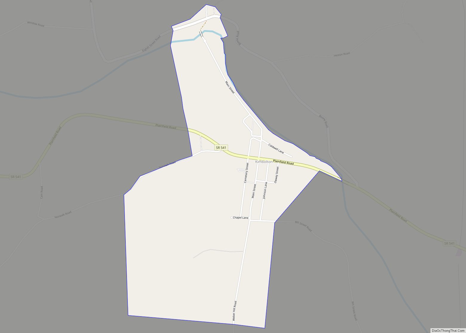
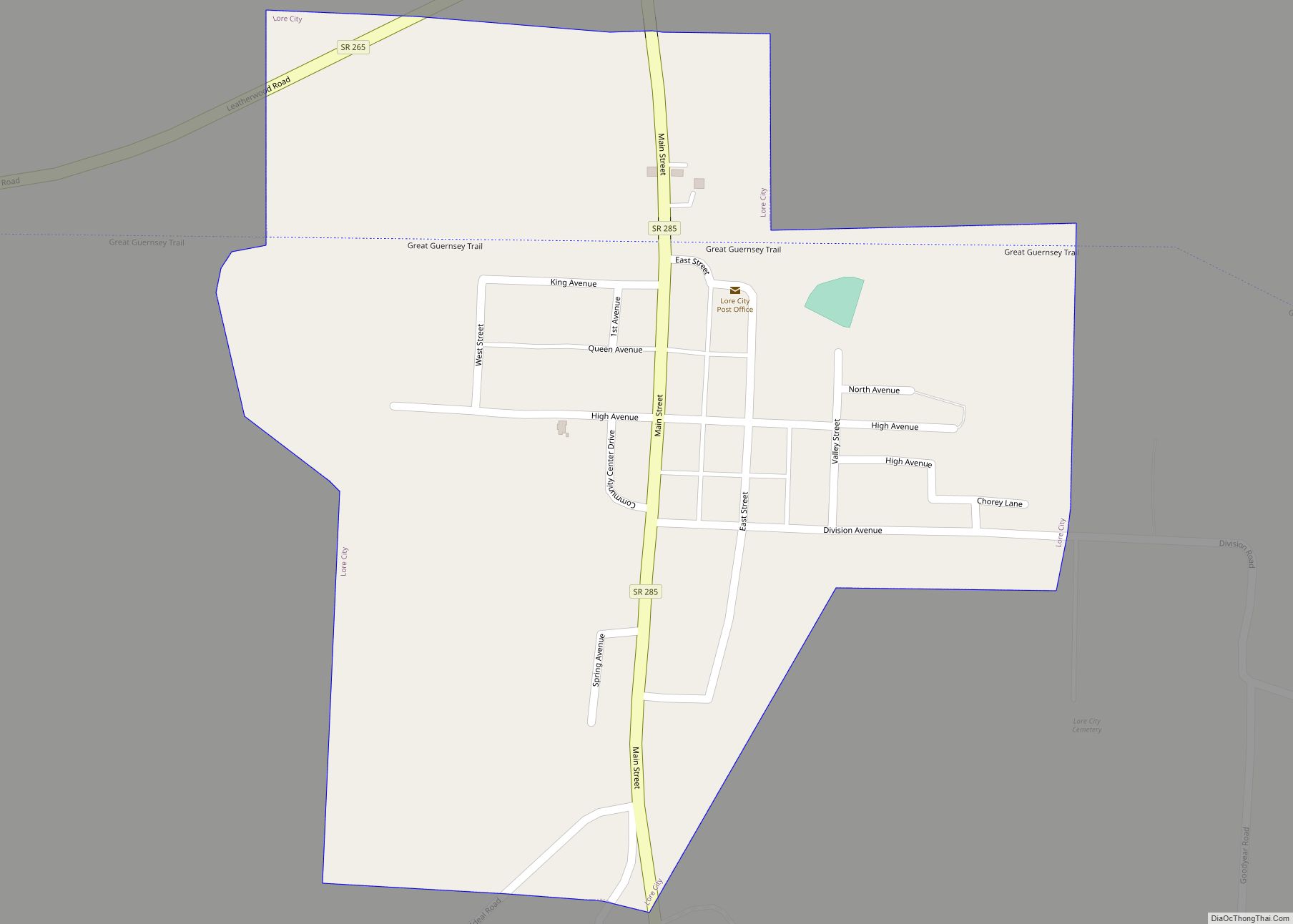
Online Interactive Map
Click on ![]() to view map in "full screen" mode.
to view map in "full screen" mode.
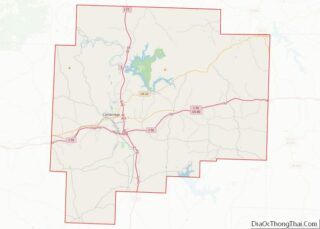
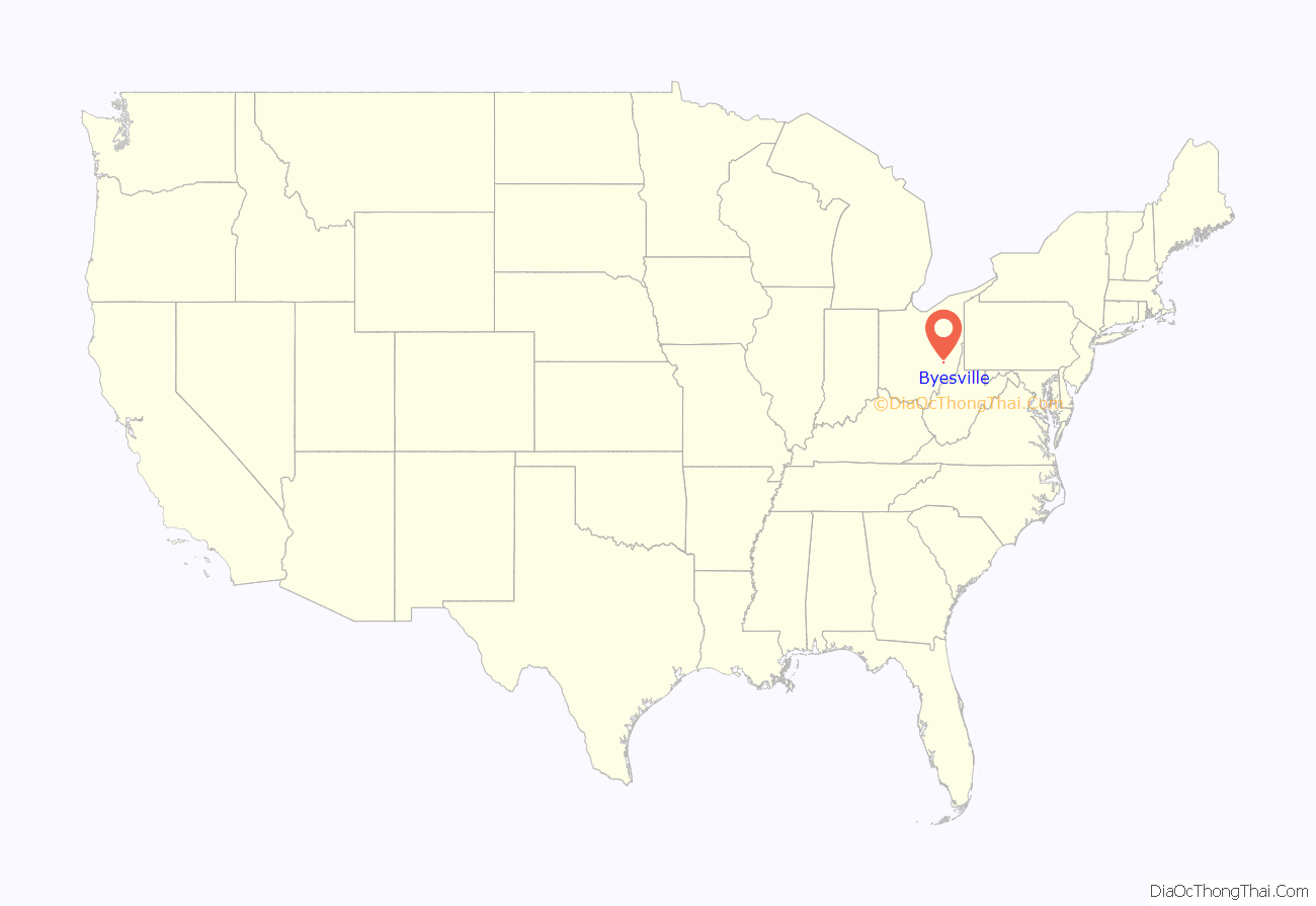
Byesville location map. Where is Byesville village?
History
Byesville was platted in 1856, and named for Jonathan Bye, the owner of a local mill. The village was incorporated in 1881.
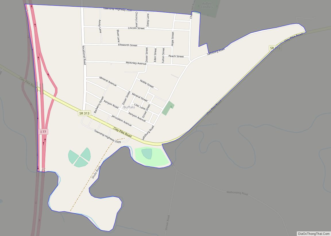
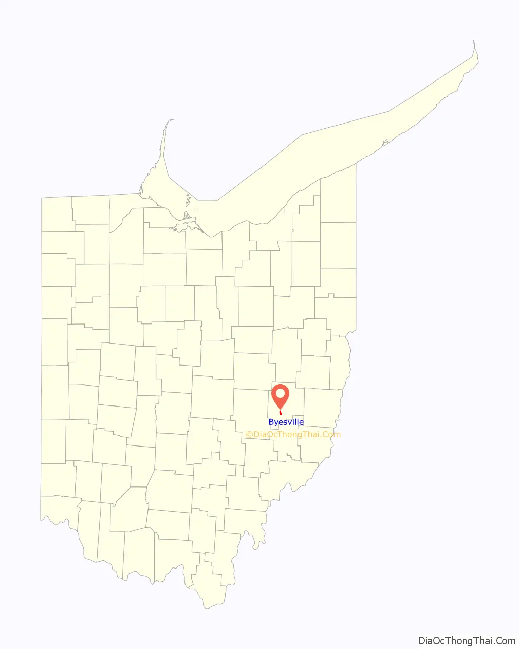
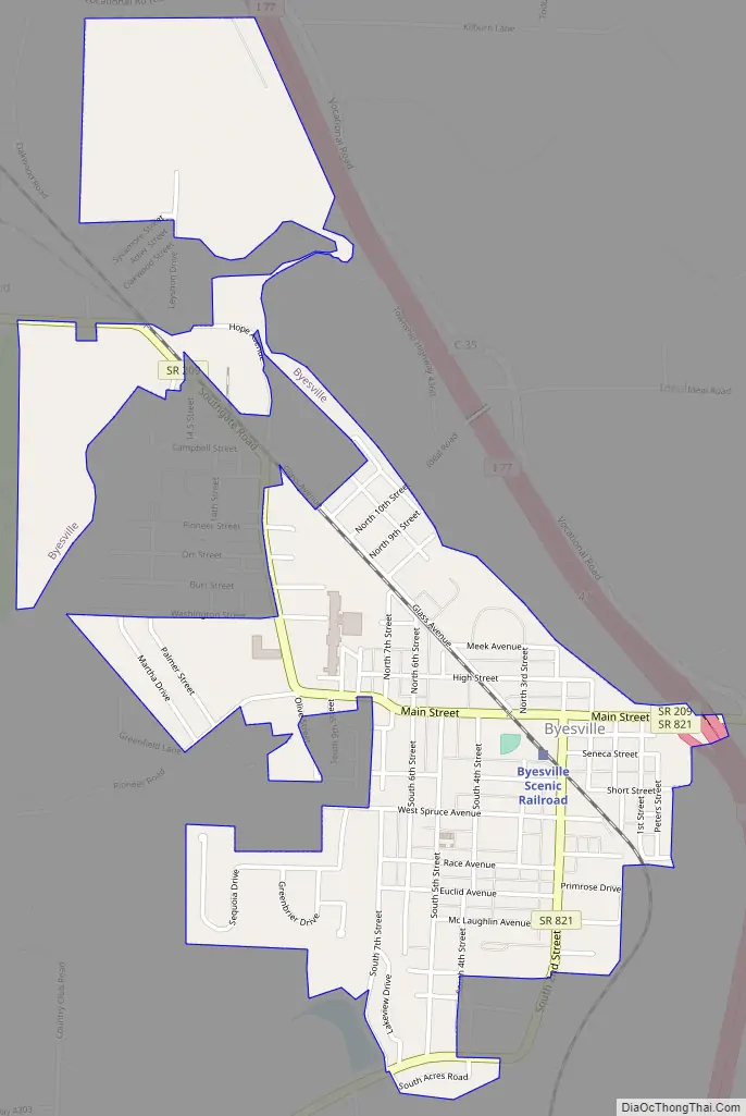
Byesville Road Map
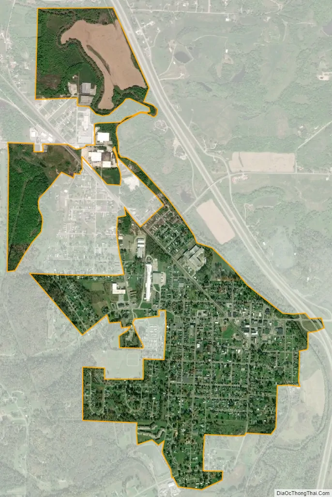
Byesville city Satellite Map
Geography
Byesville is located at 39°58′8″N 81°32′28″W / 39.96889°N 81.54111°W / 39.96889; -81.54111 (39.968985, -81.541087).
According to the United States Census Bureau, the village has a total area of 1.19 square miles (3.08 km), all land. Byesville is drained by Wills Creek.
The village is crossed by Interstate 77, Ohio State Route 209, Ohio State Route 821 and Interstate 70, about two miles north of the village.
See also
Map of Ohio State and its subdivision:- Adams
- Allen
- Ashland
- Ashtabula
- Athens
- Auglaize
- Belmont
- Brown
- Butler
- Carroll
- Champaign
- Clark
- Clermont
- Clinton
- Columbiana
- Coshocton
- Crawford
- Cuyahoga
- Darke
- Defiance
- Delaware
- Erie
- Fairfield
- Fayette
- Franklin
- Fulton
- Gallia
- Geauga
- Greene
- Guernsey
- Hamilton
- Hancock
- Hardin
- Harrison
- Henry
- Highland
- Hocking
- Holmes
- Huron
- Jackson
- Jefferson
- Knox
- Lake
- Lake Erie
- Lawrence
- Licking
- Logan
- Lorain
- Lucas
- Madison
- Mahoning
- Marion
- Medina
- Meigs
- Mercer
- Miami
- Monroe
- Montgomery
- Morgan
- Morrow
- Muskingum
- Noble
- Ottawa
- Paulding
- Perry
- Pickaway
- Pike
- Portage
- Preble
- Putnam
- Richland
- Ross
- Sandusky
- Scioto
- Seneca
- Shelby
- Stark
- Summit
- Trumbull
- Tuscarawas
- Union
- Van Wert
- Vinton
- Warren
- Washington
- Wayne
- Williams
- Wood
- Wyandot
- Alabama
- Alaska
- Arizona
- Arkansas
- California
- Colorado
- Connecticut
- Delaware
- District of Columbia
- Florida
- Georgia
- Hawaii
- Idaho
- Illinois
- Indiana
- Iowa
- Kansas
- Kentucky
- Louisiana
- Maine
- Maryland
- Massachusetts
- Michigan
- Minnesota
- Mississippi
- Missouri
- Montana
- Nebraska
- Nevada
- New Hampshire
- New Jersey
- New Mexico
- New York
- North Carolina
- North Dakota
- Ohio
- Oklahoma
- Oregon
- Pennsylvania
- Rhode Island
- South Carolina
- South Dakota
- Tennessee
- Texas
- Utah
- Vermont
- Virginia
- Washington
- West Virginia
- Wisconsin
- Wyoming