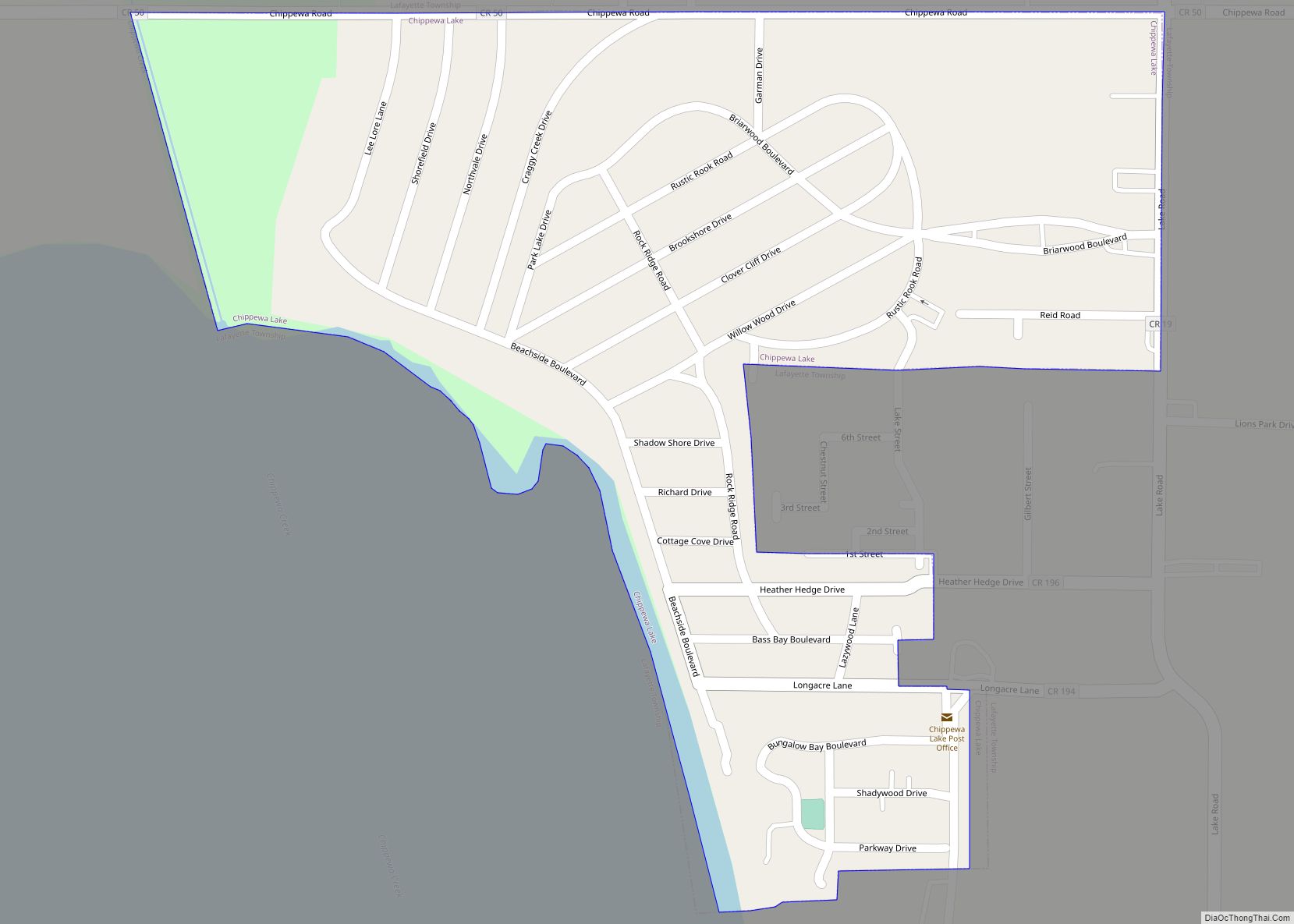
Chippewa Lake (formerly Chippewa-on-the-Lake) is a village in Medina County, Ohio, United States. It is located on Chippewa Lake, a natural inland lake in Ohio. The village was incorporated in 1920. The population was 711 at the 2010 census.
| Name: | Chippewa Lake village |
|---|---|
| LSAD Code: | 47 |
| LSAD Description: | village (suffix) |
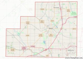
| State: | Ohio |
| County: | Medina County |
| Total Area: | 0.25 sq mi (0.64 km²) |
| Land Area: | 0.25 sq mi (0.64 km²) |
| Water Area: | 0.00 sq mi (0.00 km²) |
| Total Population: | 654 |
| Population Density: | 2,647.77/sq mi (1,023.46/km²) |
| ZIP code: | 44215 |
| Area code: | 330 |
| FIPS code: | 3914254 |
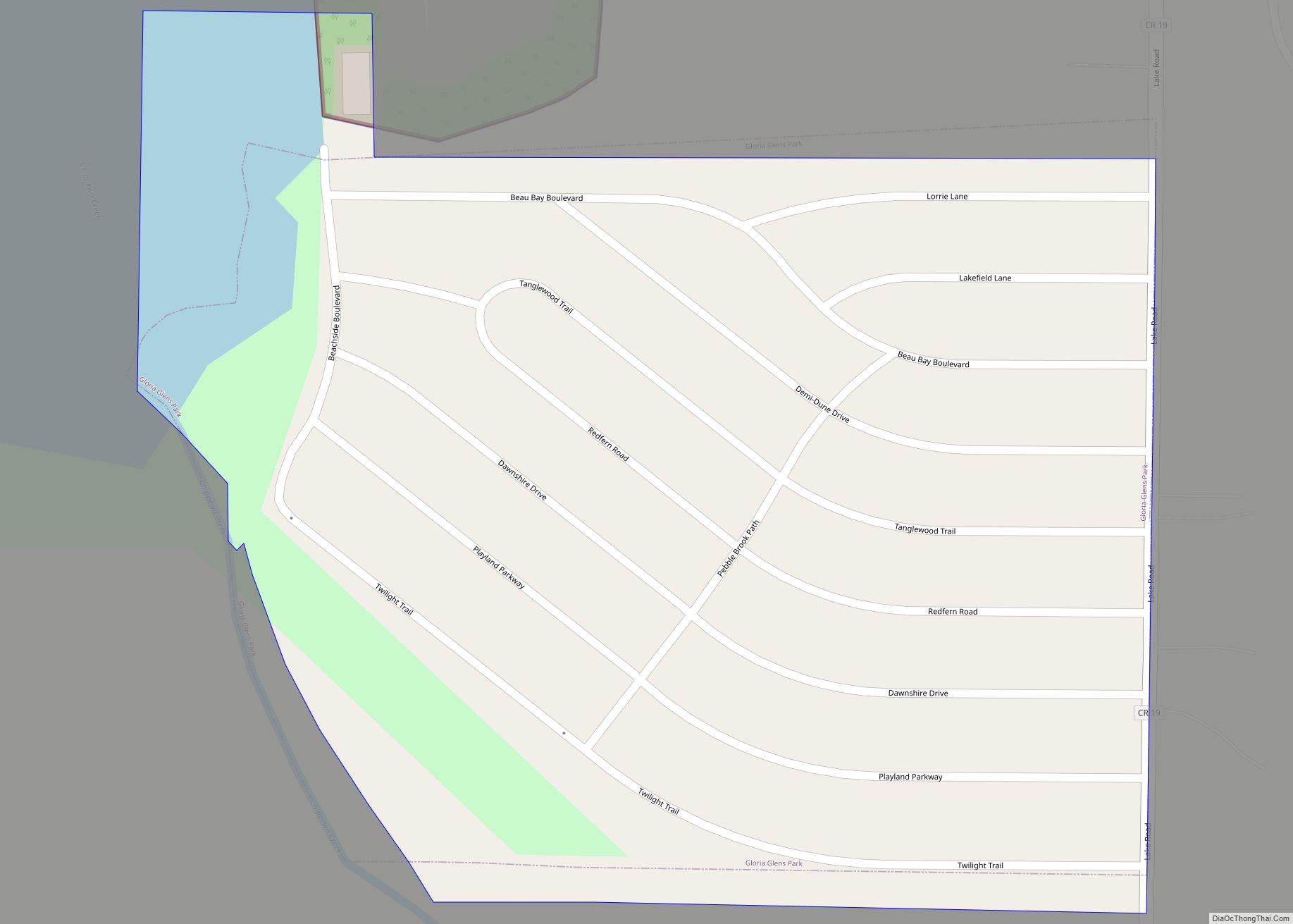
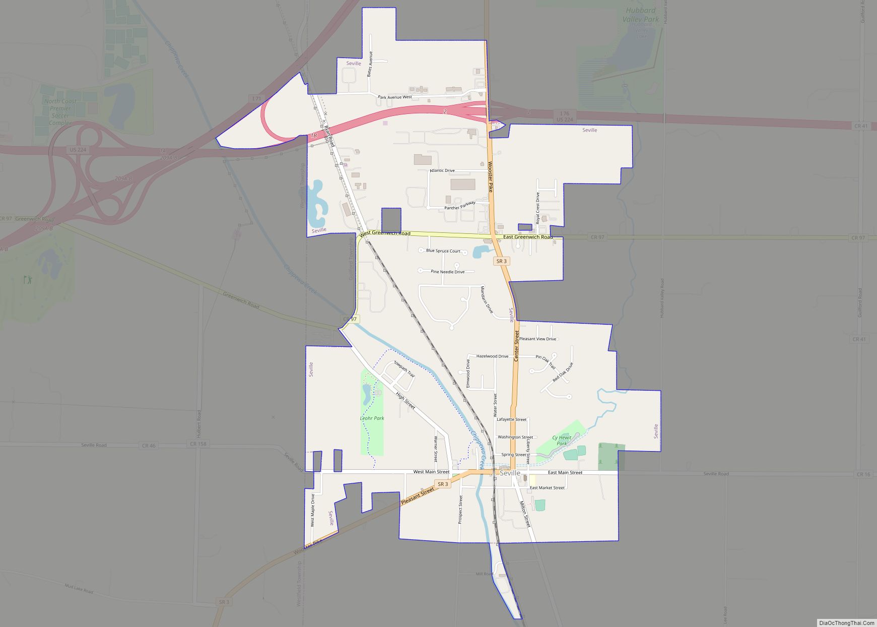
Online Interactive Map
Click on ![]() to view map in "full screen" mode.
to view map in "full screen" mode.
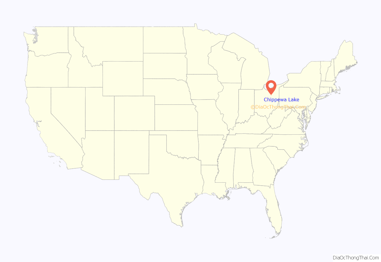
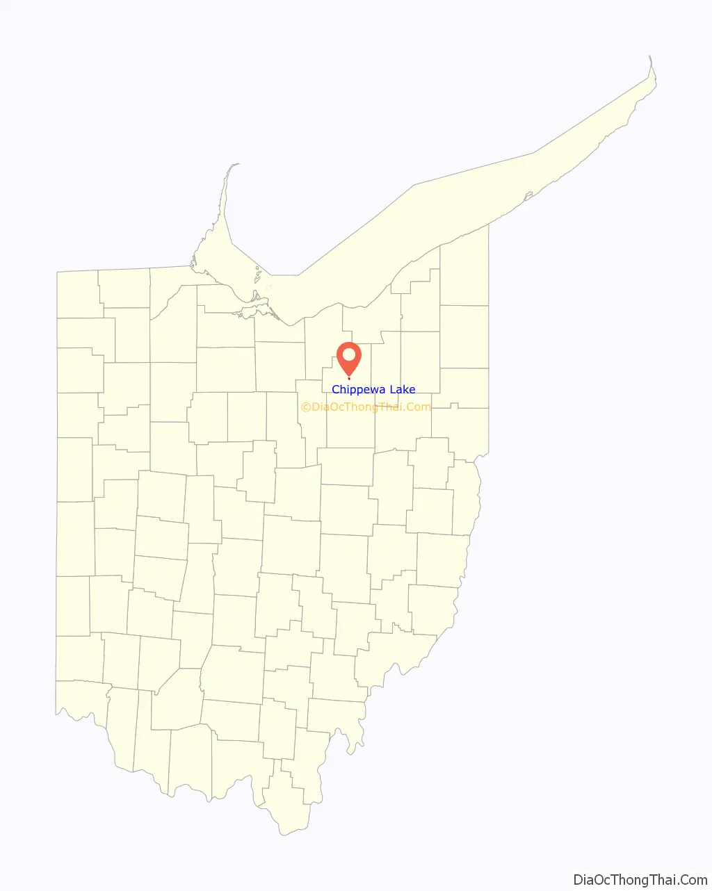
Chippewa Lake location map. Where is Chippewa Lake village?
History
Chippewa Lake took its name from the Ojibwe tribe of Native Americans.
In the 1880s, Oscar Townsend and the Cleveland, Lorain, & Wheeling Railroad developed a prosperous vacation resort, eventually called Chippewa Lake Park, on the banks of Chippewa Lake. The Great Depression and extinction of interurban rail service crippled the park, but in 1937, Parker Beach purchased the resort, and it enjoyed a swinging Golden Age through 1969, as he kept the park’s ballroom filled with dancers and famous bands. In 1978, after more than 100 years of operation, Chippewa Lake Park was shut down and left to decay.
In 2008, scenes for the horror film Closed For the Season (released in 2010) were shot at the abandoned amusement park, using many of its decrepit attractions as backgrounds.
A large estate that was originally part of Townsend’s empire in town remains intact today, and has operated for decades as The Oaks Lodge restaurant.
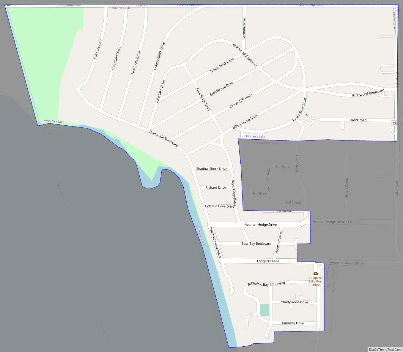
Chippewa Lake Road Map
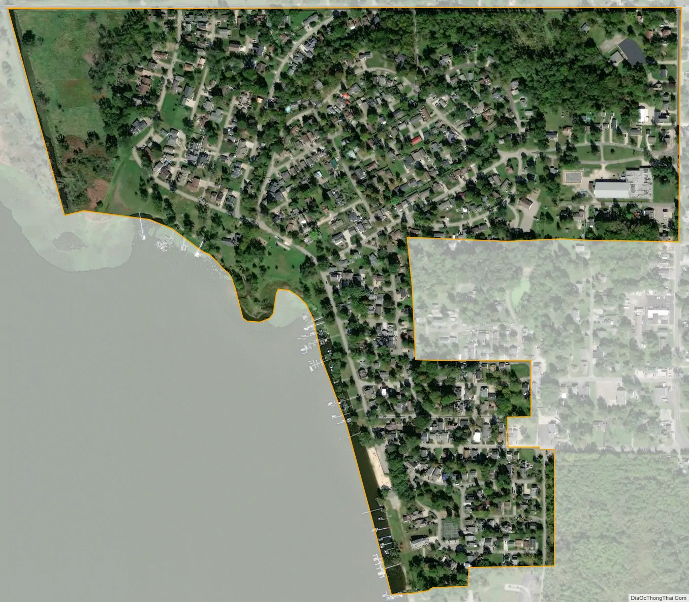
Chippewa Lake city Satellite Map
Geography
Chippewa Lake is located at 41°4′27″N 81°54′14″W / 41.07417°N 81.90389°W / 41.07417; -81.90389 (41.074039, -81.903753).
According to the United States Census Bureau, the village has a total area of 0.25 square miles (0.65 km), all land.
Climate
See also
Map of Ohio State and its subdivision:- Adams
- Allen
- Ashland
- Ashtabula
- Athens
- Auglaize
- Belmont
- Brown
- Butler
- Carroll
- Champaign
- Clark
- Clermont
- Clinton
- Columbiana
- Coshocton
- Crawford
- Cuyahoga
- Darke
- Defiance
- Delaware
- Erie
- Fairfield
- Fayette
- Franklin
- Fulton
- Gallia
- Geauga
- Greene
- Guernsey
- Hamilton
- Hancock
- Hardin
- Harrison
- Henry
- Highland
- Hocking
- Holmes
- Huron
- Jackson
- Jefferson
- Knox
- Lake
- Lake Erie
- Lawrence
- Licking
- Logan
- Lorain
- Lucas
- Madison
- Mahoning
- Marion
- Medina
- Meigs
- Mercer
- Miami
- Monroe
- Montgomery
- Morgan
- Morrow
- Muskingum
- Noble
- Ottawa
- Paulding
- Perry
- Pickaway
- Pike
- Portage
- Preble
- Putnam
- Richland
- Ross
- Sandusky
- Scioto
- Seneca
- Shelby
- Stark
- Summit
- Trumbull
- Tuscarawas
- Union
- Van Wert
- Vinton
- Warren
- Washington
- Wayne
- Williams
- Wood
- Wyandot
- Alabama
- Alaska
- Arizona
- Arkansas
- California
- Colorado
- Connecticut
- Delaware
- District of Columbia
- Florida
- Georgia
- Hawaii
- Idaho
- Illinois
- Indiana
- Iowa
- Kansas
- Kentucky
- Louisiana
- Maine
- Maryland
- Massachusetts
- Michigan
- Minnesota
- Mississippi
- Missouri
- Montana
- Nebraska
- Nevada
- New Hampshire
- New Jersey
- New Mexico
- New York
- North Carolina
- North Dakota
- Ohio
- Oklahoma
- Oregon
- Pennsylvania
- Rhode Island
- South Carolina
- South Dakota
- Tennessee
- Texas
- Utah
- Vermont
- Virginia
- Washington
- West Virginia
- Wisconsin
- Wyoming