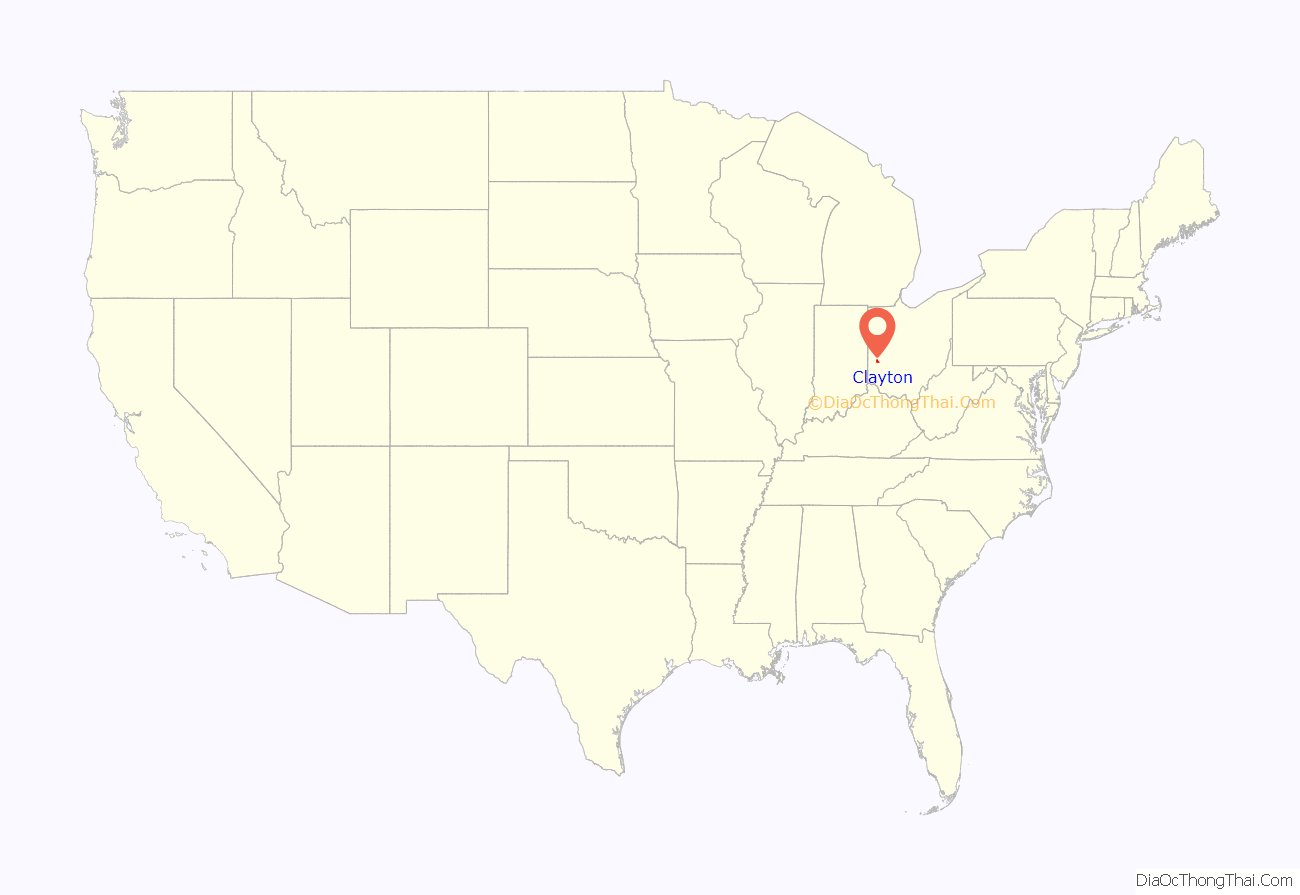
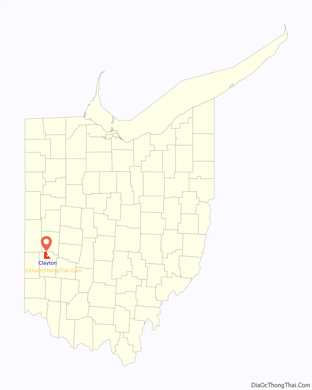
Clayton is a city in Montgomery county in the U.S. state of Ohio. The population was 13,310 at the 2020 United States census. A suburb of Dayton. It is part of the Dayton Metropolitan Statistical Area.
The city was named after John Clayton, a War of 1812 veteran.
| Name: | Clayton city |
|---|---|
| LSAD Code: | 25 |
| LSAD Description: | city (suffix) |
| State: | Ohio |
| County: | Montgomery County |
| Elevation: | 1,001 ft (305 m) |
| Total Area: | 18.58 sq mi (48.13 km²) |
| Land Area: | 18.51 sq mi (47.95 km²) |
| Water Area: | 0.07 sq mi (0.18 km²) |
| Total Population: | 13,310 |
| Population Density: | 718.99/sq mi (277.60/km²) |
| ZIP code: | 45315 |
| Area code: | 937, 326 |
| FIPS code: | 3915644 |
| GNISfeature ID: | 1056811 |
| Website: | http://www.clayton.oh.us/ |
Online Interactive Map
Click on ![]() to view map in "full screen" mode.
to view map in "full screen" mode.
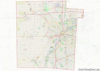
Clayton location map. Where is Clayton city?
History
Clayton was platted in 1816 and at that time was known as Salem. It suffered when the National Road bypassed it. In 1906 it became a stop on the Dayton Northern Traction Line. It became a city in 1998 through merger with the rest of Randolph Township, Montgomery County, Ohio.
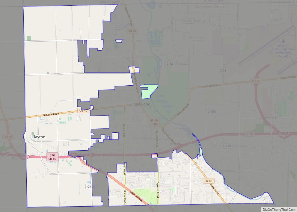
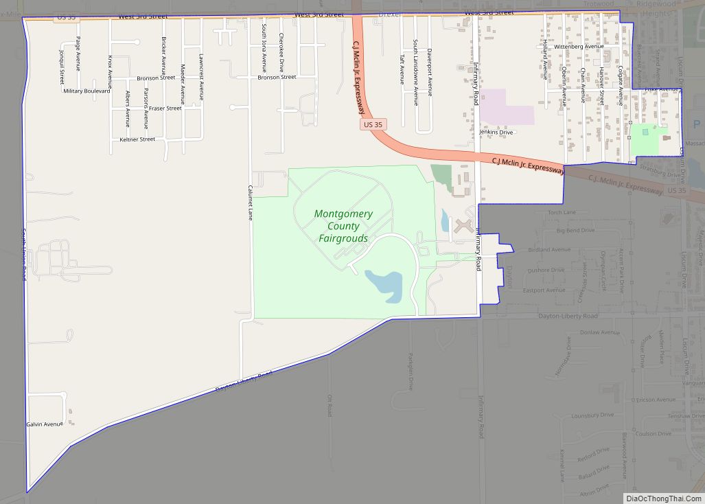
Clayton Road Map
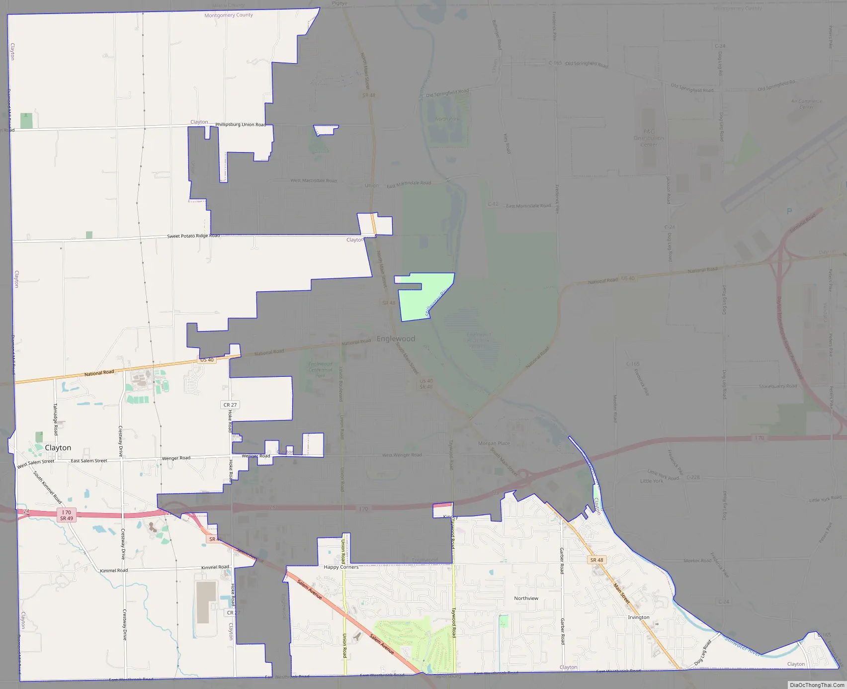
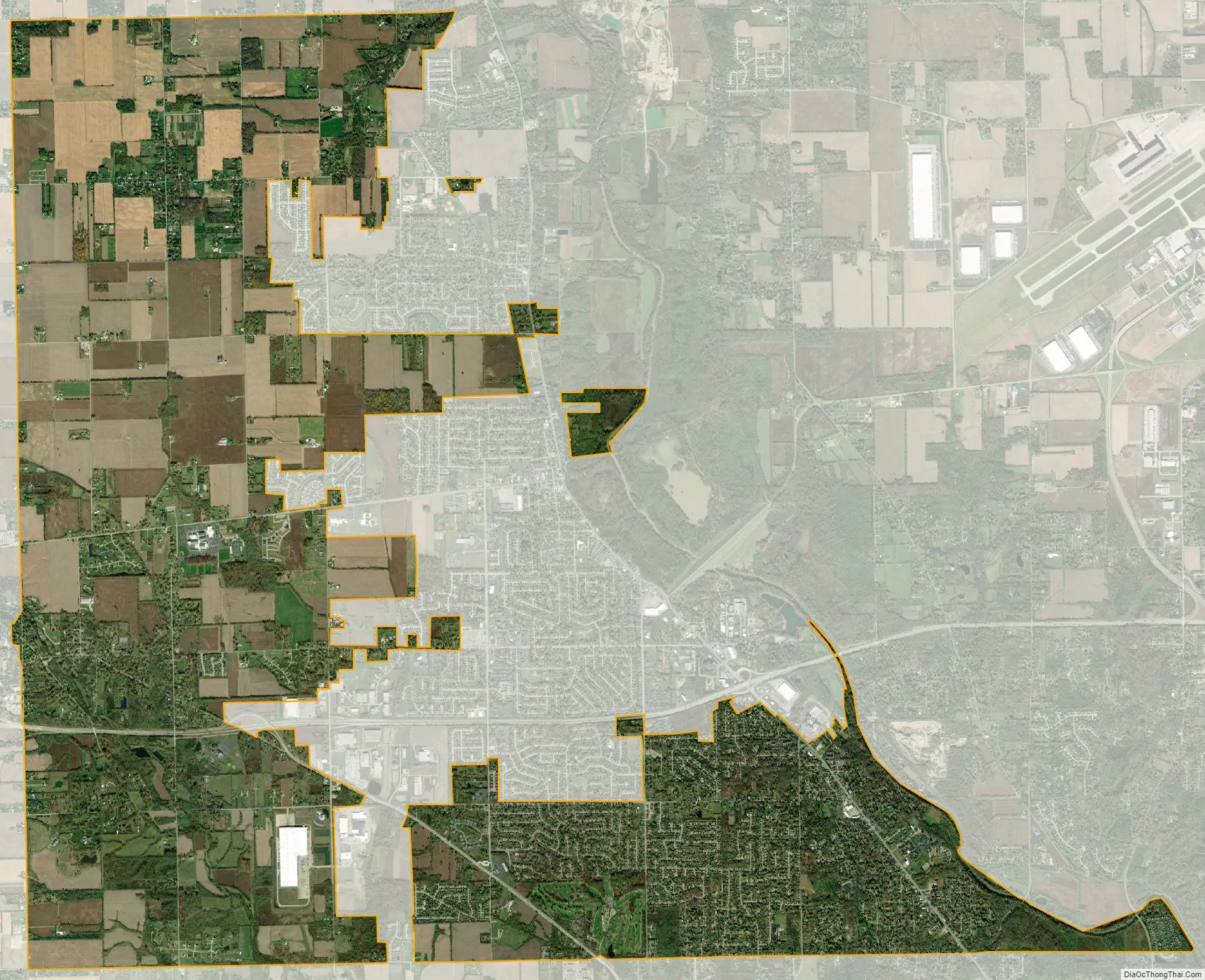
Clayton city Satellite Map
Geography
Clayton is located at 39°51′38.38″N 84°21′18.29″W / 39.8606611°N 84.3550806°W / 39.8606611; -84.3550806 (39.86066, −84.35508).
According to the United States Census Bureau, the city has a total area of 18.60 square miles (48.17 km), of which 18.51 square miles (47.94 km) is land and 0.09 square miles (0.23 km) is water.
In 1998, Clayton annexed the remainder of Montgomery County’s Randolph Township.
See also
Map of Ohio State and its subdivision:- Adams
- Allen
- Ashland
- Ashtabula
- Athens
- Auglaize
- Belmont
- Brown
- Butler
- Carroll
- Champaign
- Clark
- Clermont
- Clinton
- Columbiana
- Coshocton
- Crawford
- Cuyahoga
- Darke
- Defiance
- Delaware
- Erie
- Fairfield
- Fayette
- Franklin
- Fulton
- Gallia
- Geauga
- Greene
- Guernsey
- Hamilton
- Hancock
- Hardin
- Harrison
- Henry
- Highland
- Hocking
- Holmes
- Huron
- Jackson
- Jefferson
- Knox
- Lake
- Lake Erie
- Lawrence
- Licking
- Logan
- Lorain
- Lucas
- Madison
- Mahoning
- Marion
- Medina
- Meigs
- Mercer
- Miami
- Monroe
- Montgomery
- Morgan
- Morrow
- Muskingum
- Noble
- Ottawa
- Paulding
- Perry
- Pickaway
- Pike
- Portage
- Preble
- Putnam
- Richland
- Ross
- Sandusky
- Scioto
- Seneca
- Shelby
- Stark
- Summit
- Trumbull
- Tuscarawas
- Union
- Van Wert
- Vinton
- Warren
- Washington
- Wayne
- Williams
- Wood
- Wyandot
- Alabama
- Alaska
- Arizona
- Arkansas
- California
- Colorado
- Connecticut
- Delaware
- District of Columbia
- Florida
- Georgia
- Hawaii
- Idaho
- Illinois
- Indiana
- Iowa
- Kansas
- Kentucky
- Louisiana
- Maine
- Maryland
- Massachusetts
- Michigan
- Minnesota
- Mississippi
- Missouri
- Montana
- Nebraska
- Nevada
- New Hampshire
- New Jersey
- New Mexico
- New York
- North Carolina
- North Dakota
- Ohio
- Oklahoma
- Oregon
- Pennsylvania
- Rhode Island
- South Carolina
- South Dakota
- Tennessee
- Texas
- Utah
- Vermont
- Virginia
- Washington
- West Virginia
- Wisconsin
- Wyoming