Cleves is a village in Miami Township, Hamilton County, Ohio, United States, located along the Ohio River. The population was 3,414 at the 2020 census. Founded in 1818, it is named for John Cleves Symmes who lived here, laid out the original town site, and sold lots.
| Name: | Cleves village |
|---|---|
| LSAD Code: | 47 |
| LSAD Description: | village (suffix) |
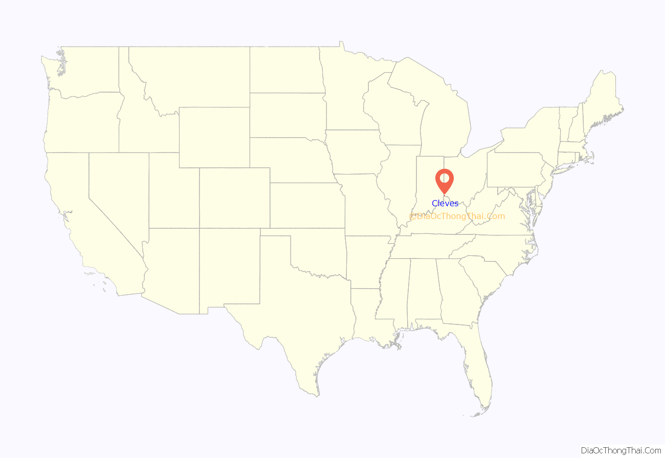
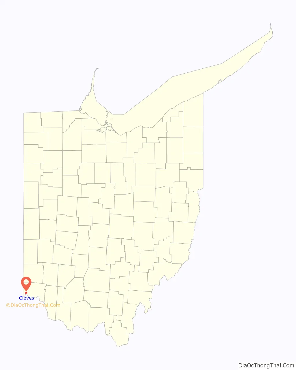
| State: | Ohio |
| County: | Hamilton County |
| Elevation: | 495 ft (151 m) |
| Total Area: | 1.61 sq mi (4.17 km²) |
| Land Area: | 1.55 sq mi (4.00 km²) |
| Water Area: | 0.07 sq mi (0.17 km²) |
| Total Population: | 3,414 |
| Population Density: | 2,208.28/sq mi (852.73/km²) |
| ZIP code: | 45002 |
| Area code: | 513 |
| FIPS code: | 3916028 |
| GNISfeature ID: | 1056814 |
| Website: | www.cleves.org |
Online Interactive Map
Click on ![]() to view map in "full screen" mode.
to view map in "full screen" mode.
Cleves location map. Where is Cleves village?
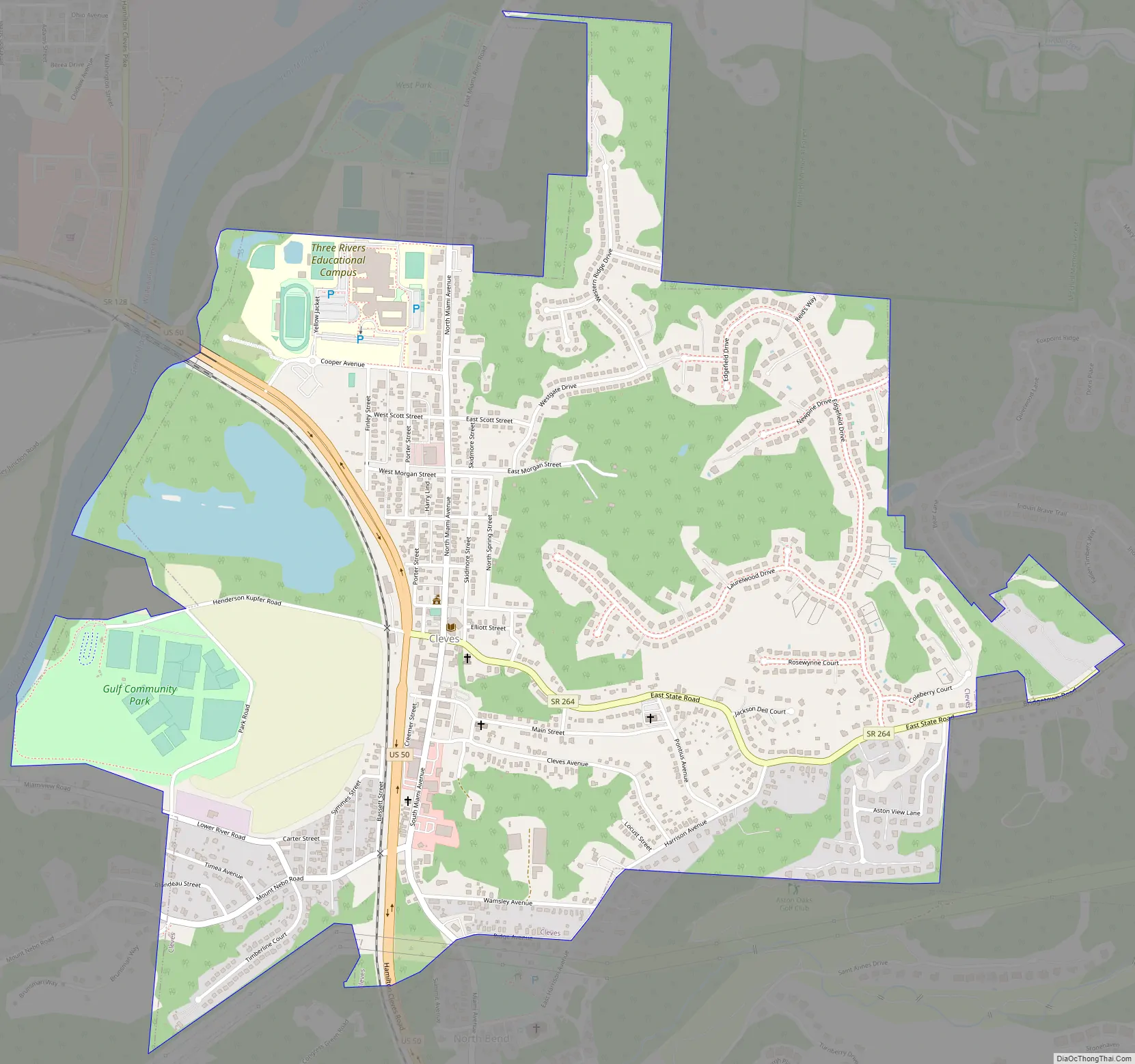
Cleves Road Map
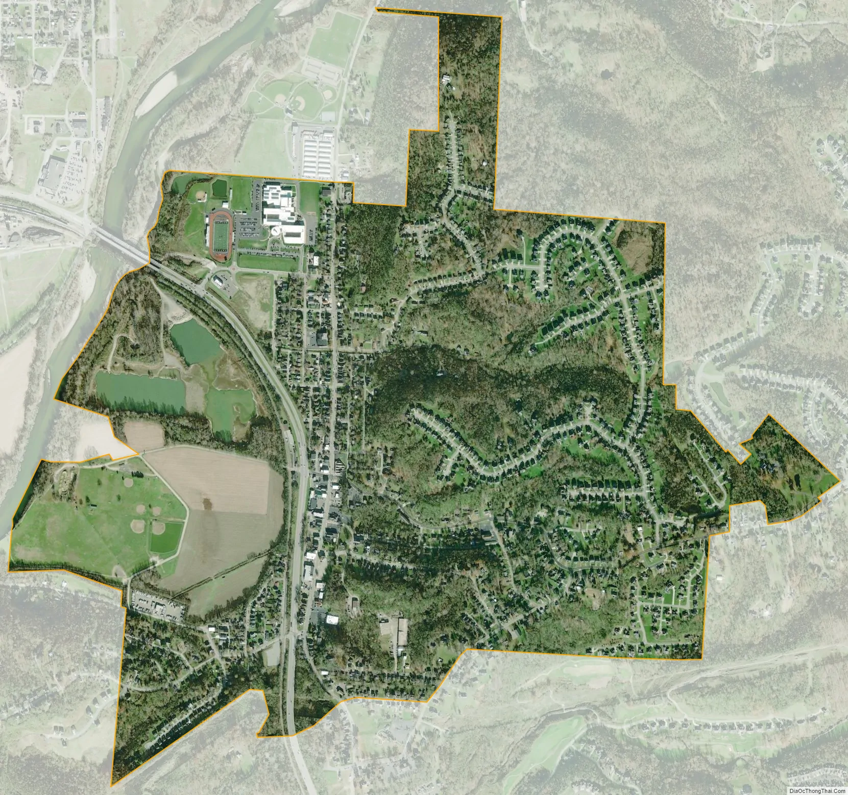
Cleves city Satellite Map
Geography
Cleves is located at 39°9′40″N 84°45′1″W / 39.16111°N 84.75028°W / 39.16111; -84.75028 (39.161241, -84.750288) between the Great Miami River and the Ohio River. It is separated from the Ohio River by the village of North Bend, along the southern border of Cleves. U.S. Route 50 passes through the village, leading east 16 miles (26 km) to downtown Cincinnati and west to Lawrenceburg, Indiana.
According to the United States Census Bureau, the village has a total area of 1.58 square miles (4.09 km), all land.
See also
Map of Ohio State and its subdivision:- Adams
- Allen
- Ashland
- Ashtabula
- Athens
- Auglaize
- Belmont
- Brown
- Butler
- Carroll
- Champaign
- Clark
- Clermont
- Clinton
- Columbiana
- Coshocton
- Crawford
- Cuyahoga
- Darke
- Defiance
- Delaware
- Erie
- Fairfield
- Fayette
- Franklin
- Fulton
- Gallia
- Geauga
- Greene
- Guernsey
- Hamilton
- Hancock
- Hardin
- Harrison
- Henry
- Highland
- Hocking
- Holmes
- Huron
- Jackson
- Jefferson
- Knox
- Lake
- Lake Erie
- Lawrence
- Licking
- Logan
- Lorain
- Lucas
- Madison
- Mahoning
- Marion
- Medina
- Meigs
- Mercer
- Miami
- Monroe
- Montgomery
- Morgan
- Morrow
- Muskingum
- Noble
- Ottawa
- Paulding
- Perry
- Pickaway
- Pike
- Portage
- Preble
- Putnam
- Richland
- Ross
- Sandusky
- Scioto
- Seneca
- Shelby
- Stark
- Summit
- Trumbull
- Tuscarawas
- Union
- Van Wert
- Vinton
- Warren
- Washington
- Wayne
- Williams
- Wood
- Wyandot
- Alabama
- Alaska
- Arizona
- Arkansas
- California
- Colorado
- Connecticut
- Delaware
- District of Columbia
- Florida
- Georgia
- Hawaii
- Idaho
- Illinois
- Indiana
- Iowa
- Kansas
- Kentucky
- Louisiana
- Maine
- Maryland
- Massachusetts
- Michigan
- Minnesota
- Mississippi
- Missouri
- Montana
- Nebraska
- Nevada
- New Hampshire
- New Jersey
- New Mexico
- New York
- North Carolina
- North Dakota
- Ohio
- Oklahoma
- Oregon
- Pennsylvania
- Rhode Island
- South Carolina
- South Dakota
- Tennessee
- Texas
- Utah
- Vermont
- Virginia
- Washington
- West Virginia
- Wisconsin
- Wyoming


