Darrtown is a census-designated place (CDP) in Milford Township, Butler County, Ohio, United States. The population was 516 at the 2010 census.
| Name: | Darrtown CDP |
|---|---|
| LSAD Code: | 57 |
| LSAD Description: | CDP (suffix) |
| State: | Ohio |
| County: | Butler County |
| Elevation: | 742 ft (226 m) |
| Total Area: | 2.36 sq mi (6.10 km²) |
| Land Area: | 2.36 sq mi (6.10 km²) |
| Water Area: | 0.00 sq mi (0.00 km²) |
| Total Population: | 514 |
| Population Density: | 218.17/sq mi (84.23/km²) |
| ZIP code: | 45056 |
| FIPS code: | 3920268 |
| GNISfeature ID: | 1064511 |
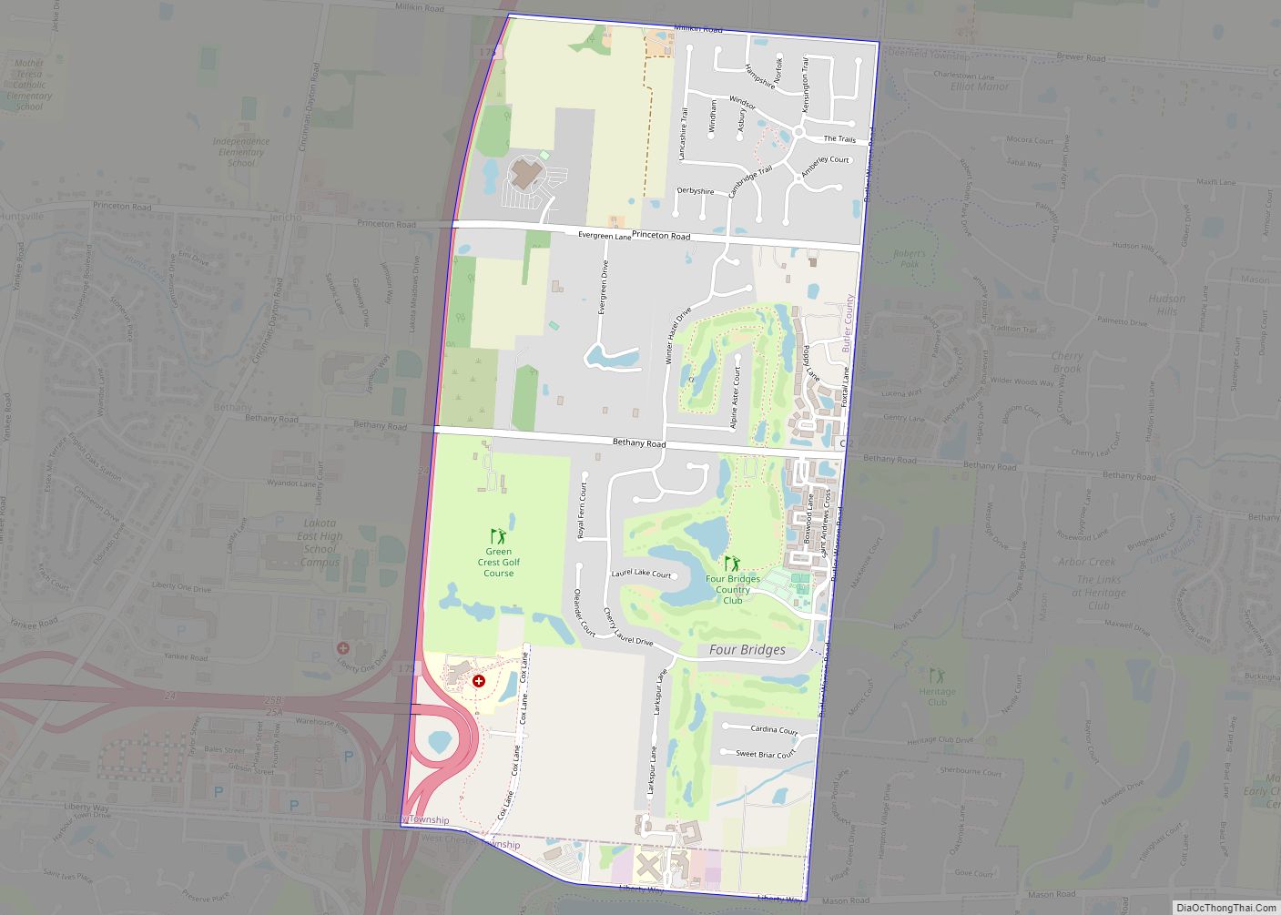
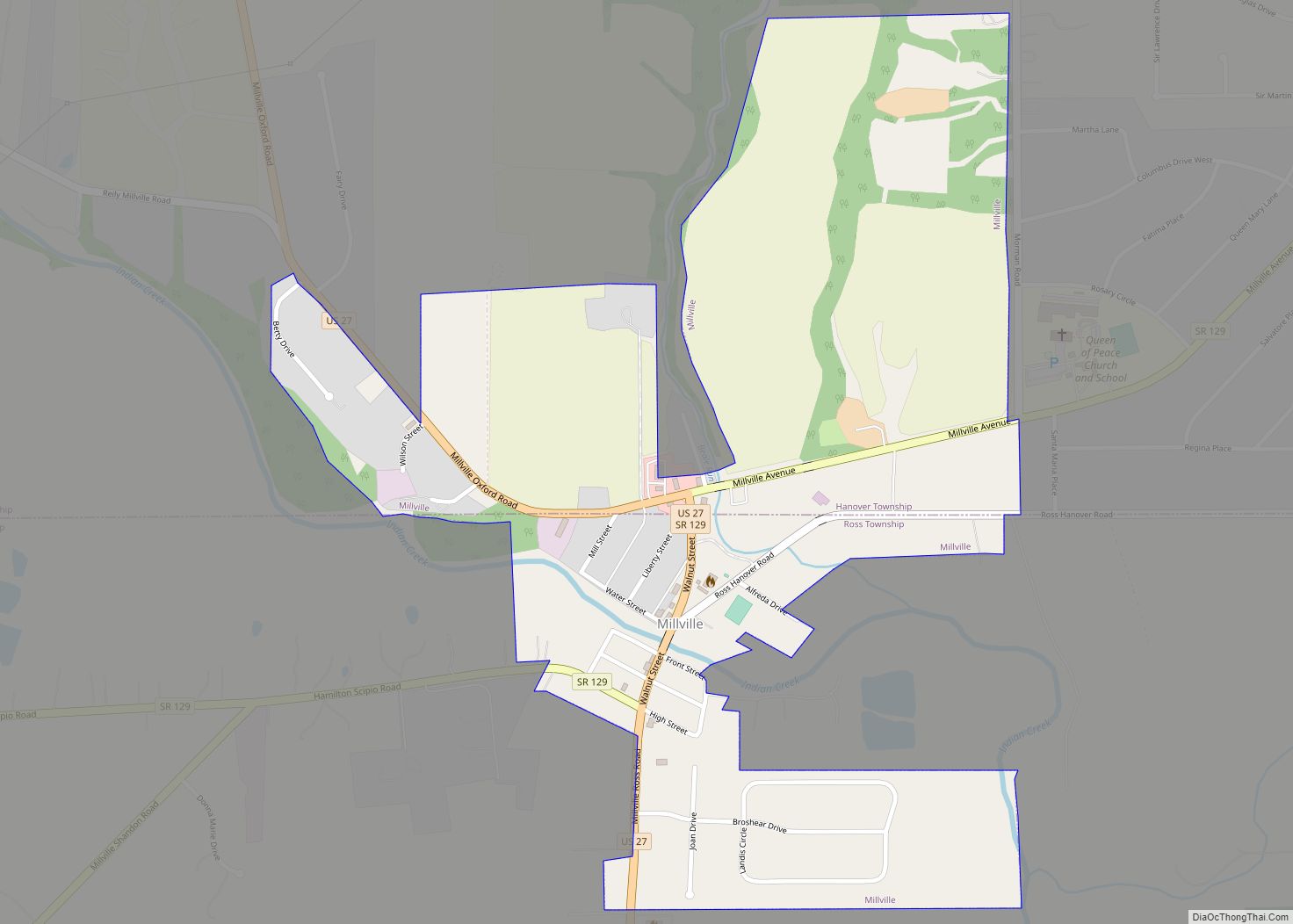
Online Interactive Map
Click on ![]() to view map in "full screen" mode.
to view map in "full screen" mode.
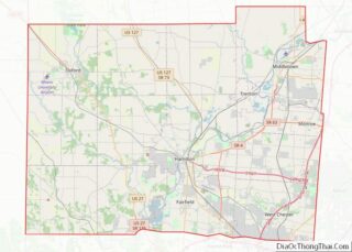
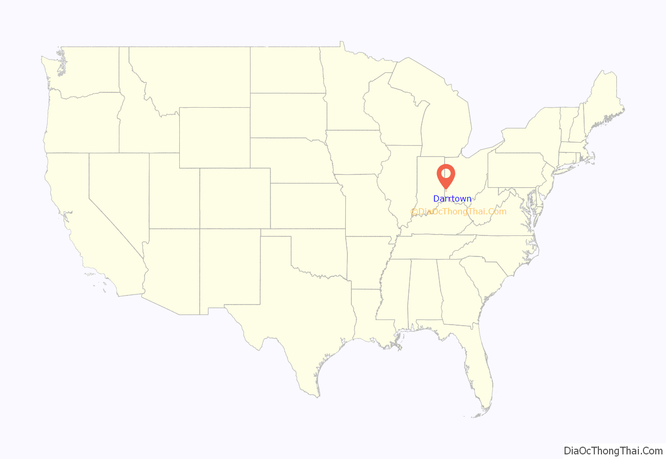
Darrtown location map. Where is Darrtown CDP?
History
Darrtown was laid out in 1814 by Conrad Darr, and named for him. A post office called Darrtown was established in 1825, and remained in operation until 1907.
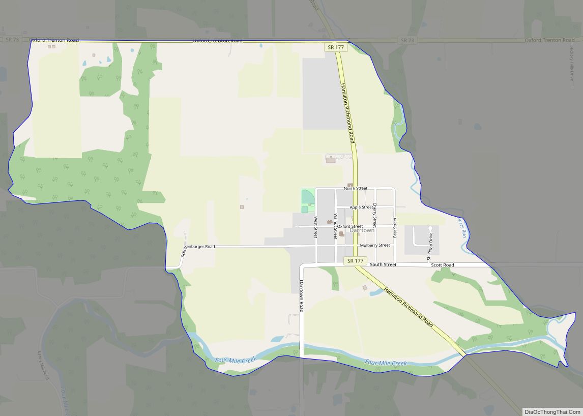
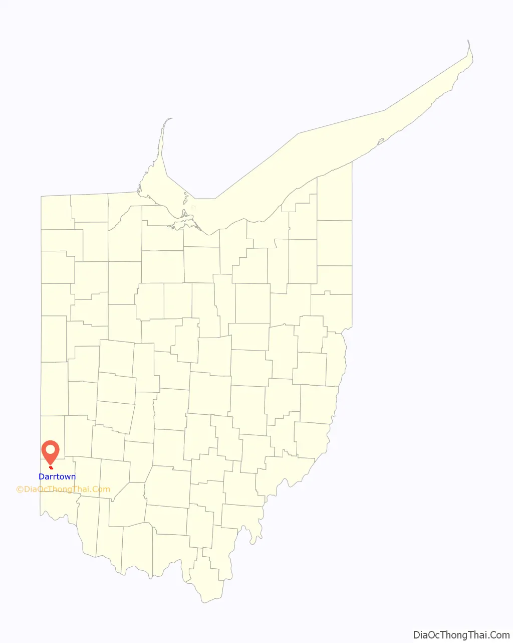
Darrtown Road Map

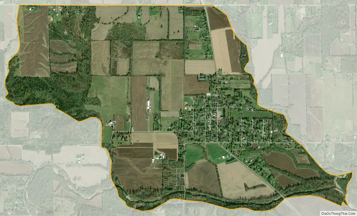
Darrtown city Satellite Map
Geography
Darrtown is located in northwestern Butler County, in the southwest part of Milford Township, in the valley of Four Mile Creek.
State Route 177 runs through the center of the community, leading 8 miles (13 km) southeast to the city of Hamilton. Oxford is 5 miles (8 km) to the west via Route 177 and Route 73.
According to the United States Census Bureau, the CDP has a total area of 2.4 square miles (6.1 km), all land.
See also
Map of Ohio State and its subdivision:- Adams
- Allen
- Ashland
- Ashtabula
- Athens
- Auglaize
- Belmont
- Brown
- Butler
- Carroll
- Champaign
- Clark
- Clermont
- Clinton
- Columbiana
- Coshocton
- Crawford
- Cuyahoga
- Darke
- Defiance
- Delaware
- Erie
- Fairfield
- Fayette
- Franklin
- Fulton
- Gallia
- Geauga
- Greene
- Guernsey
- Hamilton
- Hancock
- Hardin
- Harrison
- Henry
- Highland
- Hocking
- Holmes
- Huron
- Jackson
- Jefferson
- Knox
- Lake
- Lake Erie
- Lawrence
- Licking
- Logan
- Lorain
- Lucas
- Madison
- Mahoning
- Marion
- Medina
- Meigs
- Mercer
- Miami
- Monroe
- Montgomery
- Morgan
- Morrow
- Muskingum
- Noble
- Ottawa
- Paulding
- Perry
- Pickaway
- Pike
- Portage
- Preble
- Putnam
- Richland
- Ross
- Sandusky
- Scioto
- Seneca
- Shelby
- Stark
- Summit
- Trumbull
- Tuscarawas
- Union
- Van Wert
- Vinton
- Warren
- Washington
- Wayne
- Williams
- Wood
- Wyandot
- Alabama
- Alaska
- Arizona
- Arkansas
- California
- Colorado
- Connecticut
- Delaware
- District of Columbia
- Florida
- Georgia
- Hawaii
- Idaho
- Illinois
- Indiana
- Iowa
- Kansas
- Kentucky
- Louisiana
- Maine
- Maryland
- Massachusetts
- Michigan
- Minnesota
- Mississippi
- Missouri
- Montana
- Nebraska
- Nevada
- New Hampshire
- New Jersey
- New Mexico
- New York
- North Carolina
- North Dakota
- Ohio
- Oklahoma
- Oregon
- Pennsylvania
- Rhode Island
- South Carolina
- South Dakota
- Tennessee
- Texas
- Utah
- Vermont
- Virginia
- Washington
- West Virginia
- Wisconsin
- Wyoming