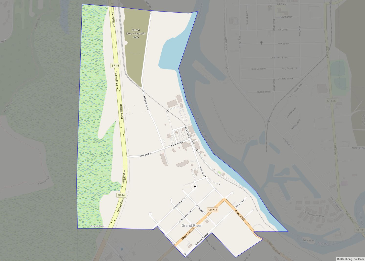
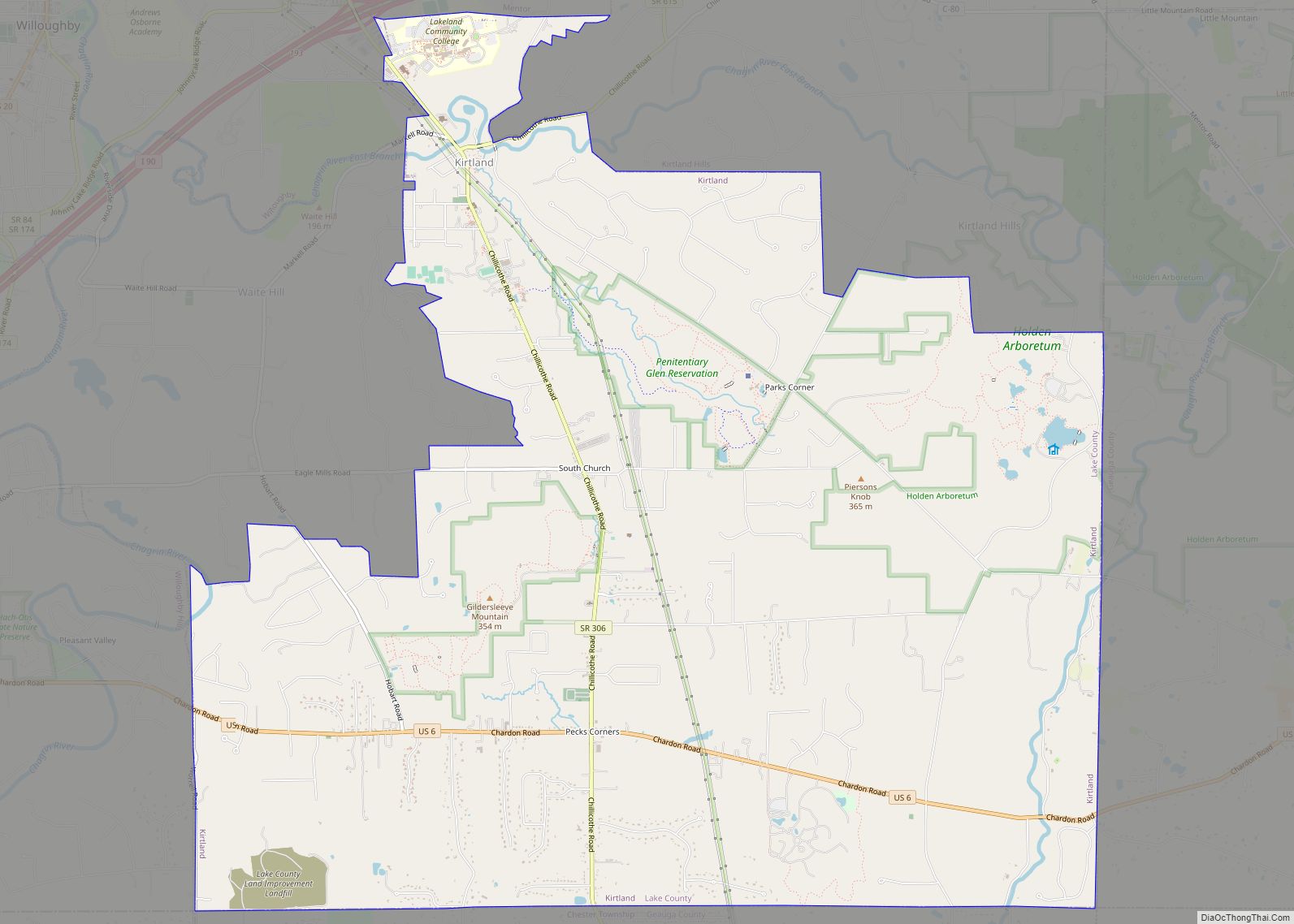
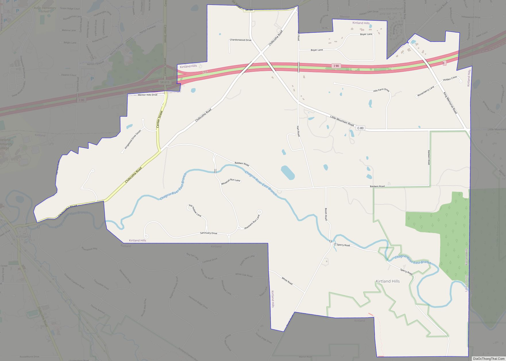
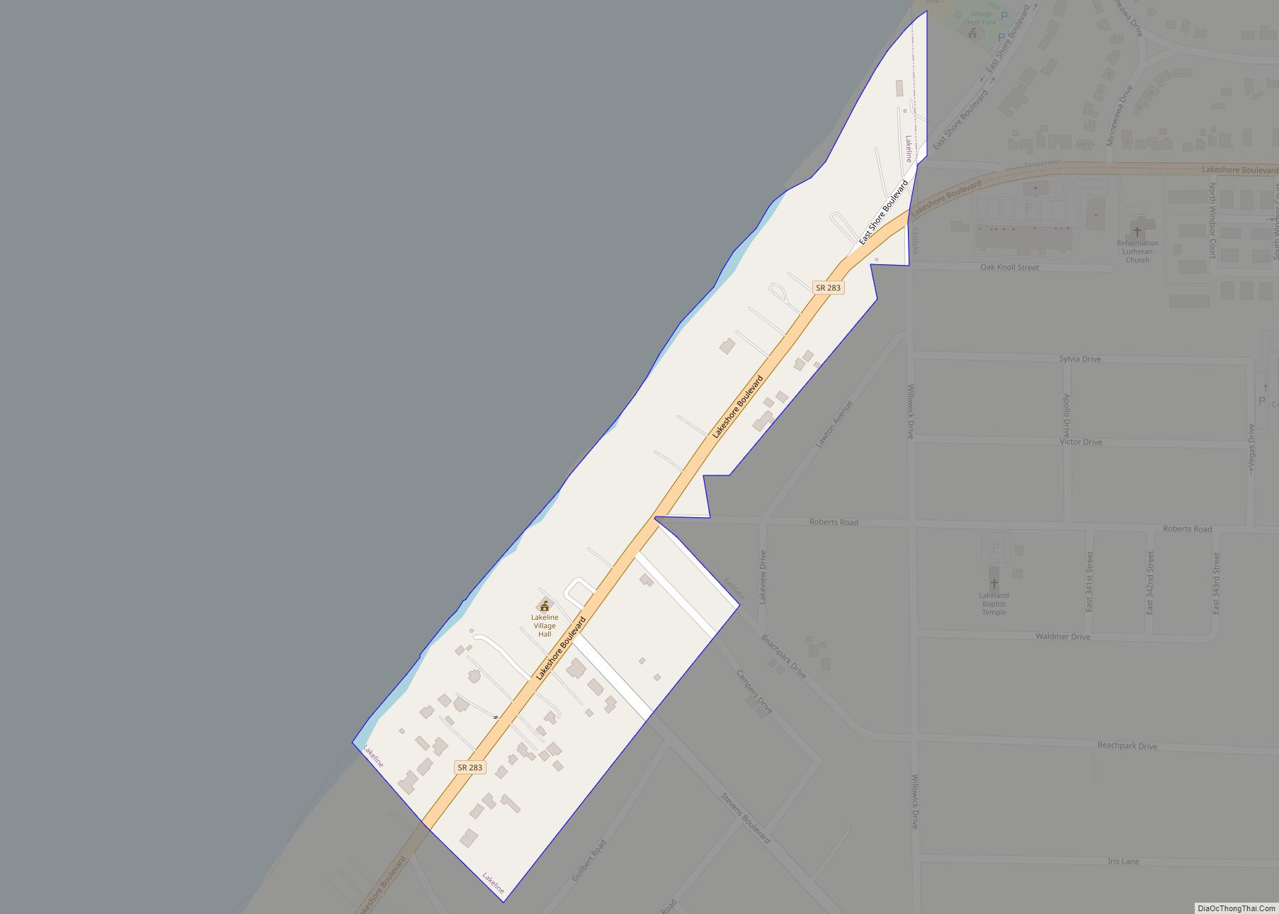
Grand River is a village in Lake County, Ohio, United States, along the Grand River. The population was 394 at the 2020 census.
| Name: | Grand River village |
|---|---|
| LSAD Code: | 47 |
| LSAD Description: | village (suffix) |
| State: | Ohio |
| County: | Lake County |
| Elevation: | 610 ft (186 m) |
| Total Area: | 0.64 sq mi (1.65 km²) |
| Land Area: | 0.59 sq mi (1.52 km²) |
| Water Area: | 0.05 sq mi (0.13 km²) |
| Total Population: | 394 |
| Population Density: | 671.21/sq mi (259.10/km²) |
| ZIP code: | 44045 |
| Area code: | 440 |
| FIPS code: | 3931234 |
| GNISfeature ID: | 1064746 |
| Website: | www.grandriverohio.net |
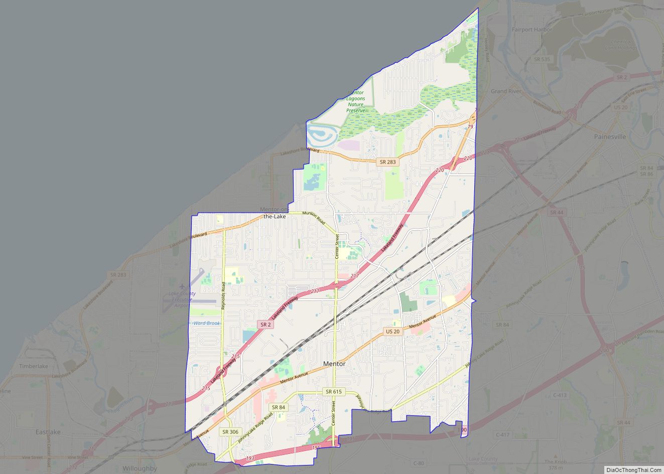
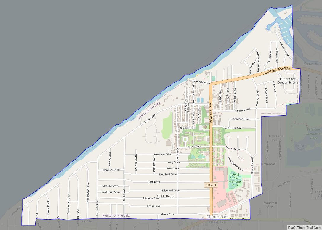
Online Interactive Map
Click on ![]() to view map in "full screen" mode.
to view map in "full screen" mode.
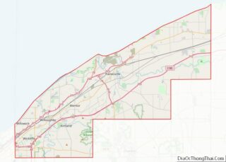
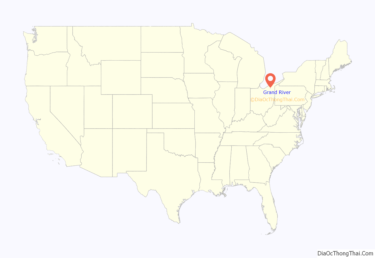
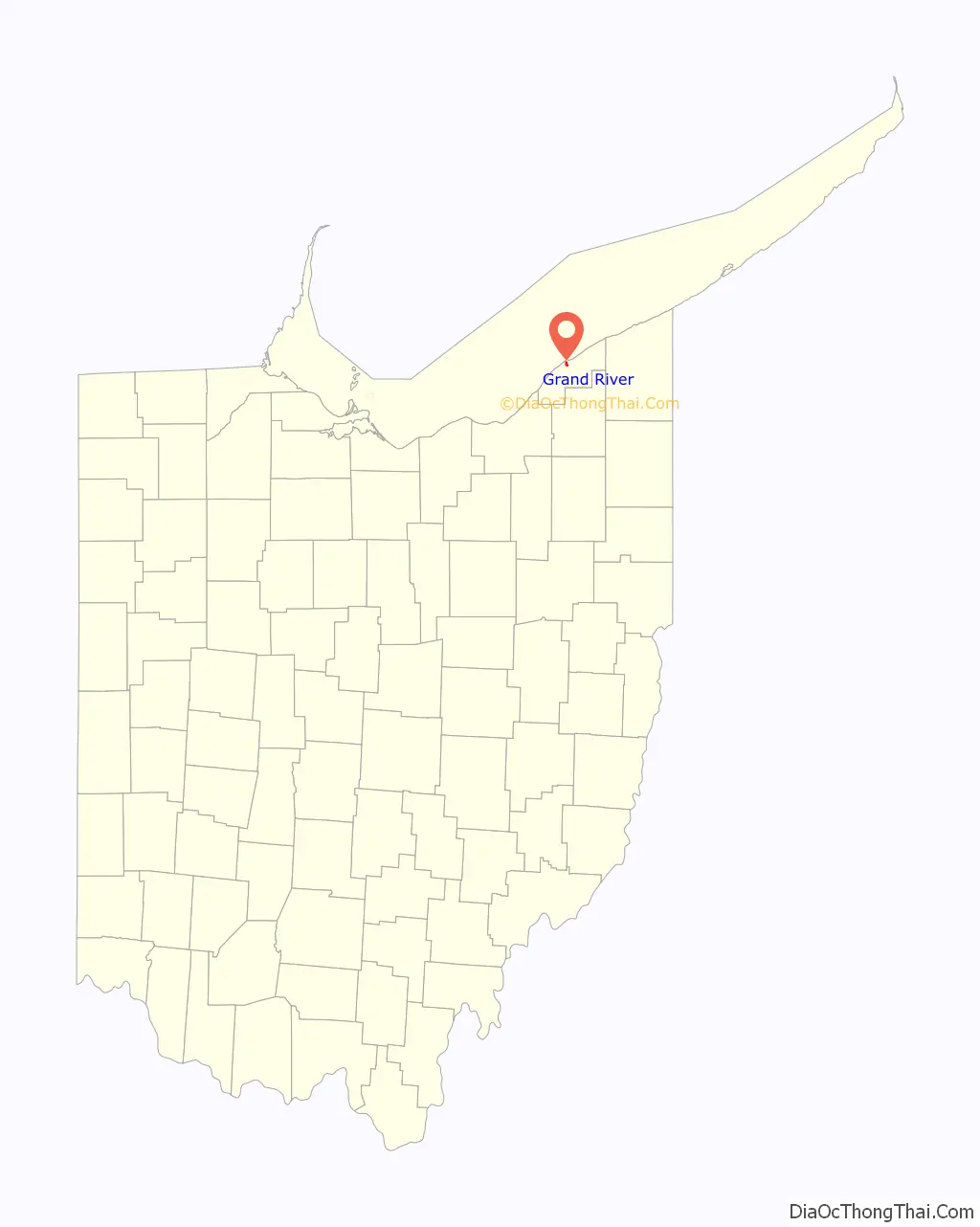
Grand River location map. Where is Grand River village?
History
A post office called Grand River has been in operation since 1890. The village was named after the nearby Grand River.
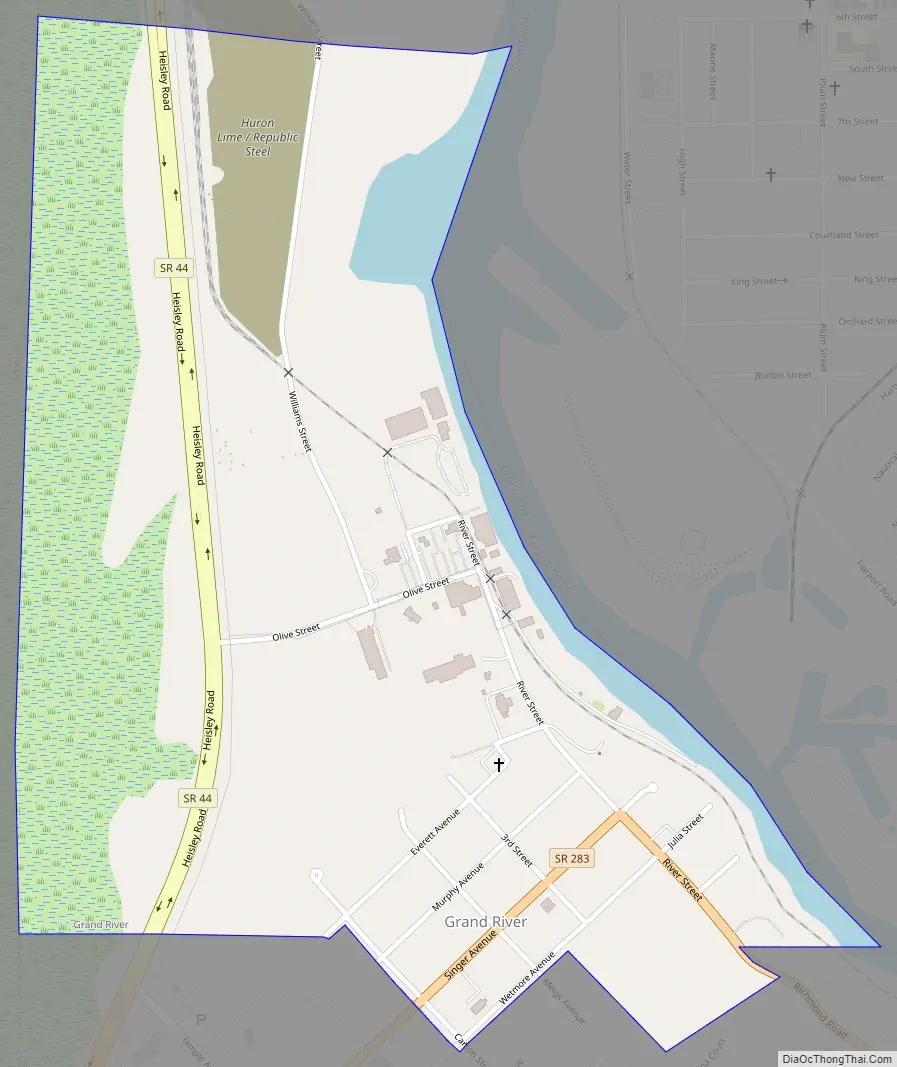
Grand River Road Map
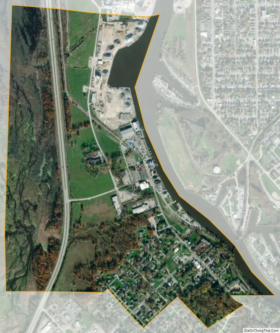
Grand River city Satellite Map
Geography
Grand River is located at 41°44′15″N 81°16′55″W / 41.73750°N 81.28194°W / 41.73750; -81.28194 (41.737443, -81.281874), within Painesville Township.
According to the United States Census Bureau, the village has a total area of 0.63 square miles (1.63 km), of which 0.54 square miles (1.40 km) are land and 0.09 square miles (0.23 km) are water.
Headlands Beach State Park lies adjacent to the village.
See also
Map of Ohio State and its subdivision:- Adams
- Allen
- Ashland
- Ashtabula
- Athens
- Auglaize
- Belmont
- Brown
- Butler
- Carroll
- Champaign
- Clark
- Clermont
- Clinton
- Columbiana
- Coshocton
- Crawford
- Cuyahoga
- Darke
- Defiance
- Delaware
- Erie
- Fairfield
- Fayette
- Franklin
- Fulton
- Gallia
- Geauga
- Greene
- Guernsey
- Hamilton
- Hancock
- Hardin
- Harrison
- Henry
- Highland
- Hocking
- Holmes
- Huron
- Jackson
- Jefferson
- Knox
- Lake
- Lake Erie
- Lawrence
- Licking
- Logan
- Lorain
- Lucas
- Madison
- Mahoning
- Marion
- Medina
- Meigs
- Mercer
- Miami
- Monroe
- Montgomery
- Morgan
- Morrow
- Muskingum
- Noble
- Ottawa
- Paulding
- Perry
- Pickaway
- Pike
- Portage
- Preble
- Putnam
- Richland
- Ross
- Sandusky
- Scioto
- Seneca
- Shelby
- Stark
- Summit
- Trumbull
- Tuscarawas
- Union
- Van Wert
- Vinton
- Warren
- Washington
- Wayne
- Williams
- Wood
- Wyandot
- Alabama
- Alaska
- Arizona
- Arkansas
- California
- Colorado
- Connecticut
- Delaware
- District of Columbia
- Florida
- Georgia
- Hawaii
- Idaho
- Illinois
- Indiana
- Iowa
- Kansas
- Kentucky
- Louisiana
- Maine
- Maryland
- Massachusetts
- Michigan
- Minnesota
- Mississippi
- Missouri
- Montana
- Nebraska
- Nevada
- New Hampshire
- New Jersey
- New Mexico
- New York
- North Carolina
- North Dakota
- Ohio
- Oklahoma
- Oregon
- Pennsylvania
- Rhode Island
- South Carolina
- South Dakota
- Tennessee
- Texas
- Utah
- Vermont
- Virginia
- Washington
- West Virginia
- Wisconsin
- Wyoming