Lake Darby is an unincorporated community and census-designated place in Franklin County, Ohio, United States, located mostly in Prairie Township and partly in Brown Township. It is more commonly known among locals as Darby Estates, which is also the name of the older housing development there, with the newer development called “West Point”. As of the 2010 census, the CDP had a population of 4,592, up from 3,727 at the 2000 census.
| Name: | Lake Darby CDP |
|---|---|
| LSAD Code: | 57 |
| LSAD Description: | CDP (suffix) |
| State: | Ohio |
| County: | Franklin County |
| Elevation: | 925 ft (282 m) |
| Total Area: | 3.50 sq mi (9.06 km²) |
| Land Area: | 3.46 sq mi (8.97 km²) |
| Water Area: | 0.04 sq mi (0.10 km²) |
| Total Population: | 4,731 |
| Population Density: | 1,366.95/sq mi (527.71/km²) |
| FIPS code: | 3941363 |
| GNISfeature ID: | 1867458 |
Online Interactive Map
Click on ![]() to view map in "full screen" mode.
to view map in "full screen" mode.
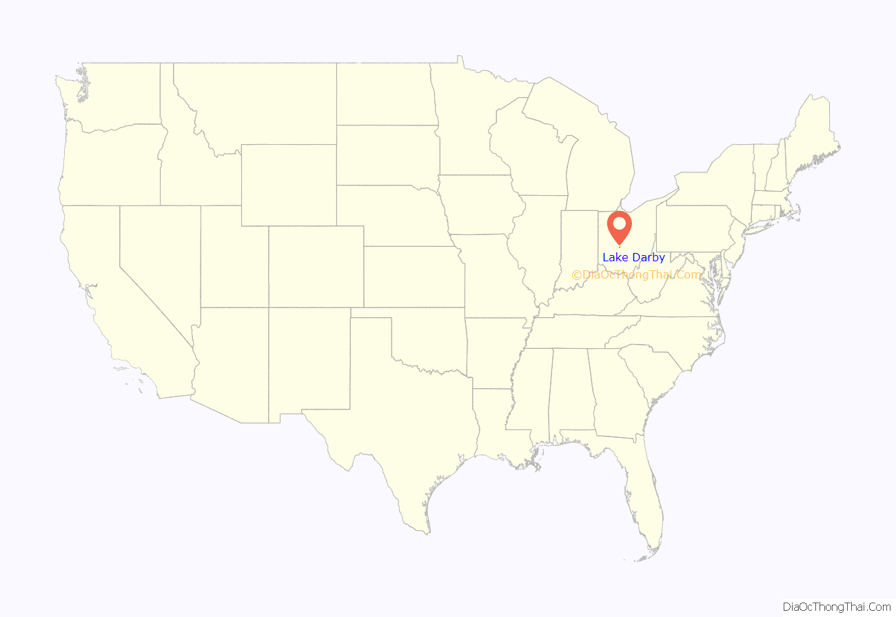
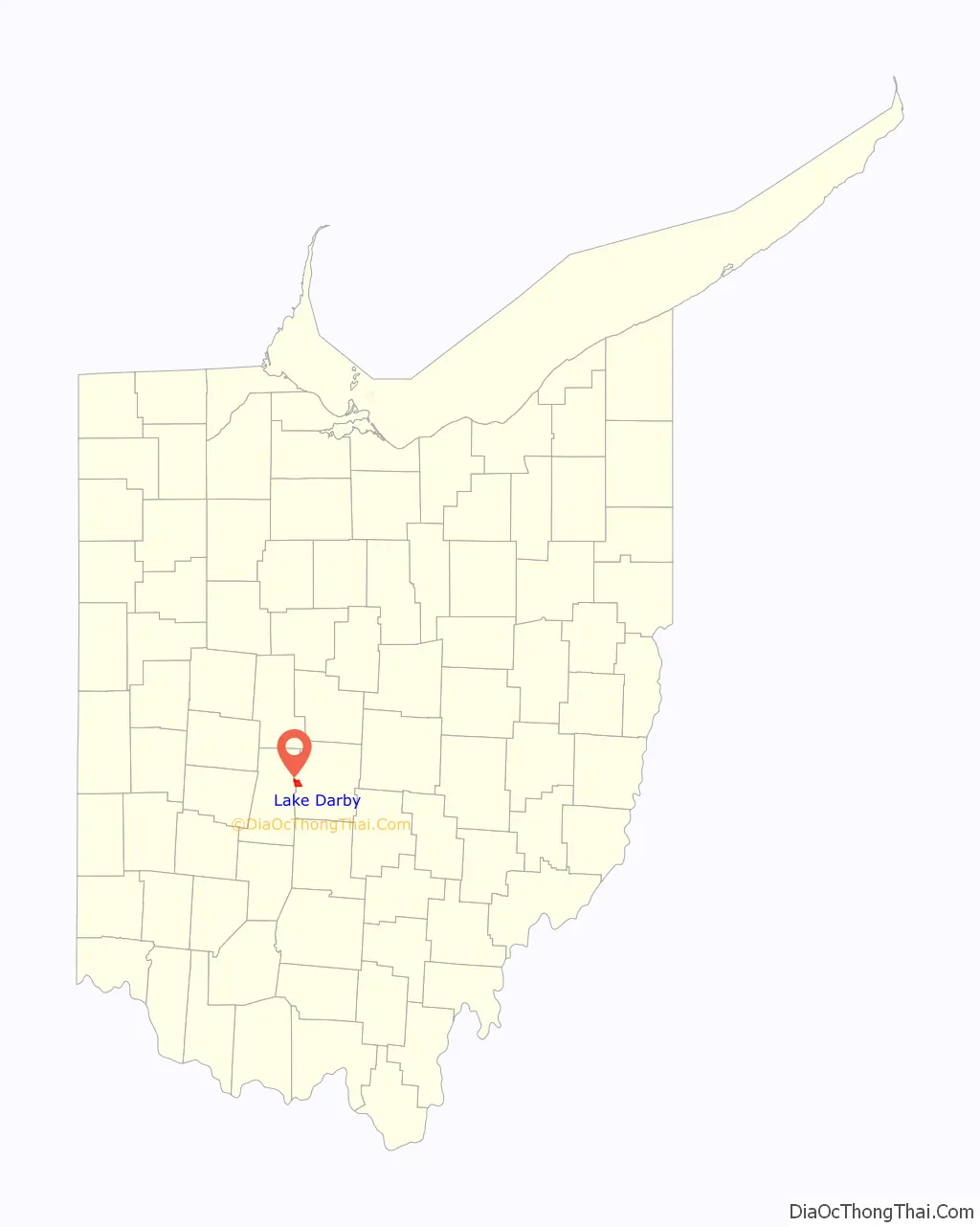
Lake Darby location map. Where is Lake Darby CDP?
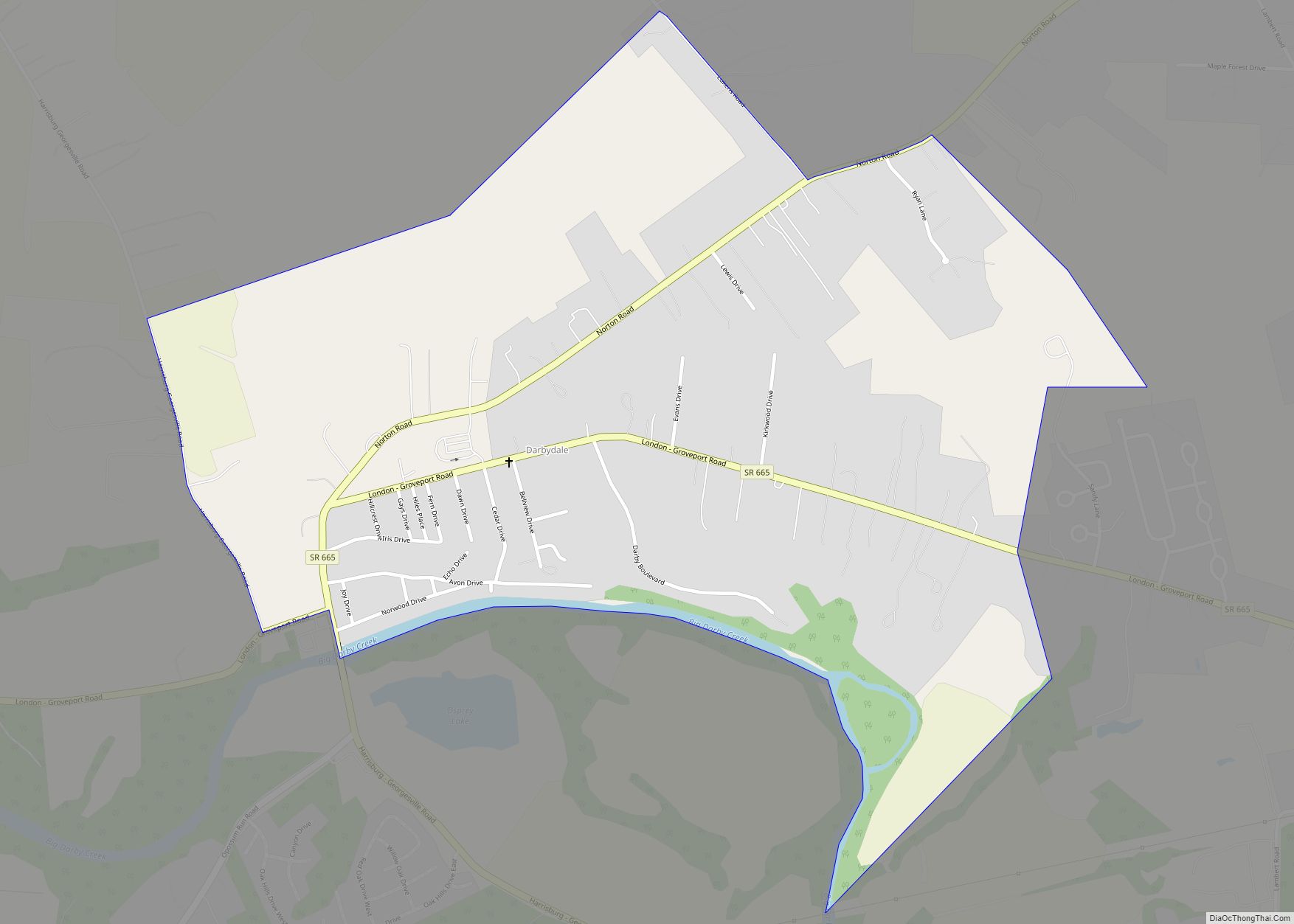
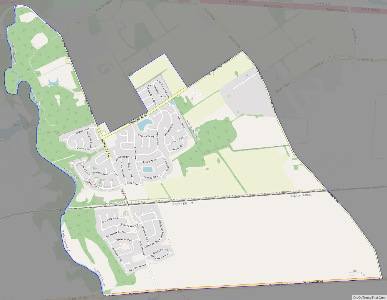
Lake Darby Road Map
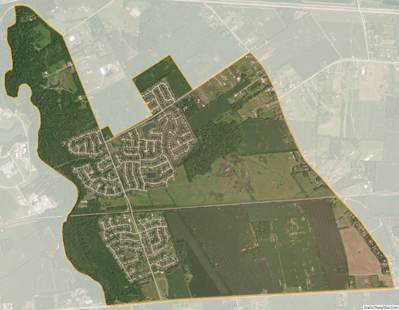
Lake Darby city Satellite Map
Geography
Lake Darby is located in western Franklin County at 39°57′42″N 83°13′59″W / 39.96167°N 83.23306°W / 39.96167; -83.23306 (39.961630, -83.233059). The majority of the community is in Prairie Township, with two portions extending north into Brown Township. Big Darby Creek, a tributary of the Scioto River, forms the western border of the CDP as well as the Franklin County/Madison County line. The village of West Jefferson lies directly across the creek from Lake Darby.
U.S. Route 40 (National Road), a four-lane highway, forms the southern edge of the community, leading east 13 miles (21 km) to downtown Columbus and west 31 miles (50 km) to Springfield, Ohio.
According to the United States Census Bureau, the Lake Darby CDP has a total area of 3.5 square miles (9.1 km), of which 3.5 square miles (9.0 km) is land and 0.04 square miles (0.1 km), or 1.15%, is water.
See also
Map of Ohio State and its subdivision:- Adams
- Allen
- Ashland
- Ashtabula
- Athens
- Auglaize
- Belmont
- Brown
- Butler
- Carroll
- Champaign
- Clark
- Clermont
- Clinton
- Columbiana
- Coshocton
- Crawford
- Cuyahoga
- Darke
- Defiance
- Delaware
- Erie
- Fairfield
- Fayette
- Franklin
- Fulton
- Gallia
- Geauga
- Greene
- Guernsey
- Hamilton
- Hancock
- Hardin
- Harrison
- Henry
- Highland
- Hocking
- Holmes
- Huron
- Jackson
- Jefferson
- Knox
- Lake
- Lake Erie
- Lawrence
- Licking
- Logan
- Lorain
- Lucas
- Madison
- Mahoning
- Marion
- Medina
- Meigs
- Mercer
- Miami
- Monroe
- Montgomery
- Morgan
- Morrow
- Muskingum
- Noble
- Ottawa
- Paulding
- Perry
- Pickaway
- Pike
- Portage
- Preble
- Putnam
- Richland
- Ross
- Sandusky
- Scioto
- Seneca
- Shelby
- Stark
- Summit
- Trumbull
- Tuscarawas
- Union
- Van Wert
- Vinton
- Warren
- Washington
- Wayne
- Williams
- Wood
- Wyandot
- Alabama
- Alaska
- Arizona
- Arkansas
- California
- Colorado
- Connecticut
- Delaware
- District of Columbia
- Florida
- Georgia
- Hawaii
- Idaho
- Illinois
- Indiana
- Iowa
- Kansas
- Kentucky
- Louisiana
- Maine
- Maryland
- Massachusetts
- Michigan
- Minnesota
- Mississippi
- Missouri
- Montana
- Nebraska
- Nevada
- New Hampshire
- New Jersey
- New Mexico
- New York
- North Carolina
- North Dakota
- Ohio
- Oklahoma
- Oregon
- Pennsylvania
- Rhode Island
- South Carolina
- South Dakota
- Tennessee
- Texas
- Utah
- Vermont
- Virginia
- Washington
- West Virginia
- Wisconsin
- Wyoming