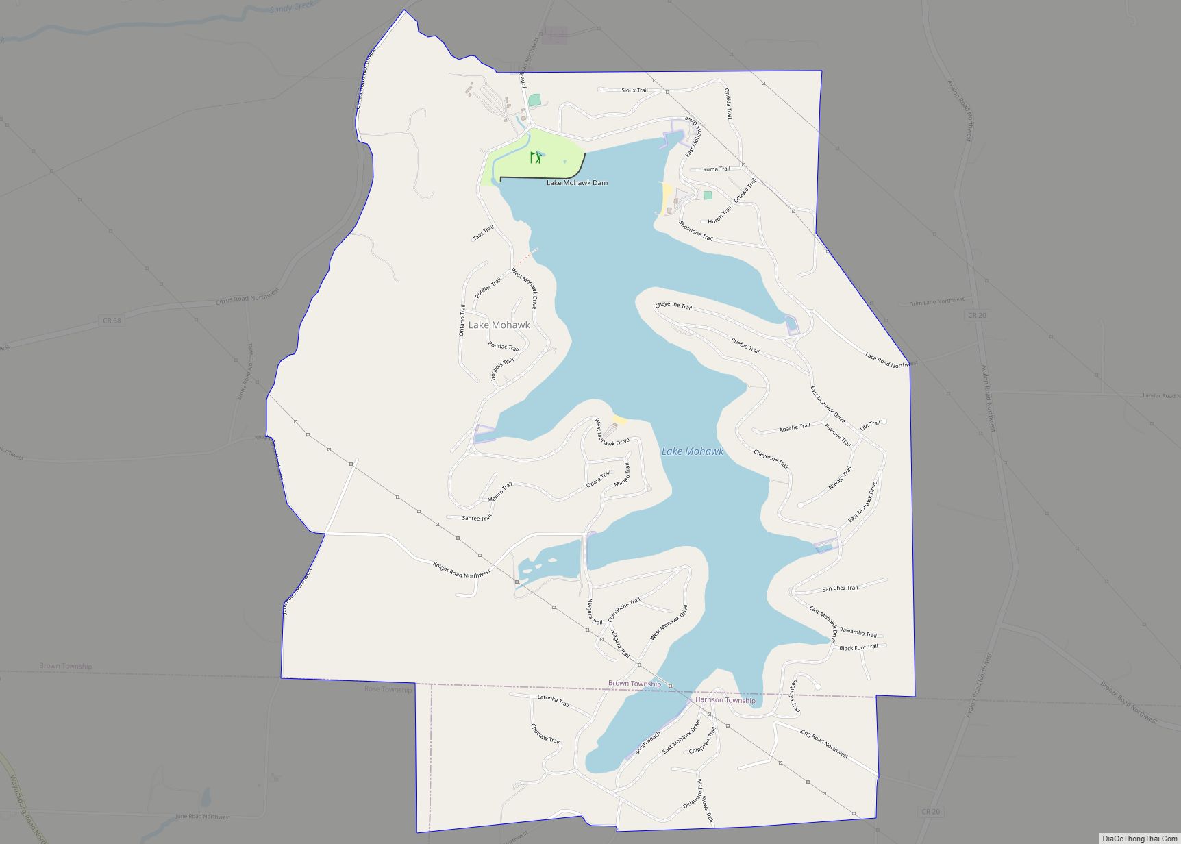
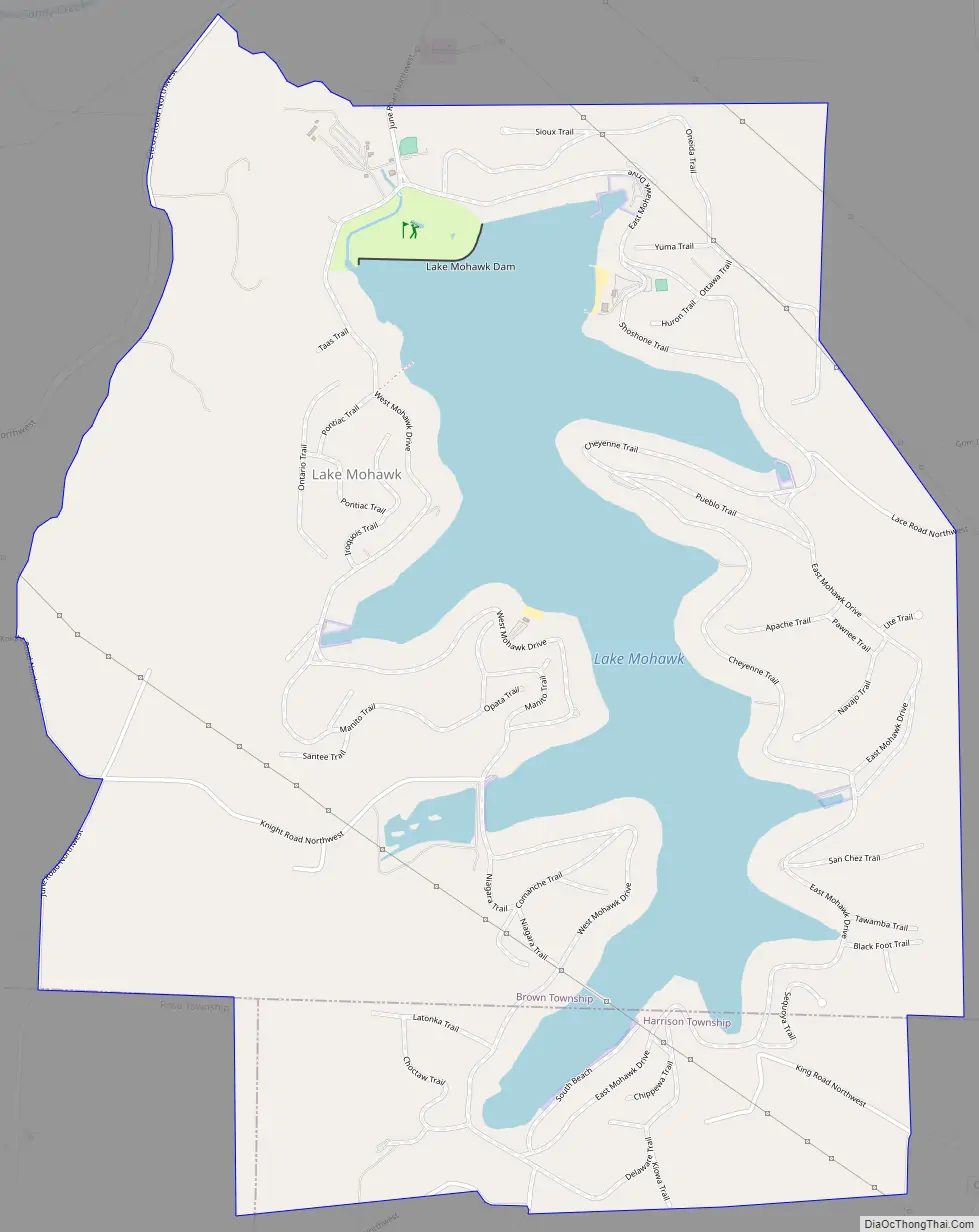
Lake Mohawk is a census-designated place (CDP) in Brown and Harrison townships of Carroll County, Ohio, United States, developed around Lake Mohawk, a reservoir. The population of the CDP was 1,652 as of the 2010 census.
| Name: | Lake Mohawk CDP |
|---|---|
| LSAD Code: | 57 |
| LSAD Description: | CDP (suffix) |
| State: | Ohio |
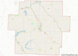
| County: | Carroll County |
| Elevation: | 1,030 ft (310 m) |
| Total Area: | 4.47 sq mi (11.59 km²) |
| Land Area: | 3.67 sq mi (9.50 km²) |
| Water Area: | 0.81 sq mi (2.08 km²) |
| Total Population: | 1,601 |
| Population Density: | 436.24/sq mi (168.44/km²) |
| FIPS code: | 3941443 |
Online Interactive Map
Click on ![]() to view map in "full screen" mode.
to view map in "full screen" mode.
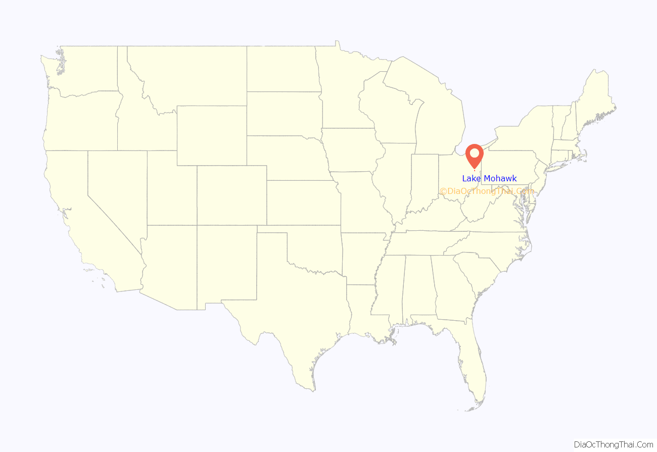
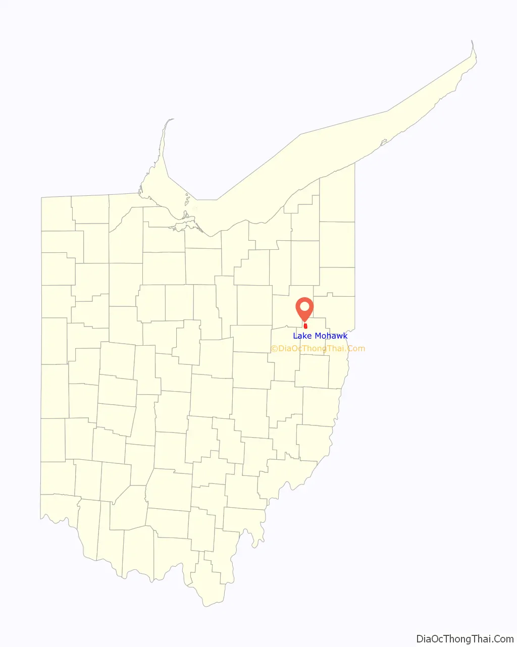
Lake Mohawk location map. Where is Lake Mohawk CDP?
History
Lake Mohawk was founded in 1963 by property developers as a planned community.
Lake Mohawk Road Map
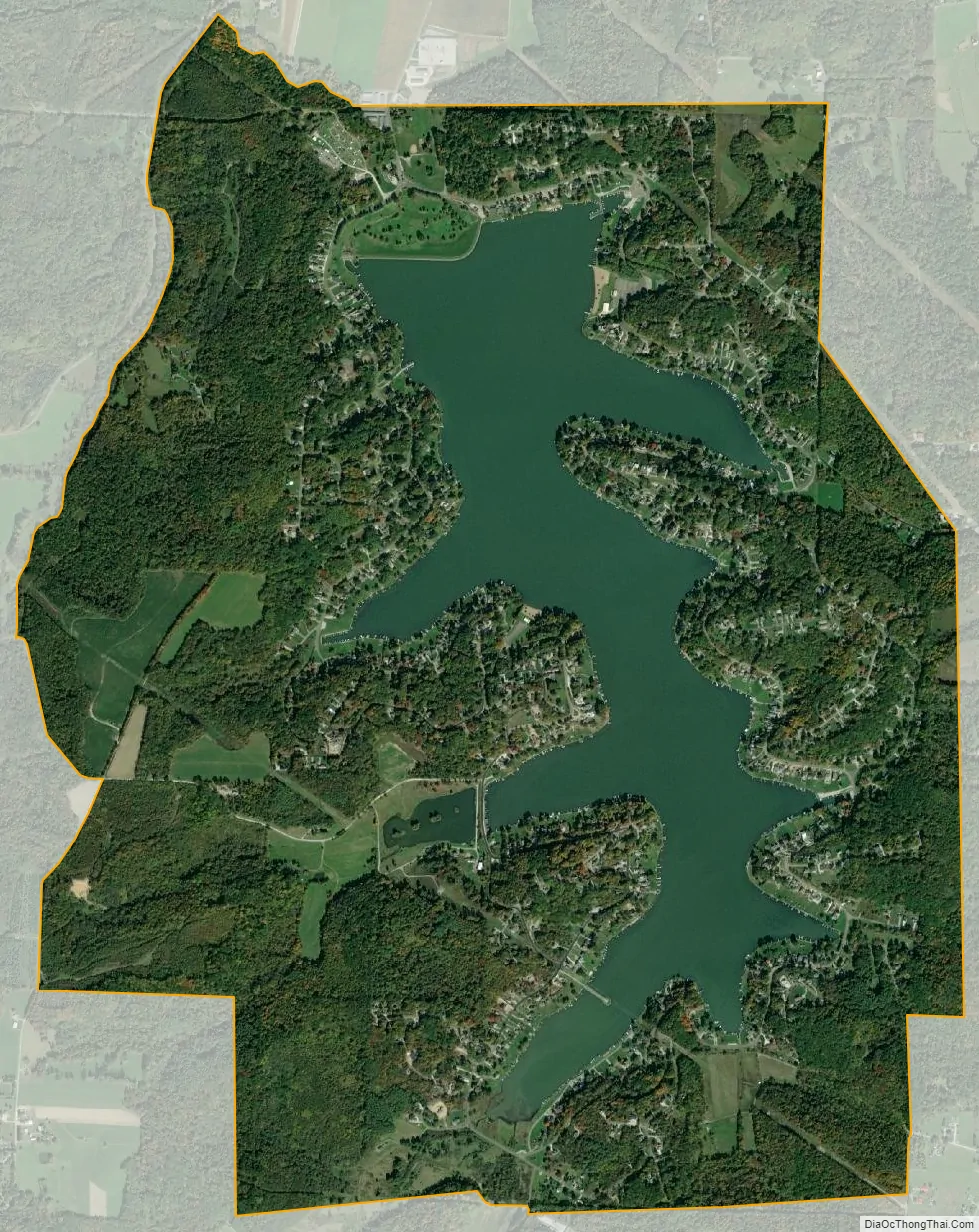
Lake Mohawk city Satellite Map
Geography
The Lake Mohawk community is situated on both sides of Lake Mohawk, a small reservoir on Middle Creek, a tributary of Sandy Creek, part of the Tuscarawas River watershed flowing to the Ohio River. The majority of the lake and community are in Brown Township, with the upstream end of the lake extending south into Harrison Township. The lake’s outlet is 1.5 miles (2.4 km) south of the village of Malvern.
The community was established in 1963 by the American Realty Service Corporation on 1,728 acres (6.99 km) of property. The lake is inside a gated community which contains approximately 1,700 property lots that are privately owned.
According to the United States Census Bureau, the Lake Mohawk CDP has a total area of 4.5 square miles (11.6 km), of which 3.7 square miles (9.5 km) is land and 0.81 square miles (2.1 km), or 17.99%, is water.
See also
Map of Ohio State and its subdivision:- Adams
- Allen
- Ashland
- Ashtabula
- Athens
- Auglaize
- Belmont
- Brown
- Butler
- Carroll
- Champaign
- Clark
- Clermont
- Clinton
- Columbiana
- Coshocton
- Crawford
- Cuyahoga
- Darke
- Defiance
- Delaware
- Erie
- Fairfield
- Fayette
- Franklin
- Fulton
- Gallia
- Geauga
- Greene
- Guernsey
- Hamilton
- Hancock
- Hardin
- Harrison
- Henry
- Highland
- Hocking
- Holmes
- Huron
- Jackson
- Jefferson
- Knox
- Lake
- Lake Erie
- Lawrence
- Licking
- Logan
- Lorain
- Lucas
- Madison
- Mahoning
- Marion
- Medina
- Meigs
- Mercer
- Miami
- Monroe
- Montgomery
- Morgan
- Morrow
- Muskingum
- Noble
- Ottawa
- Paulding
- Perry
- Pickaway
- Pike
- Portage
- Preble
- Putnam
- Richland
- Ross
- Sandusky
- Scioto
- Seneca
- Shelby
- Stark
- Summit
- Trumbull
- Tuscarawas
- Union
- Van Wert
- Vinton
- Warren
- Washington
- Wayne
- Williams
- Wood
- Wyandot
- Alabama
- Alaska
- Arizona
- Arkansas
- California
- Colorado
- Connecticut
- Delaware
- District of Columbia
- Florida
- Georgia
- Hawaii
- Idaho
- Illinois
- Indiana
- Iowa
- Kansas
- Kentucky
- Louisiana
- Maine
- Maryland
- Massachusetts
- Michigan
- Minnesota
- Mississippi
- Missouri
- Montana
- Nebraska
- Nevada
- New Hampshire
- New Jersey
- New Mexico
- New York
- North Carolina
- North Dakota
- Ohio
- Oklahoma
- Oregon
- Pennsylvania
- Rhode Island
- South Carolina
- South Dakota
- Tennessee
- Texas
- Utah
- Vermont
- Virginia
- Washington
- West Virginia
- Wisconsin
- Wyoming