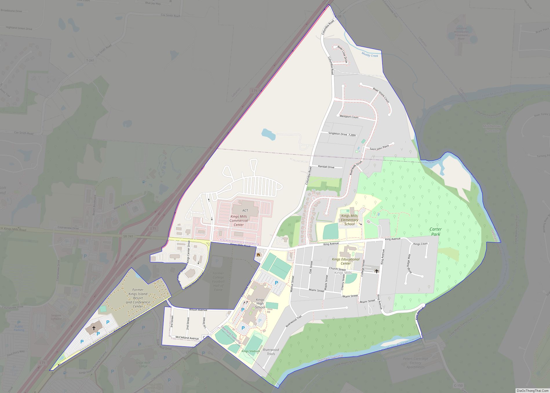
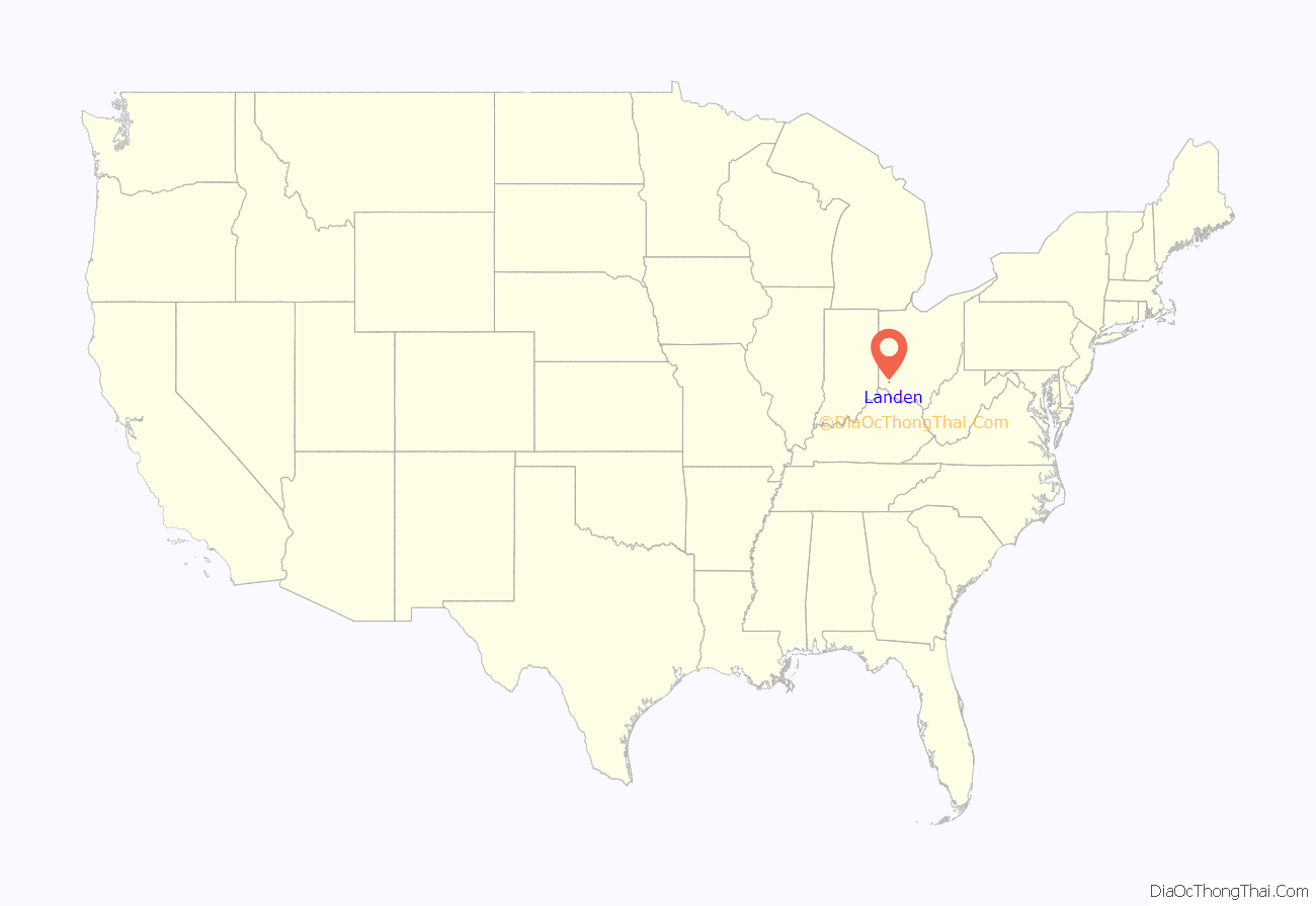
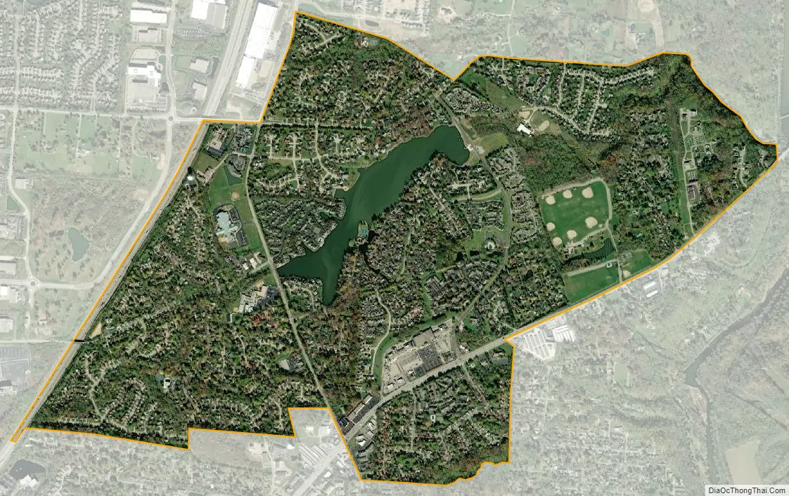
Landen is a census-designated place (CDP) in Deerfield Township, Warren County, Ohio, United States. The population was 6,995 at the 2020 census. It is located around Columbia Road and Montgomery Road in the southeastern part of the township. It surrounds Twenty Mile Stand and near Fosters.
Landen was named after Theodophilus James Landen, an early Ohio settler who owned the farmland surrounding Twenty Mile Stand. The man-made Landen Lake occupies the center of the residential area in the town. Though its formal place designation is “Landen Farm Drainage Lake”, the reduction in farming activity in the immediate area of the lake has made it suitable for recreation. The lake was further improved with the completion in 2008 of a major dredging operation that removed 184,000 cubic yards of sediment from the lake.
| Name: | Landen CDP |
|---|---|
| LSAD Code: | 57 |
| LSAD Description: | CDP (suffix) |
| State: | Ohio |
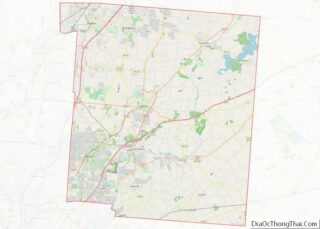
| County: | Warren County |
| Elevation: | 814 ft (248 m) |
| Total Area: | 2.12 sq mi (5.49 km²) |
| Land Area: | 2.03 sq mi (5.25 km²) |
| Water Area: | 0.09 sq mi (0.24 km²) |
| Total Population: | 6,995 |
| Population Density: | 3,449.21/sq mi (1,331.85/km²) |
| FIPS code: | 3941755 |
| GNISfeature ID: | 1052751 |
Online Interactive Map
Click on ![]() to view map in "full screen" mode.
to view map in "full screen" mode.
Landen location map. Where is Landen CDP?
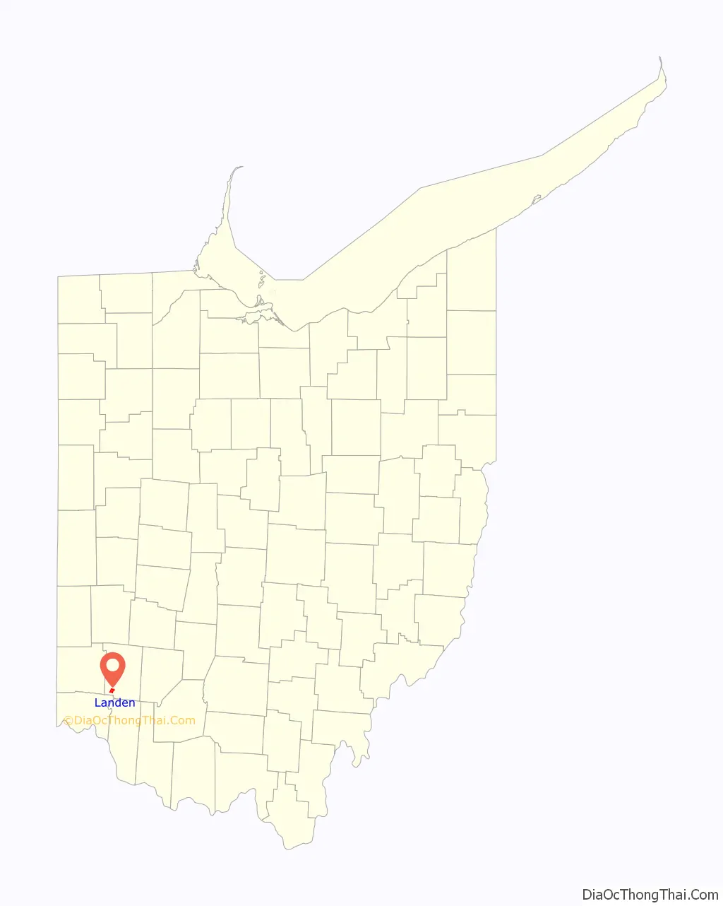
Landen Road Map
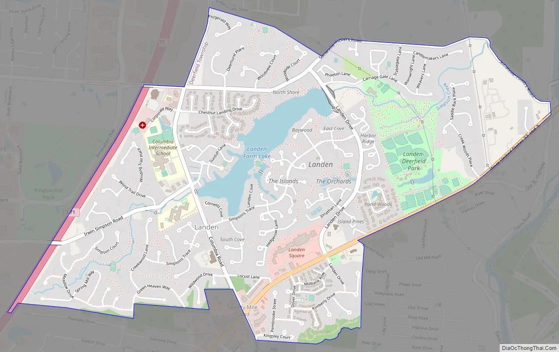
Landen city Satellite Map
Geography
Landen is located at 39°18′33″N 84°17′5″W / 39.30917°N 84.28472°W / 39.30917; -84.28472 (39.309067, -84.284739).
According to the United States Census Bureau, the CDP has a total area of 4.8 square miles (12 km), of which 4.7 square miles (12 km) is land and 0.1 square miles (0.26 km) (1.68%) is water.
See also
Map of Ohio State and its subdivision:- Adams
- Allen
- Ashland
- Ashtabula
- Athens
- Auglaize
- Belmont
- Brown
- Butler
- Carroll
- Champaign
- Clark
- Clermont
- Clinton
- Columbiana
- Coshocton
- Crawford
- Cuyahoga
- Darke
- Defiance
- Delaware
- Erie
- Fairfield
- Fayette
- Franklin
- Fulton
- Gallia
- Geauga
- Greene
- Guernsey
- Hamilton
- Hancock
- Hardin
- Harrison
- Henry
- Highland
- Hocking
- Holmes
- Huron
- Jackson
- Jefferson
- Knox
- Lake
- Lake Erie
- Lawrence
- Licking
- Logan
- Lorain
- Lucas
- Madison
- Mahoning
- Marion
- Medina
- Meigs
- Mercer
- Miami
- Monroe
- Montgomery
- Morgan
- Morrow
- Muskingum
- Noble
- Ottawa
- Paulding
- Perry
- Pickaway
- Pike
- Portage
- Preble
- Putnam
- Richland
- Ross
- Sandusky
- Scioto
- Seneca
- Shelby
- Stark
- Summit
- Trumbull
- Tuscarawas
- Union
- Van Wert
- Vinton
- Warren
- Washington
- Wayne
- Williams
- Wood
- Wyandot
- Alabama
- Alaska
- Arizona
- Arkansas
- California
- Colorado
- Connecticut
- Delaware
- District of Columbia
- Florida
- Georgia
- Hawaii
- Idaho
- Illinois
- Indiana
- Iowa
- Kansas
- Kentucky
- Louisiana
- Maine
- Maryland
- Massachusetts
- Michigan
- Minnesota
- Mississippi
- Missouri
- Montana
- Nebraska
- Nevada
- New Hampshire
- New Jersey
- New Mexico
- New York
- North Carolina
- North Dakota
- Ohio
- Oklahoma
- Oregon
- Pennsylvania
- Rhode Island
- South Carolina
- South Dakota
- Tennessee
- Texas
- Utah
- Vermont
- Virginia
- Washington
- West Virginia
- Wisconsin
- Wyoming