Lynchburg is a village in Clinton and Highland counties in the U.S. state of Ohio. The population was 1,499 at the 2010 census.
| Name: | Lynchburg village |
|---|---|
| LSAD Code: | 47 |
| LSAD Description: | village (suffix) |
| State: | Ohio |
| County: | Clinton County, Highland County |
| Elevation: | 1,007 ft (307 m) |
| Total Area: | 0.93 sq mi (2.41 km²) |
| Land Area: | 0.92 sq mi (2.39 km²) |
| Water Area: | 0.01 sq mi (0.02 km²) |
| Total Population: | 1,510 |
| Population Density: | 1,635.97/sq mi (631.58/km²) |
| ZIP code: | 45142 |
| Area code: | 937, 326 |
| FIPS code: | 3945542 |
| GNISfeature ID: | 1085472 |
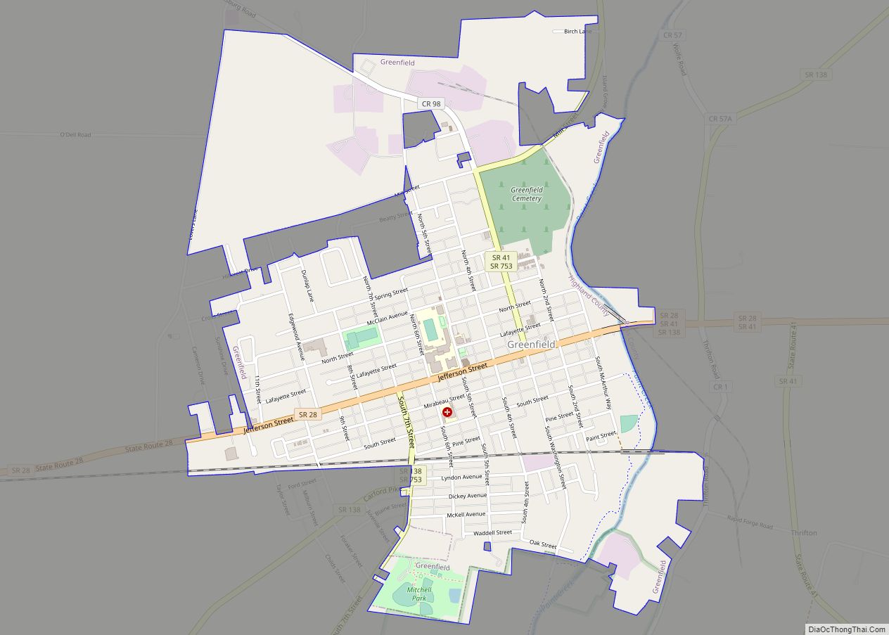
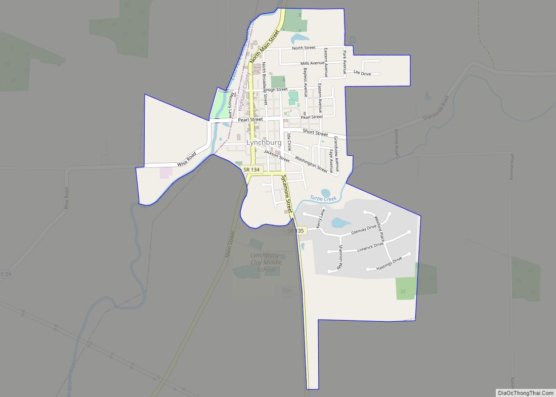
Online Interactive Map
Click on ![]() to view map in "full screen" mode.
to view map in "full screen" mode.
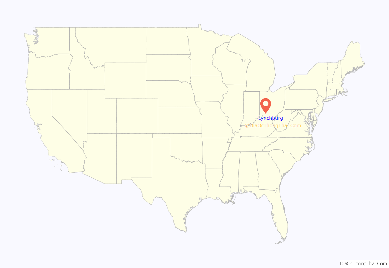
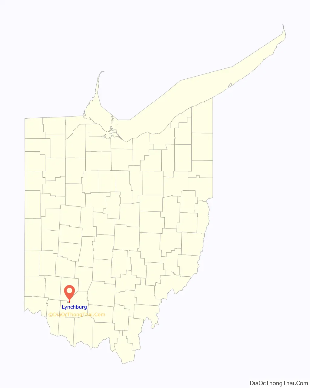
Lynchburg location map. Where is Lynchburg village?
History
Lynchburg was platted in 1830, and named after Lynchburg, Virginia, the birthplace of a first settler.
Lynchburg Covered Bridge was added in 1976 to the National Register of Historic Places.
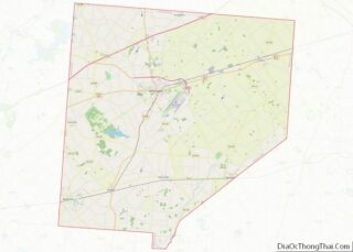
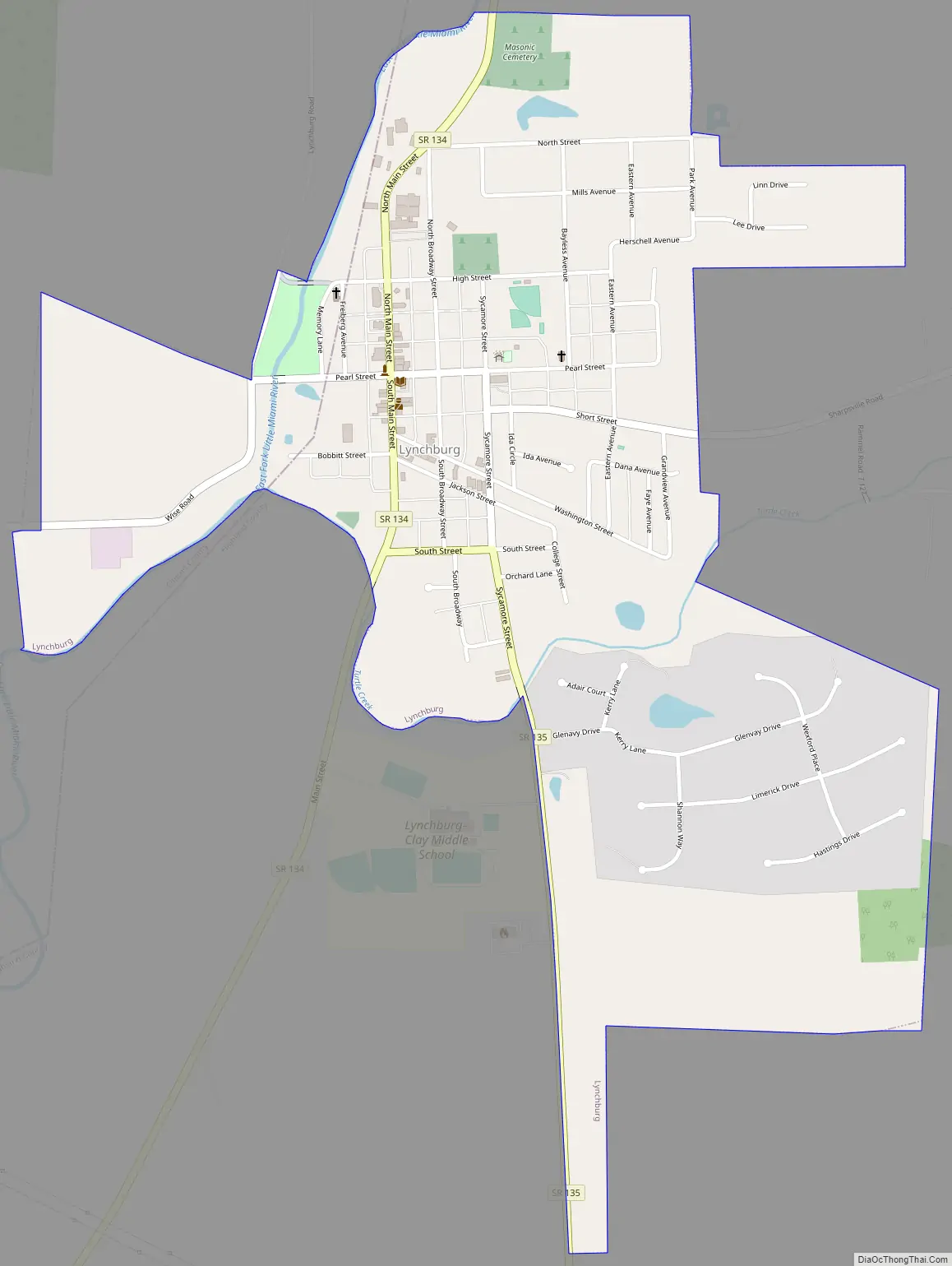
Lynchburg Road Map
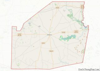
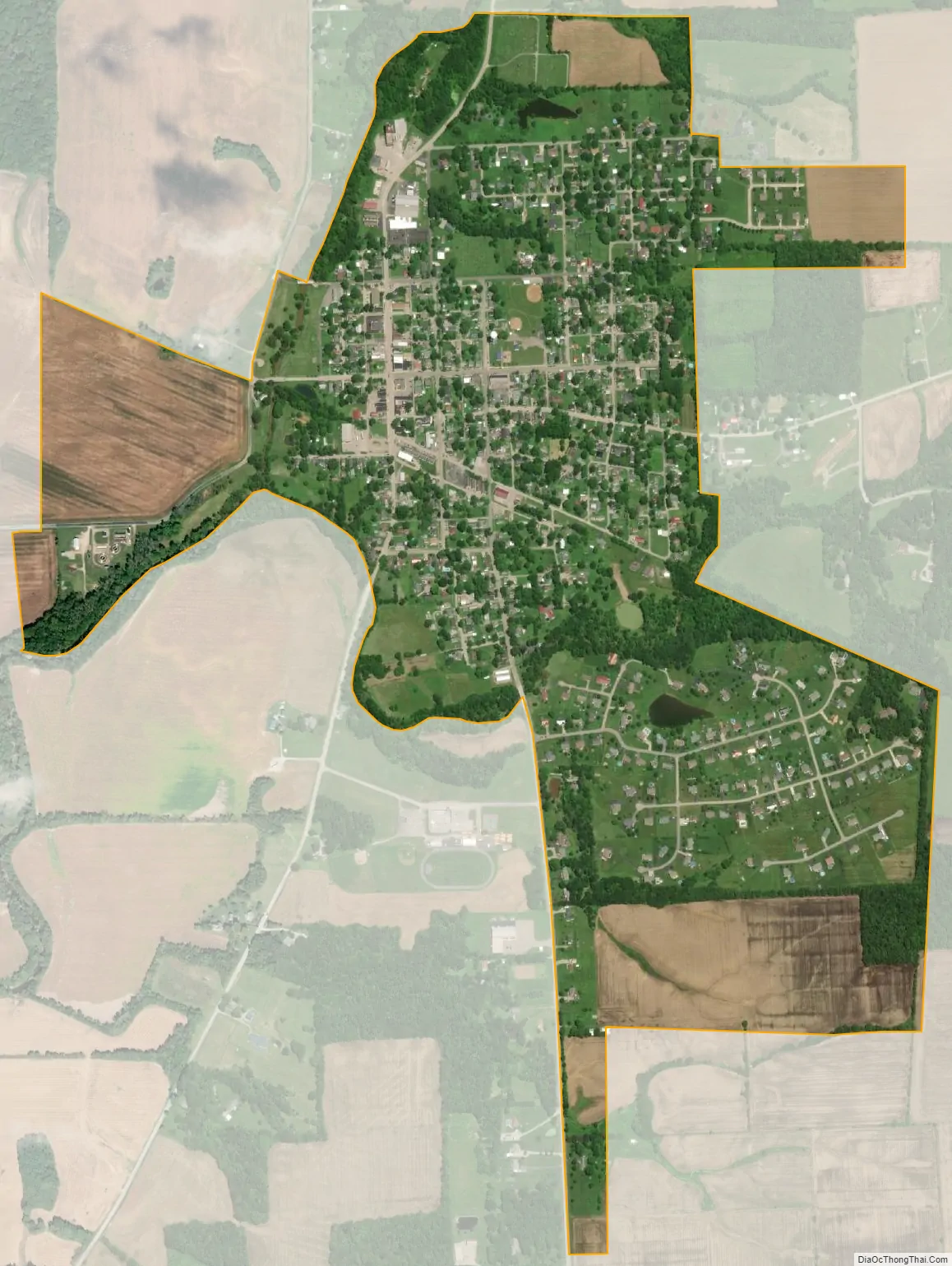
Lynchburg city Satellite Map
Geography
Lynchburg is located at 39°14′32″N 83°47′26″W / 39.24222°N 83.79056°W / 39.24222; -83.79056 (39.242207, -83.790428).
According to the United States Census Bureau, the village has a total area of 0.95 square miles (2.46 km), of which 0.94 square miles (2.43 km) is land and 0.01 square miles (0.03 km) is water.
See also
Map of Ohio State and its subdivision:- Adams
- Allen
- Ashland
- Ashtabula
- Athens
- Auglaize
- Belmont
- Brown
- Butler
- Carroll
- Champaign
- Clark
- Clermont
- Clinton
- Columbiana
- Coshocton
- Crawford
- Cuyahoga
- Darke
- Defiance
- Delaware
- Erie
- Fairfield
- Fayette
- Franklin
- Fulton
- Gallia
- Geauga
- Greene
- Guernsey
- Hamilton
- Hancock
- Hardin
- Harrison
- Henry
- Highland
- Hocking
- Holmes
- Huron
- Jackson
- Jefferson
- Knox
- Lake
- Lake Erie
- Lawrence
- Licking
- Logan
- Lorain
- Lucas
- Madison
- Mahoning
- Marion
- Medina
- Meigs
- Mercer
- Miami
- Monroe
- Montgomery
- Morgan
- Morrow
- Muskingum
- Noble
- Ottawa
- Paulding
- Perry
- Pickaway
- Pike
- Portage
- Preble
- Putnam
- Richland
- Ross
- Sandusky
- Scioto
- Seneca
- Shelby
- Stark
- Summit
- Trumbull
- Tuscarawas
- Union
- Van Wert
- Vinton
- Warren
- Washington
- Wayne
- Williams
- Wood
- Wyandot
- Alabama
- Alaska
- Arizona
- Arkansas
- California
- Colorado
- Connecticut
- Delaware
- District of Columbia
- Florida
- Georgia
- Hawaii
- Idaho
- Illinois
- Indiana
- Iowa
- Kansas
- Kentucky
- Louisiana
- Maine
- Maryland
- Massachusetts
- Michigan
- Minnesota
- Mississippi
- Missouri
- Montana
- Nebraska
- Nevada
- New Hampshire
- New Jersey
- New Mexico
- New York
- North Carolina
- North Dakota
- Ohio
- Oklahoma
- Oregon
- Pennsylvania
- Rhode Island
- South Carolina
- South Dakota
- Tennessee
- Texas
- Utah
- Vermont
- Virginia
- Washington
- West Virginia
- Wisconsin
- Wyoming