Maineville is a village in Warren County, Ohio, United States. The population was 1,405 at the 2020 census.
| Name: | Maineville village |
|---|---|
| LSAD Code: | 47 |
| LSAD Description: | village (suffix) |
| State: | Ohio |
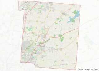
| County: | Warren County |
| Elevation: | 810 ft (247 m) |
| Total Area: | 1.59 sq mi (4.11 km²) |
| Land Area: | 1.59 sq mi (4.11 km²) |
| Water Area: | 0.00 sq mi (0.00 km²) |
| Total Population: | 1,405 |
| Population Density: | 884.76/sq mi (341.51/km²) |
| ZIP code: | 45039 |
| Area code: | 513 |
| FIPS code: | 3946872 |
| GNISfeature ID: | 1066312 |
| Website: | http://www.mainevilleoh.com |
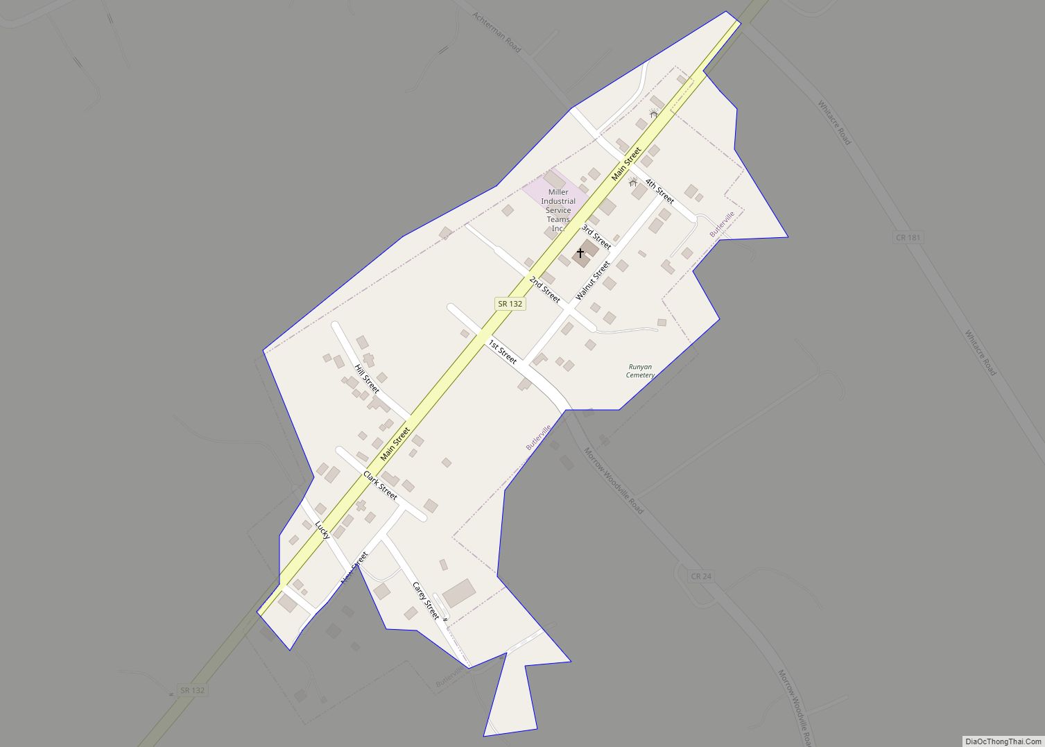
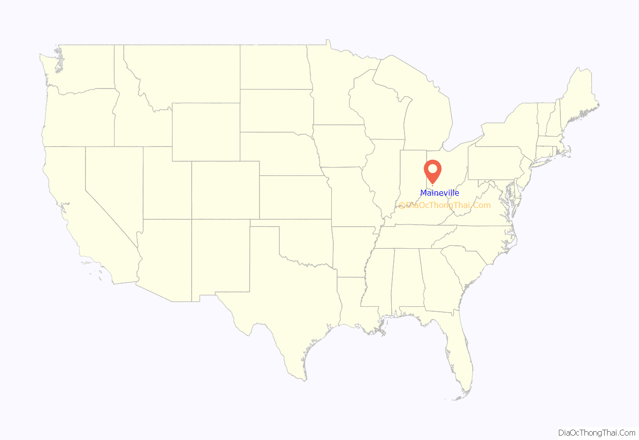
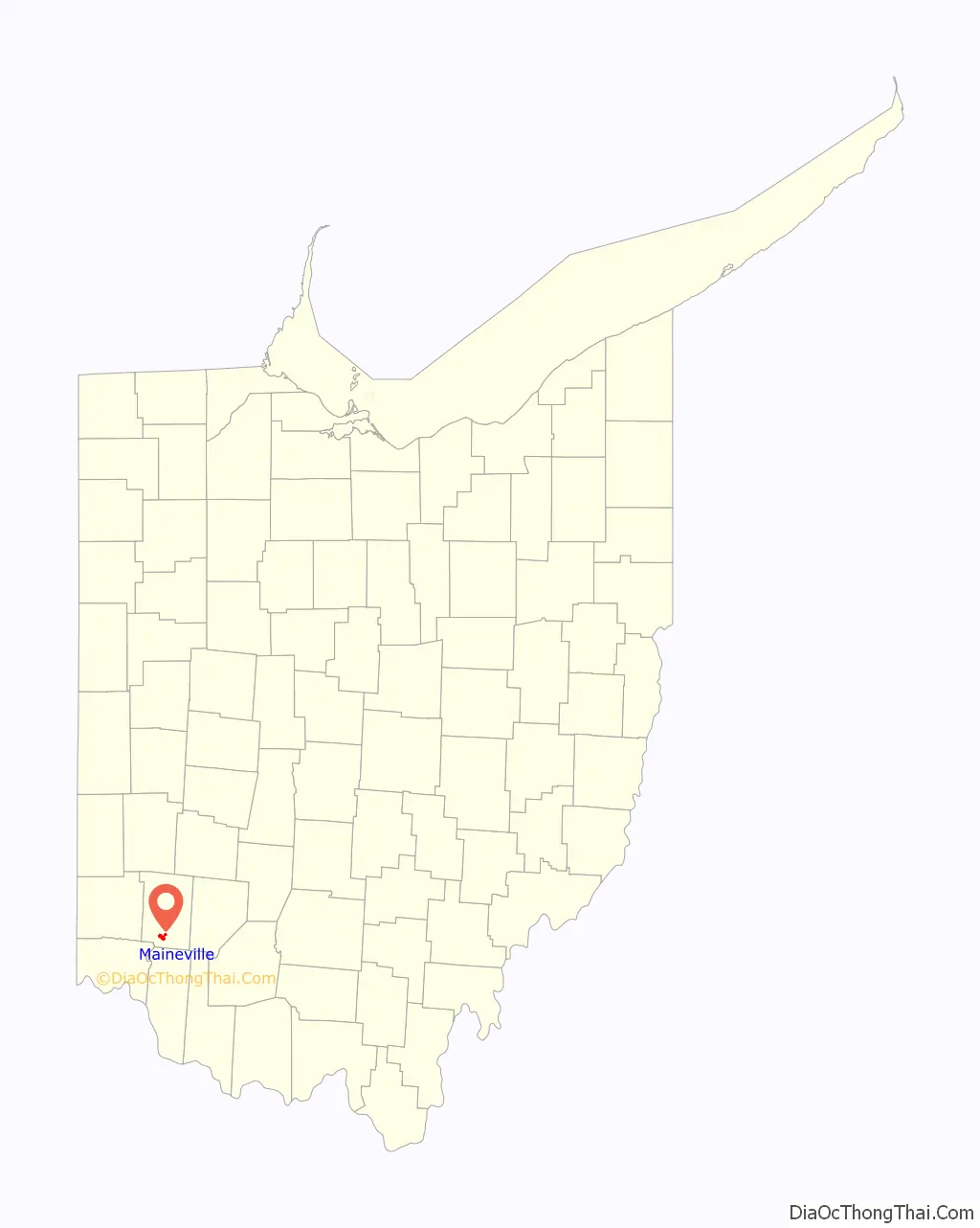
Online Interactive Map
Click on ![]() to view map in "full screen" mode.
to view map in "full screen" mode.
Maineville location map. Where is Maineville village?
History
Maineville was incorporated as a village on March 23, 1850. The village derives its name from Maine, the native state of a large share of its first settlers.The settlers came mostly from the Maine town of Phillips; and some from nearby Farmington. Originally, the relocation of these people involved nearly one hundred families (the relocation took 30 to 60 days). The town was called “Yankeetown” and “Maineville”, and in 1850 it was incorporated as “Maineville”. A village flag was designed and created by John Michael, later to become Mayor of Maineville. The flag includes Ohio and Maine, the state seals and a connecting reference to the two areas. The flag was adopted unanimously by the Maineville Council in 1994. A post office was established at Maineville in 1854.
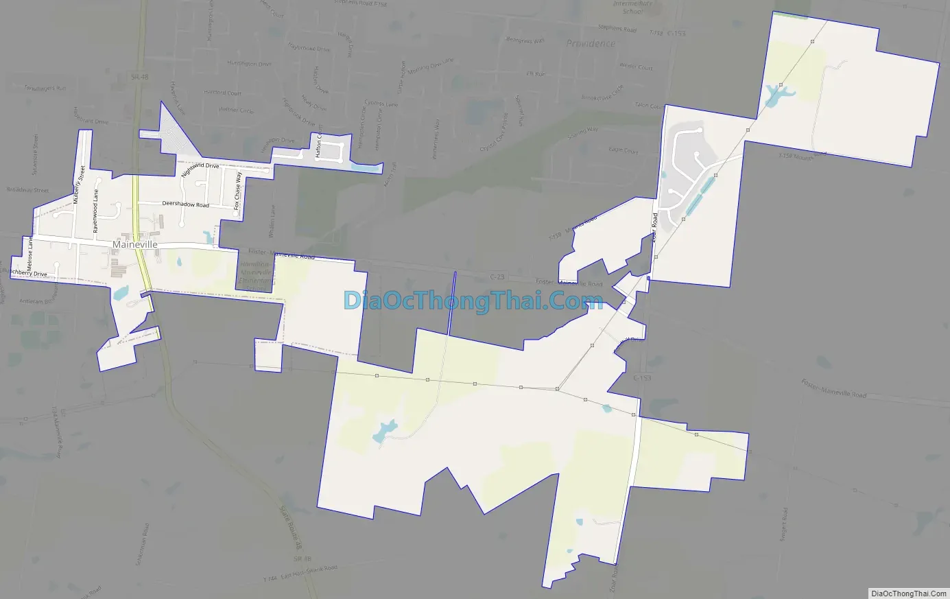
Maineville Road Map
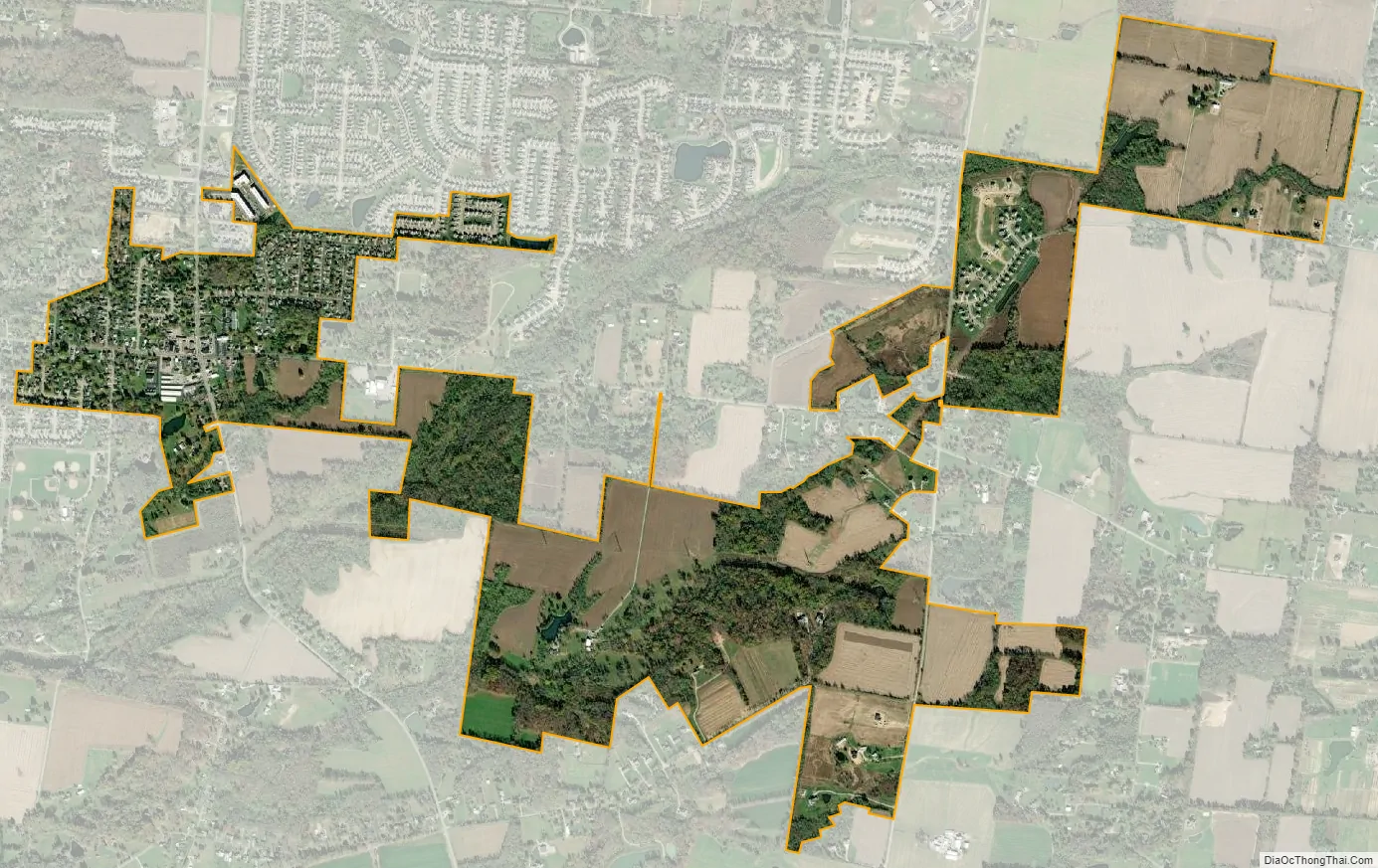
Maineville city Satellite Map
Geography
Maineville is located at 39°19′1″N 84°13′23″W / 39.31694°N 84.22306°W / 39.31694; -84.22306 (39.316998, -84.222924).
According to the United States Census Bureau, the village has a total area of 1.37 square miles (3.55 km), all land.
See also
Map of Ohio State and its subdivision:- Adams
- Allen
- Ashland
- Ashtabula
- Athens
- Auglaize
- Belmont
- Brown
- Butler
- Carroll
- Champaign
- Clark
- Clermont
- Clinton
- Columbiana
- Coshocton
- Crawford
- Cuyahoga
- Darke
- Defiance
- Delaware
- Erie
- Fairfield
- Fayette
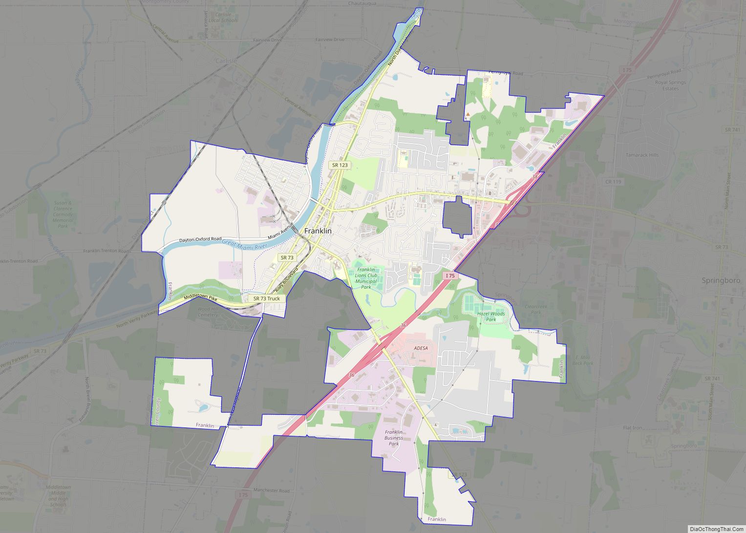
- Franklin
- Fulton
- Gallia
- Geauga
- Greene
- Guernsey
- Hamilton
- Hancock
- Hardin
- Harrison
- Henry
- Highland
- Hocking
- Holmes
- Huron
- Jackson
- Jefferson
- Knox
- Lake
- Lake Erie
- Lawrence
- Licking
- Logan
- Lorain
- Lucas
- Madison
- Mahoning
- Marion
- Medina
- Meigs
- Mercer
- Miami
- Monroe
- Montgomery
- Morgan
- Morrow
- Muskingum
- Noble
- Ottawa
- Paulding
- Perry
- Pickaway
- Pike
- Portage
- Preble
- Putnam
- Richland
- Ross
- Sandusky
- Scioto
- Seneca
- Shelby
- Stark
- Summit
- Trumbull
- Tuscarawas
- Union
- Van Wert
- Vinton
- Warren
- Washington
- Wayne
- Williams
- Wood
- Wyandot
- Alabama
- Alaska
- Arizona
- Arkansas
- California
- Colorado
- Connecticut
- Delaware
- District of Columbia
- Florida
- Georgia
- Hawaii
- Idaho
- Illinois
- Indiana
- Iowa
- Kansas
- Kentucky
- Louisiana
- Maine
- Maryland
- Massachusetts
- Michigan
- Minnesota
- Mississippi
- Missouri
- Montana
- Nebraska
- Nevada
- New Hampshire
- New Jersey
- New Mexico
- New York
- North Carolina
- North Dakota
- Ohio
- Oklahoma
- Oregon
- Pennsylvania
- Rhode Island
- South Carolina
- South Dakota
- Tennessee
- Texas
- Utah
- Vermont
- Virginia
- Washington
- West Virginia
- Wisconsin
- Wyoming